June 7, 2024 Weekend Weather Update
Canadian cold front on the way for perfect weekend weather
June 2024 was the 2nd-warmest June in the 132-year national record (1895–2026), at 71.8°F against a 1991–2020 normal of 69.5°F (+2.3°F).
June 2024 was the 41st-driest June in the 132-year national record (1895–2026), at 2.8in against a 1991–2020 normal of 3.1in (-0.3in).
NOAA/NCEI Climate at a Glance, contiguous United States. This is the observed record for the month, not a score of anything said in this piece — the forecast ledger begins 2026-08-17 and cannot reach earlier posts.

Please see Tropical Update (June 7th) for details about potential Gulf of Mexico systems: Link to blog.
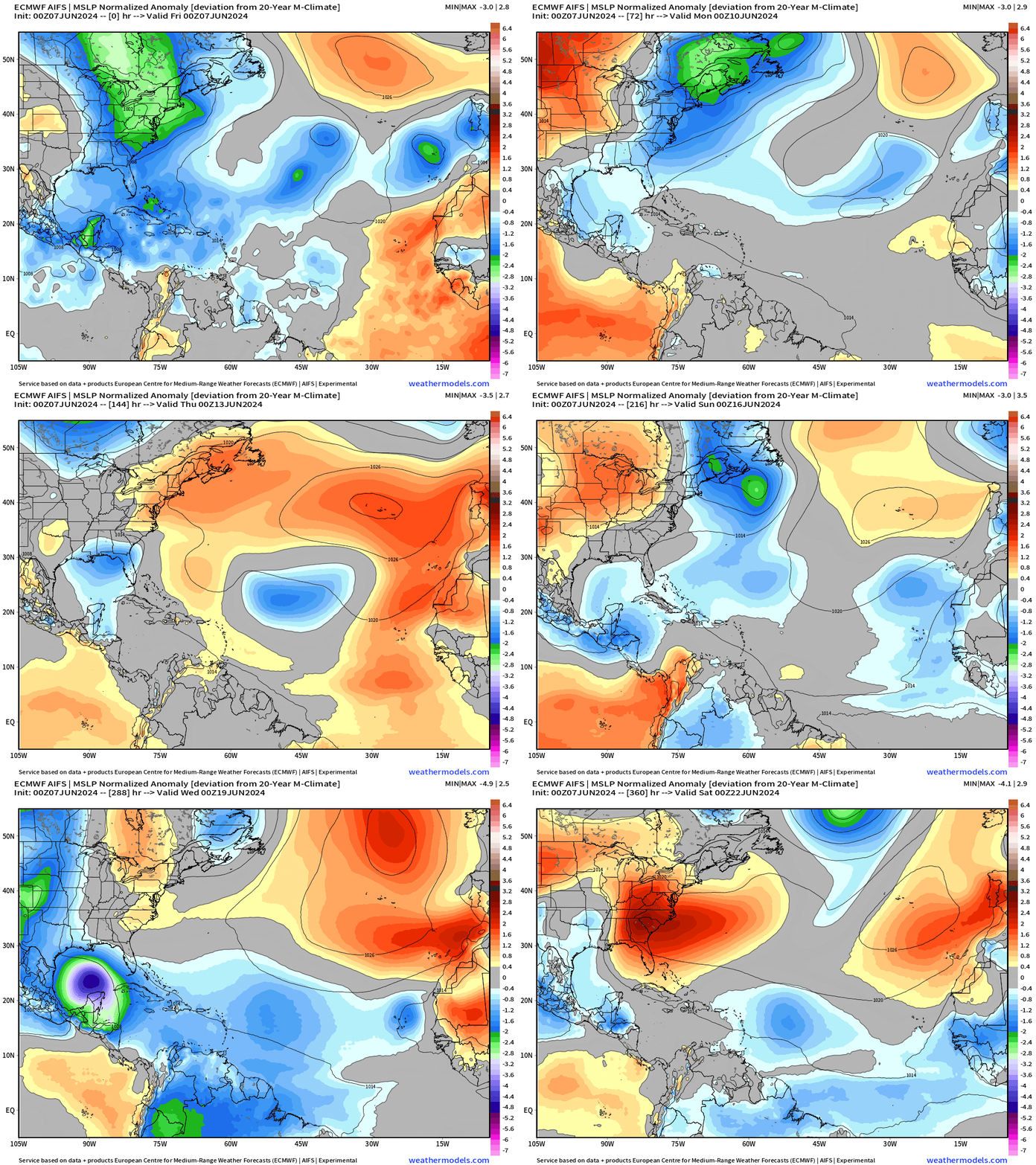
Next 15-days Upper-Level Weather Pattern | ECMWF AIFS
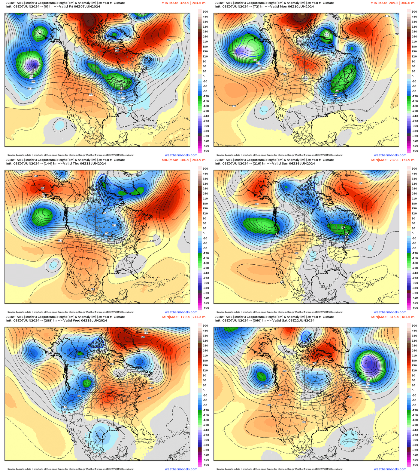
Looking for a pattern shift into Week 2 for warming / ridging east of the Rockies with the potential of “hot weather” in the Midwest and Great Lakes in 10-days or so.
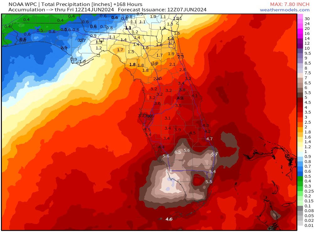
NWS WPC 7-Day Precipitation Forecast | Watering Needs
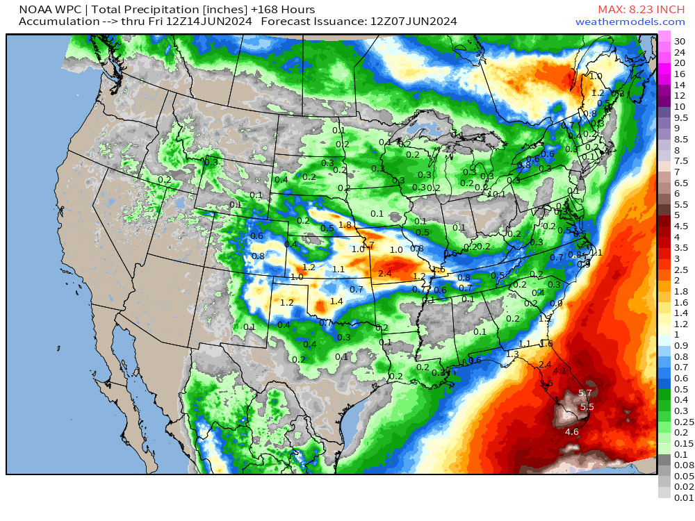
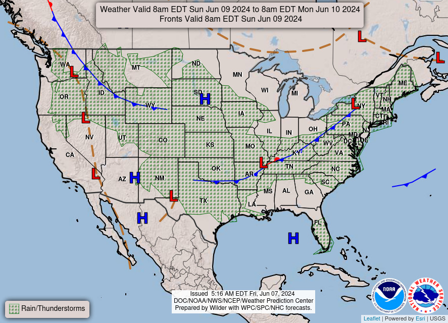
Not much rainfall or storms across much of the Lower 48 with the heat dome out west and the Canadian air mass east of the Rockies. However, the tropical flow over the Gulf of Mexico into Florida will provide plenty of welcome rainfall.
Friday High Temperatures & Weather
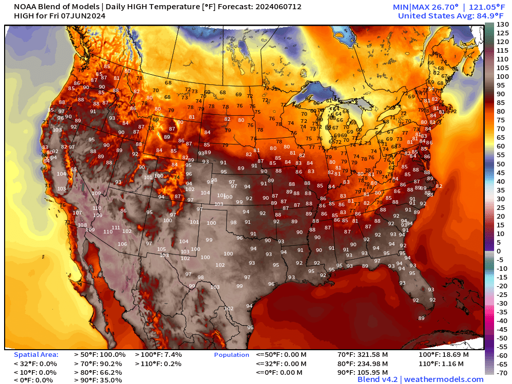
Lower 48 Average: 84.9°F | 235 Million at/above 80°F | 106 Million at/above 90°F
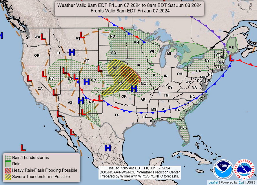
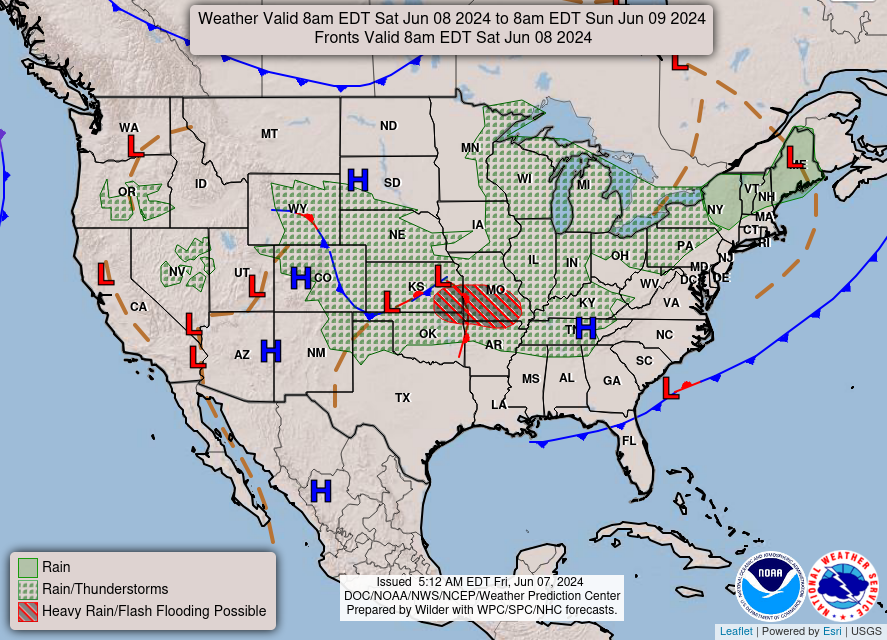
A cold front is heading through the southeast eventually bringing drier air along with gusty winds into the weekend. Perfect weather on the way for vast majority of the Lower 48 through Monday.
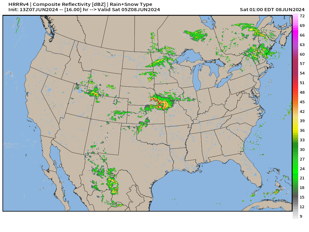
Scattered severe thunderstorms [Enhanced Risk] are possible in the central Plains later this evening with the HRRR 1 AM EDT radar simulation showing a small cluster.
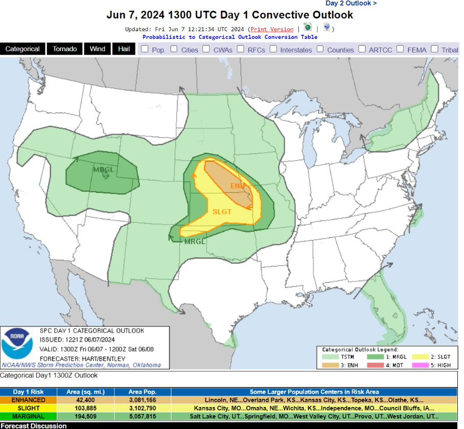
   ...THERE IS AN ENHANCED RISK OF SEVERE THUNDERSTORMS THIS AFTERNOON
   AND EVENING FROM CENTRAL NEBRASKA SOUTHEASTWARD INTO NORTHEAST
   KANSAS AND FAR WESTERN MISSOURI...

   ...SUMMARY...
   Severe thunderstorms are expected across the central Plains region
   beginning mid afternoon. Damaging winds and large hail are the
   primary threats.
Saturday High Temperatures & Weather
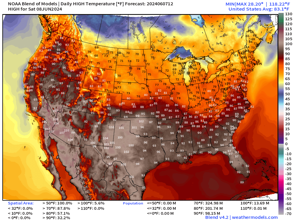
Check out the perfect temperatures from the northern Rockies into the Great Lakes and Northeast. Highs in the 70s for June 8th. Amazing.
The heat in California eases with only 90s in the Central Valley.
Still exceptionally hot in Florida with Orlando pushing upper-90s.
Sunday High Temperatures
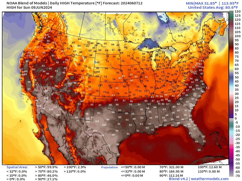
Even cooler on Sunday across the Dakotas with highs in the 60s. 70s from Minneapolis to Chicago and Detroit.
Monday High Temperatures + Anomaly
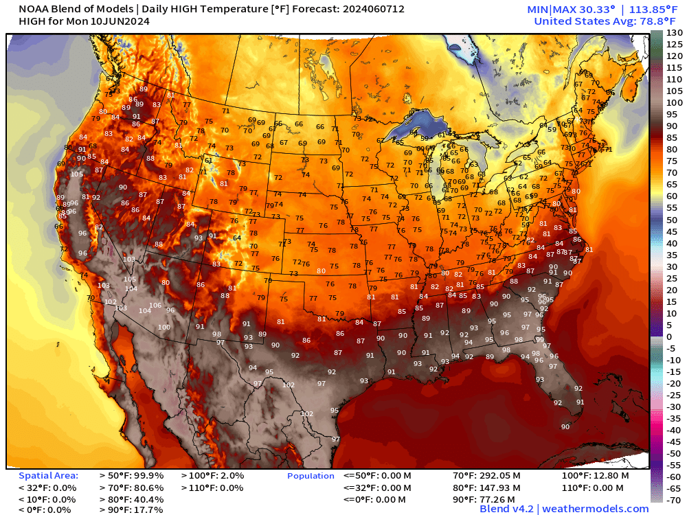
The cooler air doesn’t make it to Atlanta but Nashville in the lower-80s on Monday.
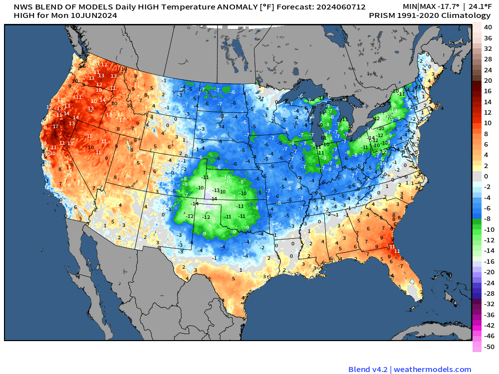
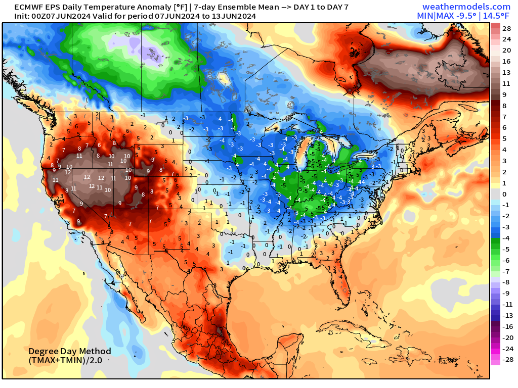
Temperature anomaly is impressive in the negative or cooler direction for the Plains and Great Lakes into upstate New York.
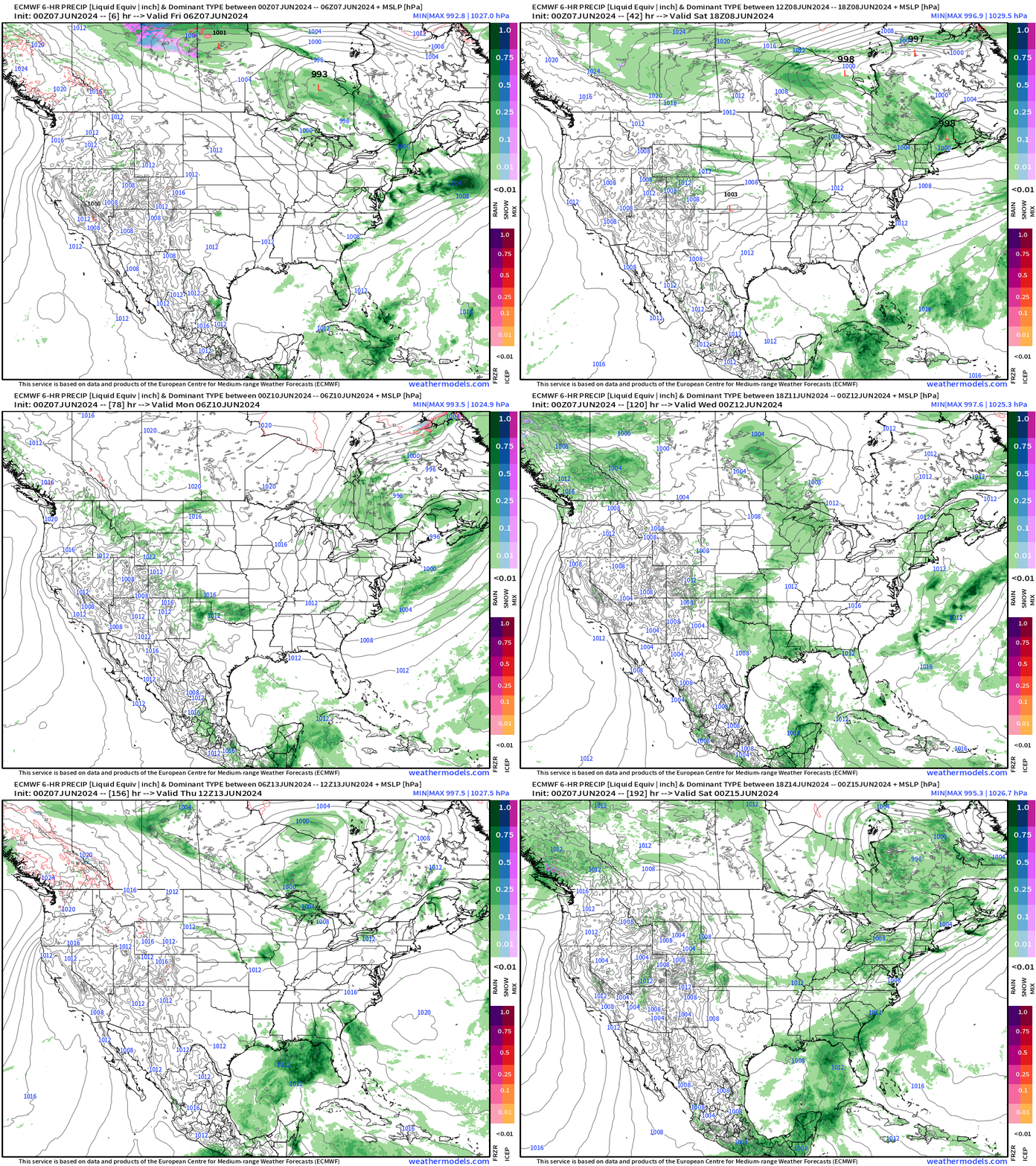
Next 8-Days Weather Systems | ECMWF HRES
15-Day Precipitation and Anomaly (%)
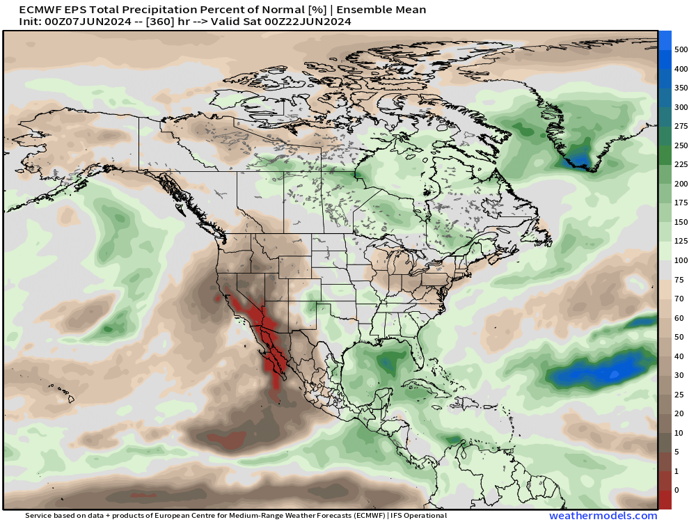
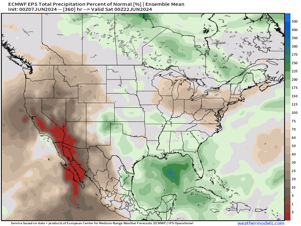
The Gulf of Mexico finally sees above average precipitation as tropical moisture could spawn tropical storms (maybe 2 of them) during the next 2-weeks.
Weekly Temperature Anomaly
EPS Week 1: June 7-13, 2024
EPS Week 2: June 14-20, 2024
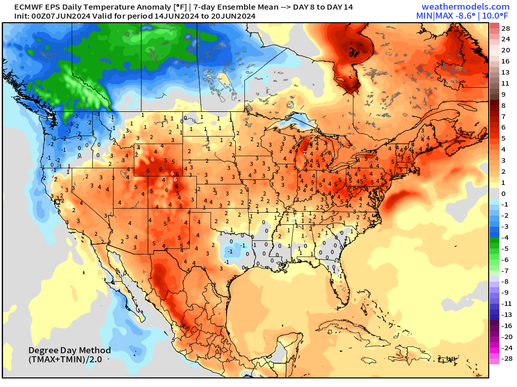
Warming trend into middle-June as the Canadian air mass finally moderates and is replaced by ridging.
Thank you to Subscribers and Supporters!
Maps sourced from weathermodels.com designed and innovated by yours truly! I actually create all of my content from scratch.
- Milepost
- 304 · laid 2024-06-07T14:51:36.131000Z
- Source
- https://weather.substack.com/p/june-7-2024-weekend-weather-update
- Digest
- 1bc4498f991e6691c31f52d0425cd4418267dde5f006a2f7ee46c7ac5b412b64
- Machine
- JSON