June 6, 2024 Tropical Update
Watching for development in Gulf of Mexico by Days 10-15
June 2024 was the 2nd-warmest June in the 132-year national record (1895–2026), at 71.8°F against a 1991–2020 normal of 69.5°F (+2.3°F).
June 2024 was the 41st-driest June in the 132-year national record (1895–2026), at 2.8in against a 1991–2020 normal of 3.1in (-0.3in).
NOAA/NCEI Climate at a Glance, contiguous United States. This is the observed record for the month, not a score of anything said in this piece — the forecast ledger begins 2026-08-17 and cannot reach earlier posts.

The investment in my research and development will pay off as A.I. enabled weather forecasts become a normal and indispensable part of our weather forecasting enterprise.
Atlantic Basin Tropical Weather Outlook
No areas of interest in the NHC Tropical Weather Outlook across the Atlantic tropics as we head through the first week of the 2024 Atlantic Hurricane Season.
Synoptic Analysis
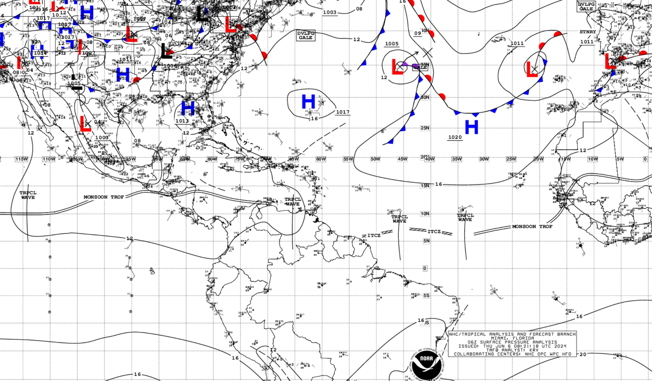
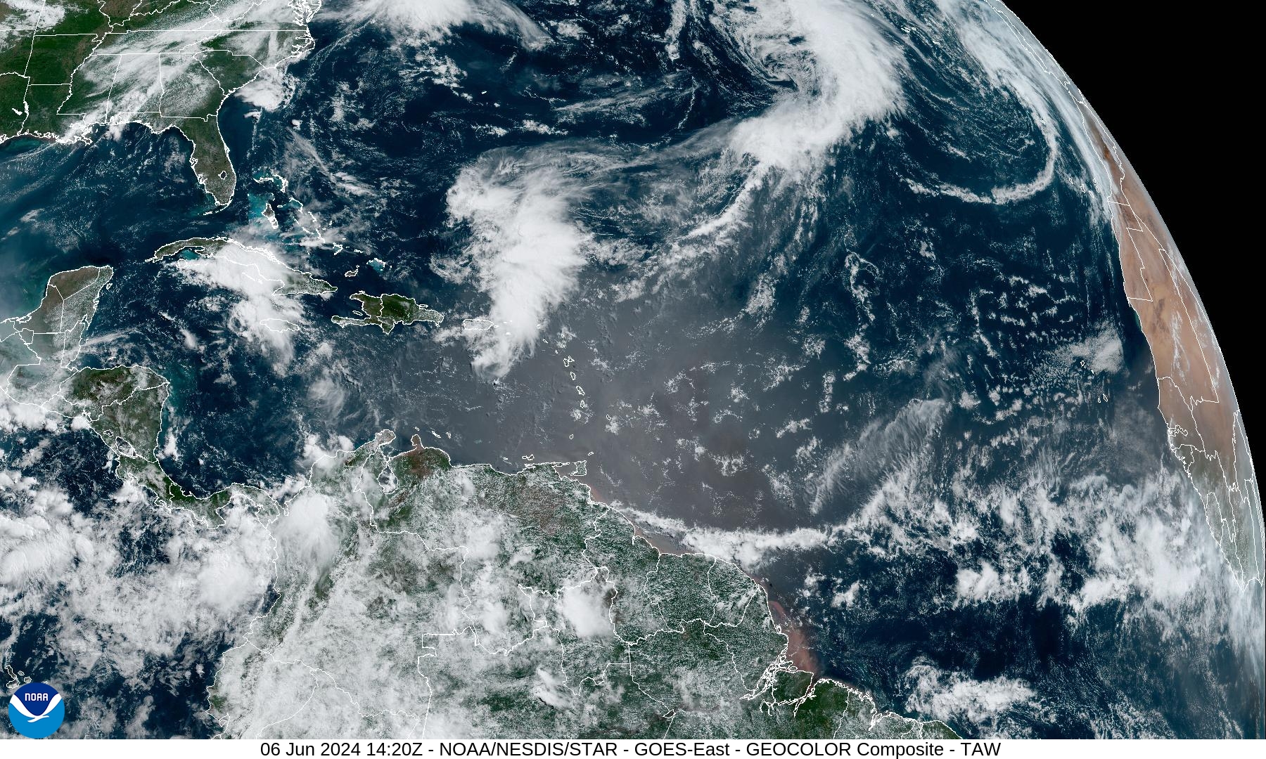
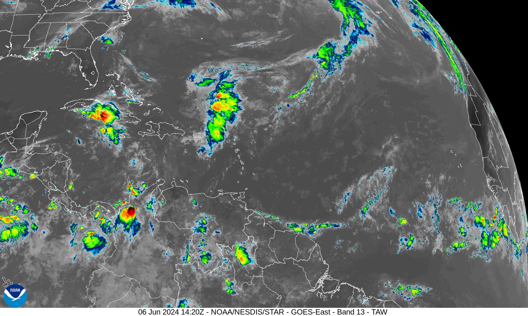
3 tropical waves in the deep tropical Atlantic along the ITCZ with the westernmost wave reaching Venezuela. The Gulf of Mexico is almost entirely clear of showers and clouds. An area of showers over Cuba and Jamaica is the only area of convection that is large enough to warrant some attention, but tropical development is unlikely.
Strong surface high pressure dominates in the subtropics from Bermuda to the Azores.
...TROPICAL WAVES...

A central Atlantic tropical wave is near 33W/34W from 11N
southward, and moving west at around 10 kt. Nearby convection is
described below.

A central tropical wave is near 46W from 11N southward, and
moving west at around 10 kt. Scattered moderate convection is from
05N to 07N between 46W and 48W.

A Caribbean tropical wave is near 65W from 14N southward to across
central Venezuela, and moving west at 10 to 15 kt. The tropical wave
is enhancing convection over portions of central and eastern
Venezuela.
Basin Wide GeoColor and Infrared Satellite Imagery
Gulf of Mexico
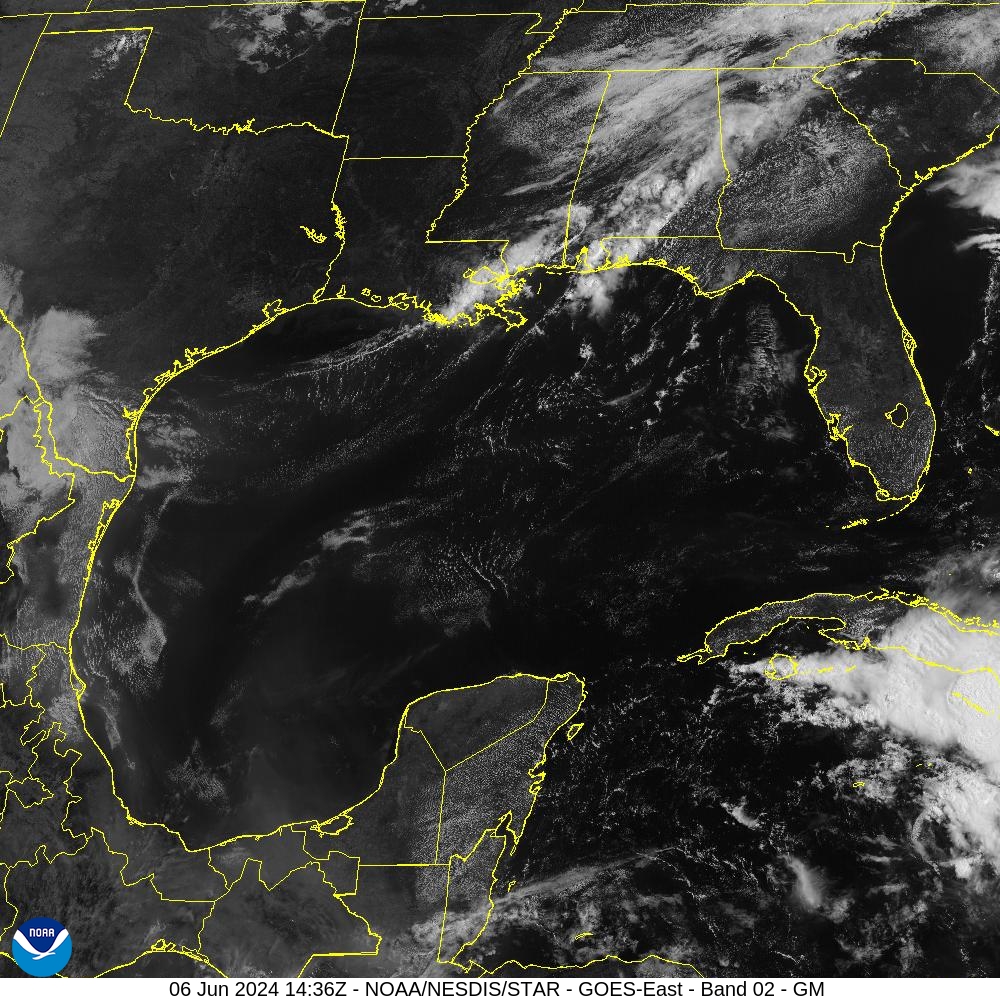
Yet another crystal clear day across the Gulf of Mexico.
Significant Wave Height
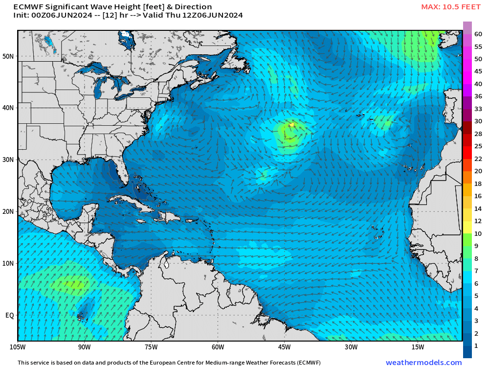
The ECMWF wave model coupled to the IFS HRES shows quiet seas across the vast majority of the Atlantic from the Gulf of Mexico to the coast of Africa.
Precipitation Anomaly Next 10-days
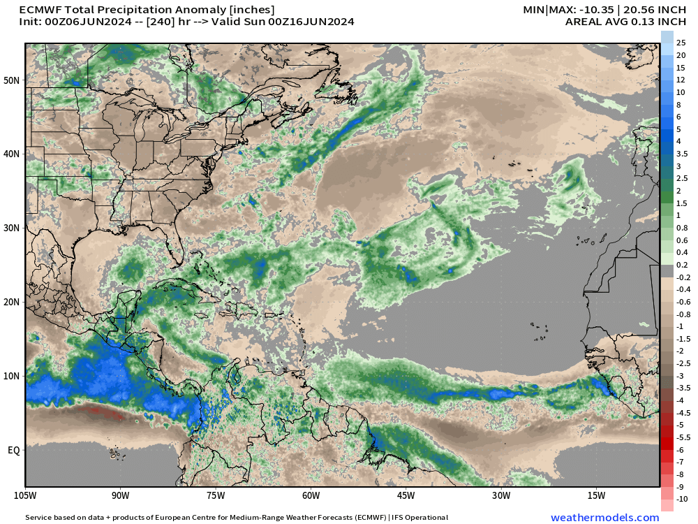
[Convection or heavy rain and storms occur in paths or tracks with or w/o organized tropical cyclones. Where it rains is the obvious footprint or evidence of where ascent, instability, and potential for development could/might occur in a 10-day period from a weather model. This is an easy way to eyeball where/if TCs will occur.]
ECMWF IFS | 10-Day Precipitable Water Anomaly Forecast
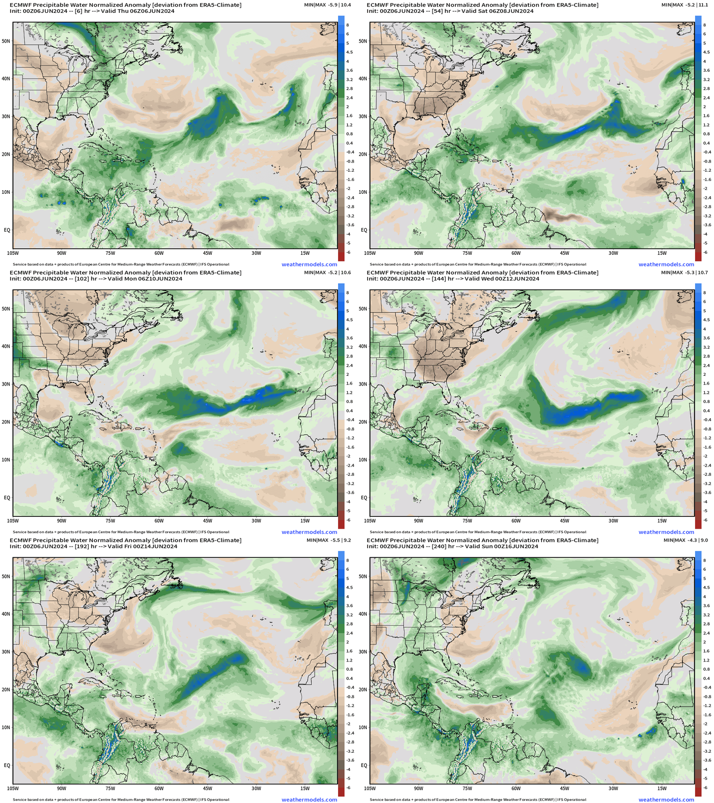
At the end of the 10-day loop, we can see a bit of a swirl in the southern Gulf of Mexico with moisture arriving from a tropical wave way back in the Main Development Region (MDR).
That’s our best chance of a tropical storm so far in 2024 — but plenty of waiting and watching.
[This is the “normalized anomaly” of precipitable water (my favorite variable) taking into account climatology (30-years) and calculating deviations from the historical mean. This allows easy tracking of extreme features like the tropical wave in the eastern Atlantic. The dry air with the late-season cold front is highlighted by this weekend.]
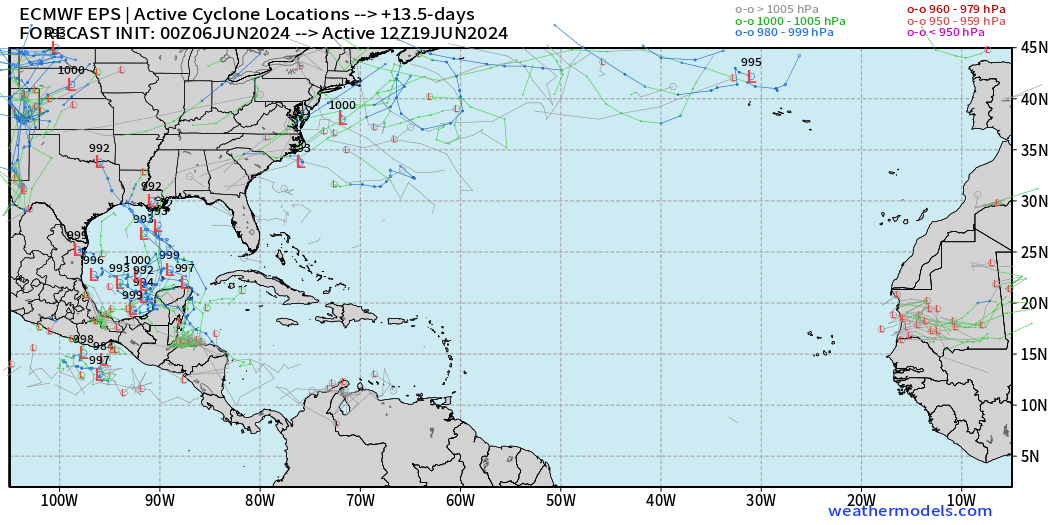
15-Day | Atlantic EPS Cyclone Tracks
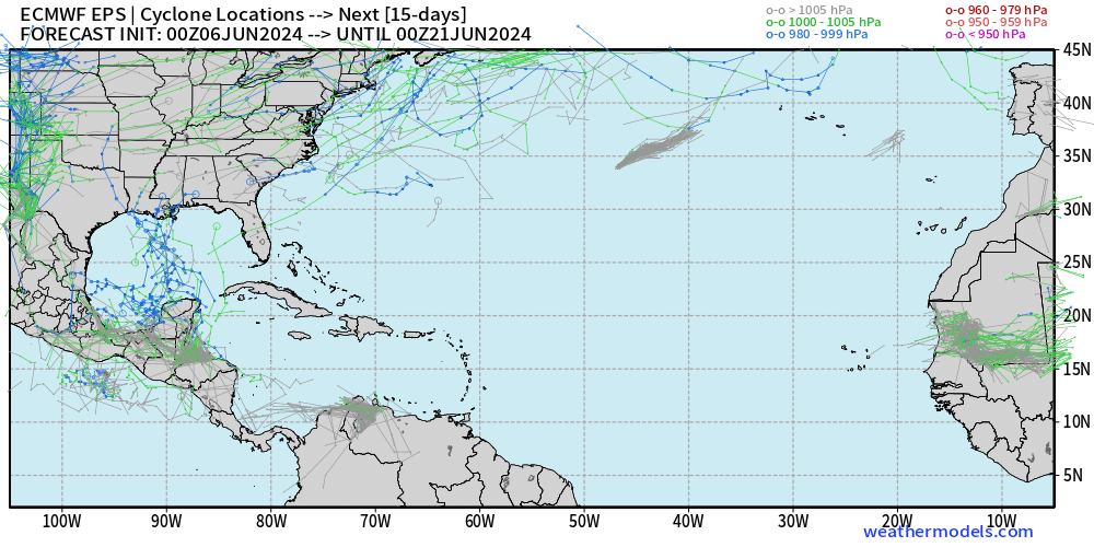
Many more ensemble members [majority] now show the development of a tropical system in the Caribbean gyre in the 10-15 day time frame.
Active storm locations at Day 13.5:
Eastern Pacific Tropical Weather Outlook
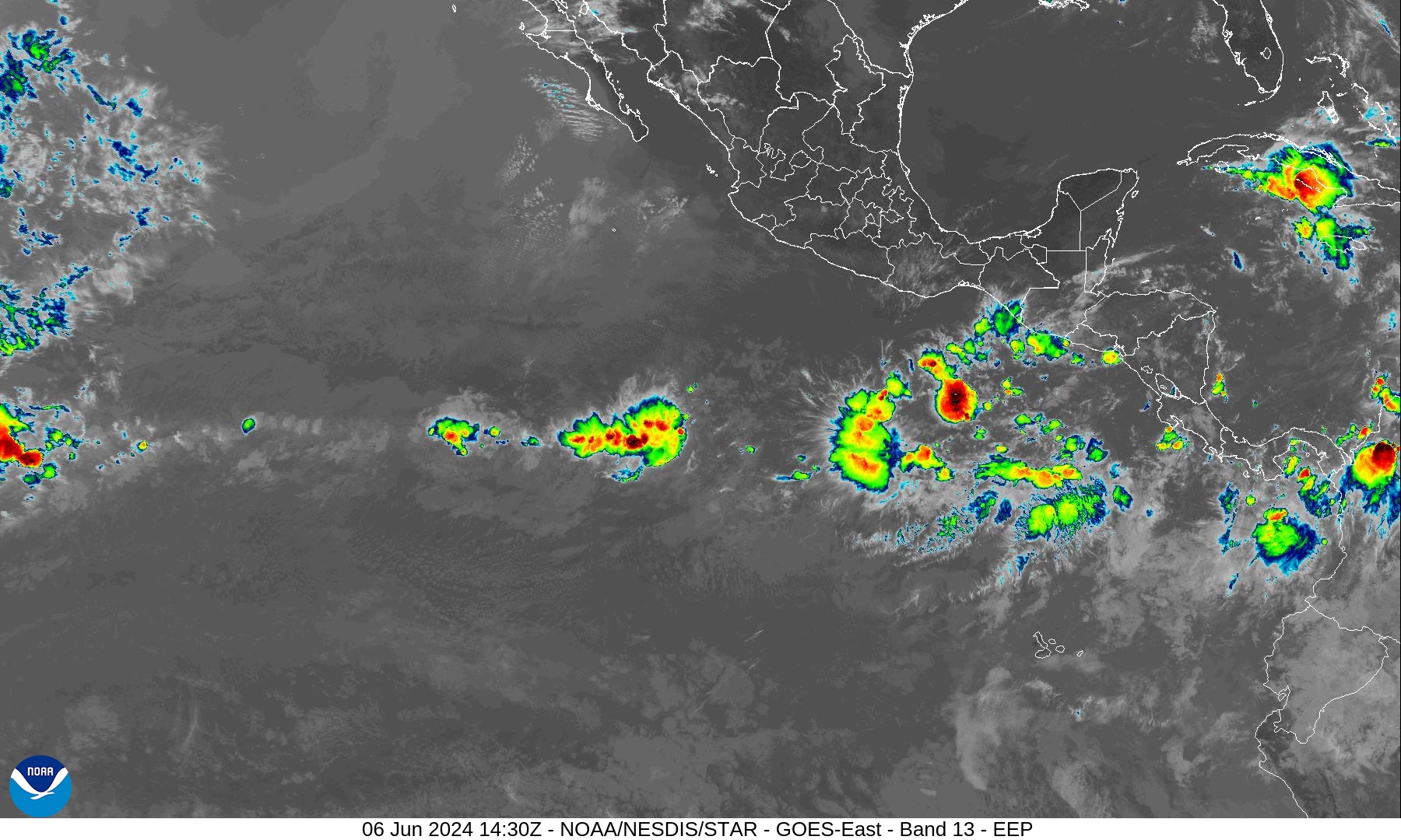
NHC does not have any areas of interest in the Tropical Weather Outlook through 48-hours and 7-days — June 13.
June can be quiet busy in the Eastern Pacific as the Caribbean gyre spawns vorticity + tropical waves reach the very warm waters west of Central America.
However, the convection associated with the waves has remained weak and unable to persist — so far evidence of a quiet season due to transition to La Nina.
Western Pacific Tropical Weather Outlook
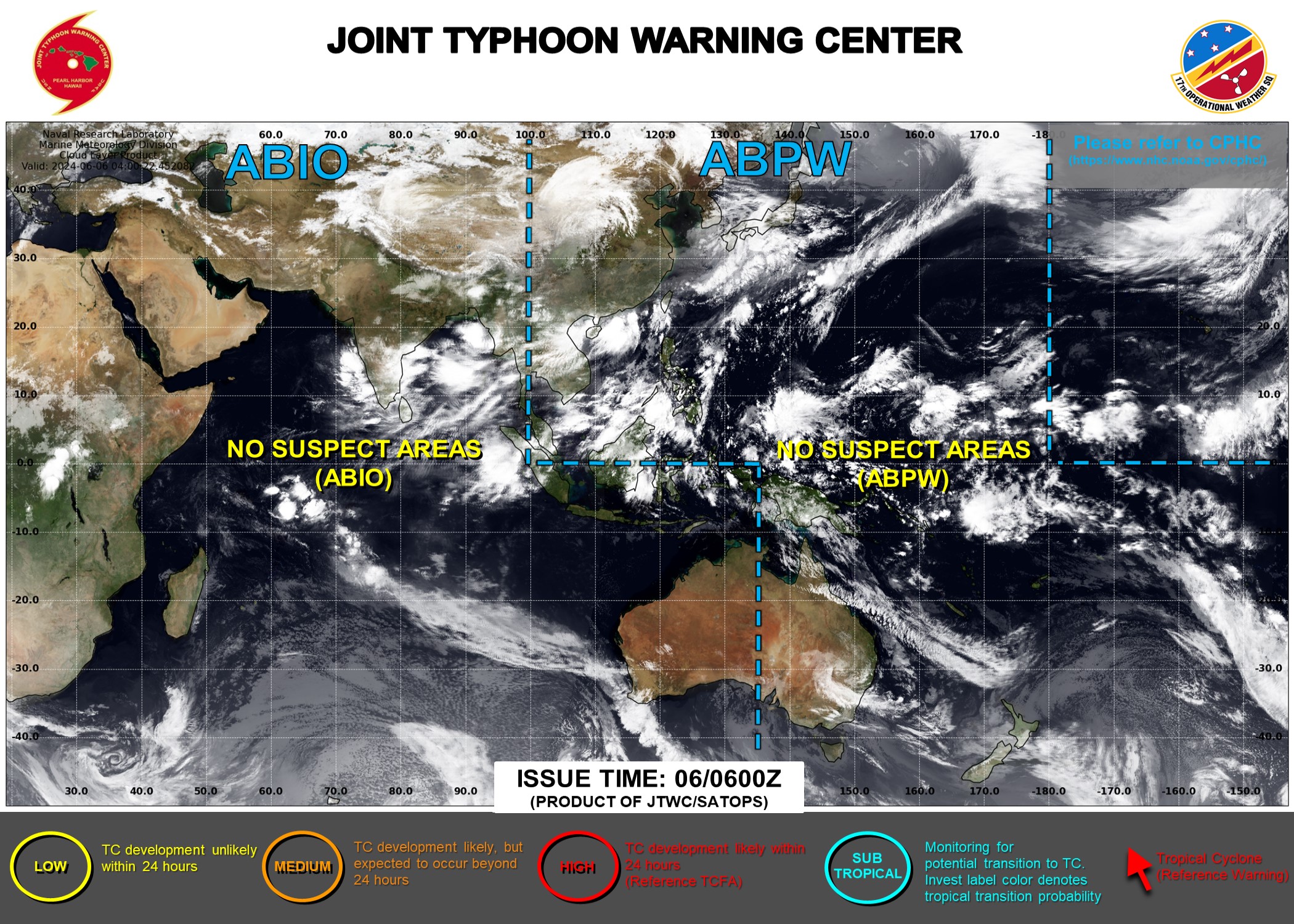
Ghost town — No areas of interest during the next 48-hours to 7-days.
ECMWF HRES 10-Day Storm Tracks
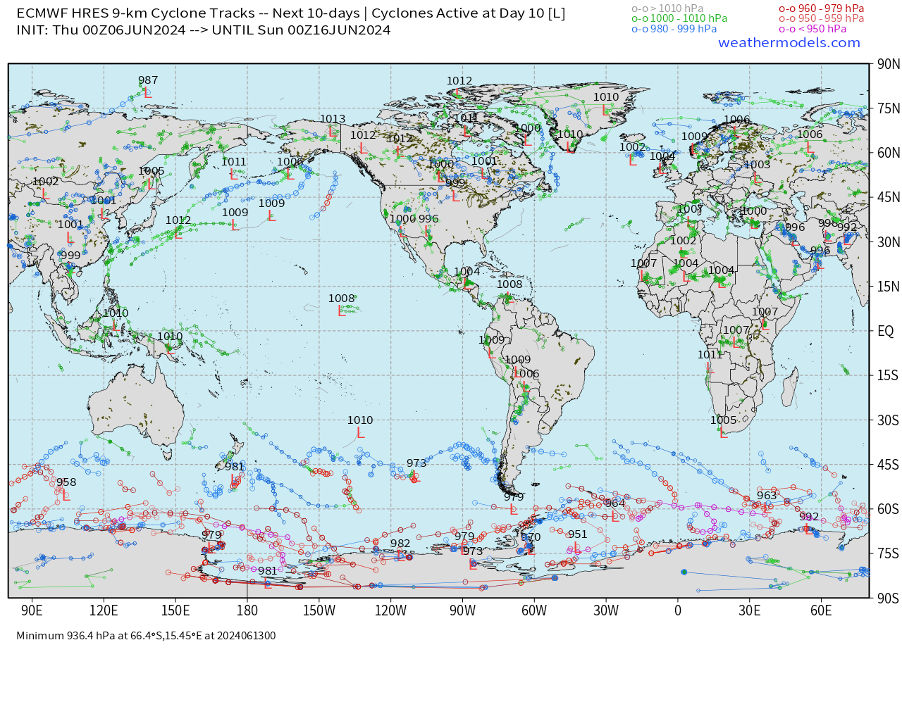
No areas of tropical cyclone in the 10-day IFS HRES forecast through June 16, 2024.
ECMWF AIFS 15-Day Storm Tracks
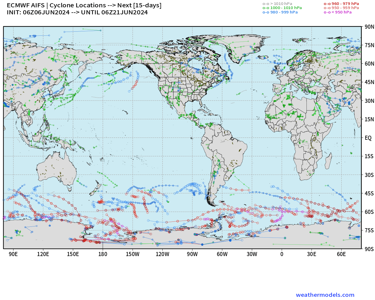
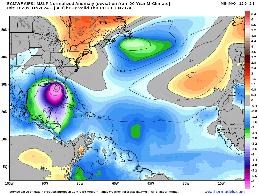
While the 06z ECMWF AIFS does not show a system in the Gulf of Mexico, forecasts from yesterday 12z/18z did show a tropical storm in the 13-15 day time range or two weeks from now.
The most recent 06z forecast has an area of low pressure over the Yucatan — really only visible with the normalized anomaly of MSLP parameter.
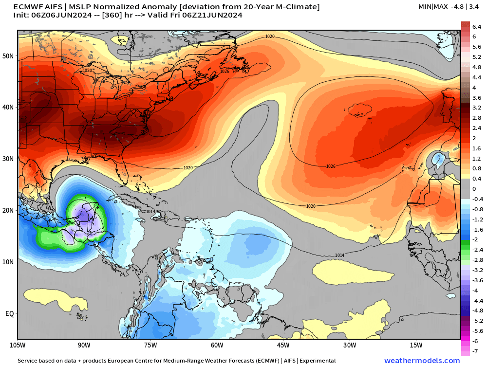
Here was the much stronger Low Pressure — likely strong TS in Wednesday’s 18z forecast run from AIFS. We really have no idea about the tropical cyclone genesis bias or hit-rate or skill — so all we can do is watch the model data on a day to day basis to learn.
Thank you to Subscribers and Supporters! Welcome to June 2024 and Atlantic Hurricane Season.
Maps sourced from weathermodels.com designed and innovated by yours truly! I actually create all of my content from scratch.
- Milepost
- 302 · laid 2024-06-06T14:59:24.091000Z
- Source
- https://weather.substack.com/p/june-6-2024-tropical-update
- Digest
- 8180c6e8b25b0ae180fe8523dcaf14334e2e8e58e6c5a4039f338926e1a1b9e5
- Machine
- JSON