June 4, 2024 Evening Weather Update
Western heat dome builds with temperatures in the 100s
June 2024 was the 2nd-warmest June in the 132-year national record (1895–2026), at 71.8°F against a 1991–2020 normal of 69.5°F (+2.3°F).
June 2024 was the 41st-driest June in the 132-year national record (1895–2026), at 2.8in against a 1991–2020 normal of 3.1in (-0.3in).
NOAA/NCEI Climate at a Glance, contiguous United States. This is the observed record for the month, not a score of anything said in this piece — the forecast ledger begins 2026-08-17 and cannot reach earlier posts.

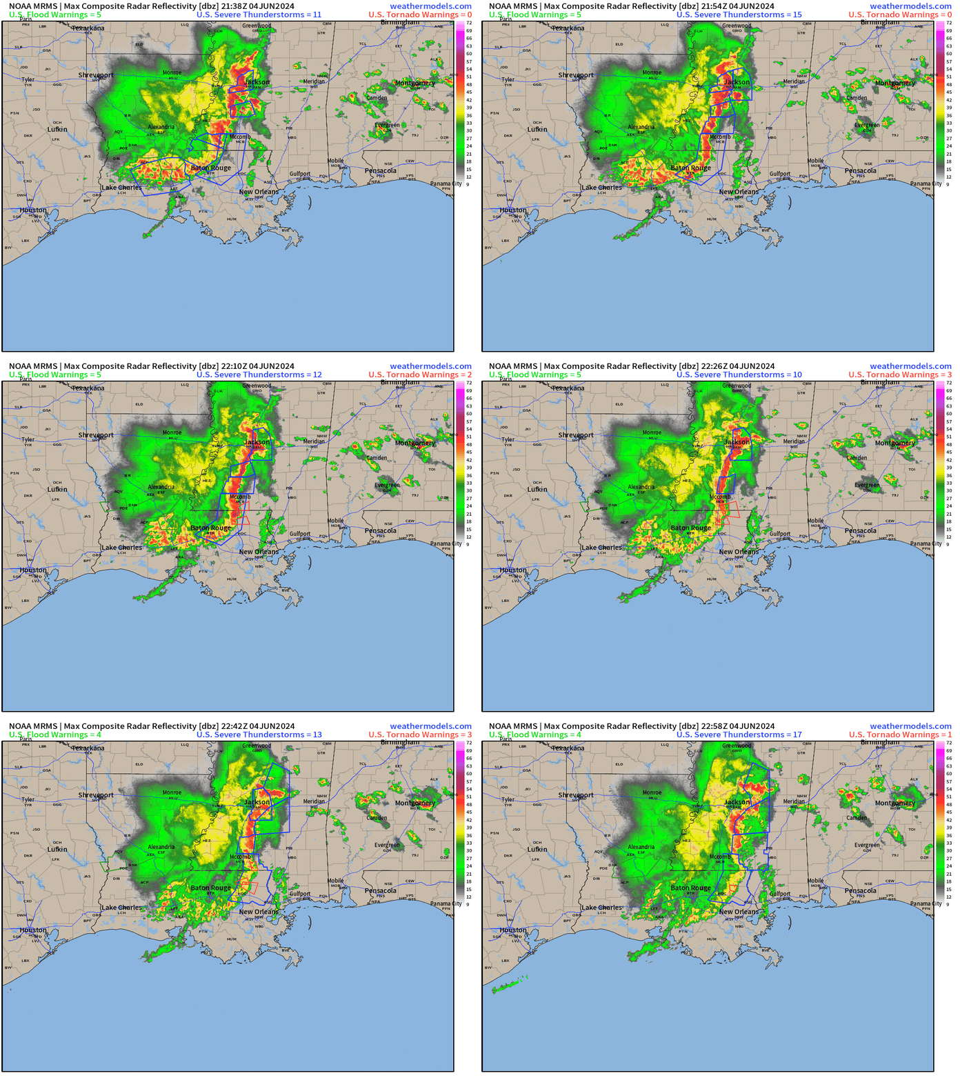
A cluster of thunderstorms is moving through Louisiana and Mississippi this evening providing heavy rain and plenty of cooling air for the sultry Gulf coast.
A heat dome or ridge of high pressure in the middle-atmosphere is building over the West Coast with height anomalies centered on northern California. The result is extreme heat into the 100s in the Central Valley and 110s into Phoenix. Death Valley should see 125°F.
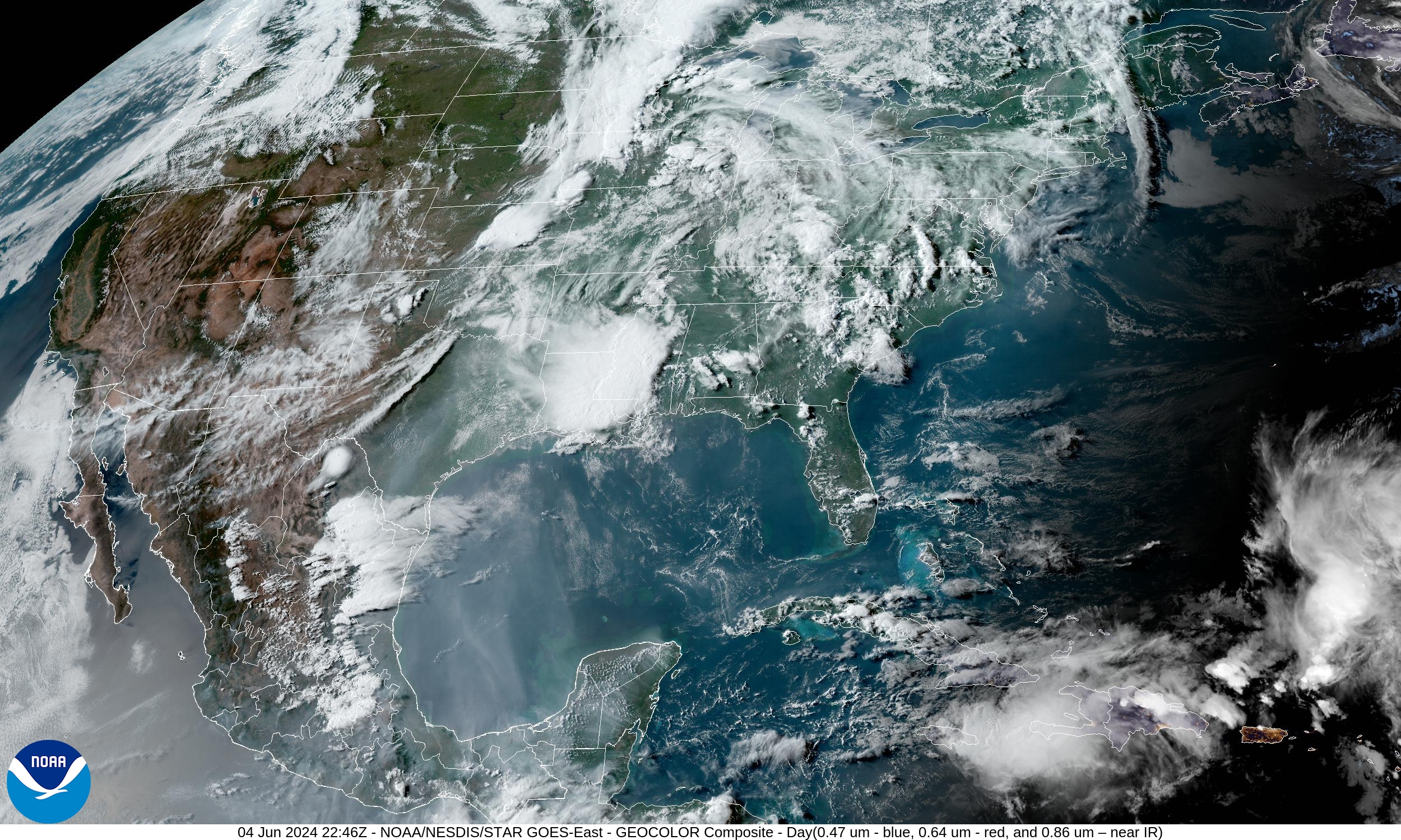
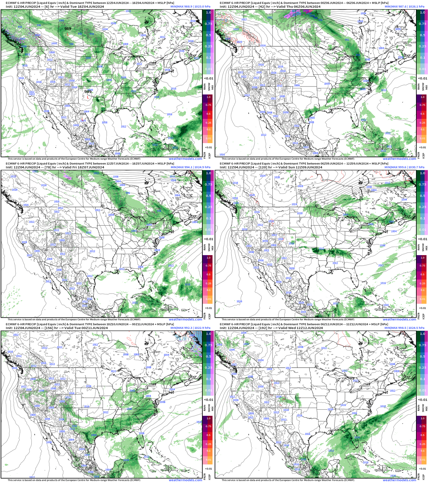
Pop-up summer-time thunderstorms dot the landscape east of the Mississippi in high-dewpoint air. However, as June continues, organized low pressure systems are rare and instead we see convective blobs or lines of storms rounding the ridge. Later this evening, a cluster of thunderstorms should fire in OK and sag southward into Texas including Dallas-Fort Worth.
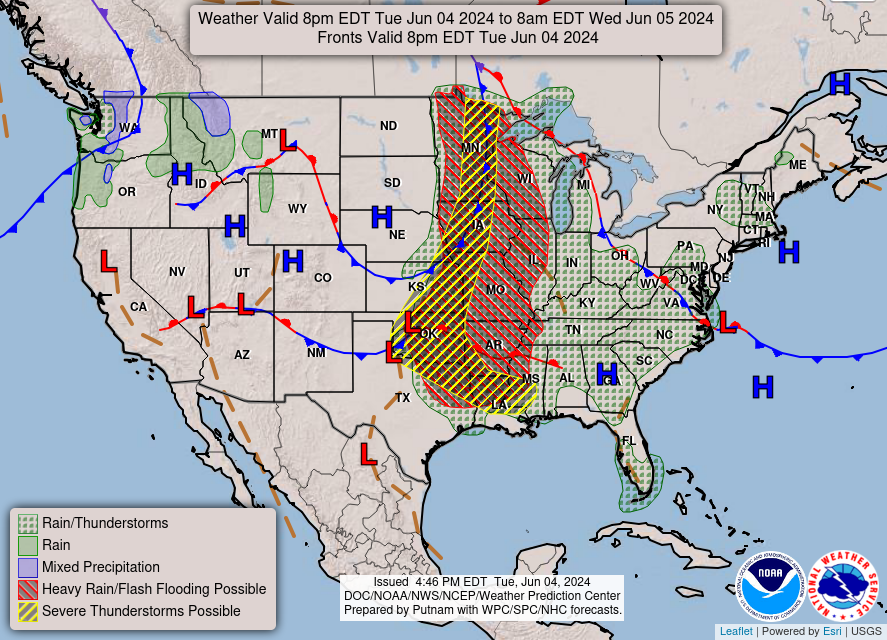
Severe storms are possible later tonight into the overnight hours along a frontal boundary that outlines a trough.
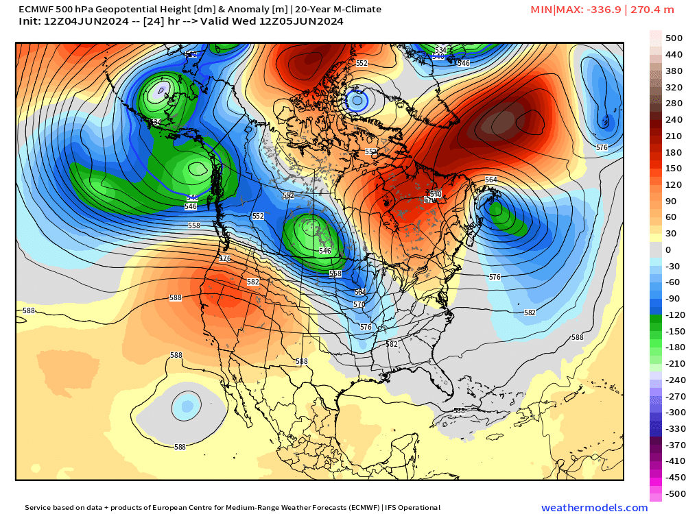
The ridge of high pressure is centered over the Western U.S. with dips or a series of troughs extending from Alaska into the Midwest.
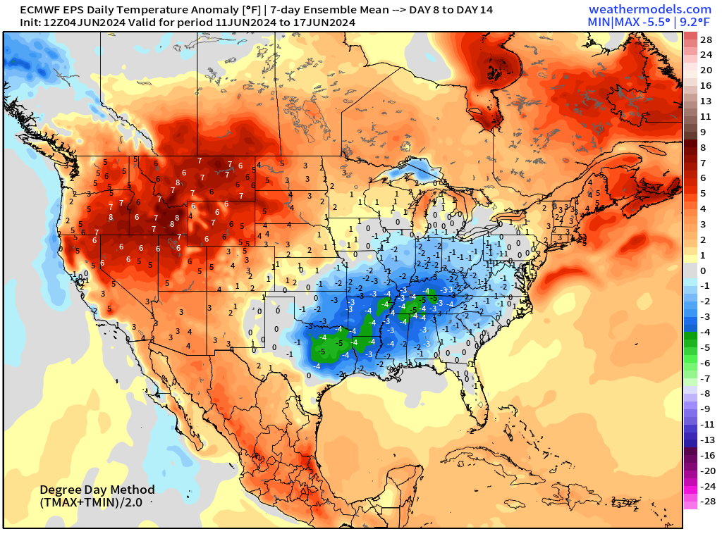
No heat dome development east of the Rockies in the next 2-weeks? Looks like that’s the case going forward through mid-June.
18-Hour Forecast | Simulated Radar | HRRR
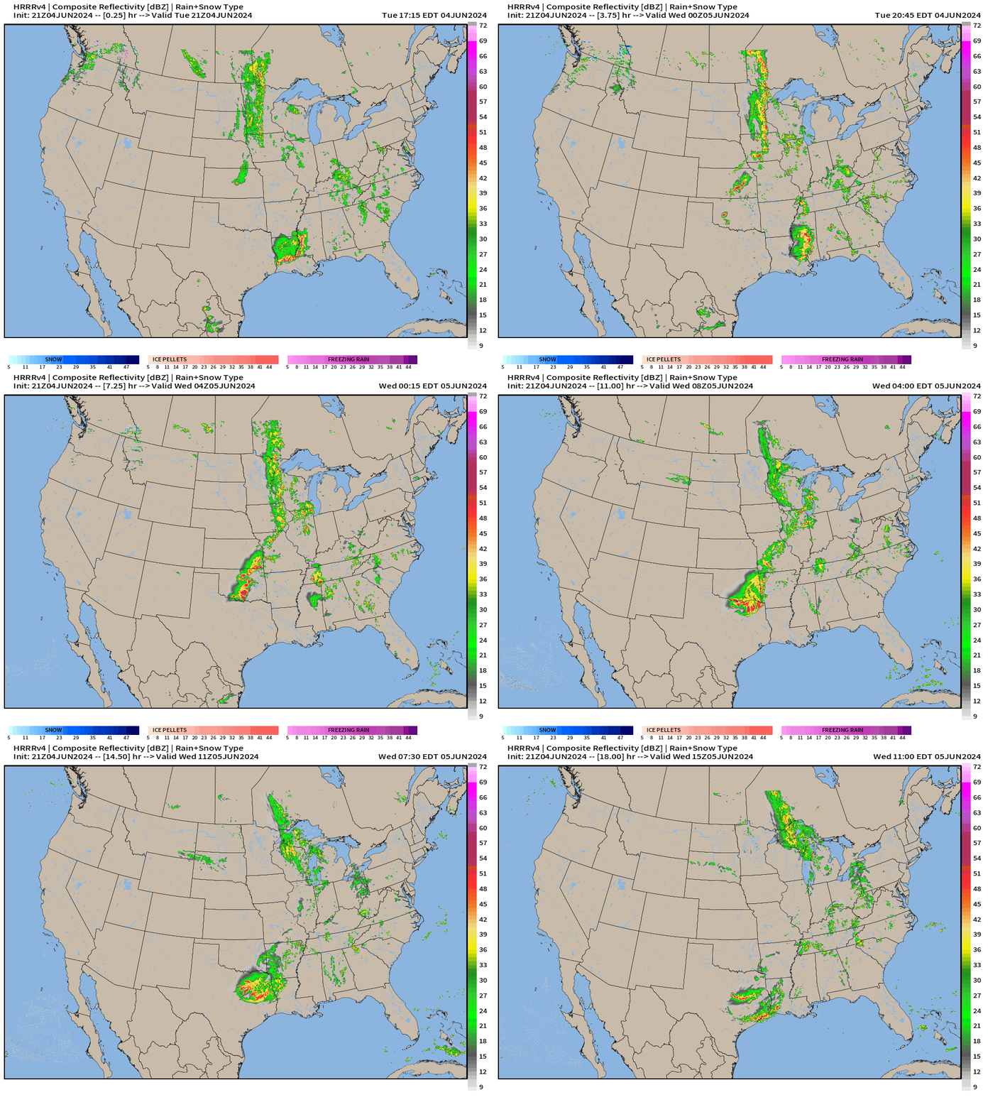
HRRR shows a cluster of storms developing in the Plains and blasting southward through Texas perhaps just east of DFW. The outflow boundaries could see gusty and damaging winds. These convective systems are very beneficial for rainfall although no shortage of precipitation:
Next 10-days Upper-Level Weather Pattern | ECMWF AIFS
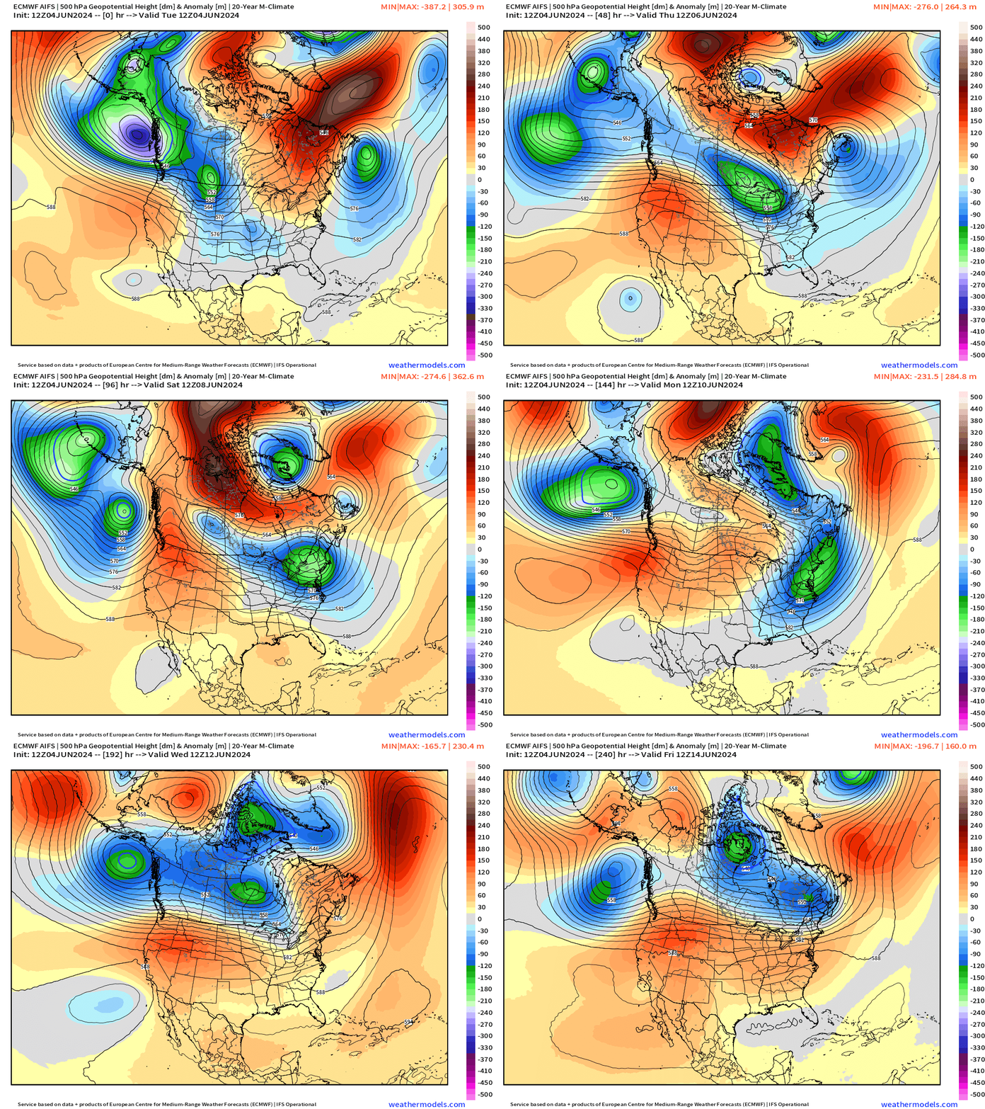
Pattern favors ridging over the Western U.S. with troughing over the Eastern U.S.
NWS WPC 7-Day Precipitation Forecast | Watering Needs
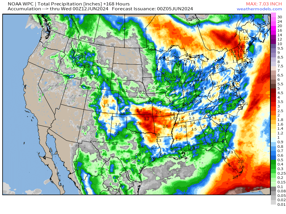
Dakotas look dry over the next 7-days. Of course, no rain across Arizona.
Wednesday High Temperatures & Weather
Lower 48 Average: 83.4°F | 262 Million at/above 80°F | 84 Million at/above 90°F
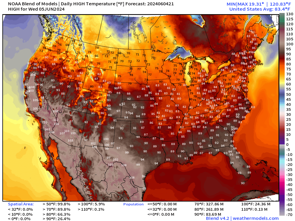
Extreme heat continues across Texas into the 100s along the Rio Grande. 110°F in Phoenix. 103-105°F in the California Central Valley.
Mild in New England in the 80s.
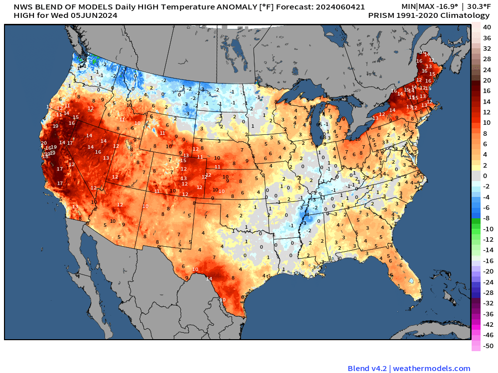
Compared to normal, high temperatures are hottest in New England about 15°F above average. Same across California and Nevada.
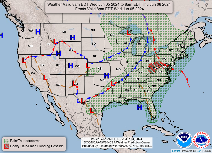
Garden variety scattered showers main threat on Wednesday but no severe weather expected.
Next 8-Days Weather Systems | ECMWF HRES
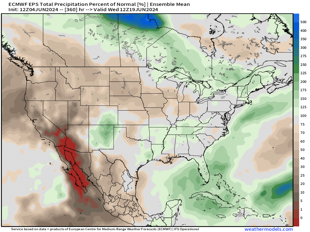
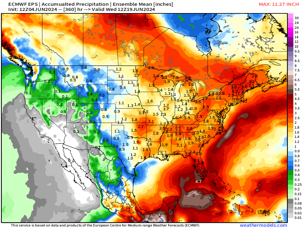
15-Day Precipitation and Anomaly (%)
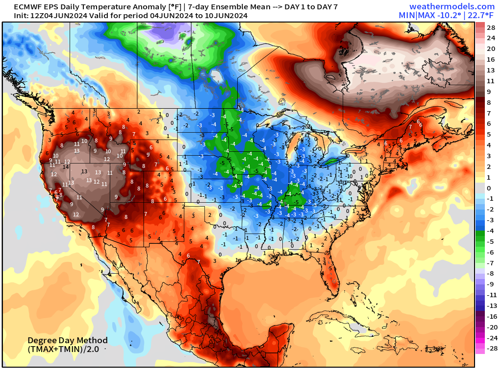
Weekly Temperature Anomaly
EPS Week 1: June 4-10, 2024
EPS Week 2: June 11-17, 2024
Thank you to Subscribers and Supporters!
Maps sourced from weathermodels.com designed and innovated by yours truly! I actually create all of my content from scratch.
- Milepost
- 300 · laid 2024-06-04T23:18:01.275000Z
- Source
- https://weather.substack.com/p/june-4-2024-evening-weather-update
- Digest
- 39455adf718b7fbe0fd8930841a2151659d5a986ff38954b6807ea75617c1399
- Machine
- JSON