May 31, 2024 Tropical Update
The 2024 Atlantic Hurricane season starts on Saturday
May 2024 was the 16th-warmest May in the 132-year national record (1895–2026), at 62.2°F against a 1991–2020 normal of 61.0°F (+1.2°F).
May 2024 was the 14th-wettest May in the 132-year national record (1895–2026), at 3.6in against a 1991–2020 normal of 3.1in (+0.5in).
NOAA/NCEI Climate at a Glance, contiguous United States. This is the observed record for the month, not a score of anything said in this piece — the forecast ledger begins 2026-08-17 and cannot reach earlier posts.

Another tropical wave has emerged off the coast of Africa with showers and storms along the ITCZ. However, as typical into early June, development is very difficult and unlikely.
Atlantic Basin Tropical Weather Outlook
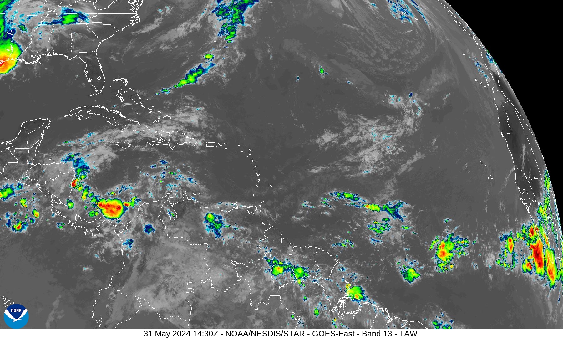
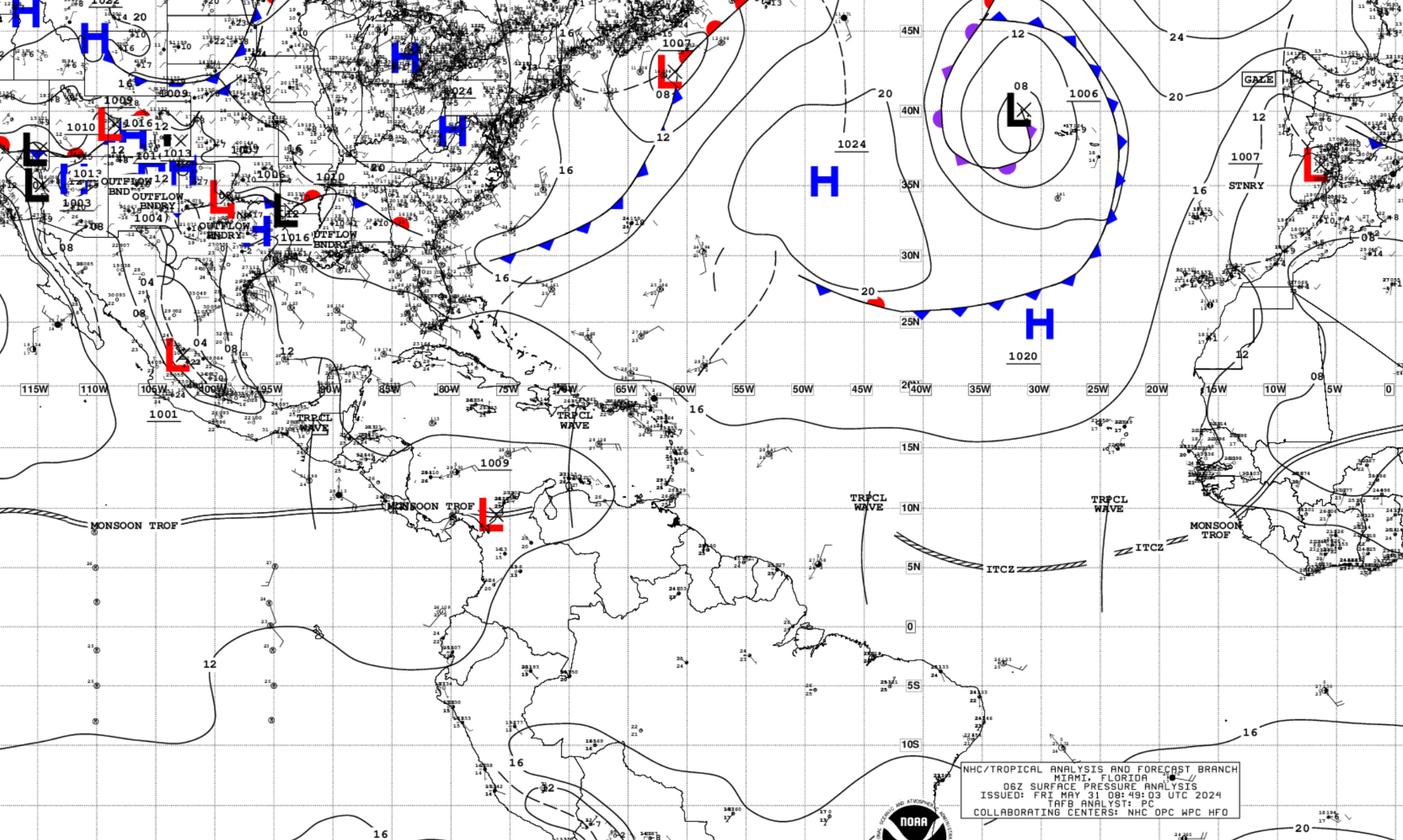
No areas of interest in the NHC Tropical Weather Outlook across the Atlantic tropics as we reach the beginning of the 2024 Hurricane Season.
African Dust | Saharan Air Layer (SAL)
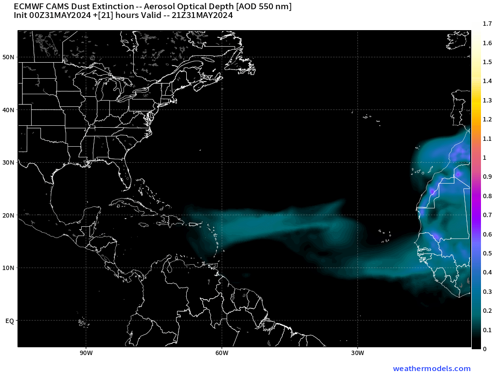
The current SAL is not particularly intense but will be noticeable today across the Lesser Antilles. This is the ECMWF CAMS dust extinction, an offline model based upon IFS. The NASA GEOS5 is on the fritz this morning.
NASA’s global weather model (based upon GFS) contains a coupled-aerosol component that diagnoses and forecasts the evolution of African dust / Saharan Air Layers (SAL). SAL events can put a lid on tropical storm development but strong tropical waves have a large enough and isolated environment that simply expunges/wipes out the convective inhibition.
10-Day Precipitable Water Anomaly Forecast
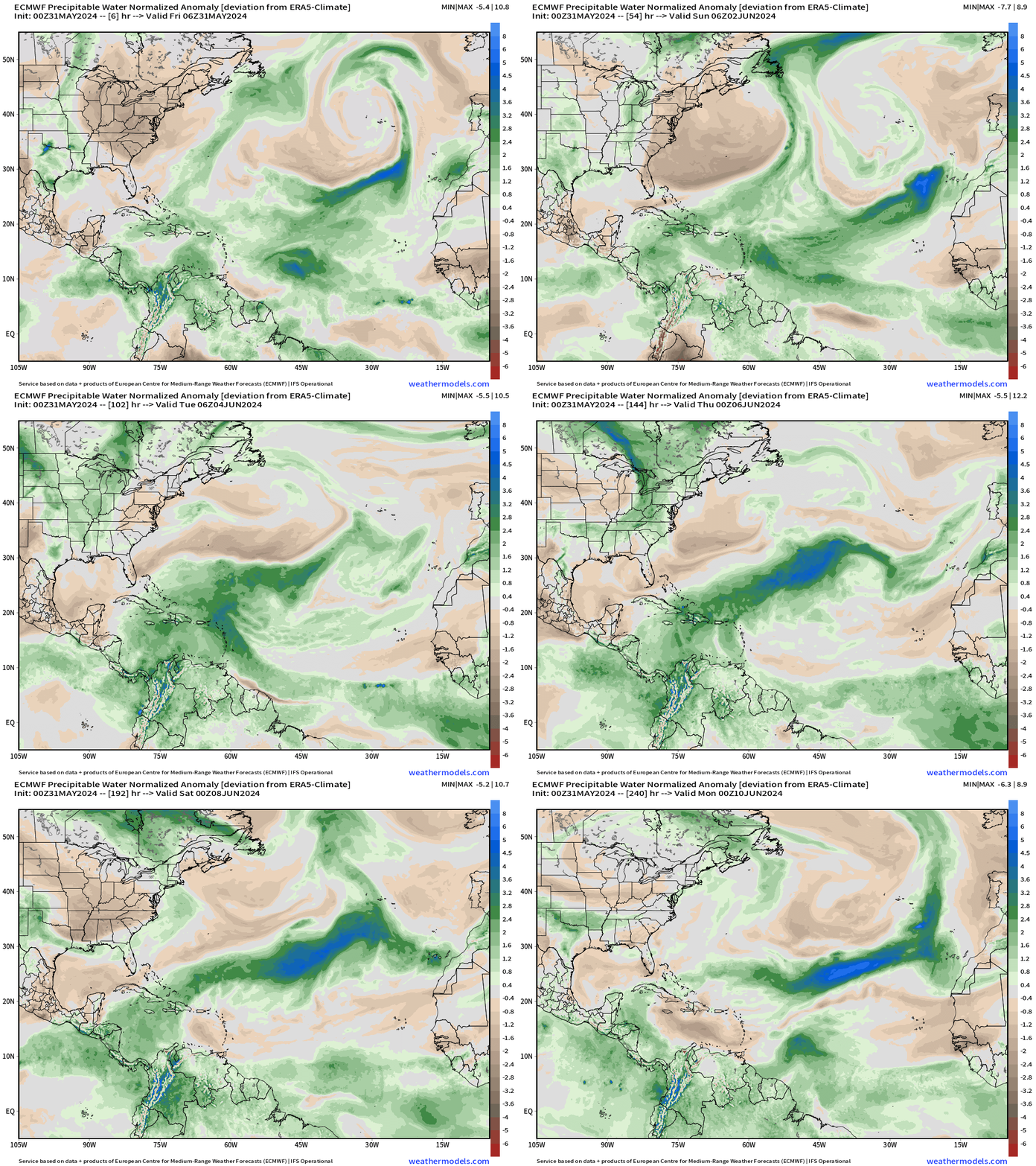
Cold fronts and troughs still impinge upon the tropics into June. As tropical waves move westward, they gain latitude and encounter hostile conditions including dry air and vertical wind shear. Not until July do the environmental conditions improve enough to expect tropical storm development in the far Atlantic even if ocean temperatures are warm enough.
[This is the “normalized anomaly” of precipitable water (my favorite variable) taking into account climatology (30-years) and calculating deviations from the historical mean. This allows easy tracking of extreme features like the tropical wave in the eastern Atlantic. The dry air with the late-season cold front is highlighted by this weekend.]
Powerful Late Season Cold Front
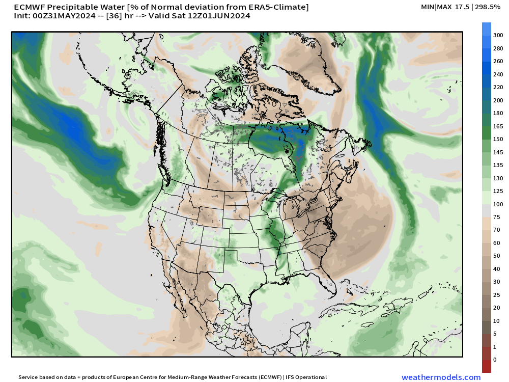
An early June cold front will blast off the U.S. East coast this weekend.
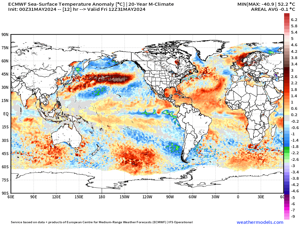
Global Sea Surface Temperature Anomaly
15-Day | Atlantic EPS Cyclone Tracks
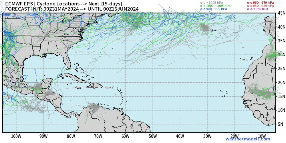
Almost no activity in the 15-day EPS Ensemble Forecast into mid-June. However, there are a couple ensemble members streaking into the Gulf of Mexico, but probability in the 1% range.
Eastern Pacific Tropical Weather Outlook
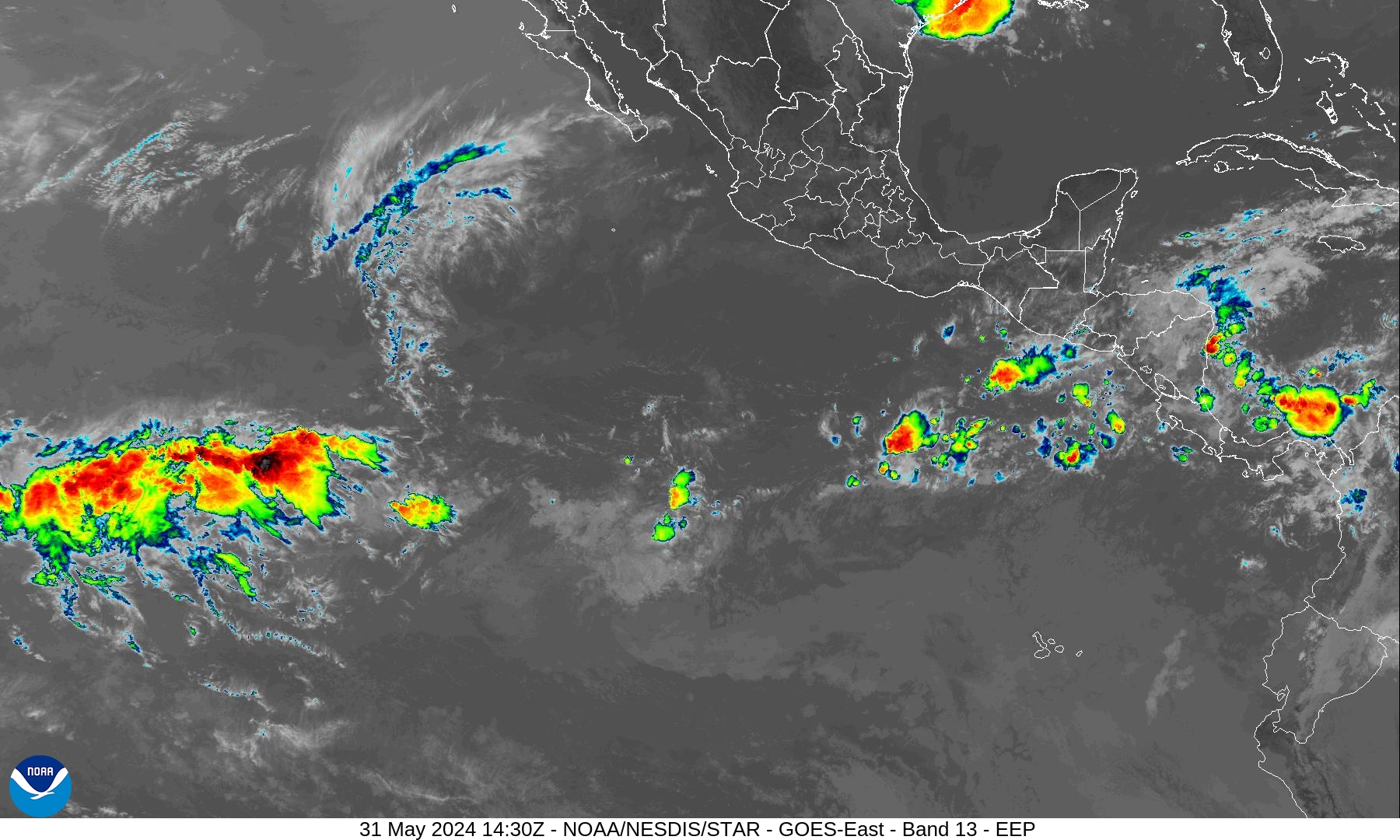
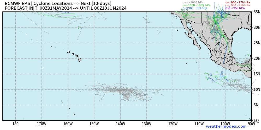
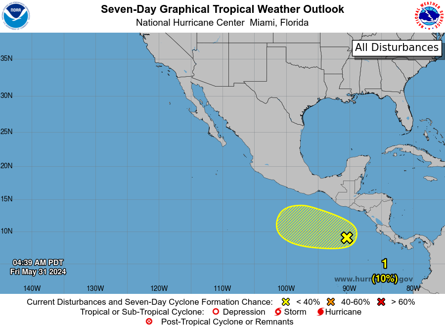
NHC still has popped up a 10% Chance of Cyclone Formation within 48-hours and 7-Days south of Mexico. There is limited ensemble support for the development of the Eastern Pacific’s first Tropical Storm or Hurricane. Better chance into the 2nd week of June as tropical waves from the Atlantic / Caribbean move into the basin.
Western Pacific Tropical Weather Outlook
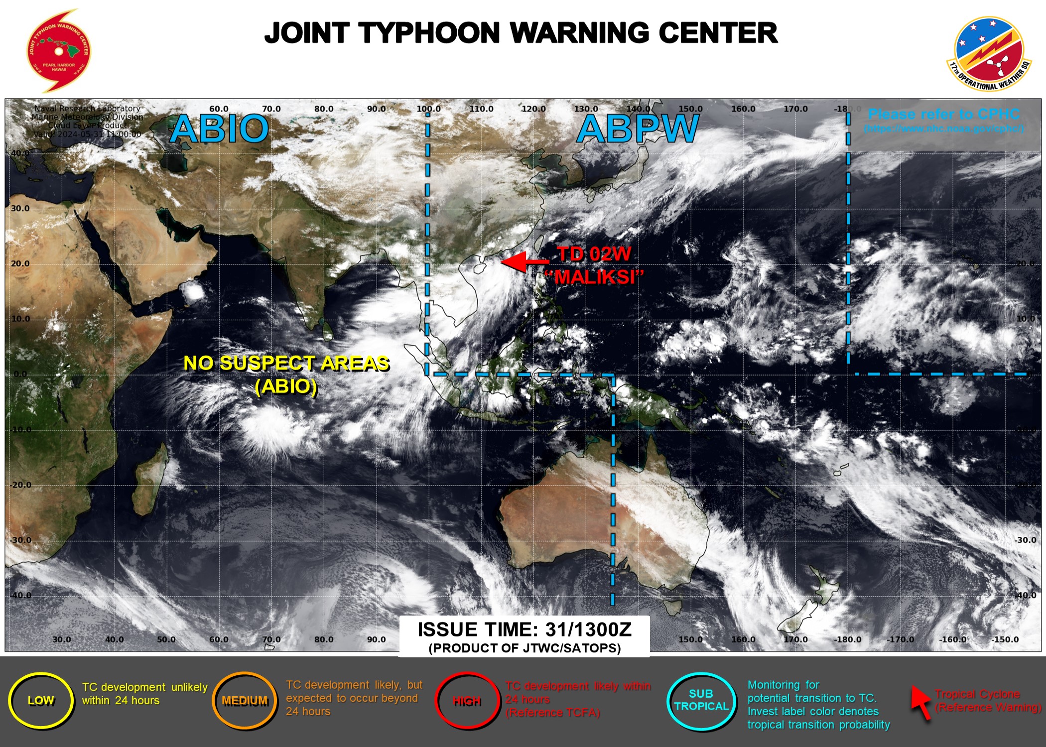
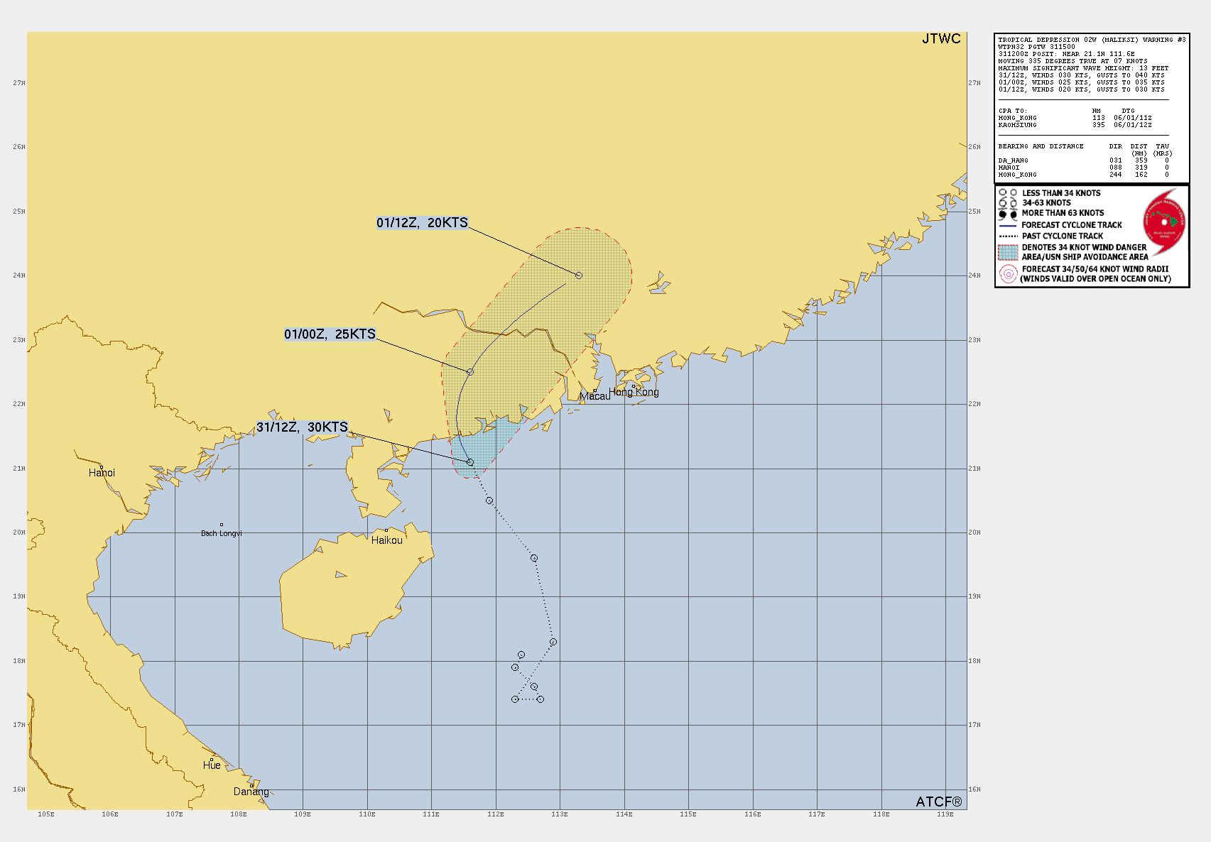
Invest 94W off the coast of China did become 02W (Maliski) with tropical depression or at most weak TS strength winds. The system will move inland with heavy rain as the primary threat to China.
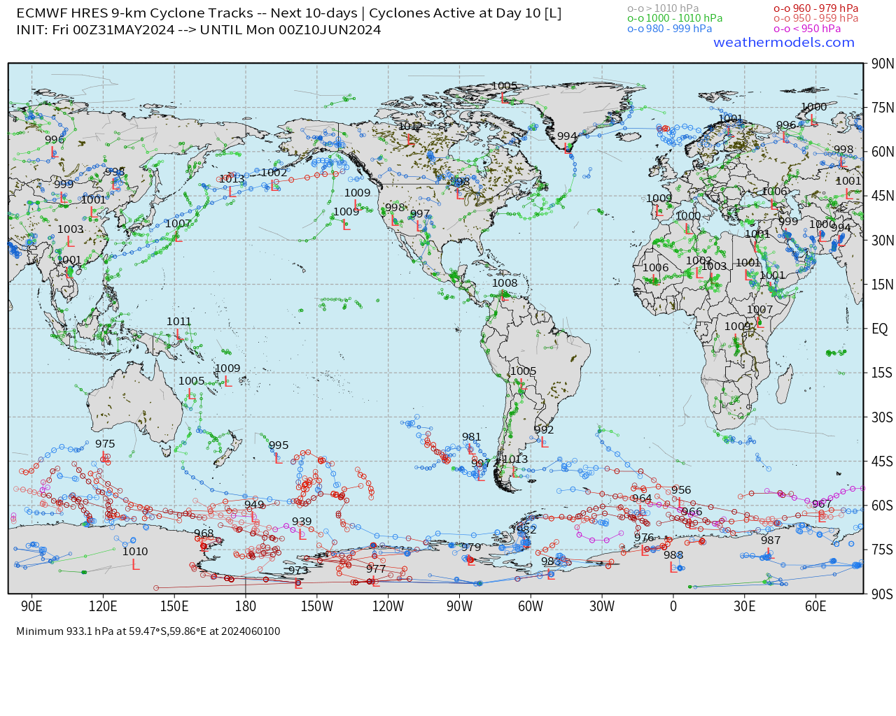
ECMWF HRES 10-Day Storm Tracks
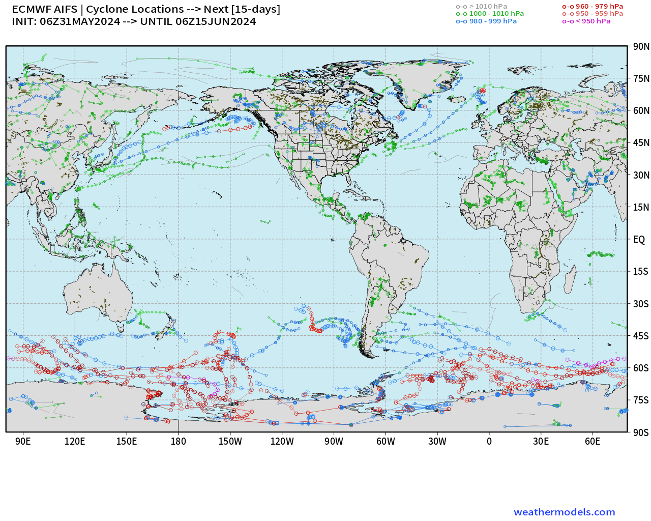
ECMWF AIFS 15-Day Storm Tracks
Thank you to Subscribers and Supporters! Welcome to May 2024 — countdown to hurricane season in 1-day.
Maps sourced from weathermodels.com designed and innovated by yours truly! I actually create all of my content from scratch.
- Milepost
- 296 · laid 2024-05-31T15:07:29.269000Z
- Source
- https://weather.substack.com/p/may-31-2024-tropical-update
- Digest
- cdb3765a10bf22a9442cefc81ac5493b2afb7beed5e39afaebf48fbe7505c9c0
- Machine
- JSON