May 28, 2024 Tropical Update
Strong tropical wave will meet a late season cold front
May 2024 was the 16th-warmest May in the 132-year national record (1895–2026), at 62.2°F against a 1991–2020 normal of 61.0°F (+1.2°F).
May 2024 was the 14th-wettest May in the 132-year national record (1895–2026), at 3.6in against a 1991–2020 normal of 3.1in (+0.5in).
NOAA/NCEI Climate at a Glance, contiguous United States. This is the observed record for the month, not a score of anything said in this piece — the forecast ledger begins 2026-08-17 and cannot reach earlier posts.

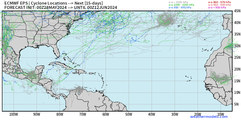
A strong tropical wave has emerged off the African continent into the Cape Verde Islands. Considerable convection (storms) are firing today but it is highly unlikely any further development occurs. However, the tropical wave should remain in tact while it heads westward toward the Lesser Antilles.
Thereafter, by this weekend, a powerful late-season cold front will blast off the East Coast with dry/cooler air to sweep the tropics clear of any disturbances.
We watch the tail ends of these subtropical/tropical cold fronts for vorticity and spin-ups that can become tropical storms.
Atlantic Basin Tropical Weather Outlook
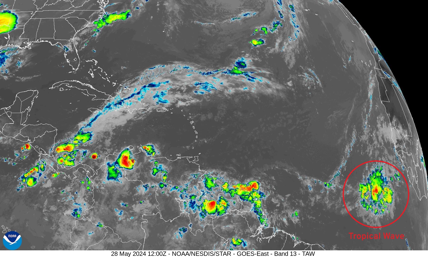
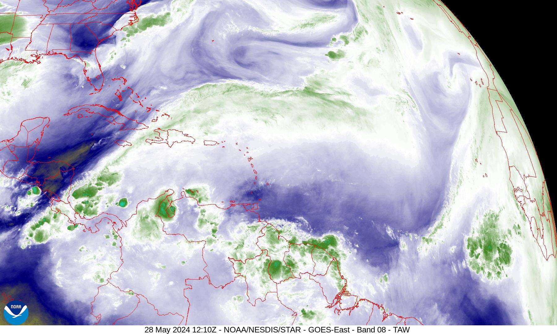
Water vapor imagery is quite useful to determine how moist and convectively unstable the tropical atmosphere is in the Atlantic. The darker blue colors show very dry air that usually indicates sinking air — suppressing storm development. The tropical wave along 22°W longitude will continue westward into the central Main Development Region (MDR).
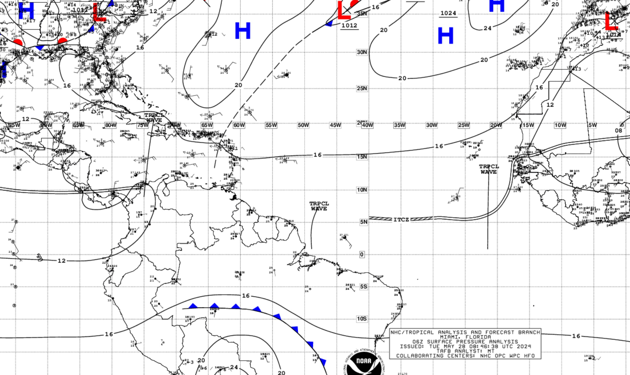
No other areas of interest across the Atlantic tropics as we reach the beginning of the 2024 Hurricane Season.
African Dust | Saharan Air Layer (SAL)
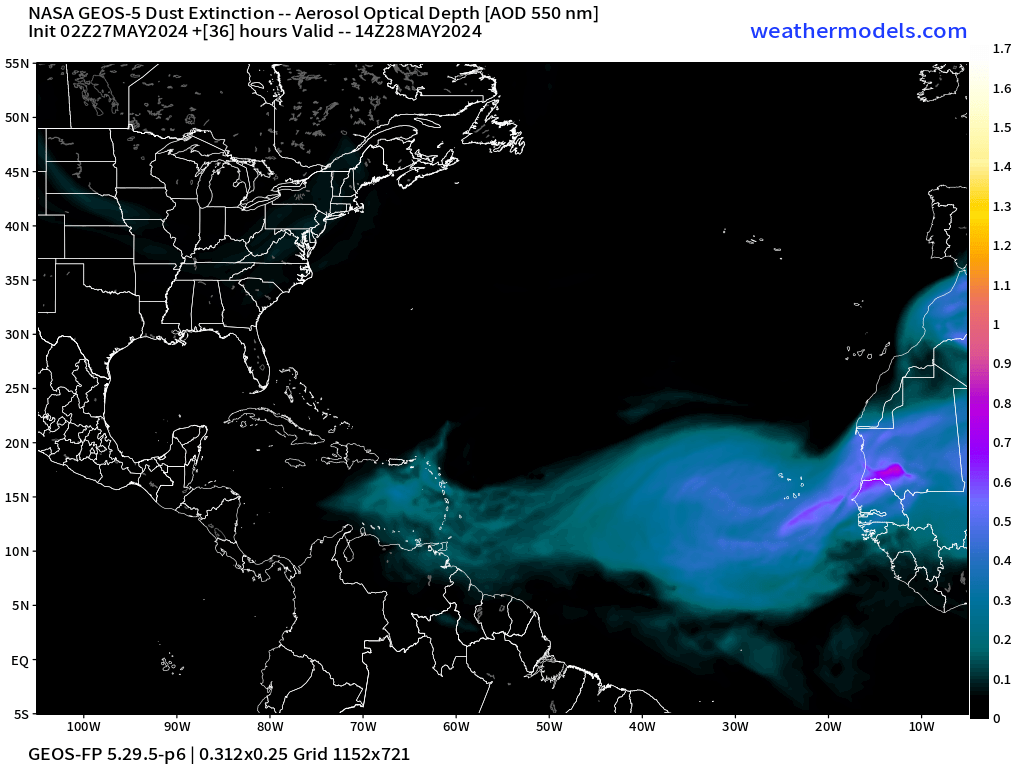
NASA’s global weather model (based upon GFS) contains a coupled-aerosol component that diagnoses and forecasts the evolution of African dust / Saharan Air Layers (SAL).
One such SAL layer is emerging off the African coast and heading westward. However, this is not a particularly intense event — which pick up in June and July.
SAL events can put a lid on tropical storm development but strong tropical waves have a large enough and isolated environment that simply expunges/wipes out the convective inhibition.
10-Day Precipitable Water Forecast
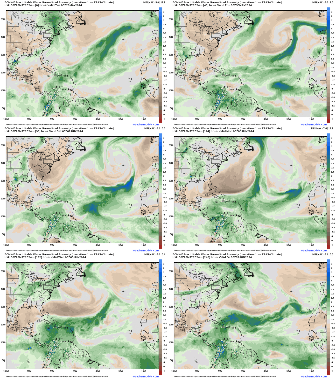
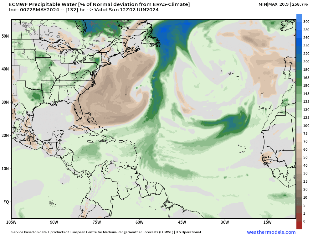
This is the “normalized anomaly” of precipitable water (my favorite variable) taking into account climatology (30-years) and calculating deviations from the historical mean. This allows easy tracking of extreme features like the tropical wave in the eastern Atlantic. The dry air with the late-season cold front is highlighted by this weekend.
Potential Subtropical Development?
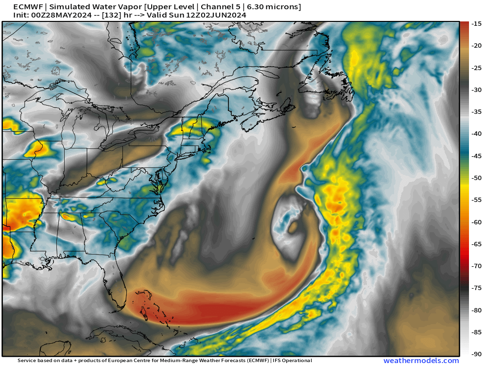
There could be some sort of subtropical cyclone development with this system at 35°N latitude by Sat/Sun.
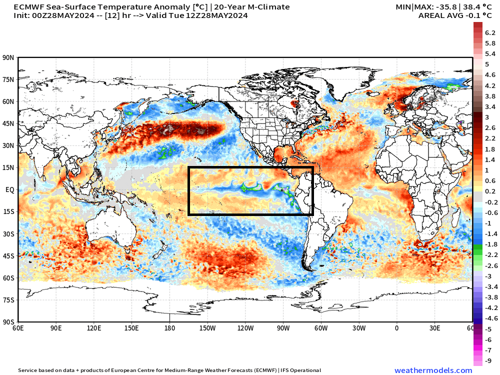
Atlantic Sea Surface Temperatures
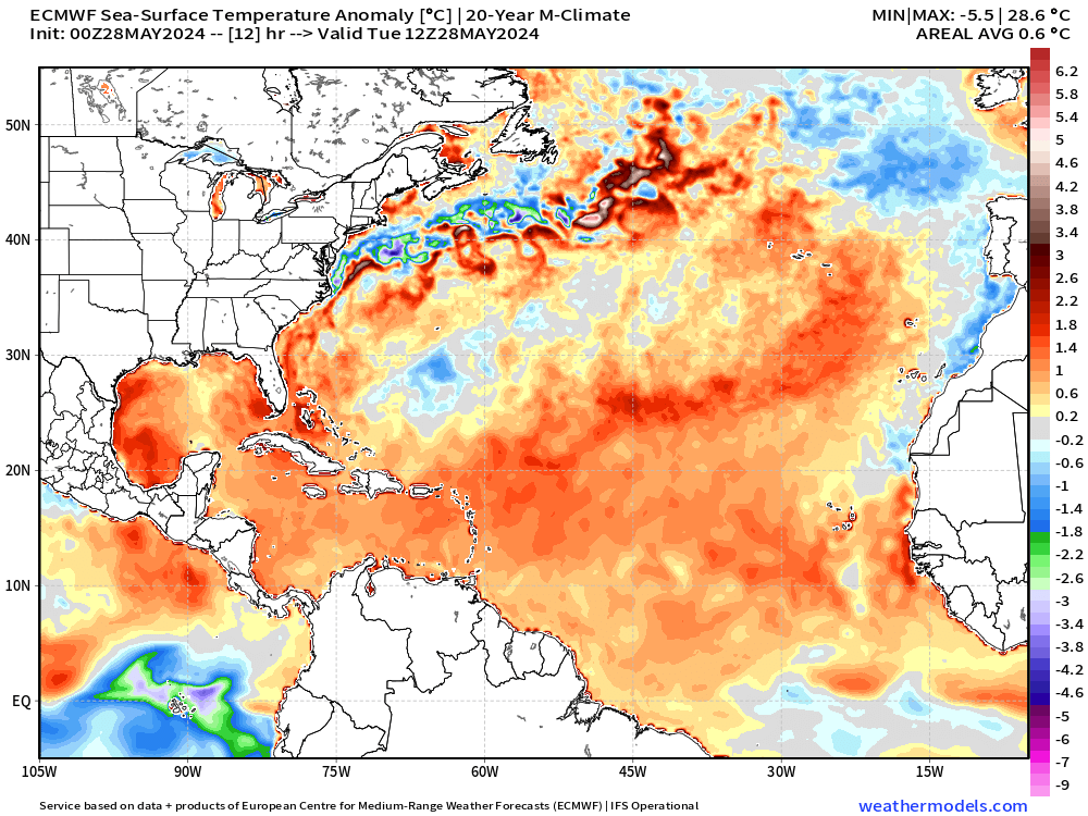
The Atlantic is much warmer than climatology by 1-2°C
15-Day EPS Cyclone Tracks
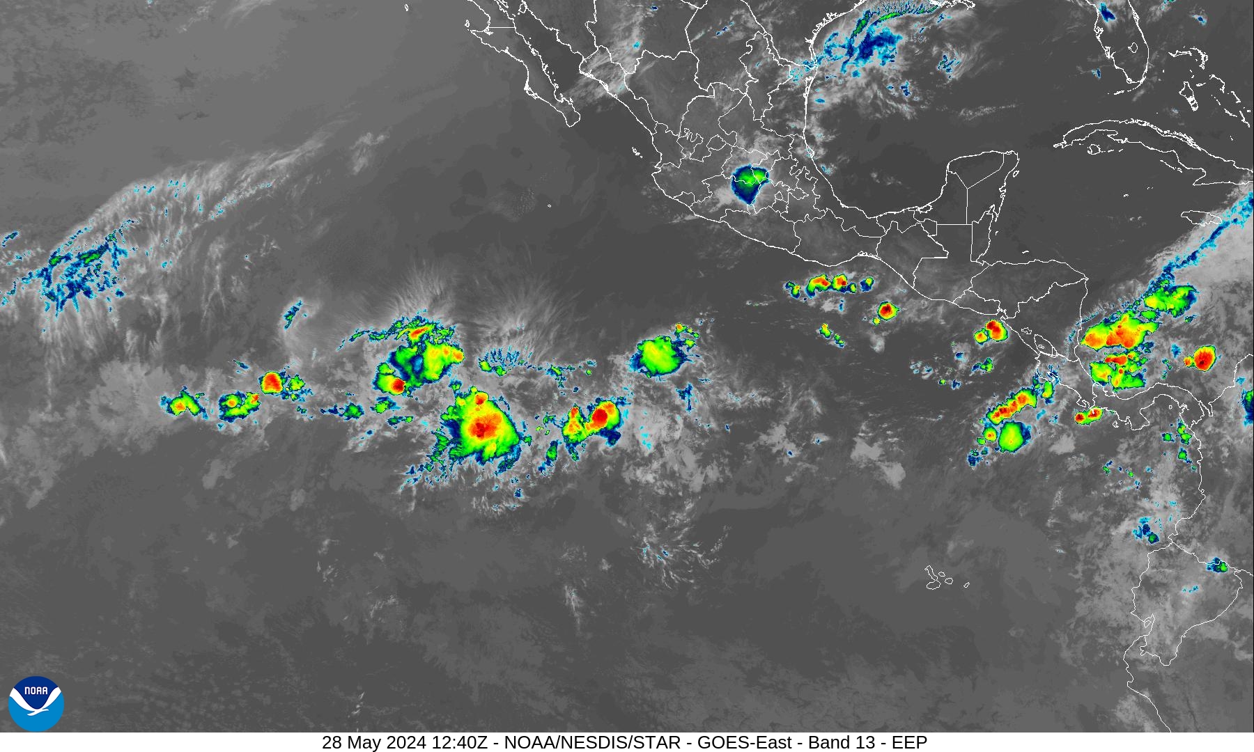
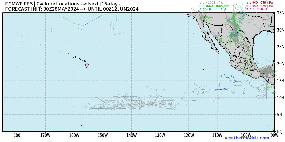
Eastern Pacific Tropical Weather Outlook
No areas of development in the EPAC over the next 7-days from the NHC tropical weather outlook. However, the EPS cyclone tracks do not register many areas of low pressure. This feels like 1977.
Western Pacific Tropical Weather Outlook
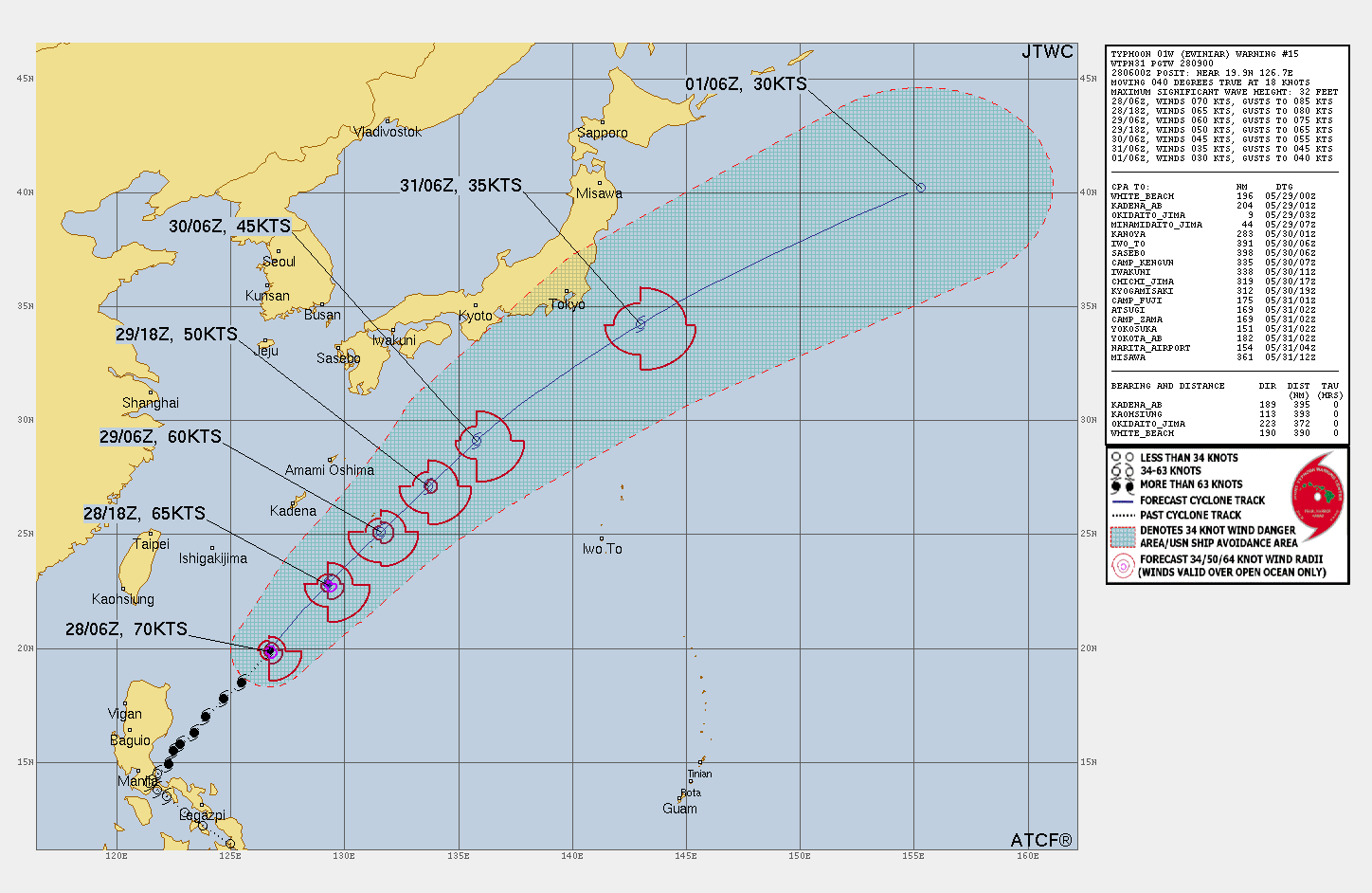
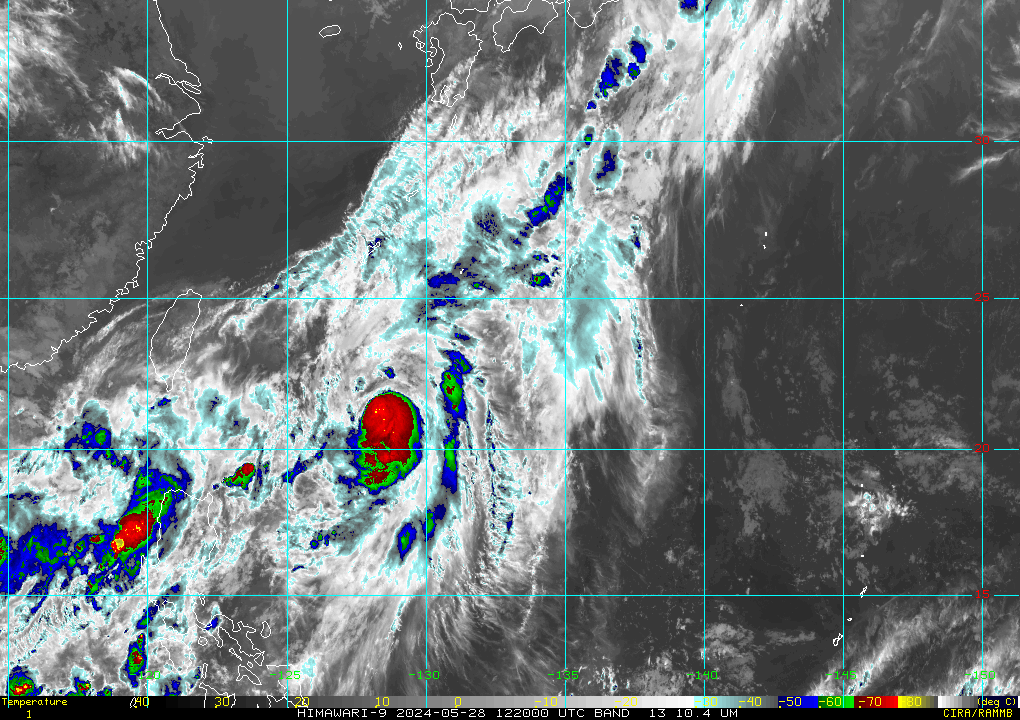
Typhoon Ewiniar [01W] has survived some wind shear and now has a small but concentrated convective burst over the center of circulation. Winds are estimated at 70-knots
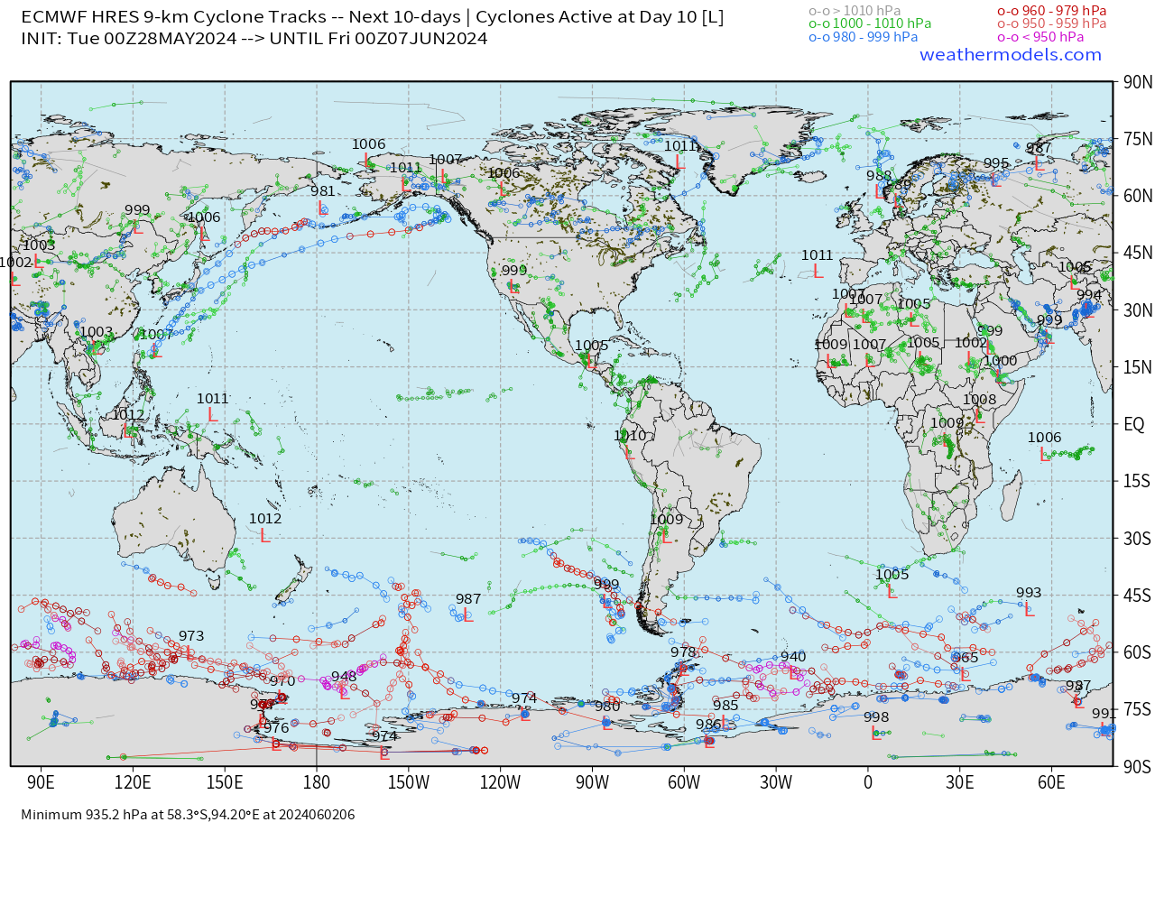
ECMWF HRES 10-Day Storm Tracks
Thank you to Subscribers and Supporters! Welcome to May 2024 — countdown to hurricane season in 4-days.
Maps sourced from weathermodels.com designed and innovated by yours truly! I actually create all of my content from scratch.
- Milepost
- 293 · laid 2024-05-28T13:17:28.531000Z
- Source
- https://weather.substack.com/p/may-28-2024-tropical-update
- Digest
- 2737536ba3bf7b45afcd8117d77e53bb8bffcd499bf3879b01ab2d6d69c5dd5b
- Machine
- JSON