May 27, 2024 Memorial Day Forecast
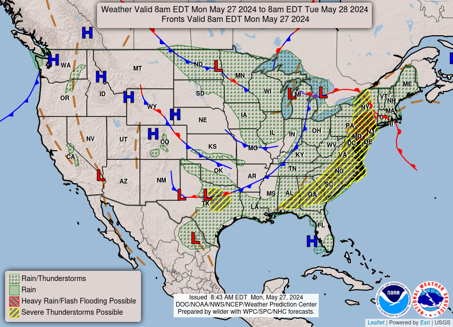
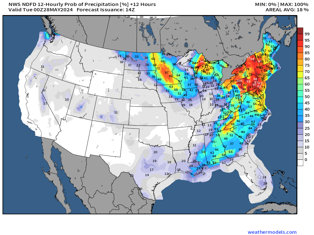
Showers and storms in the Northeast
May 2024 was the 16th-warmest May in the 132-year national record (1895–2026), at 62.2°F against a 1991–2020 normal of 61.0°F (+1.2°F).
May 2024 was the 14th-wettest May in the 132-year national record (1895–2026), at 3.6in against a 1991–2020 normal of 3.1in (+0.5in).
NOAA/NCEI Climate at a Glance, contiguous United States. This is the observed record for the month, not a score of anything said in this piece — the forecast ledger begins 2026-08-17 and cannot reach earlier posts.

Atlantic Basin Tropical Weather Outlook
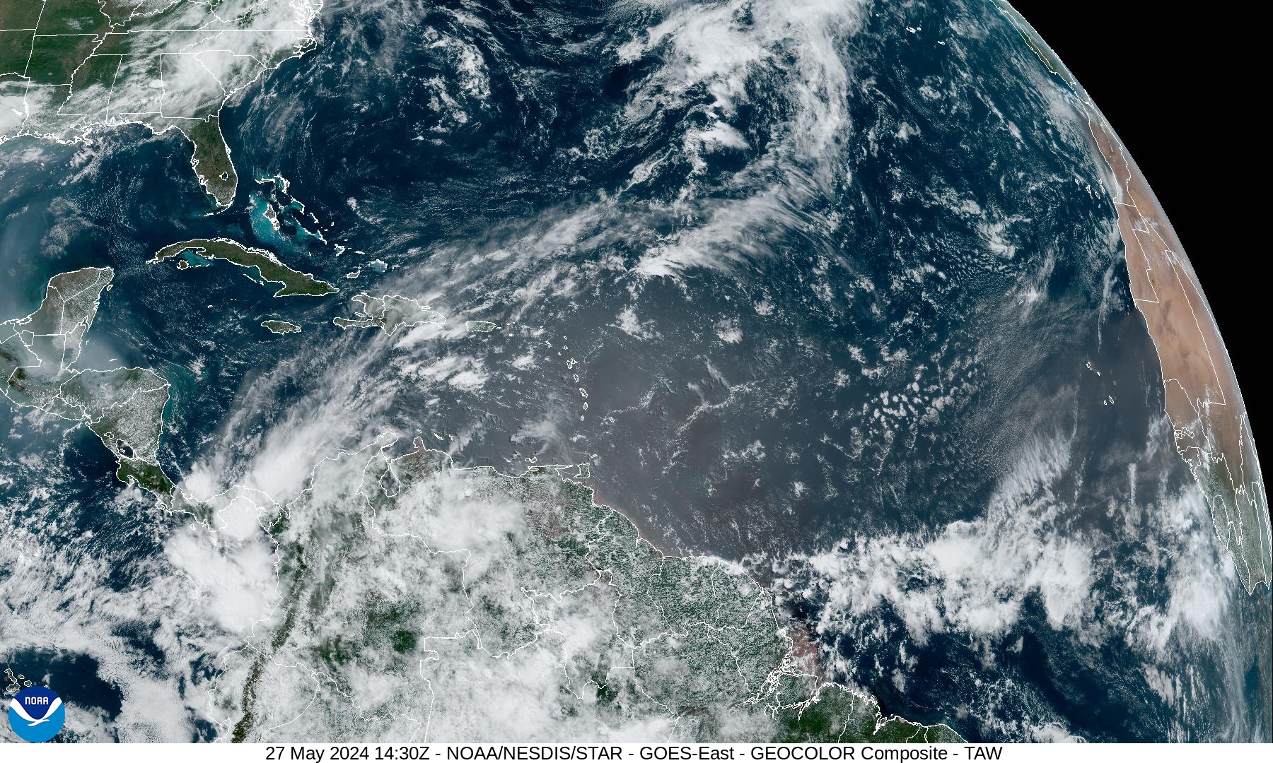
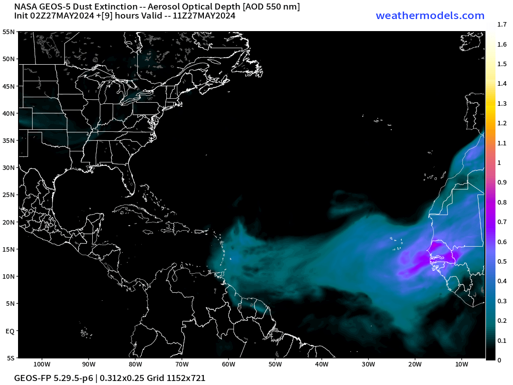
No areas of development across the North Atlantic today. A tropical wave in the central Main Development Region (MDR) is firing up showers but no circulation or continued genesis is expected. The GeoColor + sun glint shows the hue of sand / African dust layer entering the Caribbean with a more significant dust cloud coming off the coast of Africa today.
Eastern Pacific Tropical Weather Outlook
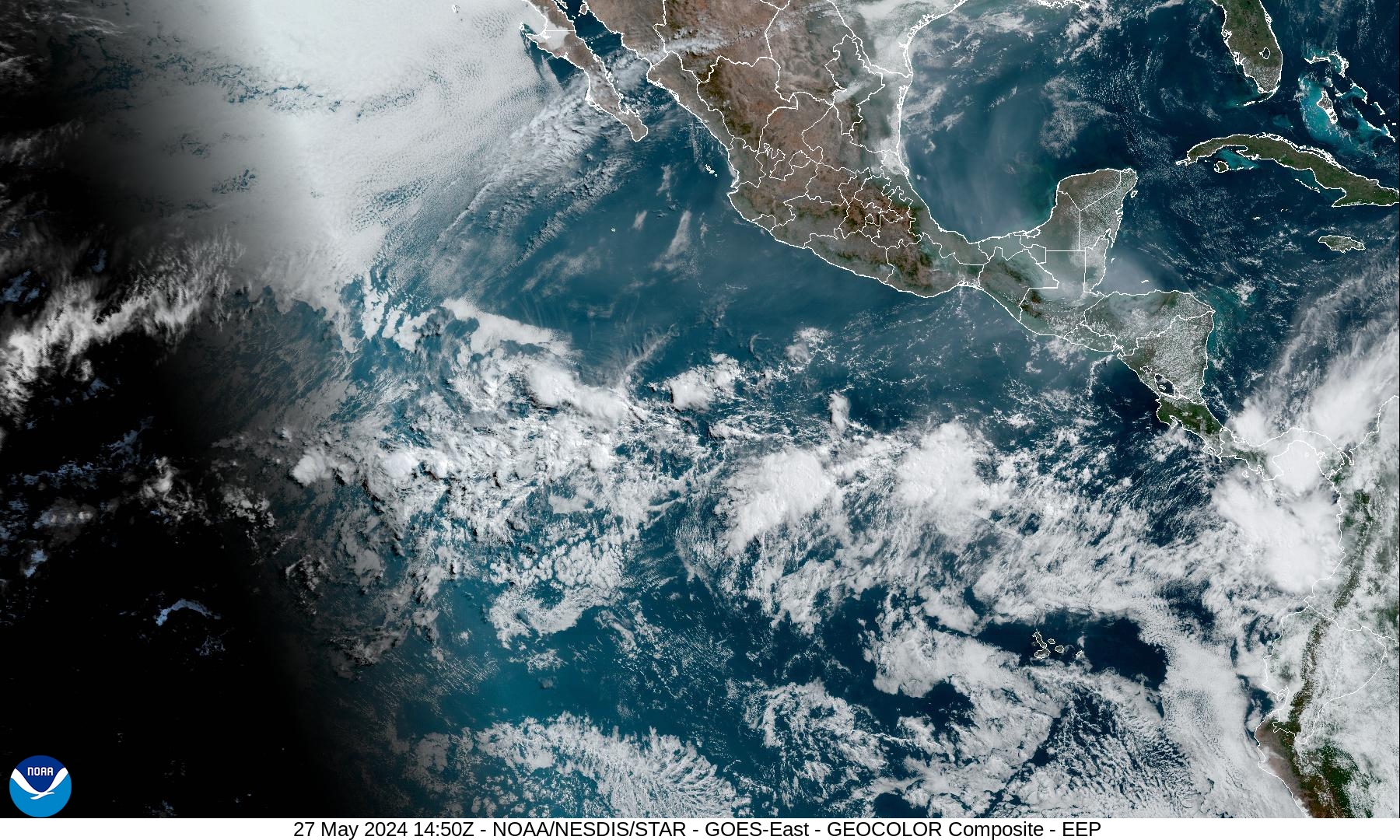
No areas of interest in the Eastern Pacific for the next 7-days. Very dry across Mexico and central America and not much convection along the ITCZ.
Western Pacific Tropical Weather Outlook
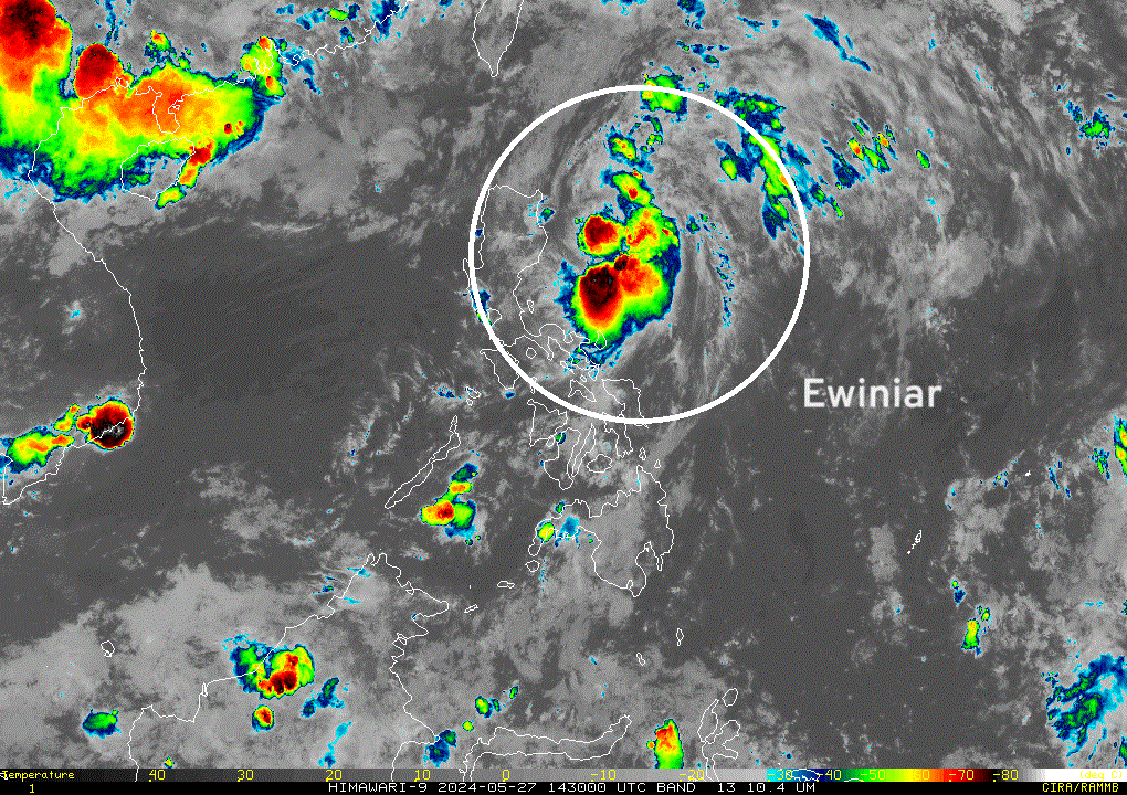
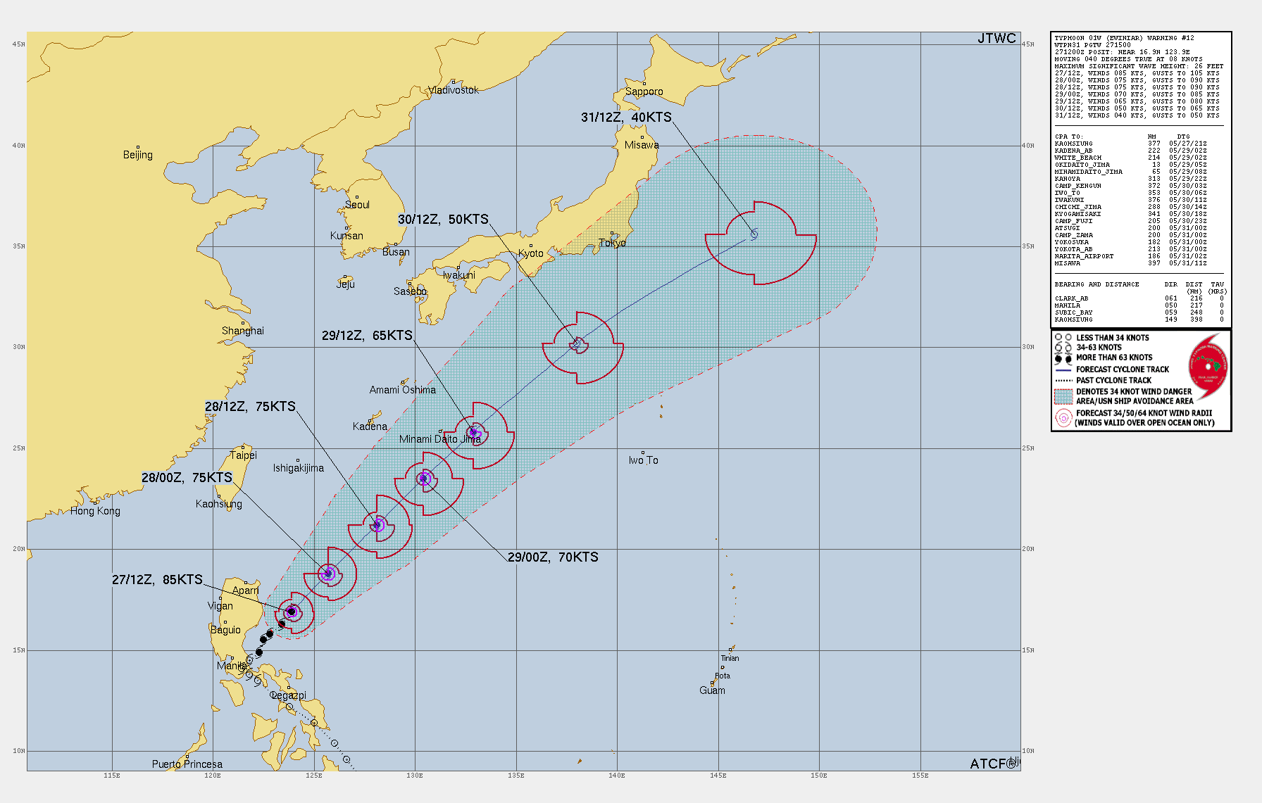
Typhoon Ewiniar [01W] formed very near land over Luzon in the Philippines reaching almost major status. The system has now become disorganized but JTWC maintains 85-knots maximum sustained winds. Ewiniar (01W) will head out to sea southeast of Japan over the next several days presenting shipping issues, but no other land impacts.
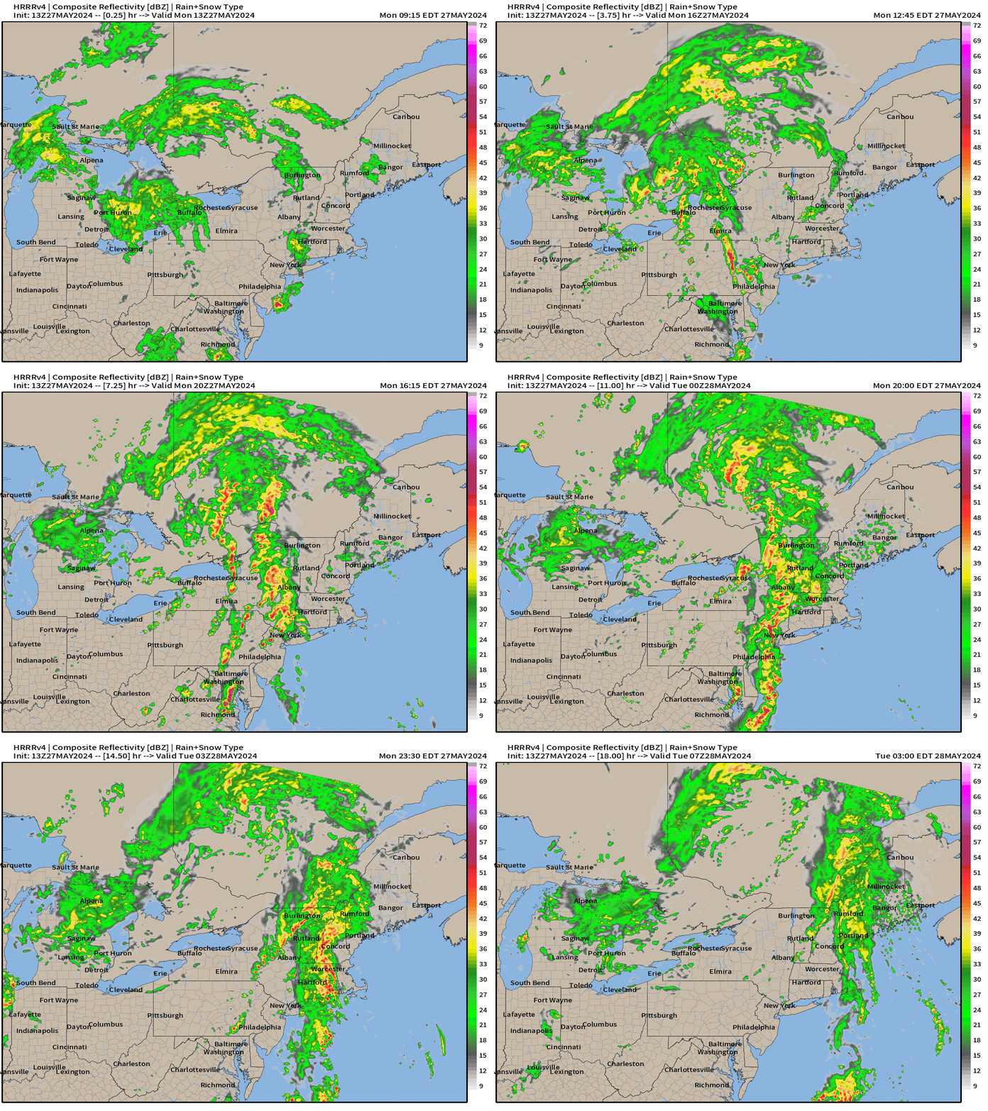
18-Hour Forecast | Simulated Radar | HRRR
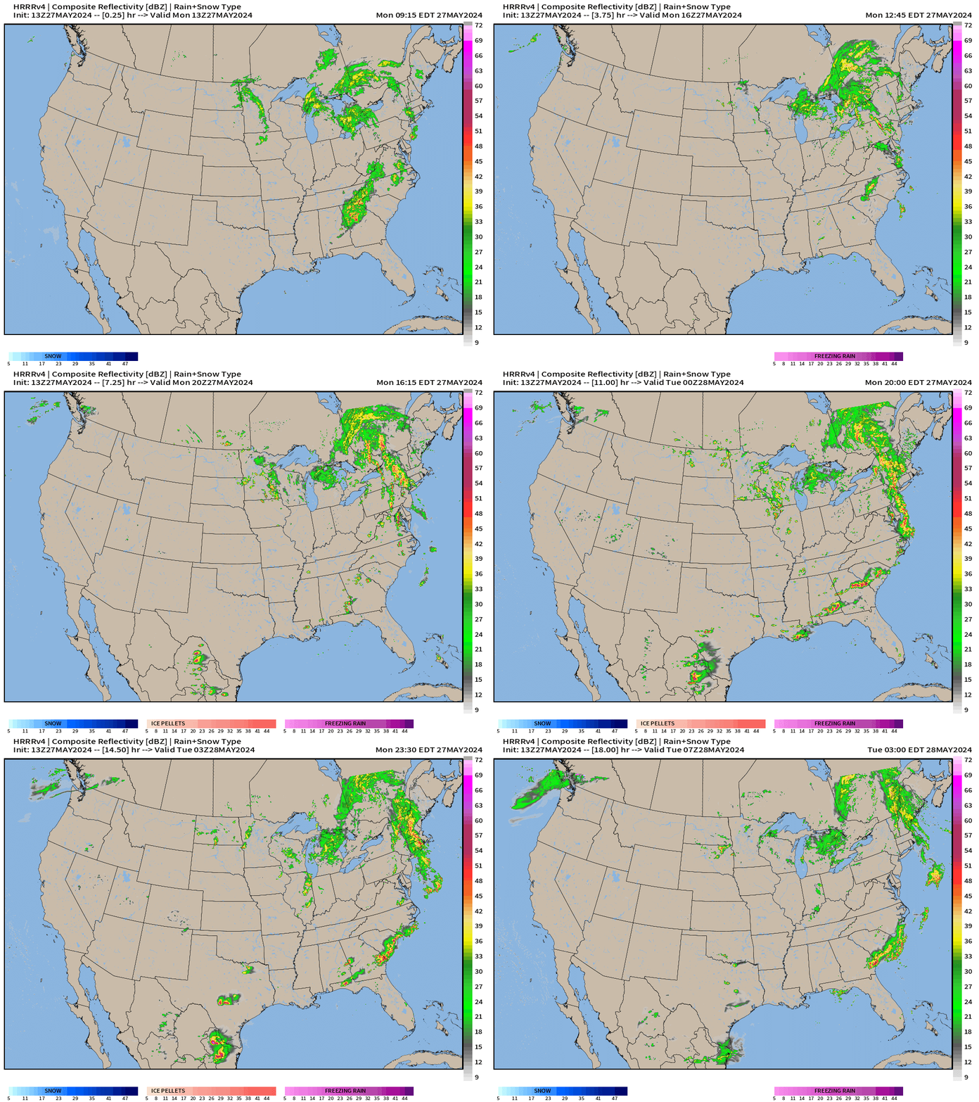
More showers and storms across the Southeast with daytime heating this afternoon.
Unfortunately, more widespread storms across the Great Lakes and Northeast with waves/lines of organized convection circulating around a broad synoptic-scale system into Canada.
Next 10-days Upper-Level Weather Pattern | ECMWF AIFS
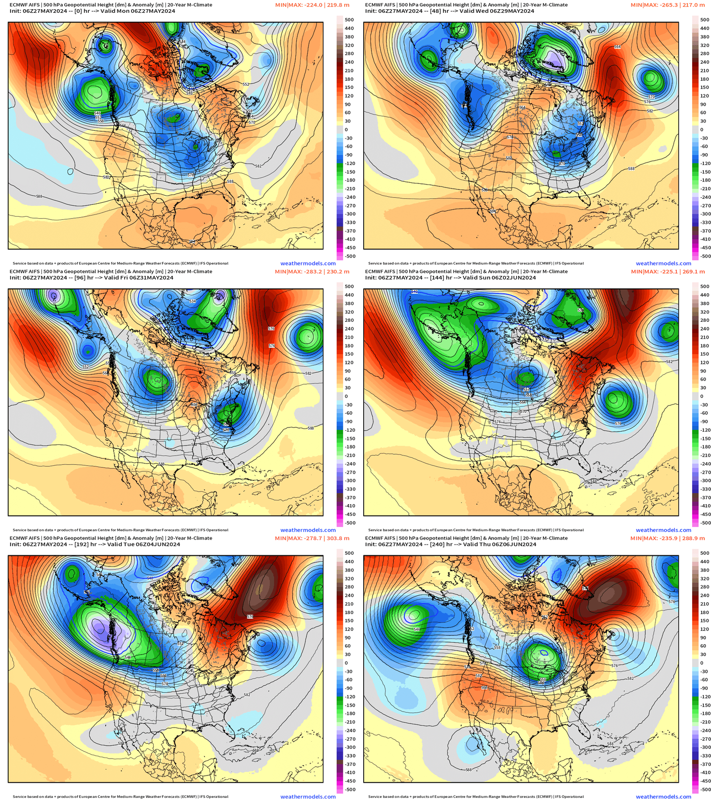
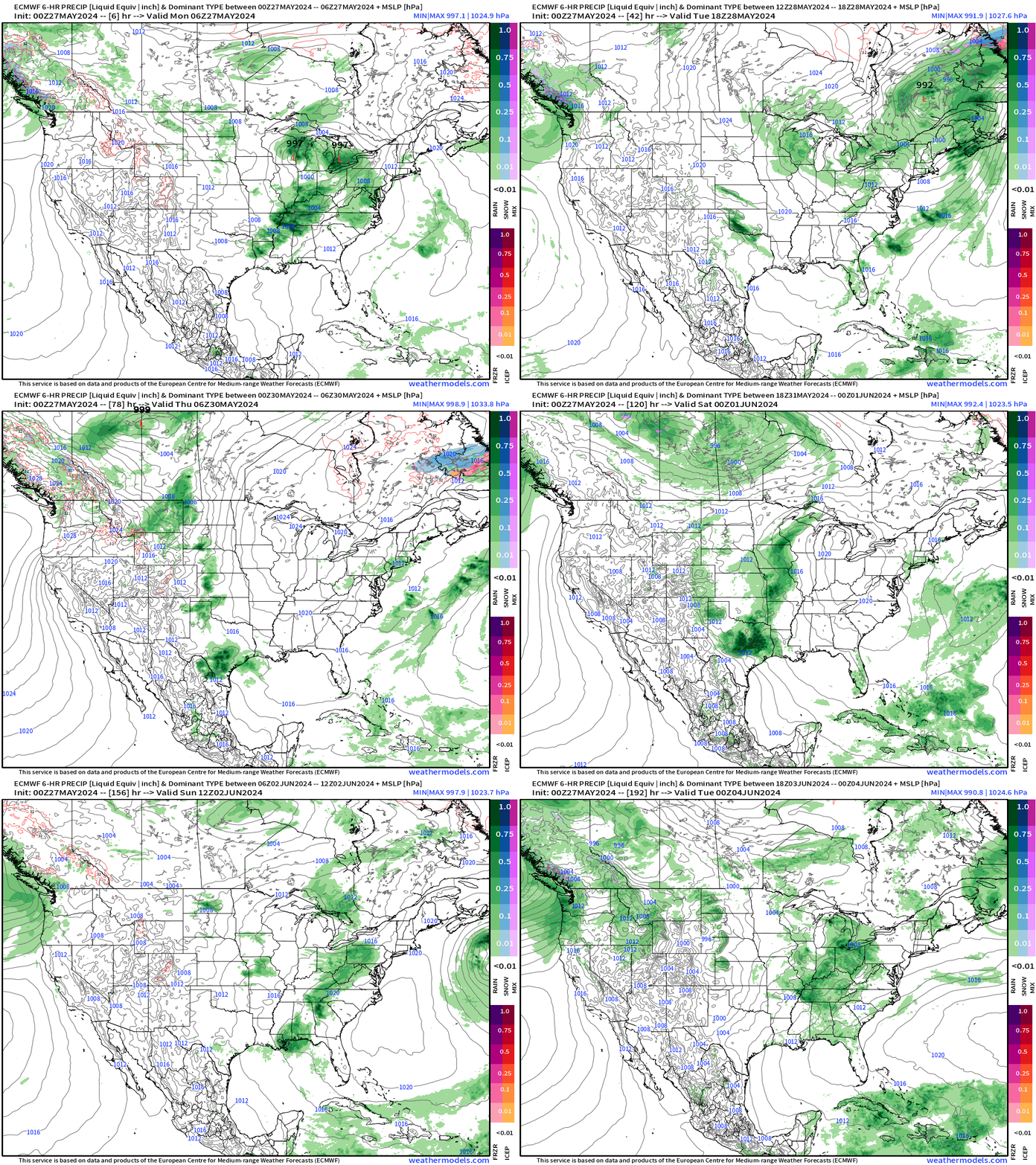
Watching for any ridge development over the Lower 48 for a “heat dome” but not seeing sustained heat waves in the next 10-days. Instead, more mobile troughs arriving from NW Canada and Alaska rotating into the Pacific Northwest and then through the Great Lakes. Each of those will be the focus of rainfall — so pretty good for anyone trying to grow things!
NWS WPC 7-Day Precipitation Forecast | Watering Needs
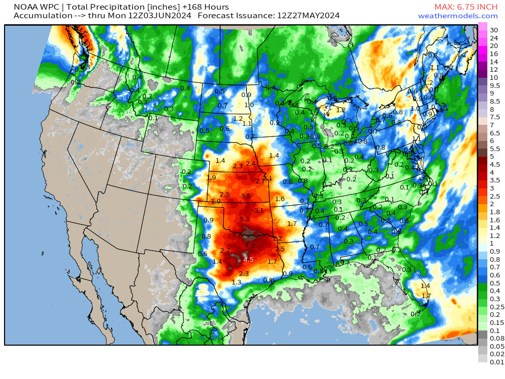
Focus for heavy rainfall amounts over the next week centered over Texas to the central Plains.
Monday Temperatures 10:30 AM ET
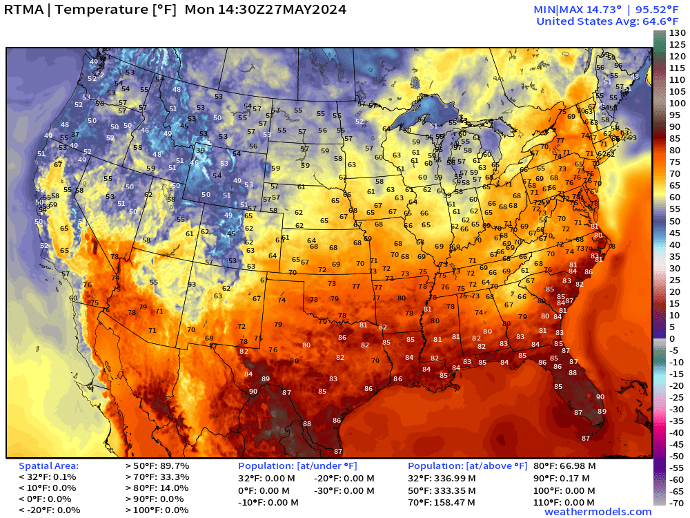
Monday High Temperatures & Weather
Lower 48 Average: 79.0°F | 172 Million at/above 80°F | 80 Million at/above 90°F
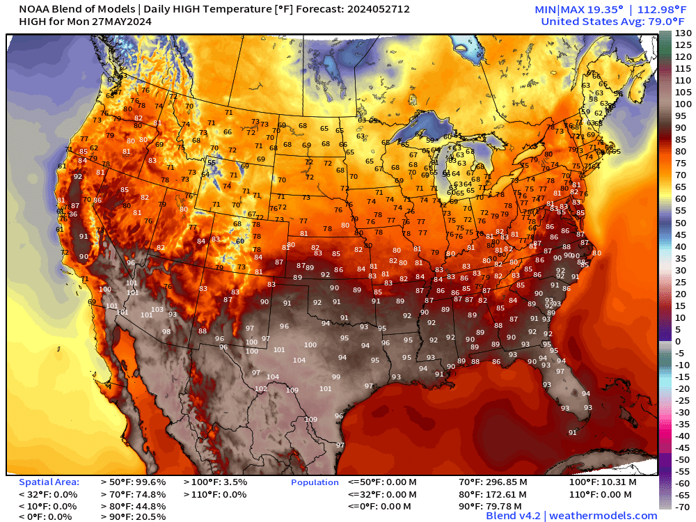
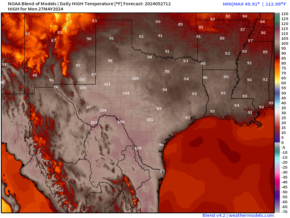
Searing heat across Texas — with 110°F likely along the Rio Grande. This heat is not breaking anytime soon.
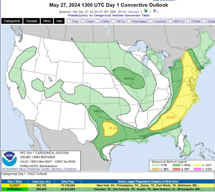
   ...THERE IS A SLIGHT RISK OF SEVERE THUNDERSTORMS OVER MUCH OF THE
   ATLANTIC SEABOARD AND NORTH/CENTRAL TX...

   ...SUMMARY...
   Severe thunderstorms are expected today across parts of the lower
   Great Lakes, Mid-Atlantic, and Southeast.  More isolated severe
   thunderstorms are possible this afternoon and evening across much of
   central and east Texas, as well as southwest Oklahoma and the
   mid/upper Mississippi Valley.
Next 8-Days Weather Systems | ECMWF HRES
Thank you to Subscribers and Supporters! Welcome to May 2024 — countdown to hurricane season in 4-days.
Maps sourced from weathermodels.com designed and innovated by yours truly! I actually create all of my content from scratch.
- Milepost
- 292 · laid 2024-05-27T15:18:35.792000Z
- Source
- https://weather.substack.com/p/may-27-2024-memorial-day-forecast
- Digest
- 662466ab9327c4ef9dd8b425dd2dc8ccd9139788be0de1c5f680a03b62b14139
- Machine
- JSON