May 20, 2024 Warm Start to Week
Temperatures pushing 90s in New England by Wednesday
May 2024 was the 16th-warmest May in the 132-year national record (1895–2026), at 62.2°F against a 1991–2020 normal of 61.0°F (+1.2°F).
May 2024 was the 14th-wettest May in the 132-year national record (1895–2026), at 3.6in against a 1991–2020 normal of 3.1in (+0.5in).
NOAA/NCEI Climate at a Glance, contiguous United States. This is the observed record for the month, not a score of anything said in this piece — the forecast ledger begins 2026-08-17 and cannot reach earlier posts.

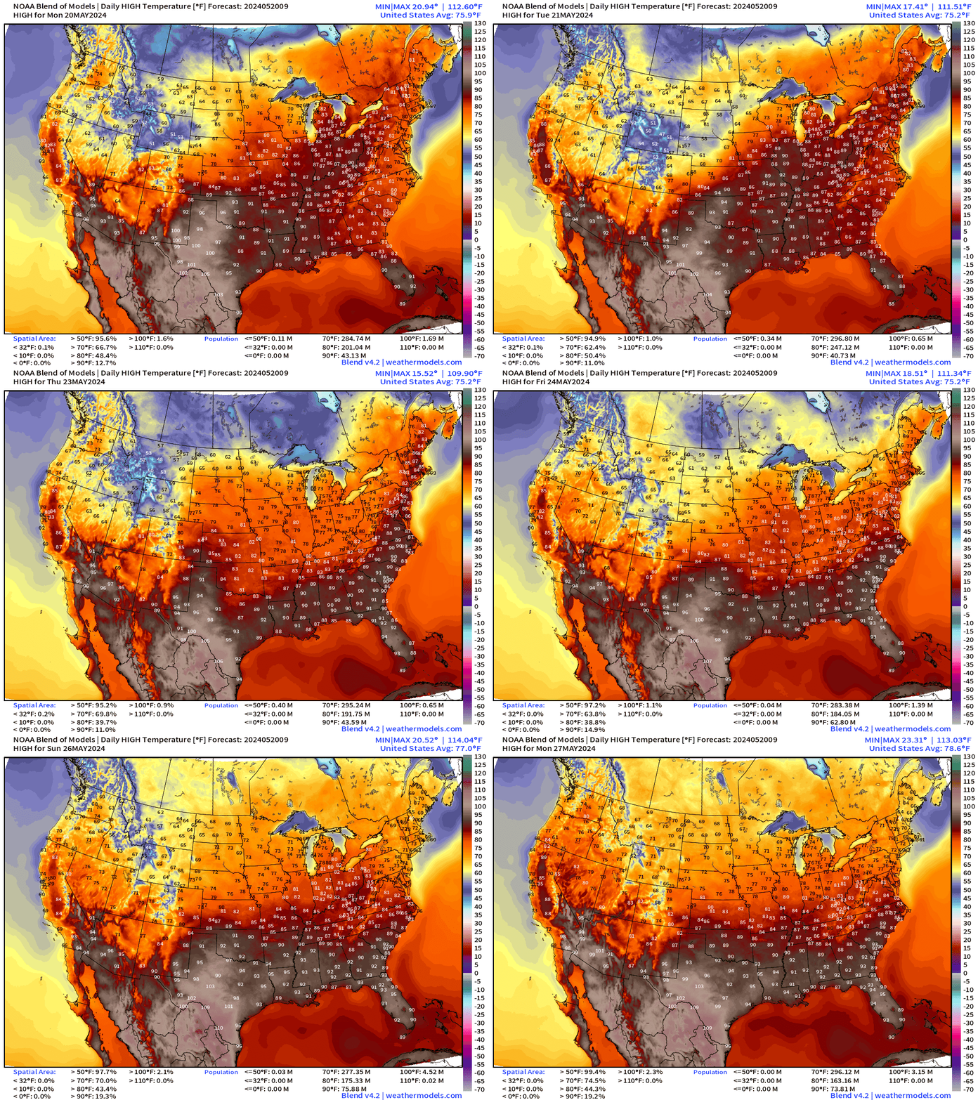
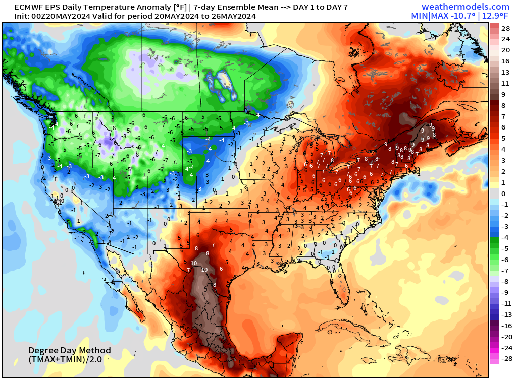
80s and even some 90s build into the Northeast by Wednesday before another cold front cools temperatures back into the 70s by this weekend.
90s look to stay in the Southeast as summer arrives. Even hotter in Texas and Mexico as bone dry conditions under brutal high pressure (pressure) continue for the next 1-2 weeks.
Atlantic Basin Tropical Weather Outlook
No activity expected in the next 7-days according to NHC tropical weather outlook.
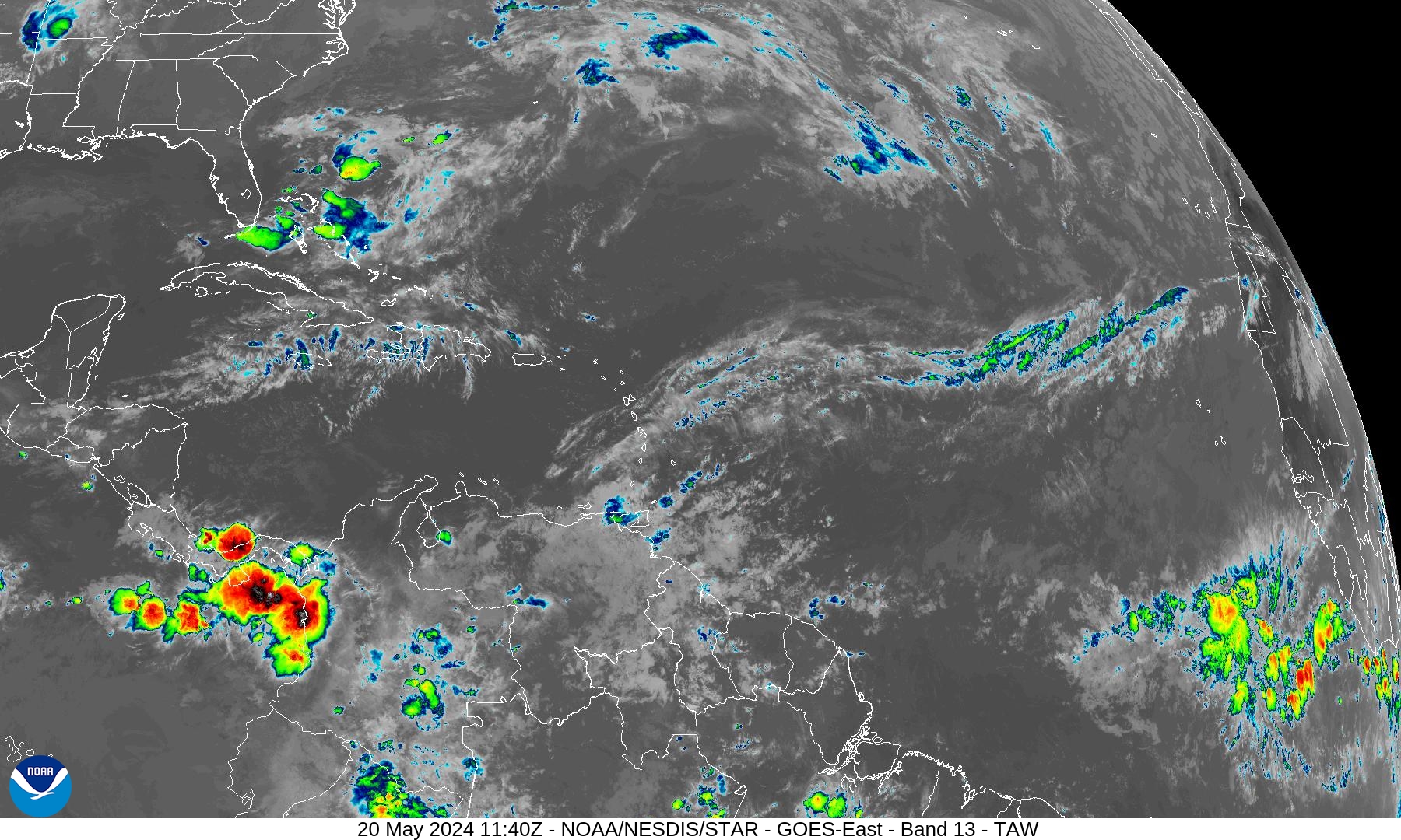
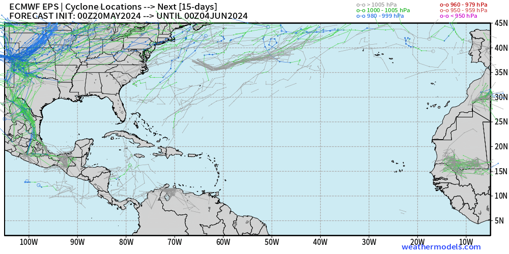
The southern Caribbean in early June is a prime location for storm development. We’ll see if more ensembles pop up some low pressure signatures.
Eastern Pacific Tropical Weather Outlook
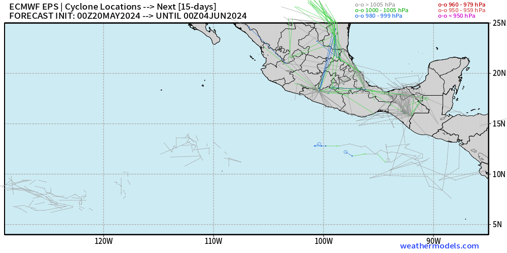
During a building La Nina, the Eastern Pacific would be quiet — even less activity than the neighboring Atlantic. Even thought EPAC hurricane season started May 15, nothing has developed. The NHC has no areas of interest in the 7-day outlook.
18-Hour Forecast | Simulated Radar
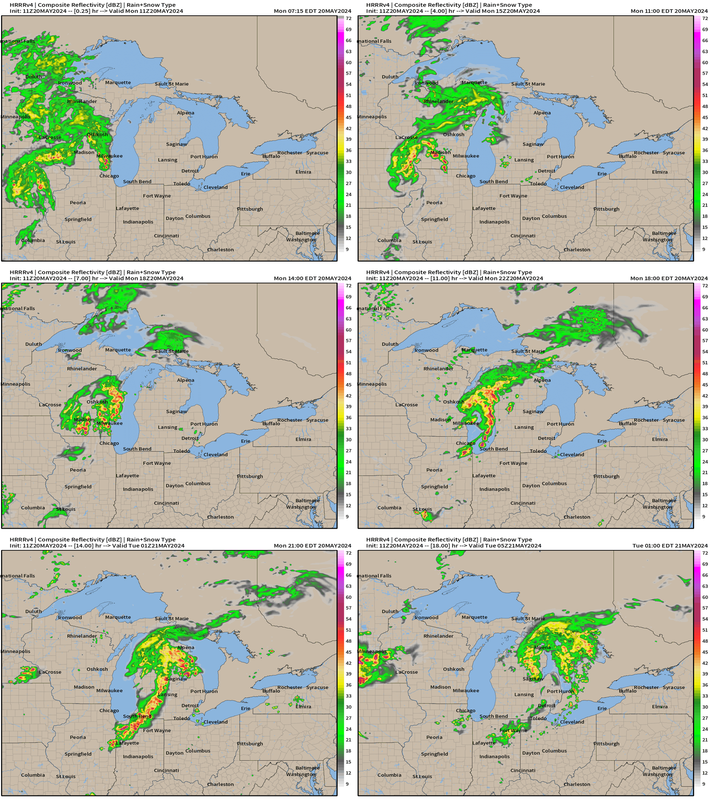
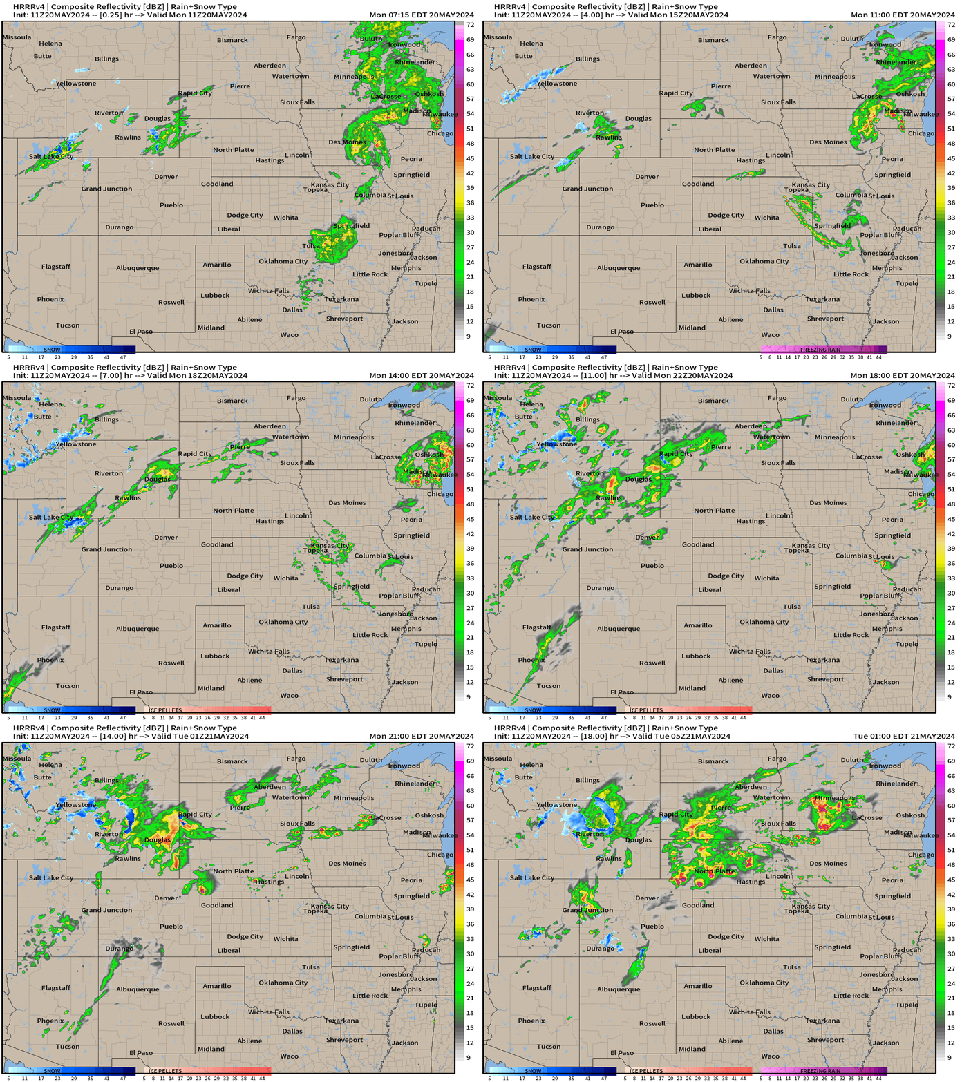
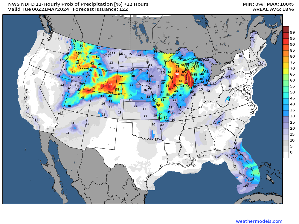
Rainfall Chance | 12 Hourly
Through early evening (8 PM ET)
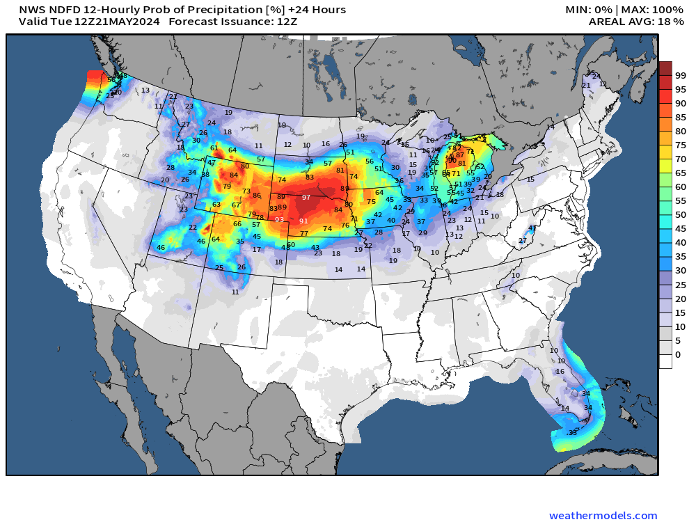
Into tomorrow morning (8 AM ET)
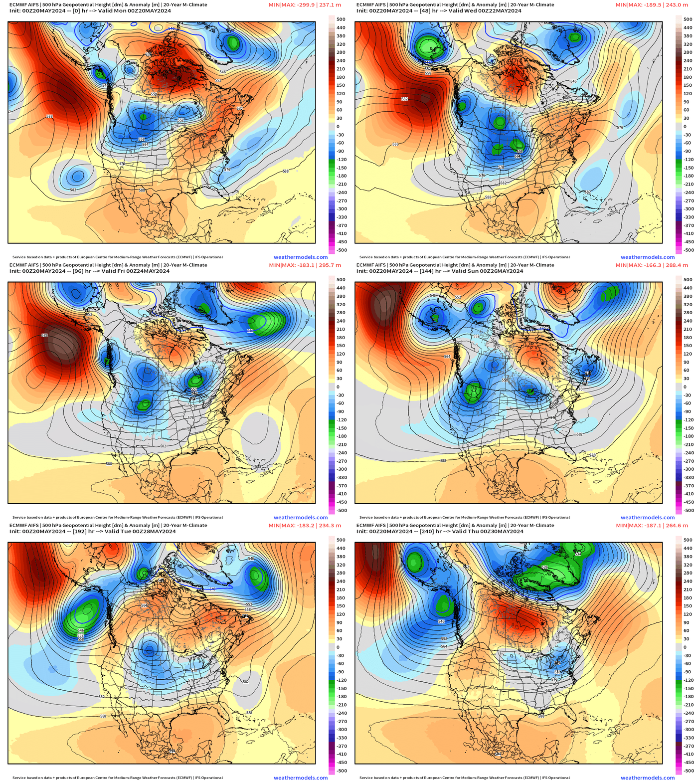
Next 10-days Upper-Level Weather Pattern | ECMWF AIFS
NWS WPC 7-Day Precipitation Forecast | Watering Needs
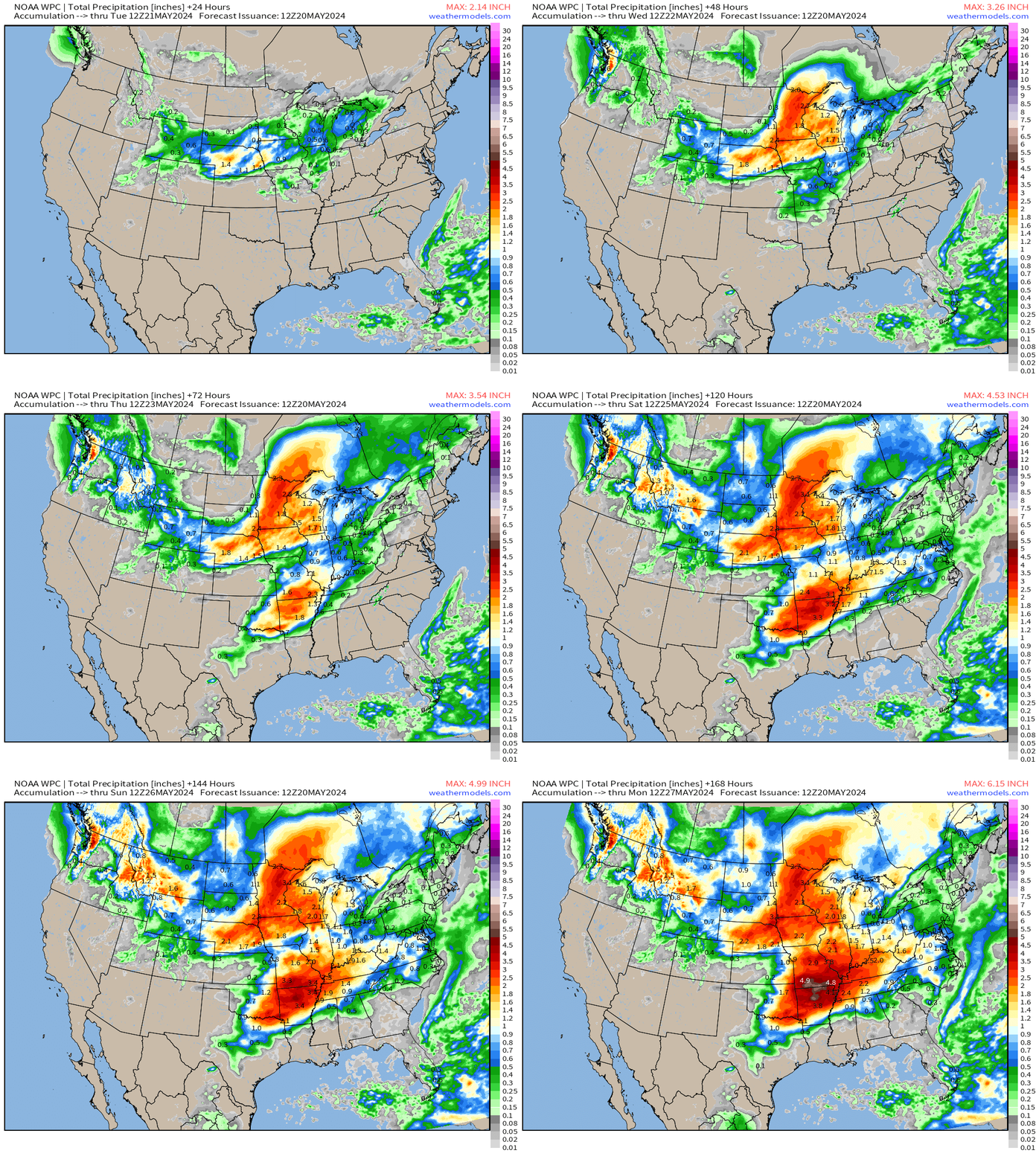
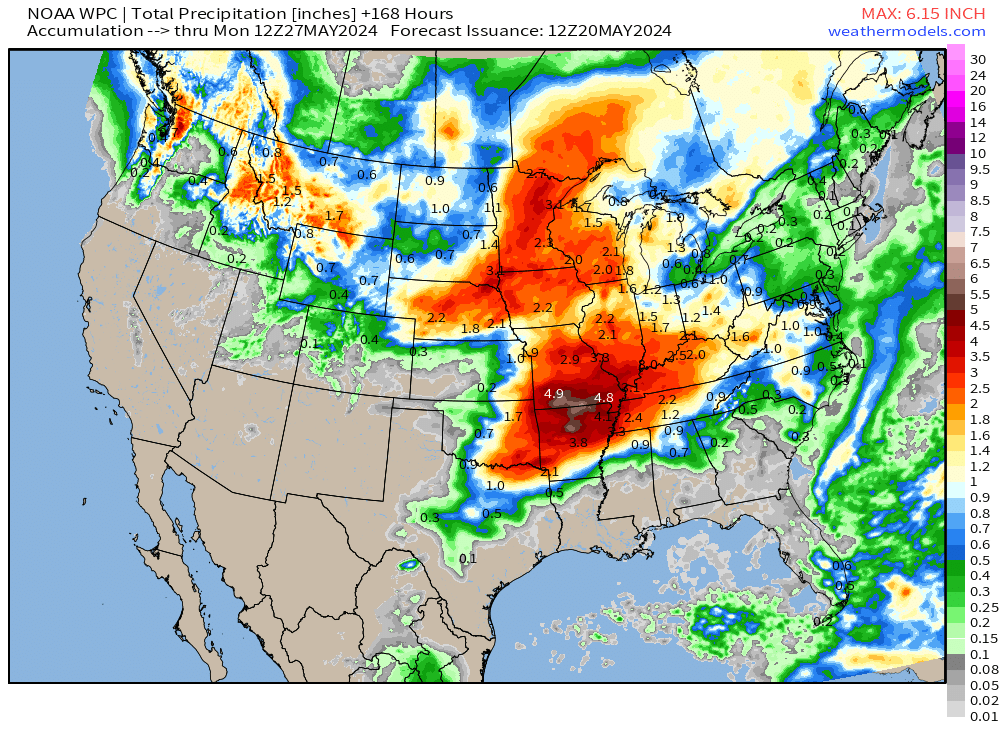
Huge rainfall totals for the Ozarks and central Mississippi Valley — with WPC showing 4-6” maximum. Also, nice area of 2” or more from Nebraska, Iowa, into the Midwest.
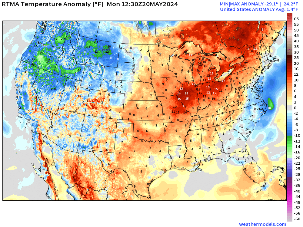
Monday Temperatures 8:30 AM ET
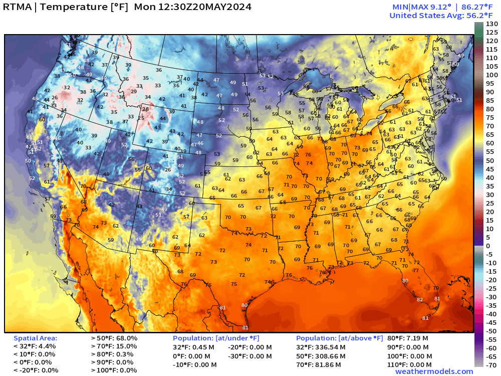
Monday High Temperatures
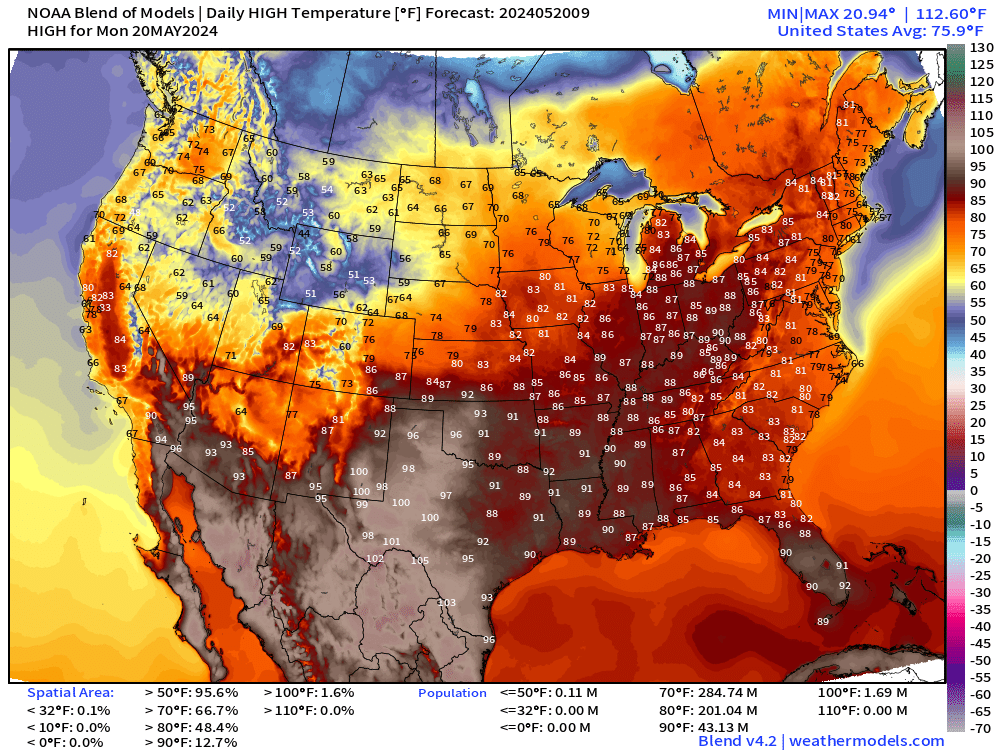
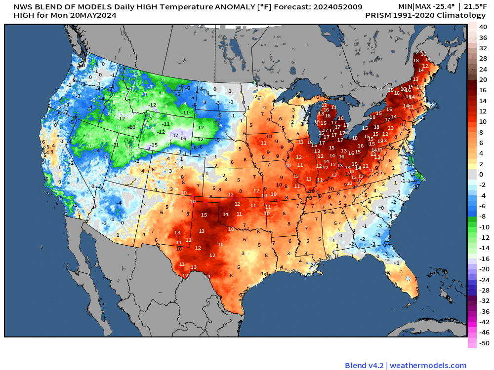
Temperatures in the upper-80s in Detroit = 17°F above normal for May 20th. That warmth will build eastward into the Ohio Valley, Mid-Atlantic and Northeast during the week.
Monday Weather and Convective Outlook
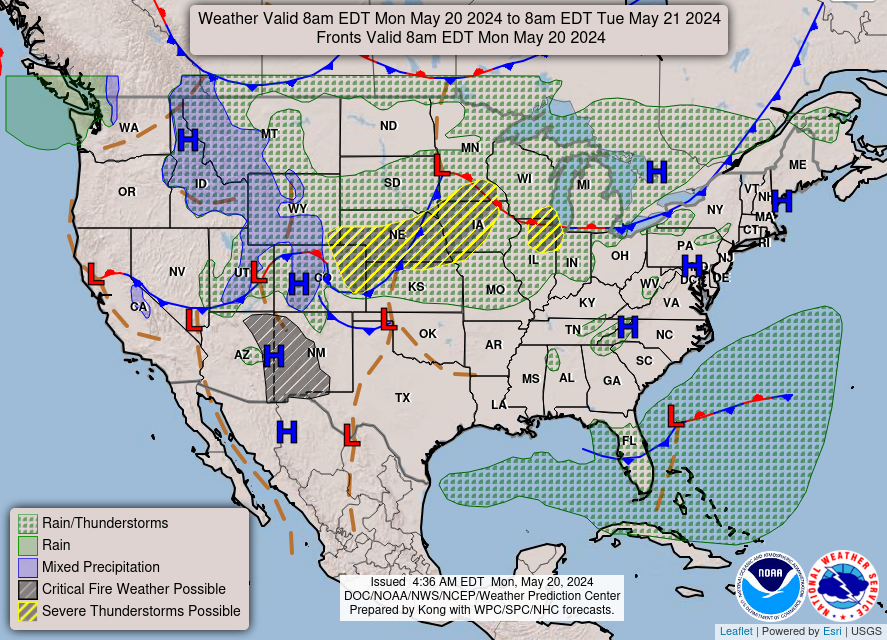
Thunderstorms likely across Nebraska into Iowa bringing Enhanced or Slight risk of severe weather. The farmers will take the rainfall!
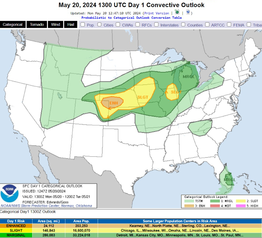
   ...THERE IS AN ENHANCED RISK OF SEVERE THUNDERSTORMS OVER PORTIONS
   OF NORTHEASTERN COLORADO...CENTRAL/SOUTHWESTERN NEBRASKA...AND
   NORTHWESTERN KANSAS...

   ...THERE IS A SLIGHT RISK OF SEVERE THUNDERSTORMS SURROUNDING THE
   ENHANCED RISK...AND ALSO OVER PARTS OF THE SOUTHWESTERN LAKE
   MICHIGAN VICINITY...
Next 8-Days Weather Systems | ECMWF HRES
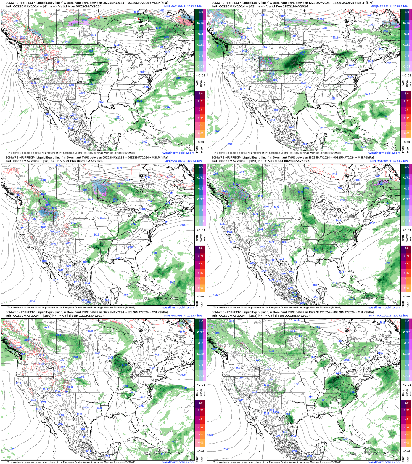
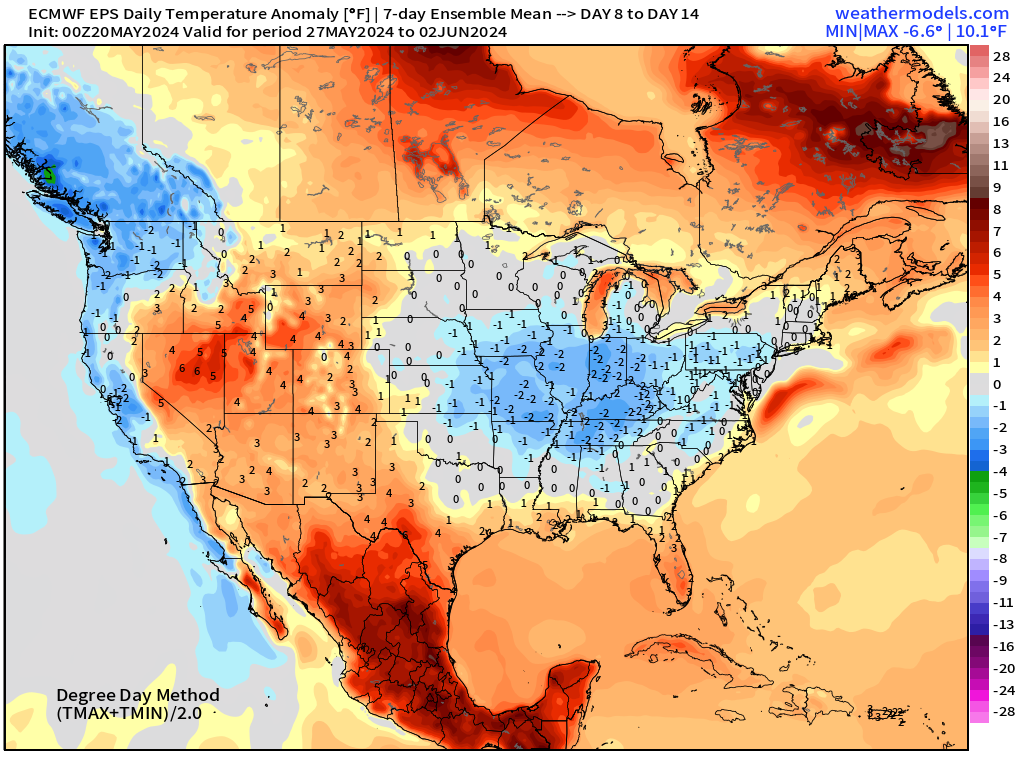
Pattern still favors continued unsettled / rainy bouts across the Lower 48 during the next 7-10 days. This will certainly keep a lid on extreme temperatures except in southern Texas and Mexico.
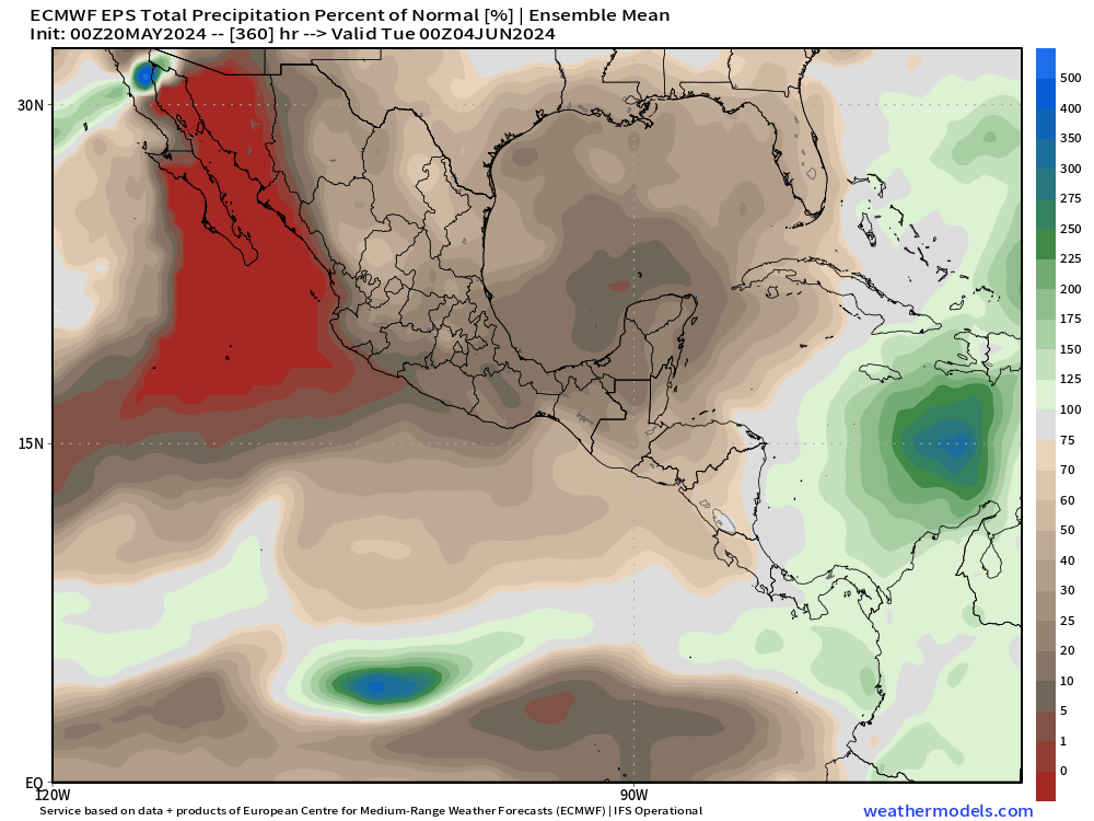
Forecast Farm | EPS 15-Day Precipitation + Anomaly [%]
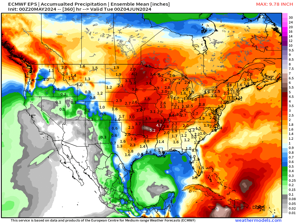
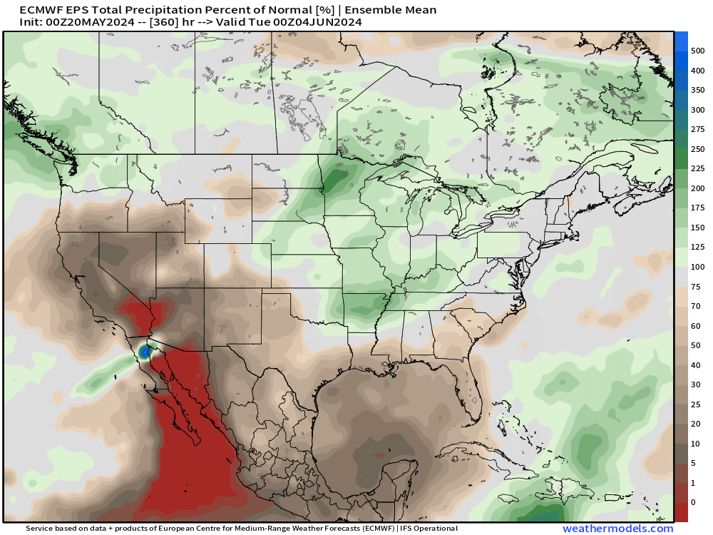
Very dry across Mexico and Central America with the subtropical ridge stuck in place.
ECMWF Ensemble | 7-Day Temperature Anomaly
Week 1 | May 20-26, 2024
Week 2 | May 27 - Jun 2, 2024
Thank you to Subscribers and Supporters! Welcome to May 2024 — countdown to hurricane season in 11-days.
Maps sourced from weathermodels.com designed and innovated by yours truly! I actually create all of my content from scratch.
- Milepost
- 287 · laid 2024-05-20T13:22:27.689000Z
- Source
- https://weather.substack.com/p/may-20-2024-warm-start-to-week
- Digest
- 8705119b633ec274cdbc85de008235cb5364473407f3b73e6a8c51a8d9504094
- Machine
- JSON