May 3, 2024 Dodging Showers this Weekend
Major cool down by next weekend for central and eastern U.S.
May 2024 was the 16th-warmest May in the 132-year national record (1895–2026), at 62.2°F against a 1991–2020 normal of 61.0°F (+1.2°F).
May 2024 was the 14th-wettest May in the 132-year national record (1895–2026), at 3.6in against a 1991–2020 normal of 3.1in (+0.5in).
NOAA/NCEI Climate at a Glance, contiguous United States. This is the observed record for the month, not a score of anything said in this piece — the forecast ledger begins 2026-08-17 and cannot reach earlier posts.

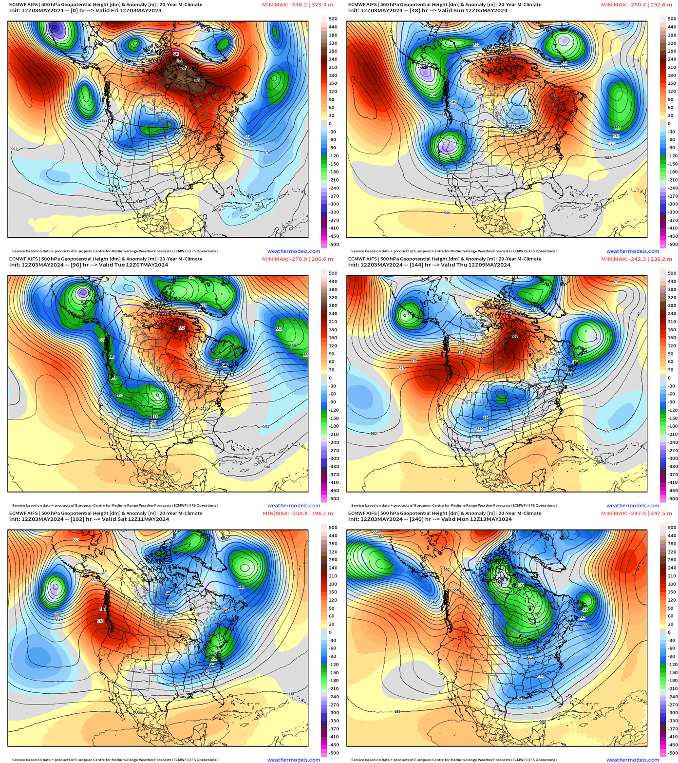
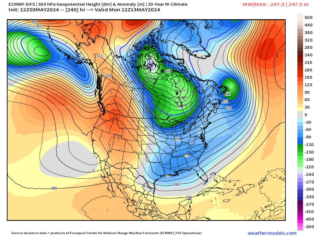
Highlight is the pattern flip next weekend to a ridge across the Pacific Northwest and major dip in the jet stream with a strong upper-level trough digging into the Southeast. This means mild or even cool temperatures — well below normal — for Week 2 or by this next weekend.
Next 10-days Upper-Level Weather Pattern | ECMWF AIFS
NWS WPC 7-Day Precipitation Forecast | Watering Needs
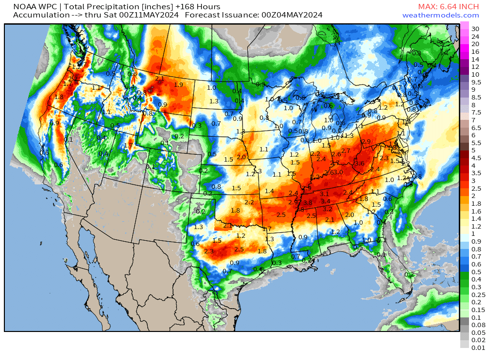
Large area of 2-3” of rainfall centered upon the Ohio Valley across Tennessee.
Thunderstorms and rainfall today: HRRR next 48-hours through Sunday 2 PM
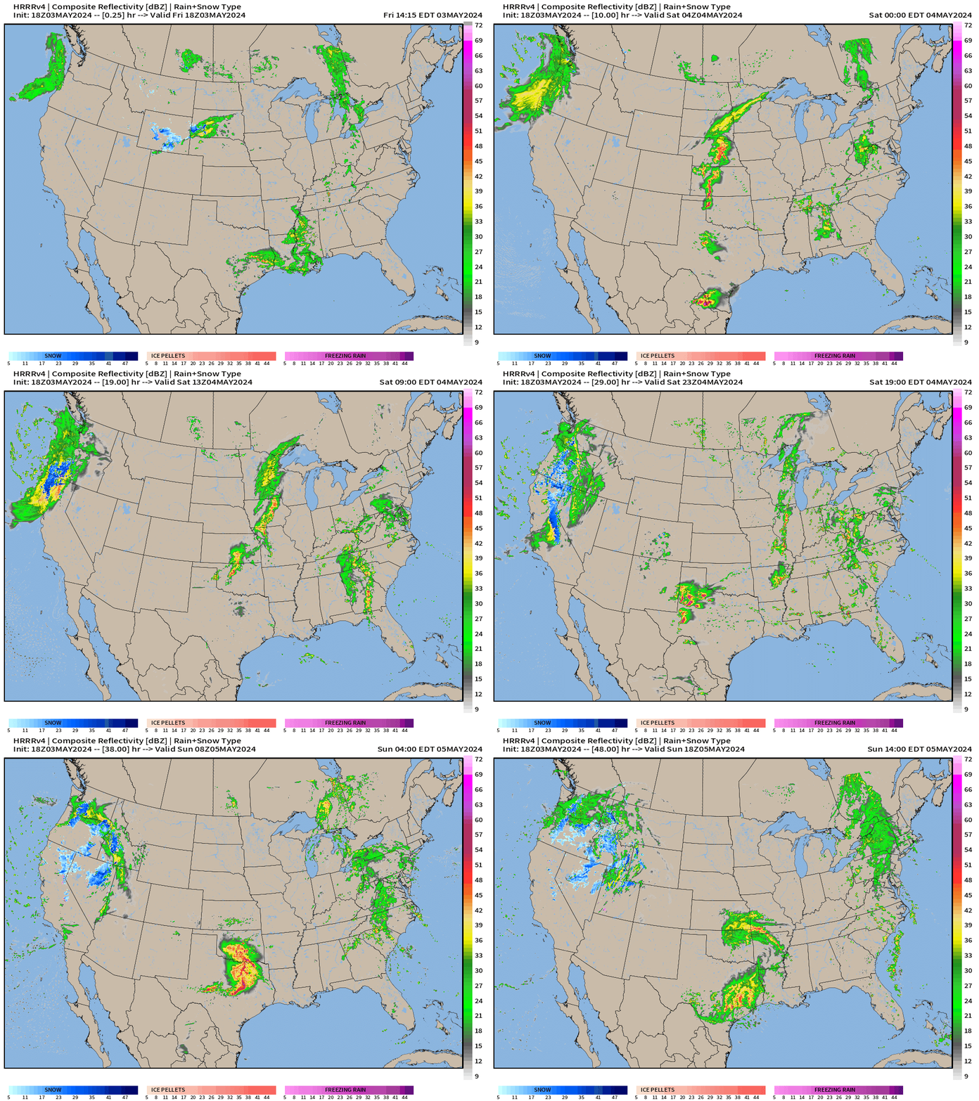
Storm system across the Northwest will spill rain and snow into California. Texas will see another round of heavy showers and severe storms late Saturday.
Scattered showers across the entire U.S. but not severe.
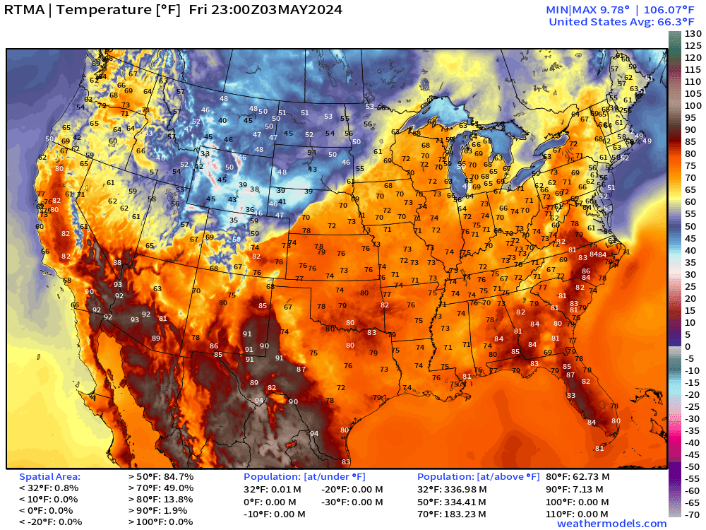
Friday Evening Temperatures 7:00 PM ET
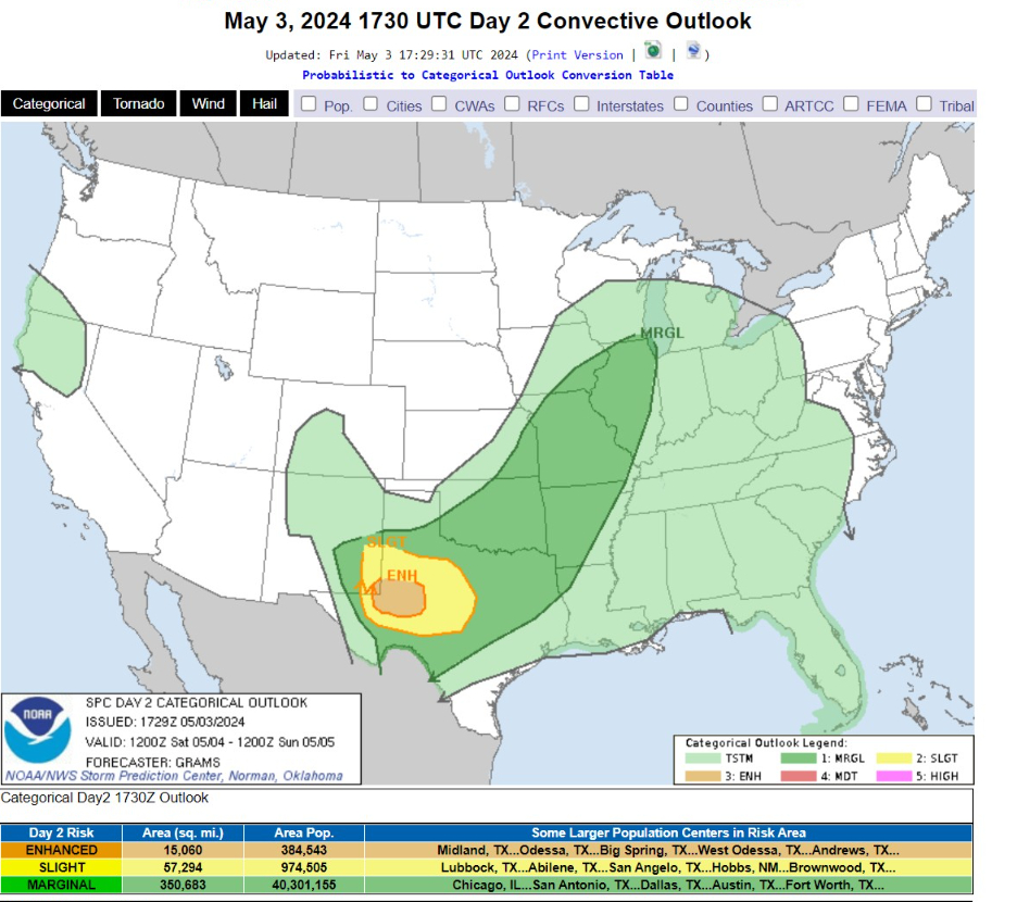
Saturday Weather and Convective Outlook
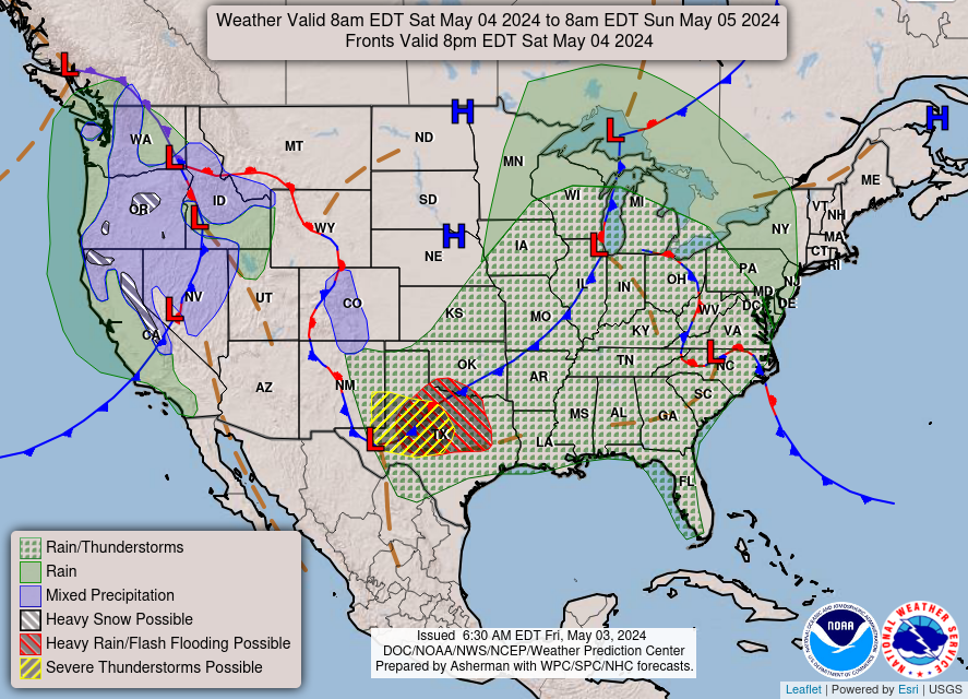
   Scattered severe thunderstorms are expected across parts of west
   Texas from late afternoon through the evening on Saturday. Several
   storms may produce very large to giant hail, and a couple strong
   tornadoes are possible.
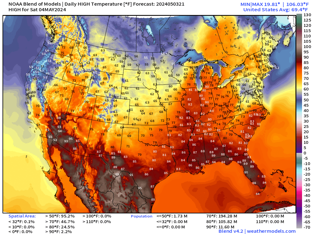
Highs in the 80s into Chicago on Saturday. Uh oh — clouds and cooler temperatures in mid-Atlantic, only in the 50s and 60s around D.C.
Also, highs in the 60s in the Plains. Whoosh for early May.
Sunday Weather
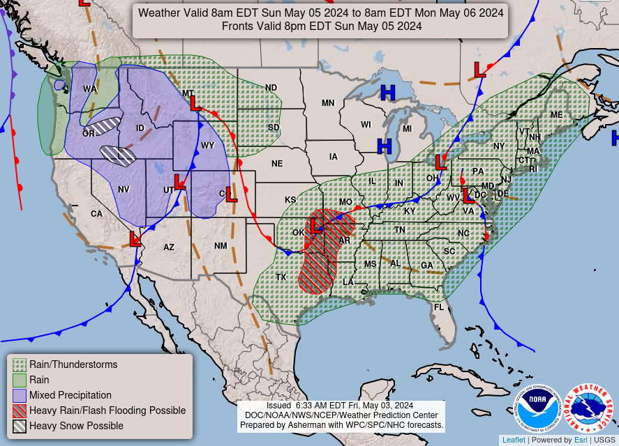
Scattered showers over a large area from Texas into Northeast on Sunday as boatloads of Gulf of Mexico moisture stream northward. Heaviest rain in eastern OK/TX and western Arkansas, as shown also in the HRRR 48-hour simulated radar.
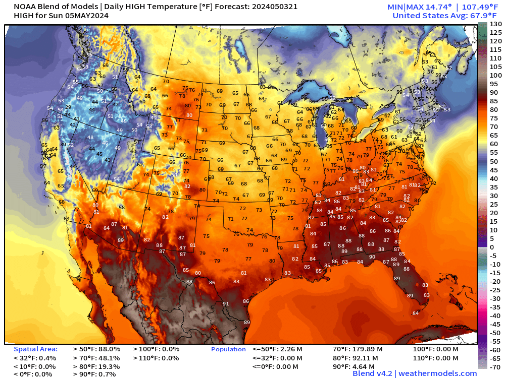
Mild and comfortable across the central U.S. only in the 60s and 70s.
80s in the Southeast. Only 69°F for a high in Las Vegas on Sunday.
Next 8-Days Weather Systems
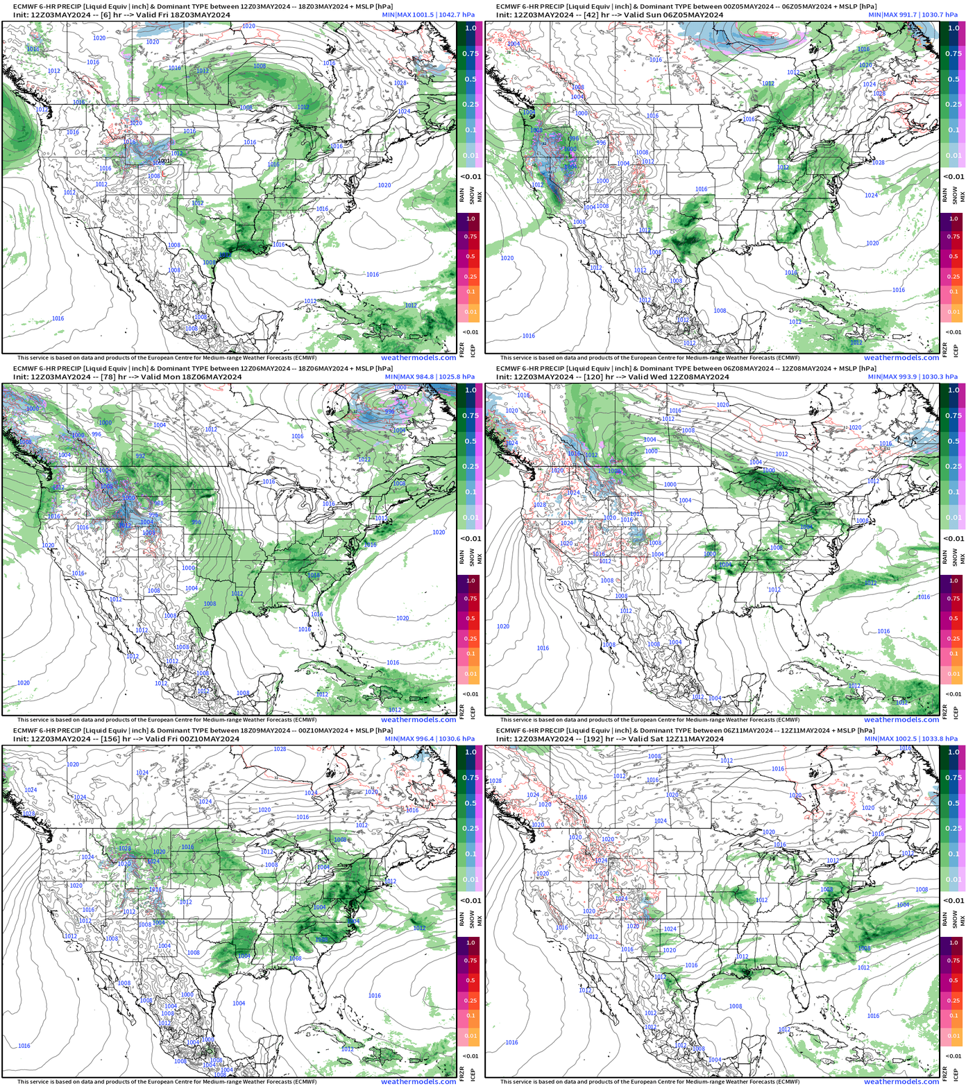
Series of storm systems for the central and eastern U.S. keeps the Lower 48 largely under threat of showers and thunderstorms —
Forecast Farm | 15-Day Precipitation Anomaly [%]
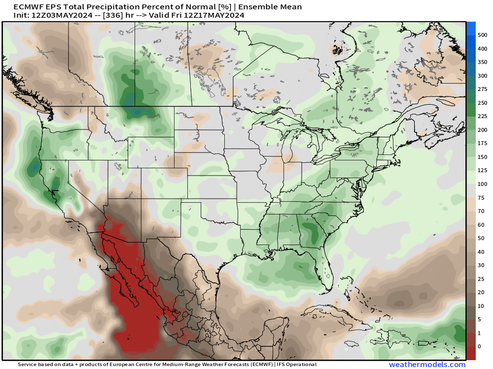
Nice to see above normal precipitation for the Southeast and Mid-Atlantic.
ECMWF Ensemble | 7-Day Temperature Anomaly
Next 7-Days | May 3-9
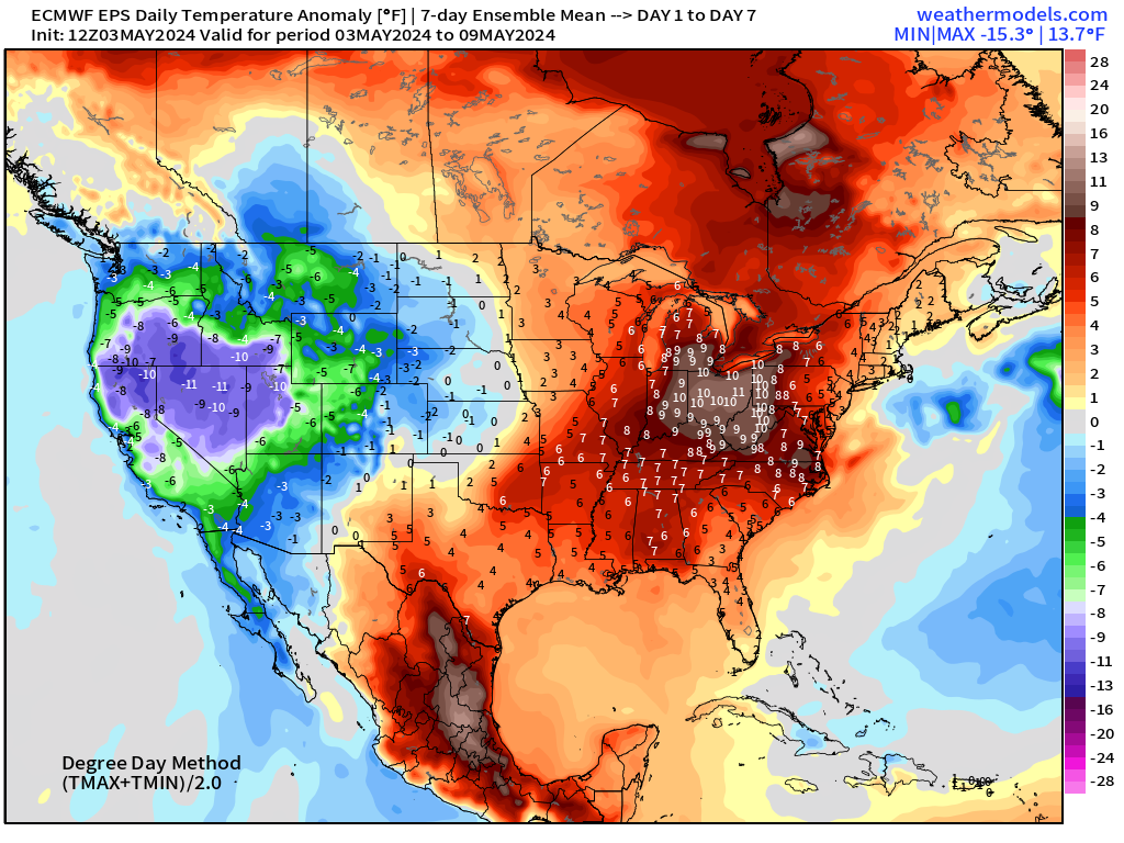
Week 2 | May 10-16
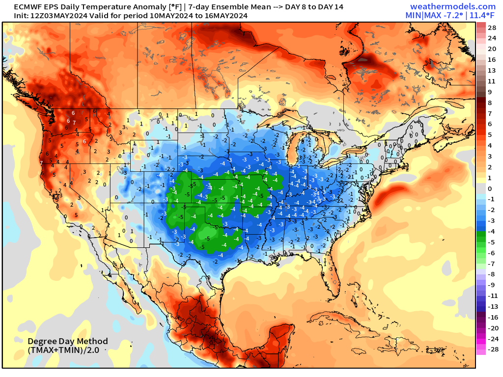
Eastern U.S. goes below normal by up to 4° or 5°F for week 2 heading into mid-May. Wow — that’s a major reprieve from potentially very hot weather
Dallas in the 70s for mid-May.
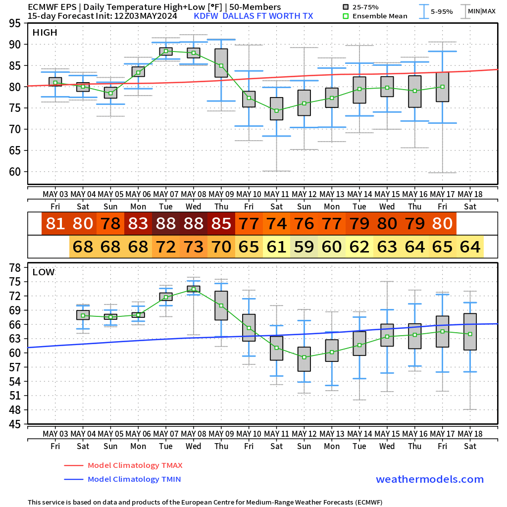
No surprise — a significant trough digging into the Southeast by next weekend and early next week. This is an extreme event on the cool side.
Thank you to Subscribers and Supporters! Welcome to May 2024 — countdown to hurricane season in 28-days.
Maps sourced from weathermodels.com designed and innovated by yours truly! I actually create all of my content from scratch.
- Milepost
- 277 · laid 2024-05-03T23:51:51.876000Z
- Source
- https://weather.substack.com/p/may-3-2024-dodging-showers-this-weekend
- Digest
- fc57f0ce65ec53405c2b967ac2b9c3f50f6e510f9f315c900fff42bcf1462731
- Machine
- JSON