April 26, 2024 Plains Wet Pattern
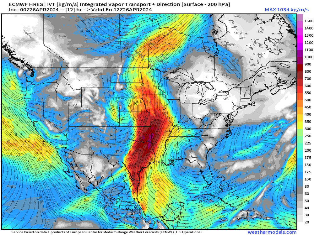
Moisture plume from Gulf of Mexico to also fuel severe weather
April 2024 was the 15th-warmest April in the 132-year national record (1895–2026), at 53.6°F against a 1991–2020 normal of 51.8°F (+1.8°F).
April 2024 was the 37th-wettest April in the 132-year national record (1895–2026), at 2.8in against a 1991–2020 normal of 2.7in (+0.1in).
NOAA/NCEI Climate at a Glance, contiguous United States. This is the observed record for the month, not a score of anything said in this piece — the forecast ledger begins 2026-08-17 and cannot reach earlier posts.

Main story for the next few days will be the upper-level trough in the west leading to significant moisture transport out of the Gulf of Mexico into Texas and the Plains. The result will be potentially flooding rains in thunderstorms. Overall, a large area of at least 2-inches of rain from Texas to the Great Lakes.
NWS WPC 7-Day Precipitation Forecast | Watering Needs
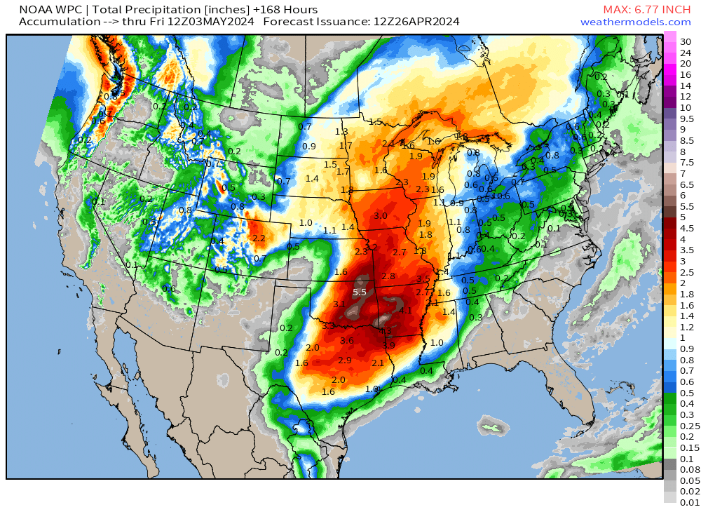
Very little rainfall in Georgia and Florida over the next week. Indeed, looking ahead to the next 15-days, locations like Orlando may not seen 0.5” of precipitation. This will certainly require plenty of watering for your lawn, flowers, and weeds.
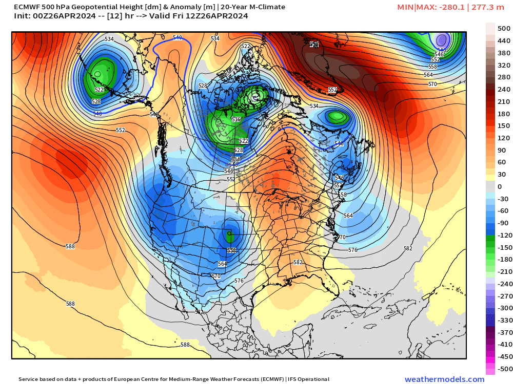
The 500 hPa or mid-level trough over the Western U.S. will remain entrenched for a while. Ridging east of the Mississippi would typically mean a heat dome, but the rainfall and cloud cover will keep temperatures in check.
The Integrated Moisture Transport (IVT) out of the Gulf of Mexico is evident along with the surface low over Nebraska and ridge centered over North Florida. Some variables like IVT concisely demonstrate the synoptic pattern.
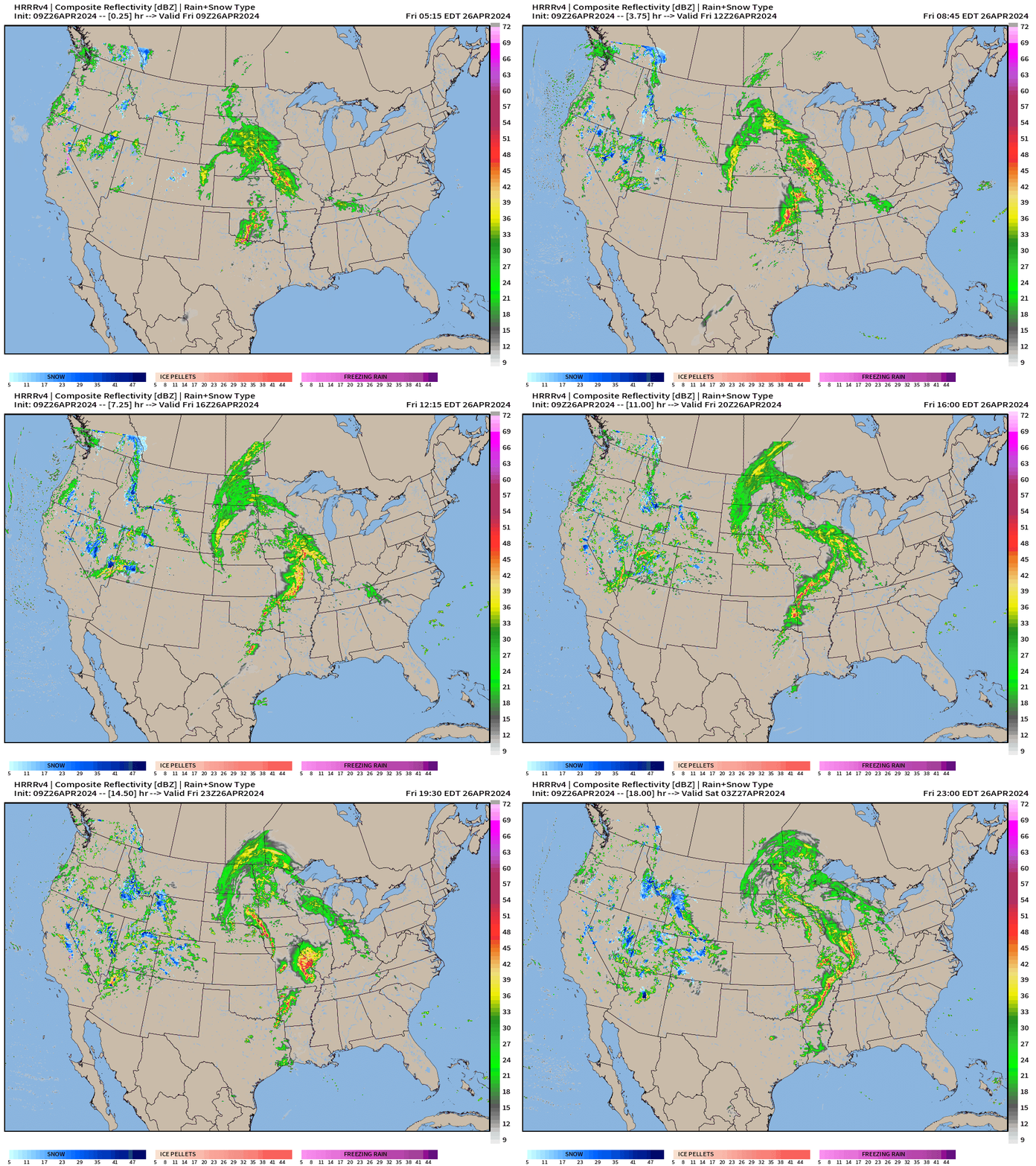
Thunderstorms and rainfall today: HRRR next 18-hours through 11 PM ET
Friday High Temperatures
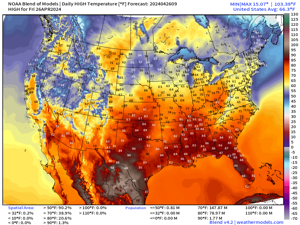
80 million at/above 80°F this afternoon. Below normal across the Southwest with Phoenix in the lower-80s instead of pushing 100°F, which is quite possible in late April.
60s into the Great Lakes and New England.
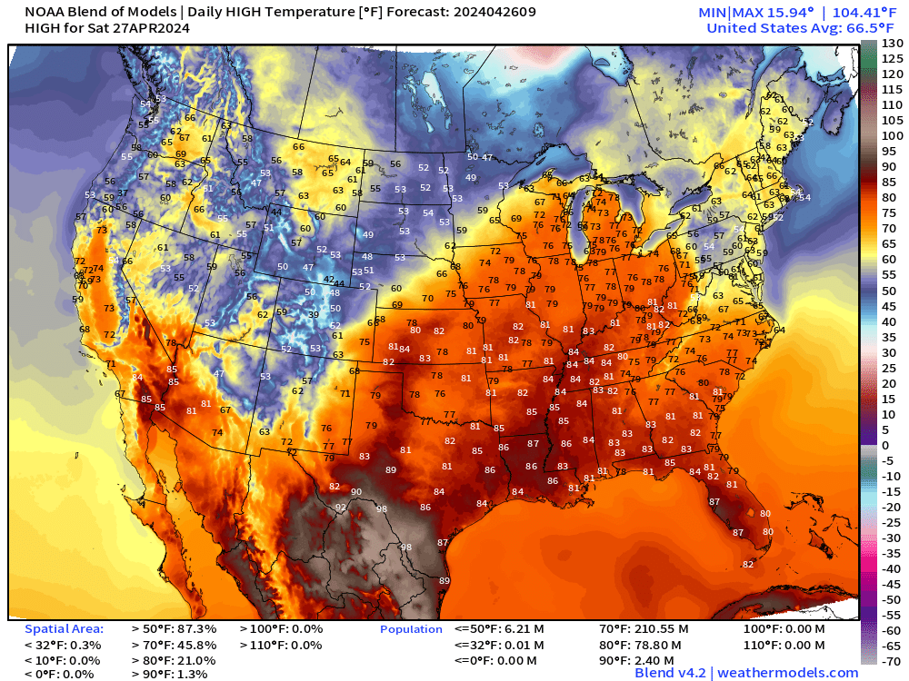
Weekend High Temperatures
Saturday High Temperatures
Sunday High Temperatures
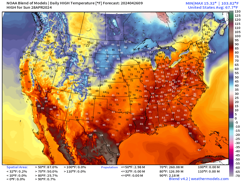
Widespread 80s across the eastern U.S. including upper-80s in the Ohio Valley
Friday Morning Temperatures 7:00 AM ET
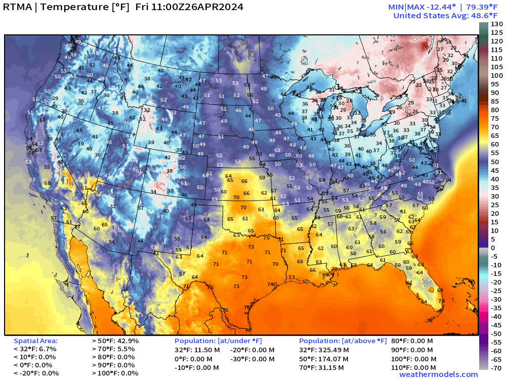
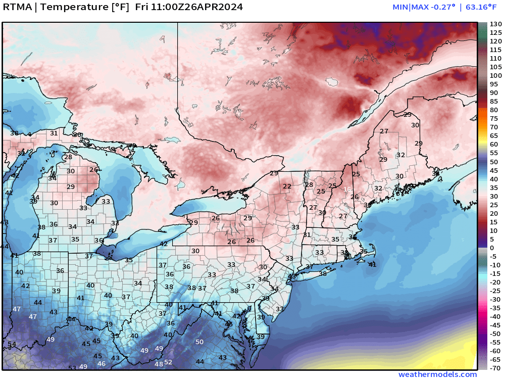
Temperatures below freezing = 11 million population at 7 AM including Michigan and New England.
Friday Weather and Convective Outlook
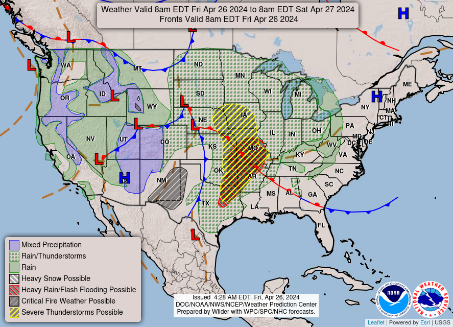
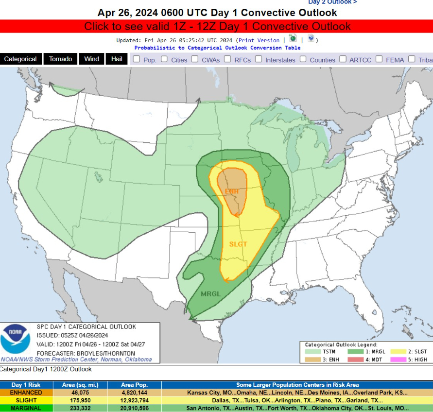
Strongest thunderstorms this evening centered on Kansas City and Des Moines.
   All hazards will be possible,
   including tornadoes with some potentially strong, very large hail
   over two inches in diameter, and wind damage.
Next 66-Hours Precipitation | NWS NDFD
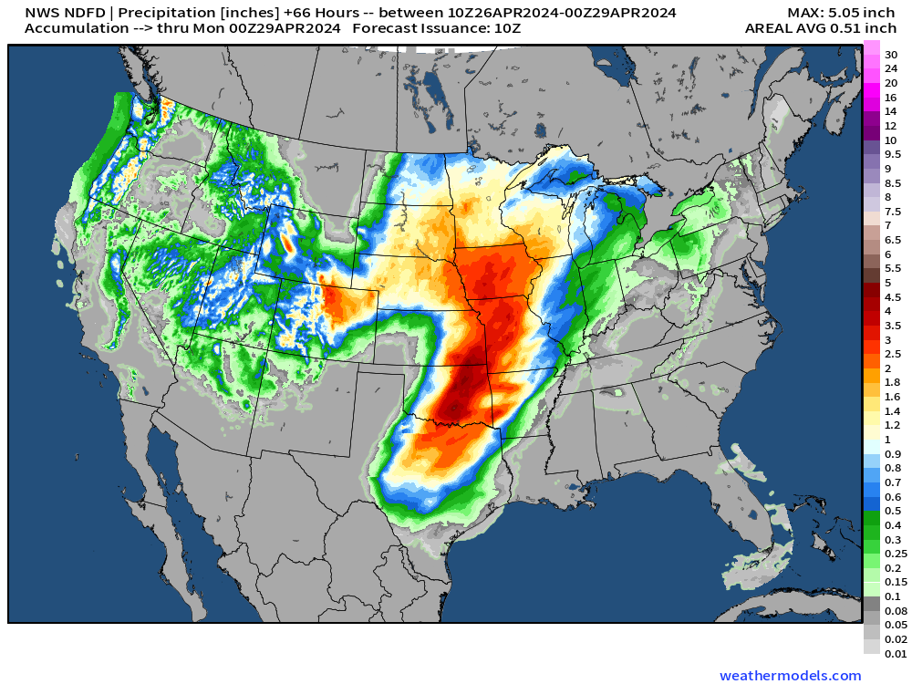
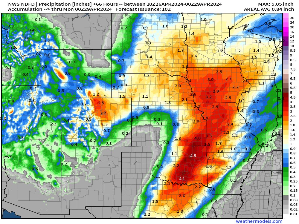
Heavy rainfall for Iowa > 2” and up to 5” or more in thunderstorms.
Next 8-Days Weather Systems
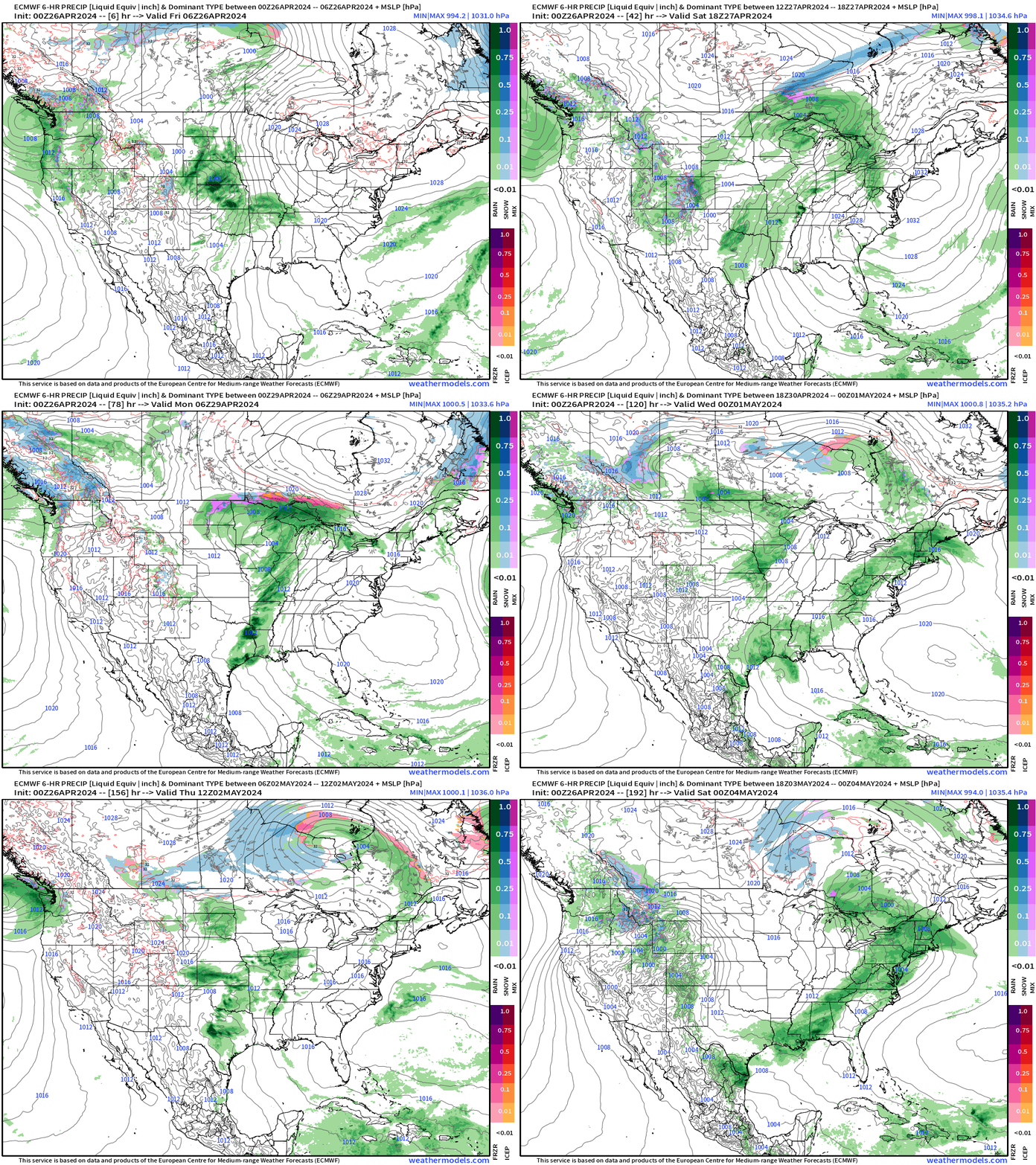
Active weather pattern continues well into next week = starting May out with a wet, unsettled Lower 48.
Forecast Farm | 15-Day Precipitation Anomaly [%]
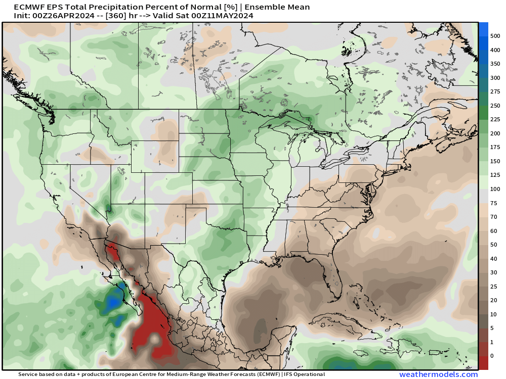
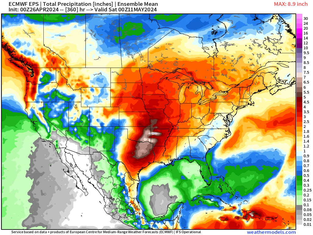
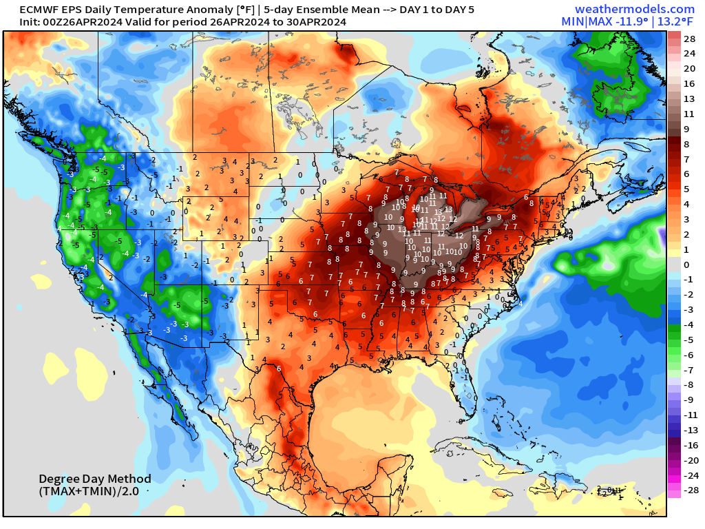
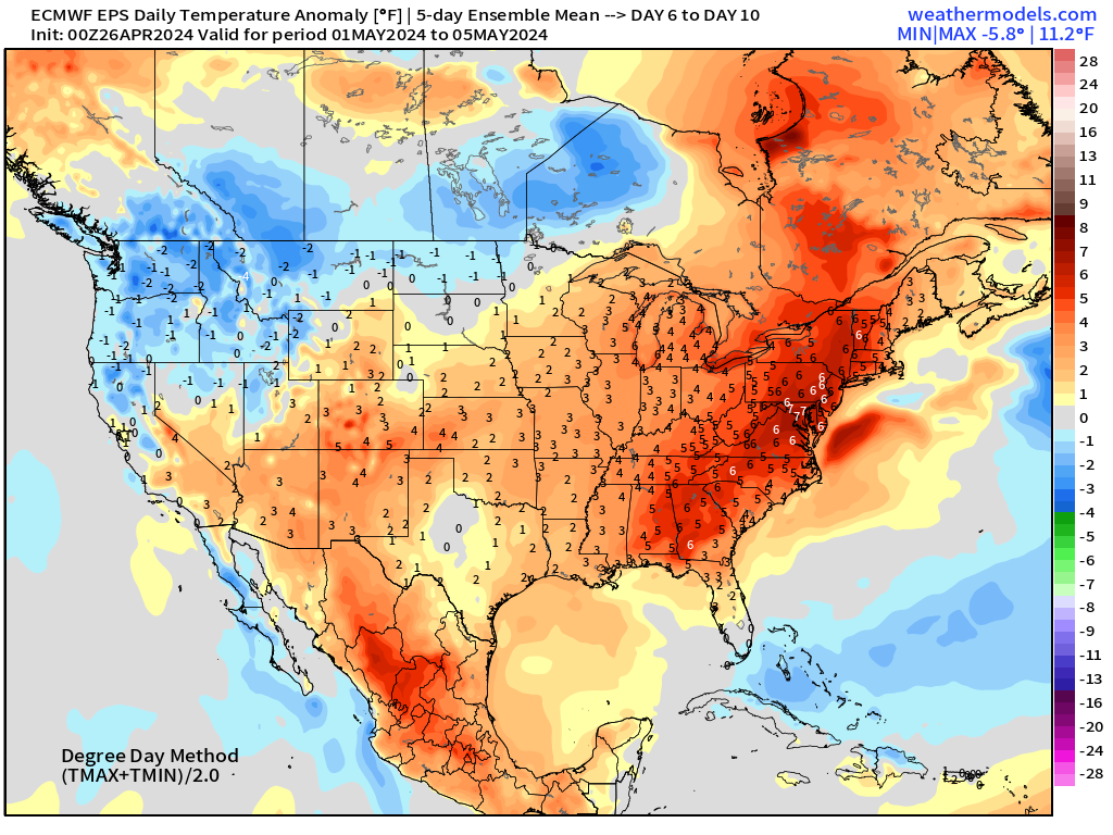
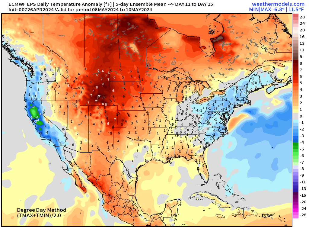
ECMWF Ensemble | 5-Day Temperature Anomaly
Next 5-Days From April 26-30
Days 6-10 From May 1-5
Days 11-15 From May 6-10
Thank you to Subscribers and Supporters! It’s the growing season — so much is going on in the world of weather!
Maps sourced from weathermodels.com designed and innovated by yours truly! I actually create all of my content from scratch.
- Milepost
- 272 · laid 2024-04-26T11:46:56.015000Z
- Source
- https://weather.substack.com/p/april-26-2024-plains-wet-pattern
- Digest
- 13a08b8e9f77b9a267d94e2c4268a6457310b5c1205c7111c7da8b2930155f70
- Machine
- JSON