April 24, 2024 Plains Severe Weather and Heavy Rain
Persistent pattern with moisture plumes out of Gulf of Mexico, soggy conditions
April 2024 was the 15th-warmest April in the 132-year national record (1895–2026), at 53.6°F against a 1991–2020 normal of 51.8°F (+1.8°F).
April 2024 was the 37th-wettest April in the 132-year national record (1895–2026), at 2.8in against a 1991–2020 normal of 2.7in (+0.1in).
NOAA/NCEI Climate at a Glance, contiguous United States. This is the observed record for the month, not a score of anything said in this piece — the forecast ledger begins 2026-08-17 and cannot reach earlier posts.

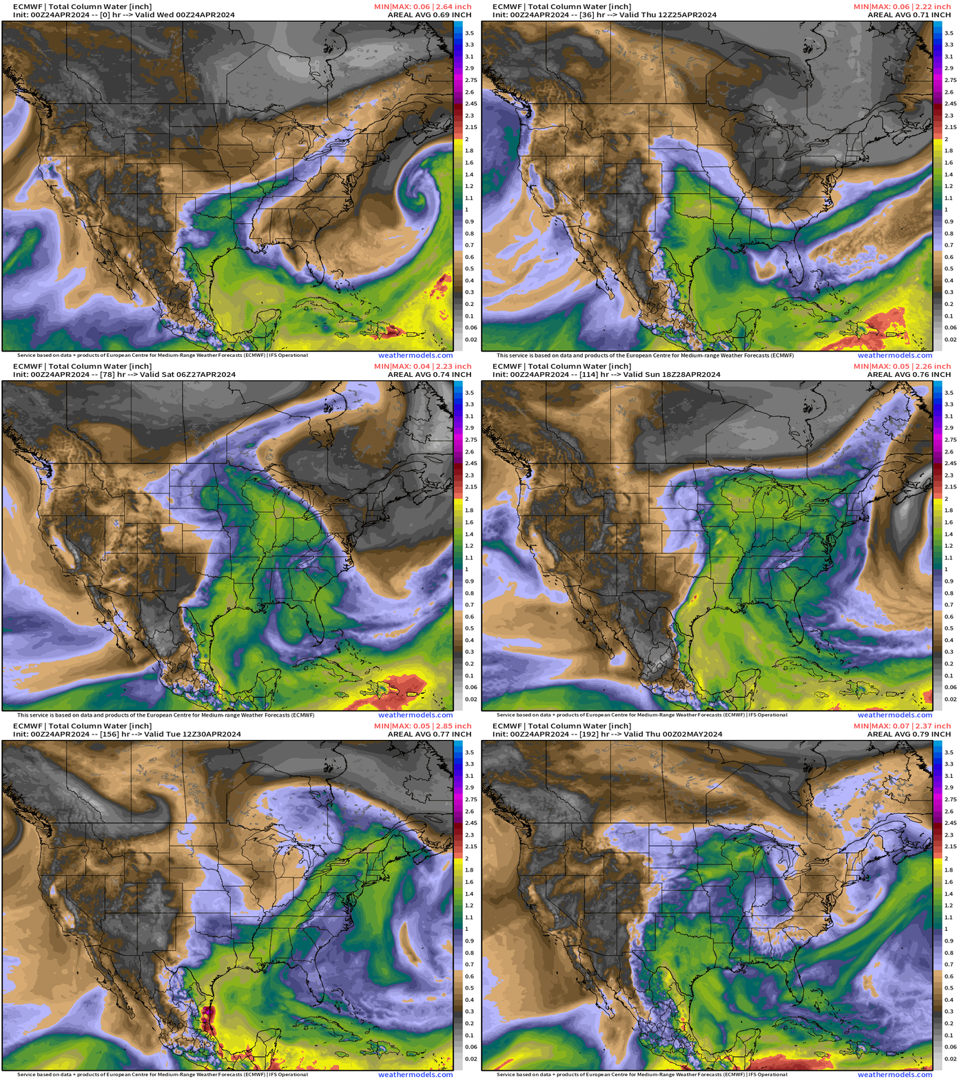
Over the next week, a persistent weather pattern will flood the central plains with boatloads of Gulf of Mexico warm and moist air.
The resulting instability and higher dewpoints will spur severe weather as upper-level short-waves arrive into the U.S. Southwest and then track into the Great Lakes. Surface lows will form and be the focus of all modes of severe weather starting on Thursday but also heading into next week.
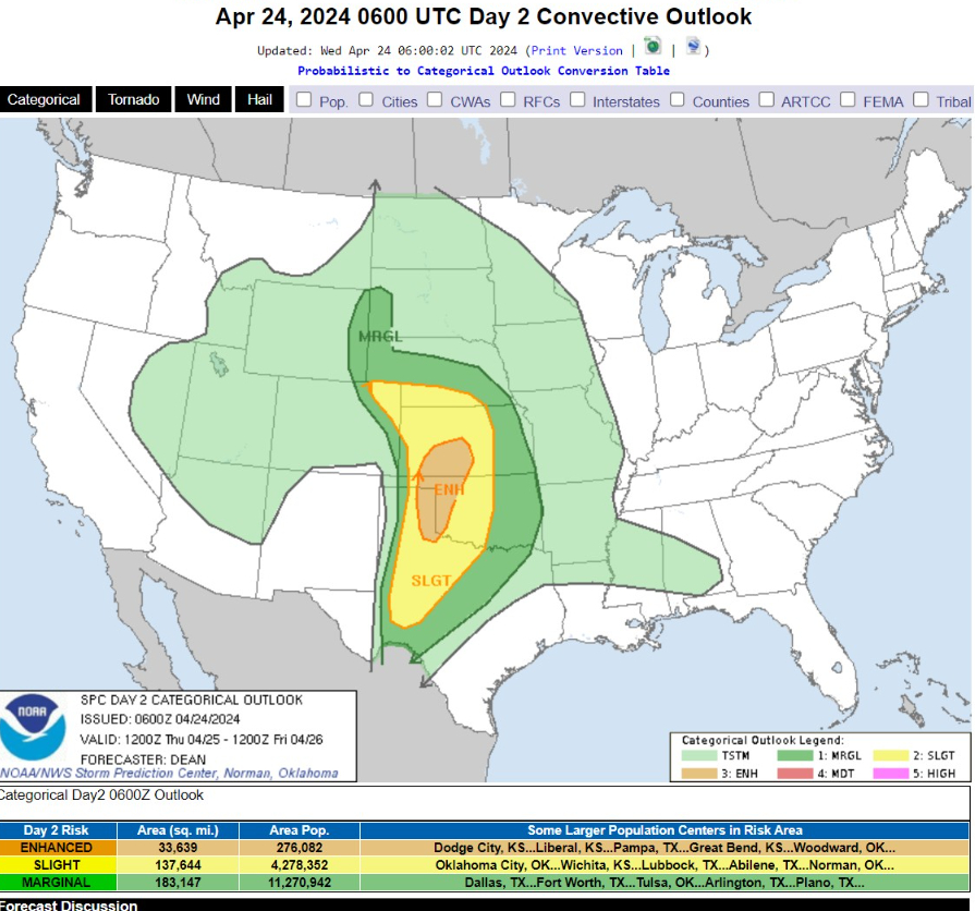
Enhanced Risk of severe thunderstorms only encompasses 276,000 population but will probably be the location of 1,000 storm chasers looking for tornadoes during this so-far rather quiet Spring severe weather season.
Wednesday High Temperatures
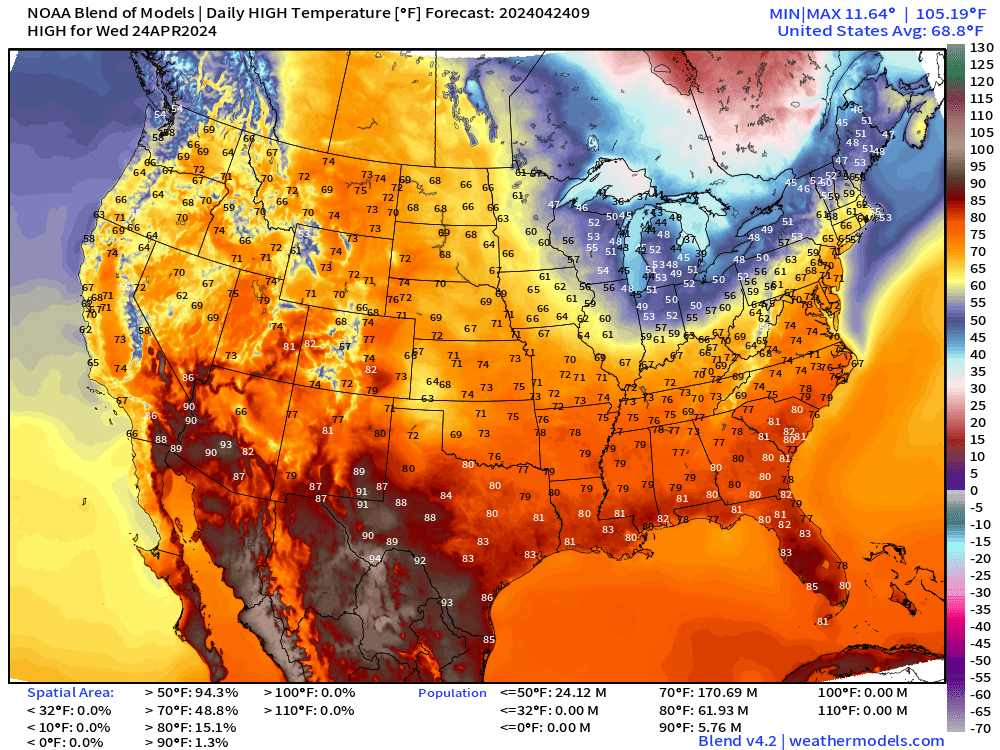
Chilly late-April across the Great Lakes and Northeast. However, moderating temperatures and then some more heat on the way this weekend.
Comfortable elsewhere in the 60s and 70s.
Wednesday Morning Temperatures 7:00 AM ET
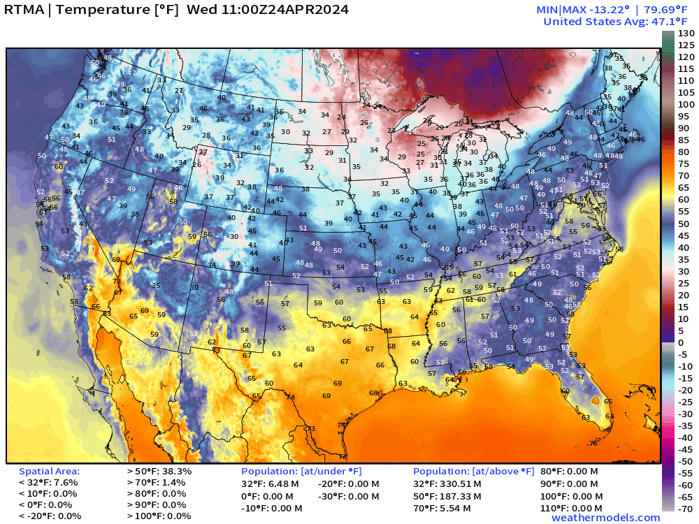
Still hard freezes across Wisconsin and Michigan. Of course, planting anything before Memorial Day is a bit of a coin flip up there.
Next 18-Hours Weather | Simulated Radar
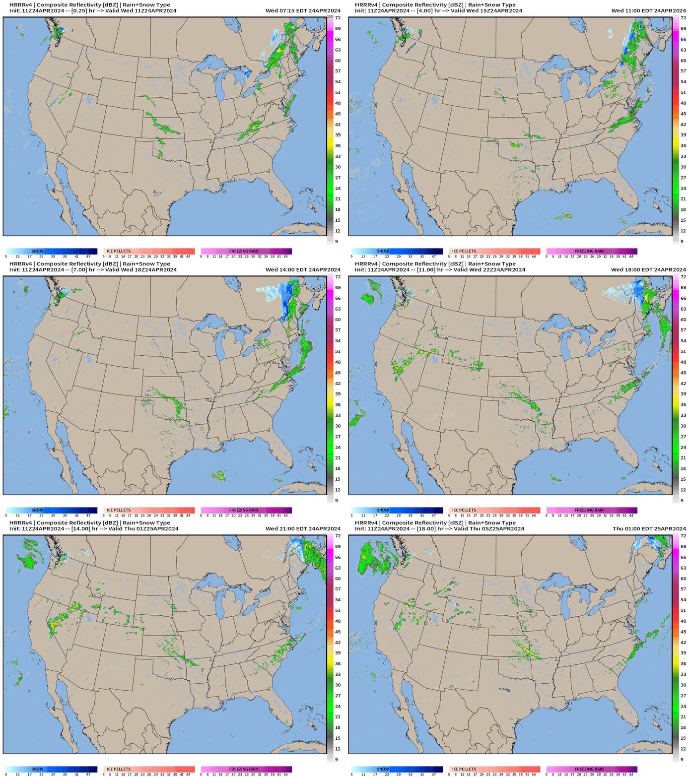
Just scattered showers today across the Lower 48 with nothing organized or severe to speak much about.
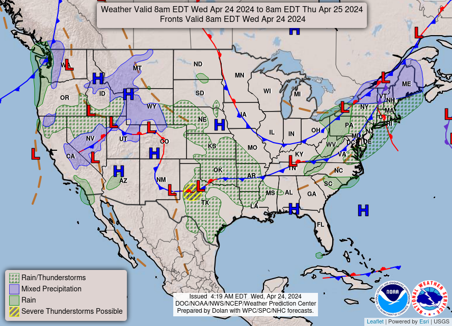
Wednesday Weather
Next 72-Hours Precipitation | NWS NDFD
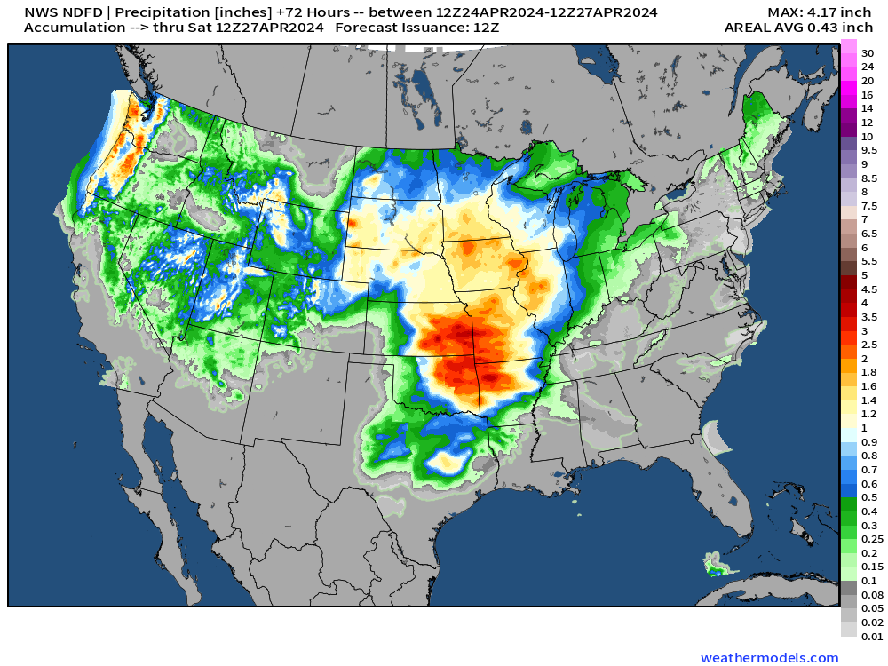
Here comes the “boatloads” of rainfall of the southern Plains into the Corn Belt over the next 3-days.
Weekend Ahead
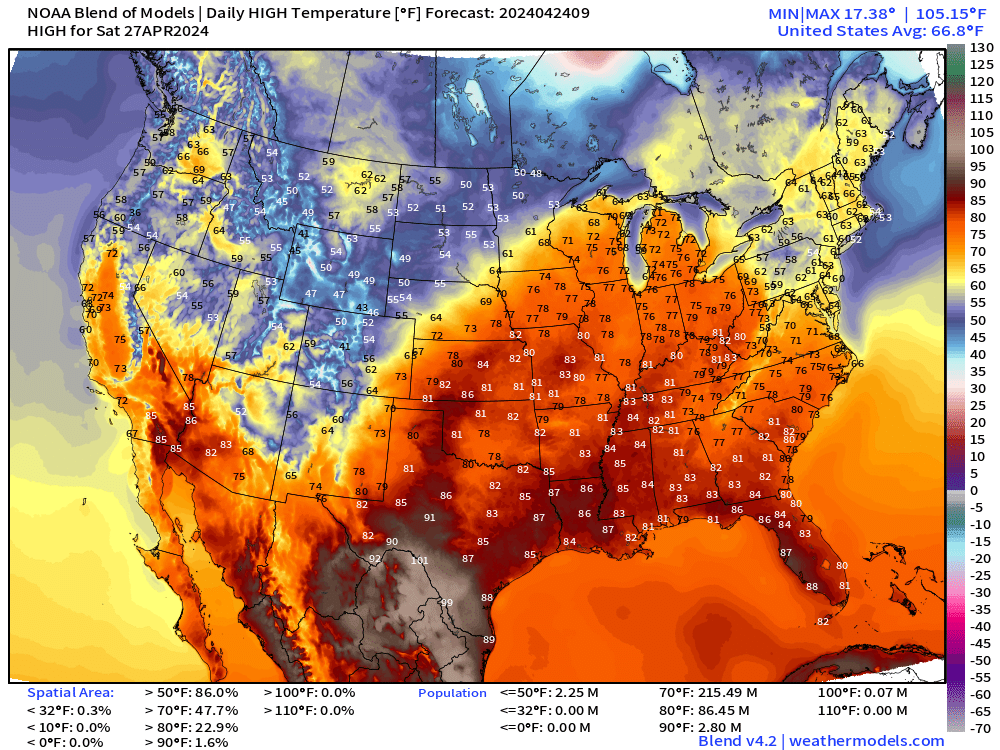
Saturday’s highs in the 70s into the Great Lakes, finally.
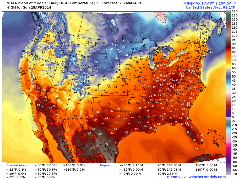
Then, warmer on Sunday with mid-80s in the Ohio River Valley.
Next 8-Days Weather Systems
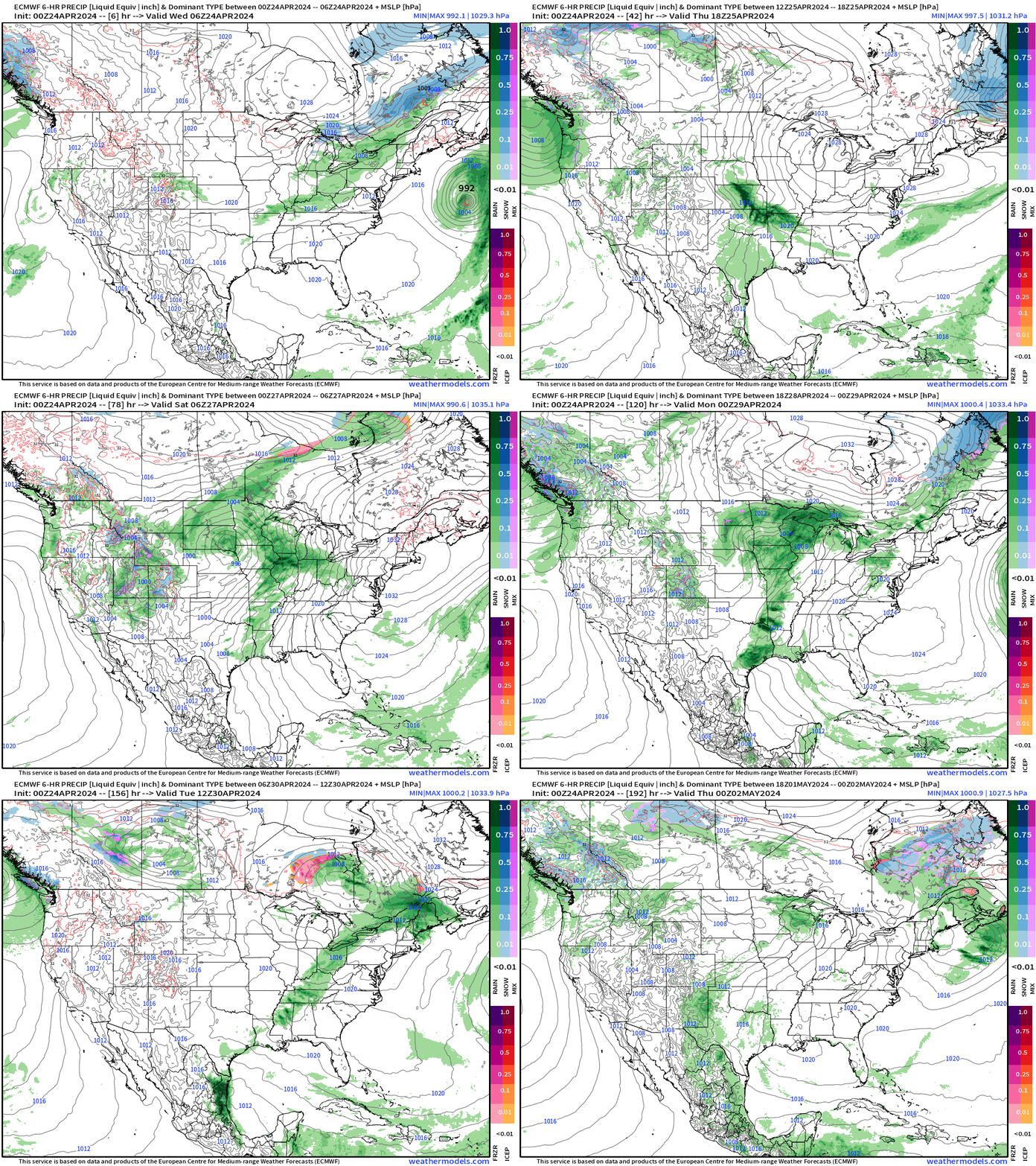
A series of surface lows will be the focus of severe weather episodes every 2 days or so across the central Plains: late Thursday, late Saturday into Sunday.
NWS WPC 7-Day Precipitation Forecast | Watering Needs
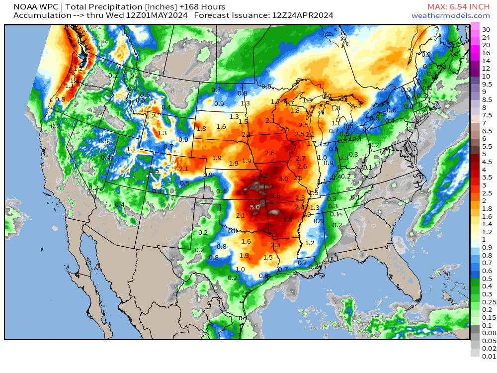
WPC with a large area of 2-inches+ from Texas to Minnesota over the next 7-days.
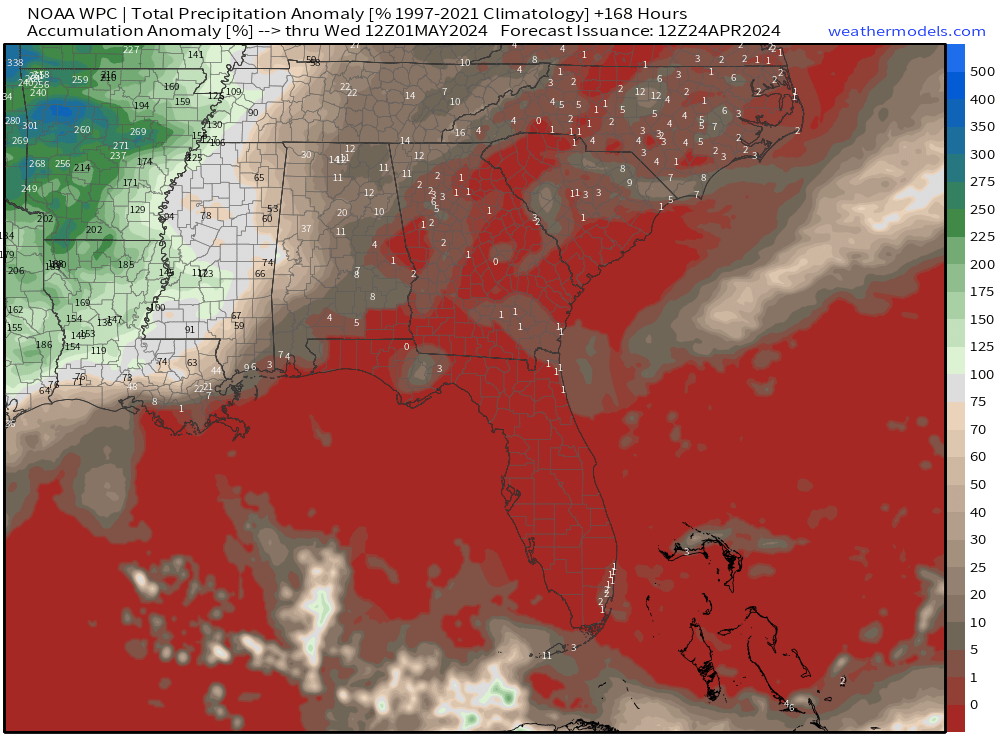
Very dry across the Southeast under a solid ridge of high pressure helping to direct the moisture plumes across the Plains.
Forecast Farm | 15-Day Precipitation Anomaly [%]
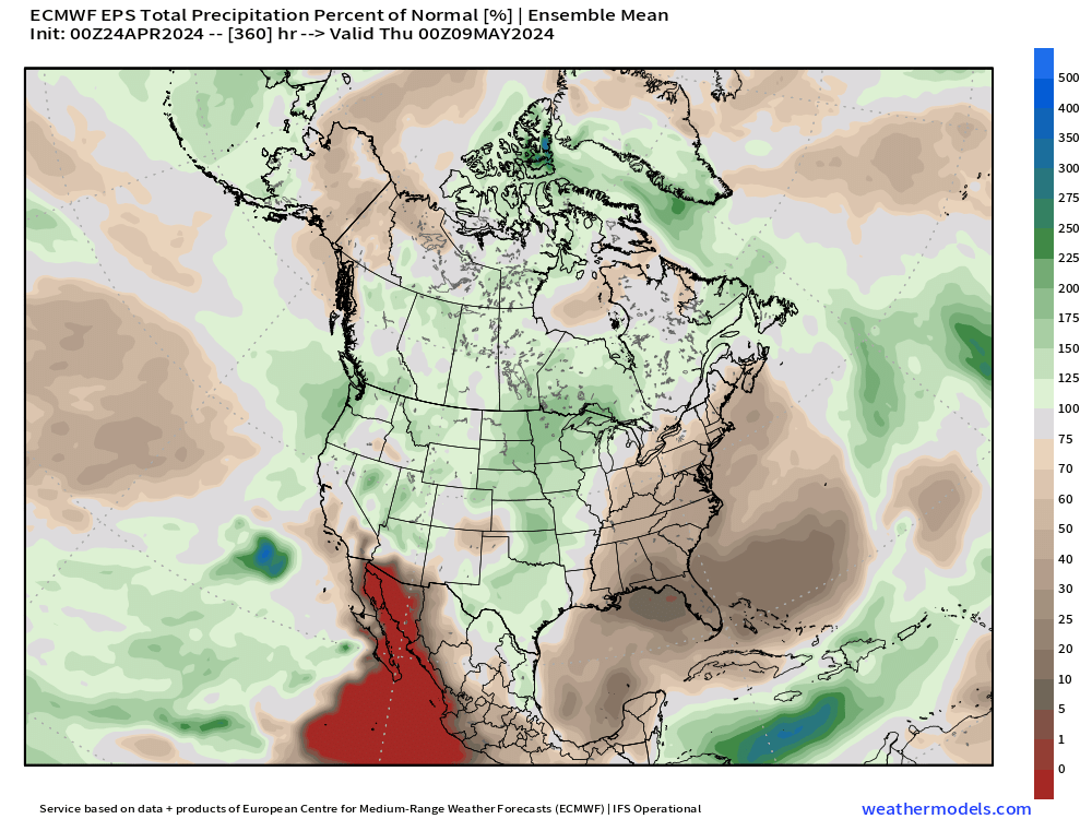
Zooming out to North America: the southeast is a very dry zone for the next 2-weeks.
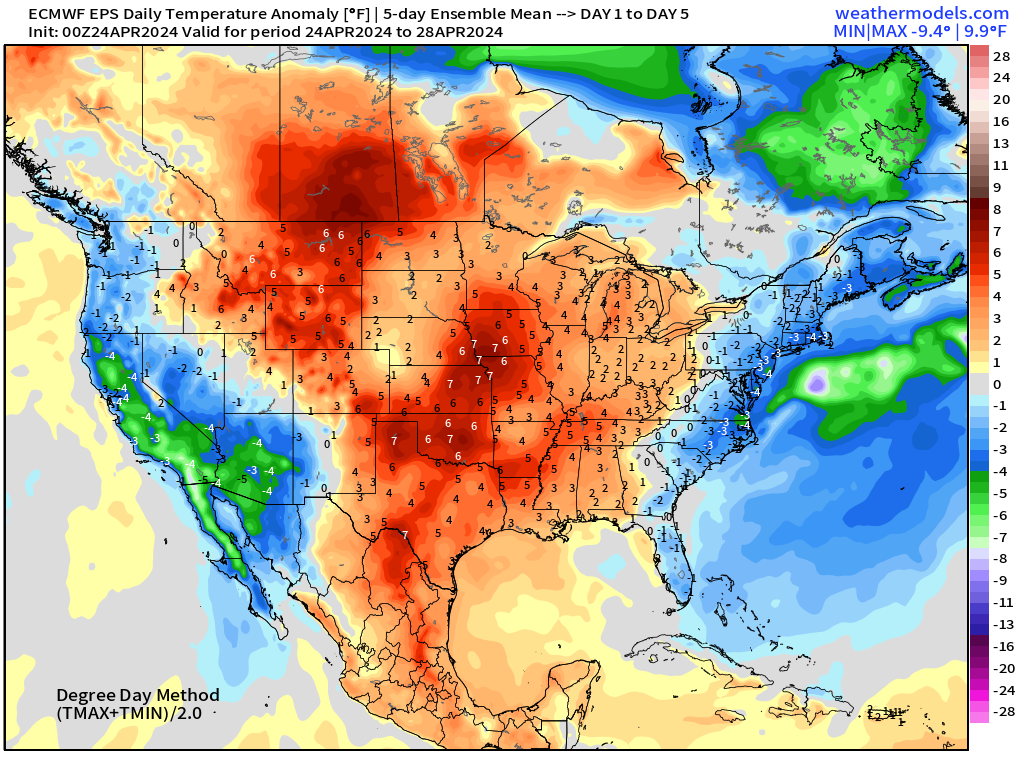
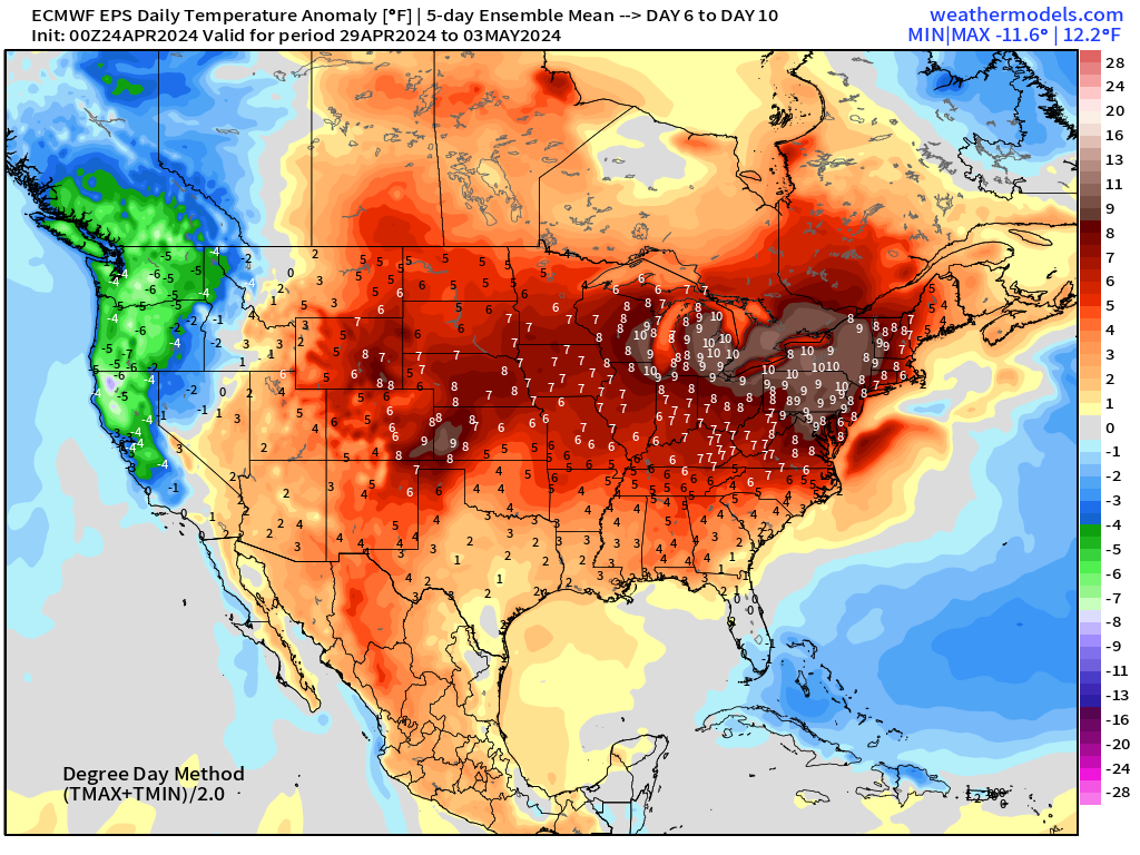
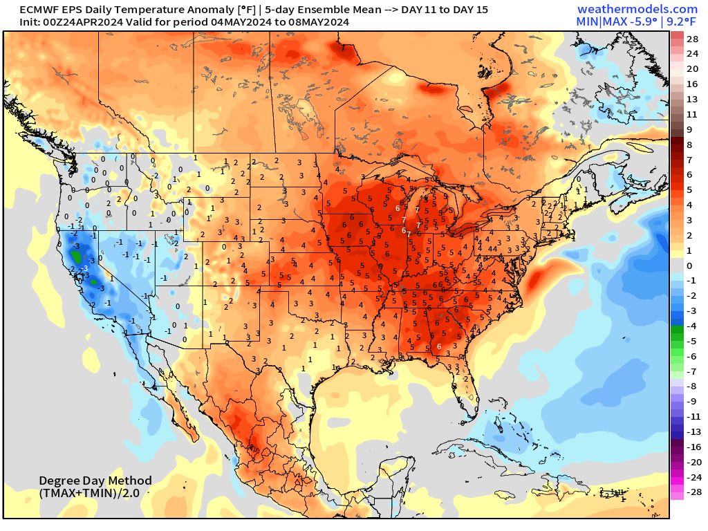
ECMWF Ensemble | 5-Day Temperature Anomaly
Next 5-Days From April 24-28
Days 6-10 From April 29-May 3
Days 11-15 From May 4-8
Thank you to Subscribers and Supporters! It’s the growing season — so much is going on in the world of weather!
Maps sourced from weathermodels.com designed and innovated by yours truly! I actually create all of my content from scratch.
- Milepost
- 270 · laid 2024-04-24T13:30:52.057000Z
- Source
- https://weather.substack.com/p/april-24-2024-plains-severe-weather
- Digest
- 67705dc760085bc1459065bd3fa8592b8ddaecfe86d7e6e29c203c2a2c686415
- Machine
- JSON