April 17, 2024 Cooling Trend into Weekend then Heat to end month
Last week of April could be quite hot
April 2024 was the 15th-warmest April in the 132-year national record (1895–2026), at 53.6°F against a 1991–2020 normal of 51.8°F (+1.8°F).
April 2024 was the 37th-wettest April in the 132-year national record (1895–2026), at 2.8in against a 1991–2020 normal of 2.7in (+0.1in).
NOAA/NCEI Climate at a Glance, contiguous United States. This is the observed record for the month, not a score of anything said in this piece — the forecast ledger begins 2026-08-17 and cannot reach earlier posts.

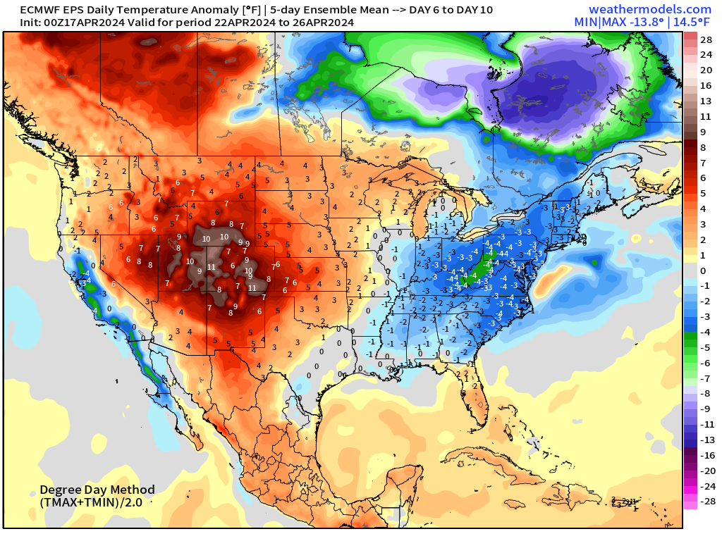
The last gasp of the Arctic polar front a.k.a. the “Polar Vortex” arrives this weekend with a rather impressive frontal boundary across the eastern U.S. with below average temperatures. The bulk of the “cold air” remains over Canada but enough breaks off into the Lower 48. The result is a crisp continental air mass with brilliant sunshine and dry conditions for many days coming up. The pattern turns very quite under northwesterly flow — a welcome change from the recent weeks of progressive storms arriving along the West Coast and then re-intensifying in the lee of the Rockies.
High temperatures cool off into the 60s for the weekend in St. Louis from Friday to Monday. 60s also arrive in Atlanta for Sunday and Monday. However, by middle of next week, this cool interlude will be history as southerly flow and ridging dominates the eastern U.S.
Into the last days of April, significant heat could be on the way!
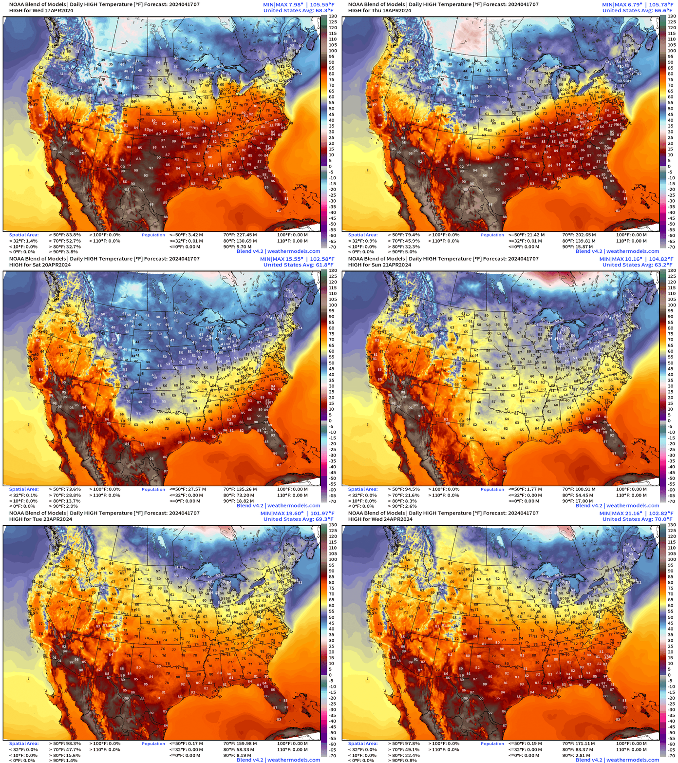
Wednesday High Temperatures
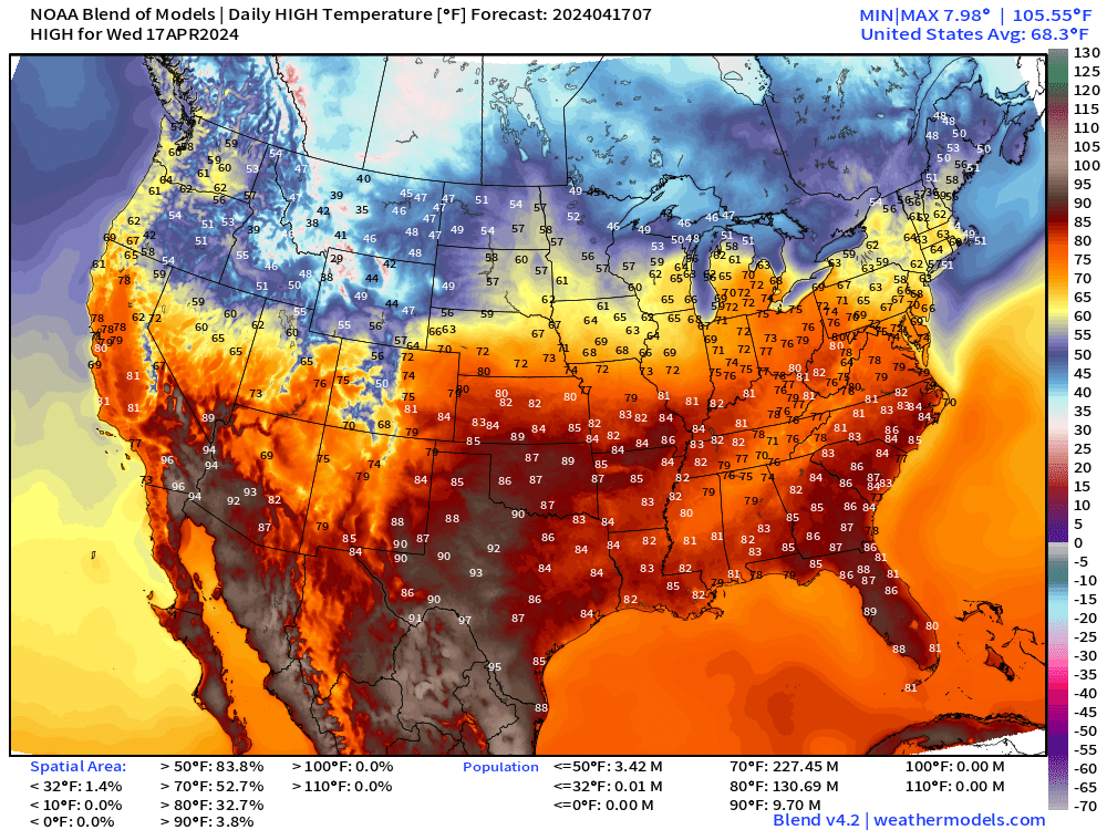
Another warm Spring Day across the Ohio Valley with 70s and 80s. Detroit into the 70s. New England a bit cooler in the 60s but that is still near normal or even a bit above for mid-April.
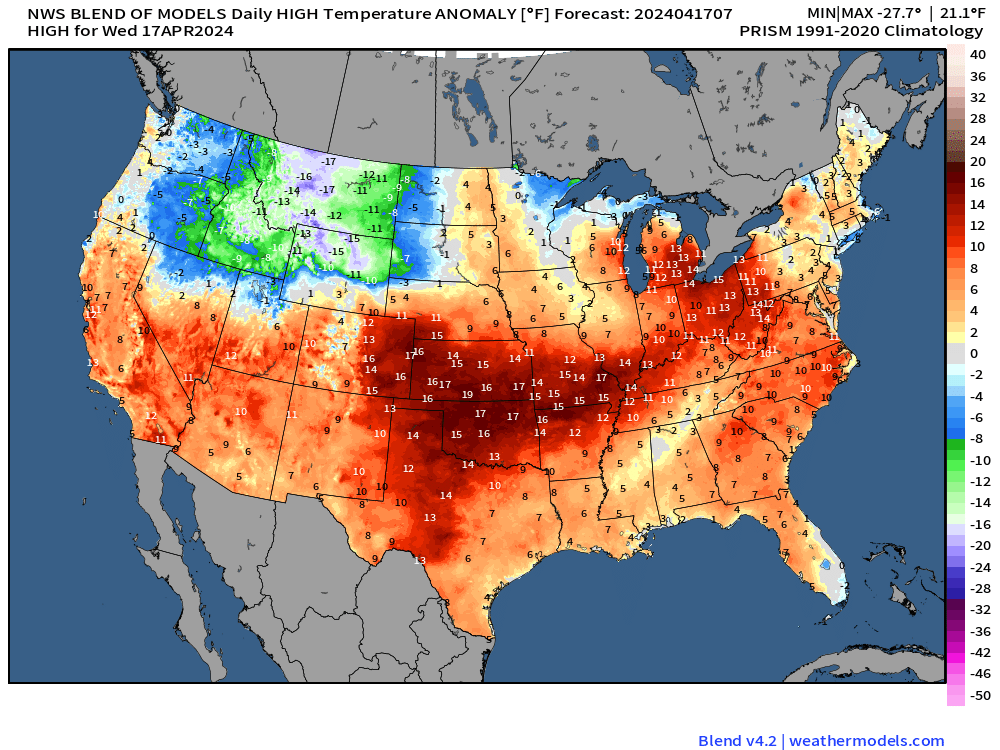
Cooler Canadian air filters into the northern Rockies with 15°F anomalies below average in Montana.
Wednesday Morning Temperatures 5:30 AM ET
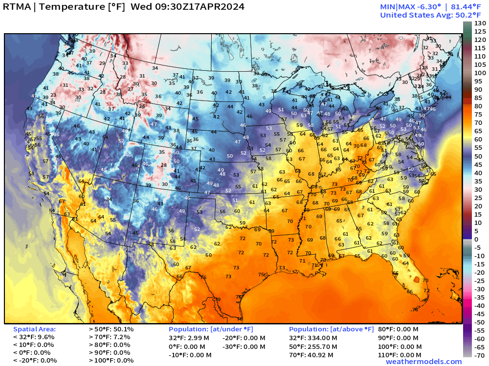
Balmy summer-like temperatures early this morning across the Ohio River Valley in the warm sector of the lingering upper-level low and storm system.
Next 48-Hours Weather | Simulated Radar
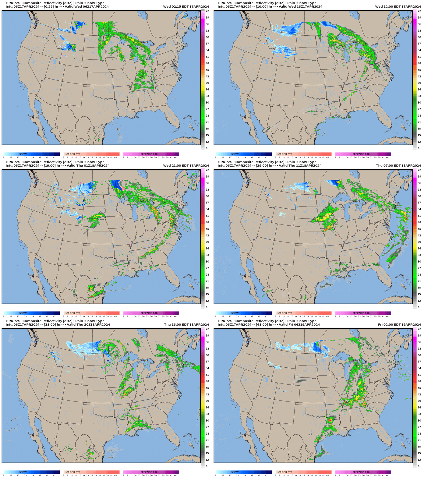
Frontal boundary finally sweeps through the Great Lakes by late this evening with scattered showers and thunderstorms — welcome rainfall along with a cool-down.
Wednesday Weather + Severe Storm Convection Outlook
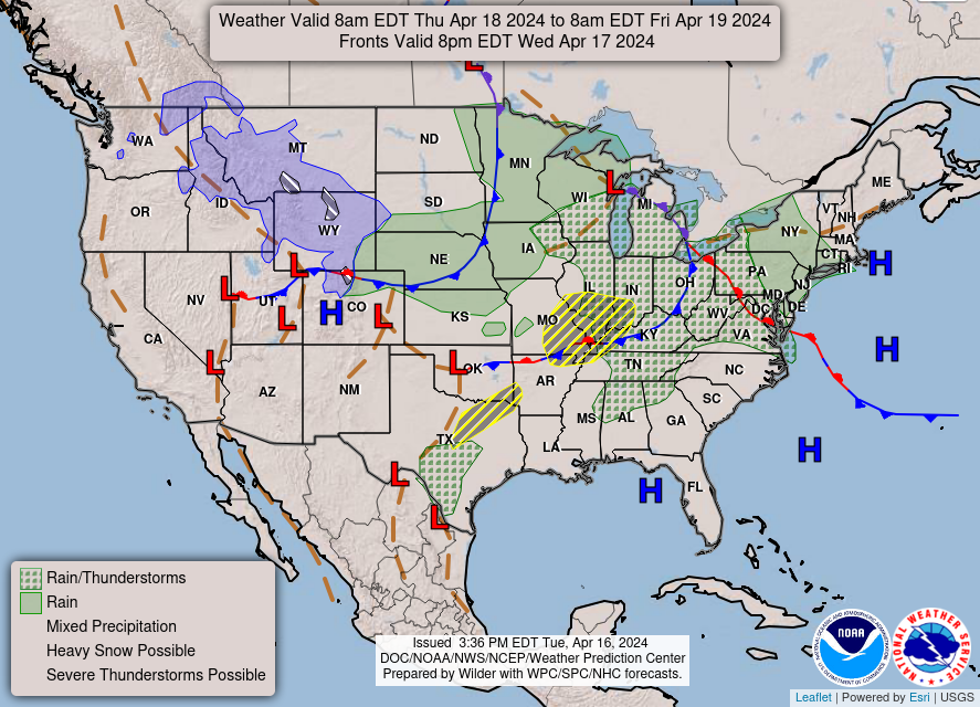
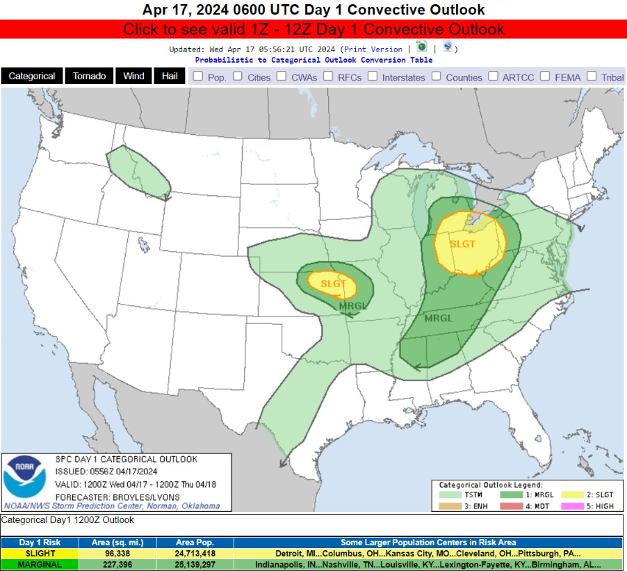
Only a slight risk of severe weather today across Detroit, Pittsburgh, and Kansas City.
Next 66-Hours Precipitation | NWS NDFD
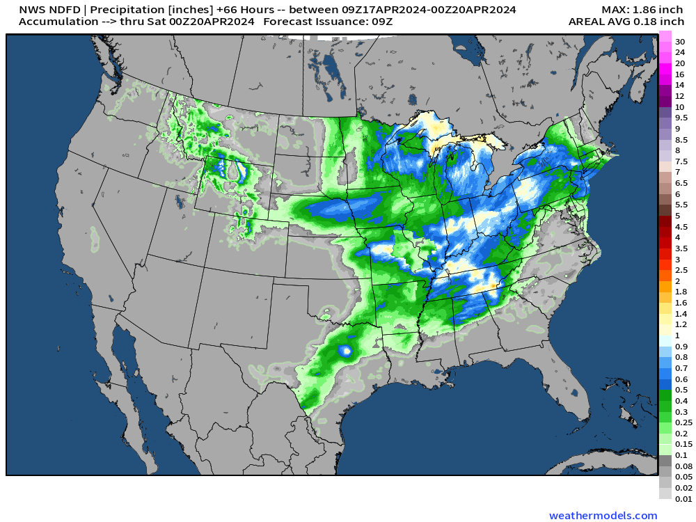
Rainfall could reach 1-inch in stronger thunderstorms, but much of the rain is scattered.
Next 7-Days Weather Systems
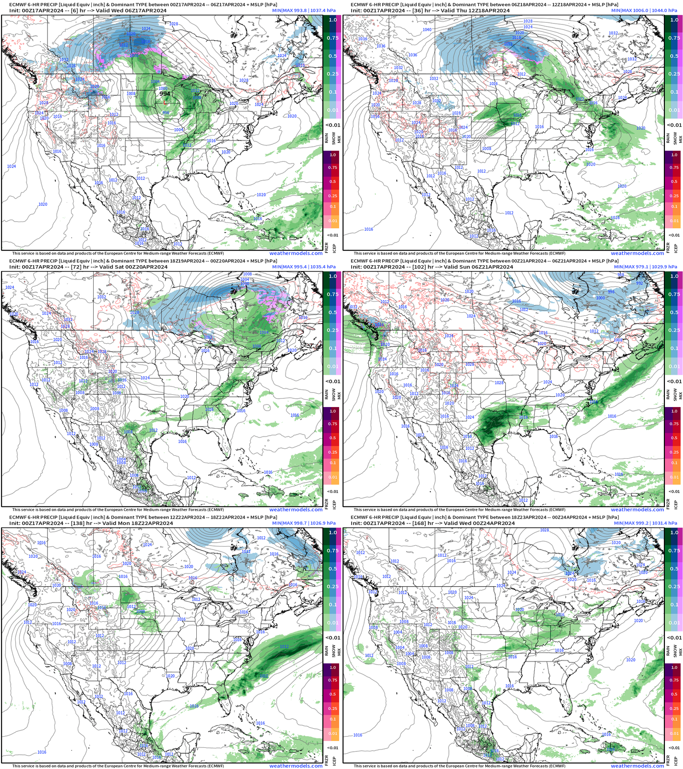
Quiet across much of the Lower 48 under control of Canadian high pressure. The only fly in the ointment will be later Sat/Sun with southerly flow and heaviest rainfall in Texas.
Blend of Models 10-Day Precipitation Forecast
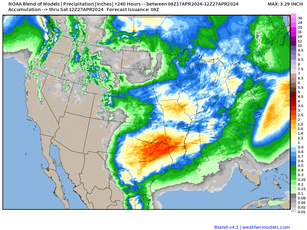
Blend of Models has upgraded to version 4.2 — an improvement over the previous iteration now more than 1-year old. WPC is actually on the fritz with FTP data delivery issues, but the Blend of Models is a great substitute through 10-days.
Note that the Western U.S. is quite dry through the 27th along with Florida.
Forecast Farm | 15-Day Precipitation Anomaly [%]
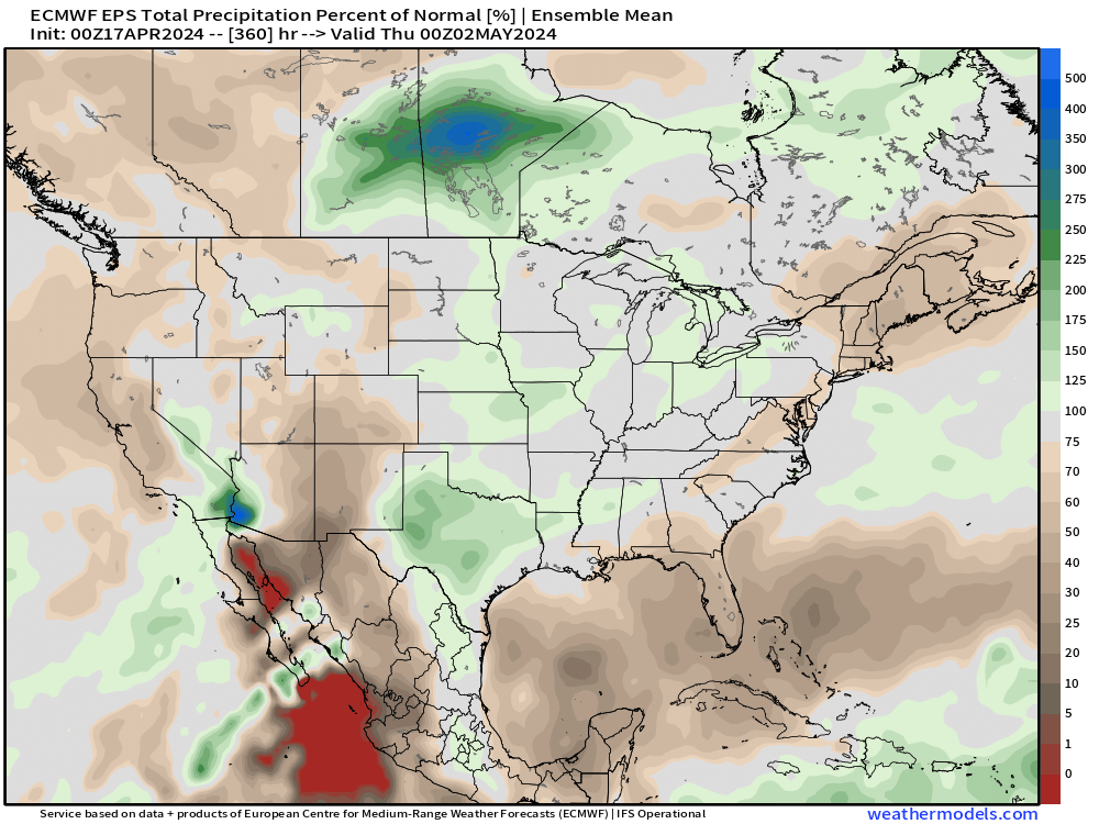
Brown areas are “below normal” precipitation accumulated over the next 2-weeks.
ECMWF Ensemble | 5-Day Temperature Anomaly
Next 5-Days From April 17-21
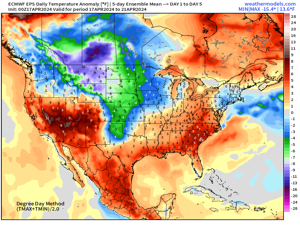
Days 6-10 From April 22-26
Days 11-15 From April 27-May 1
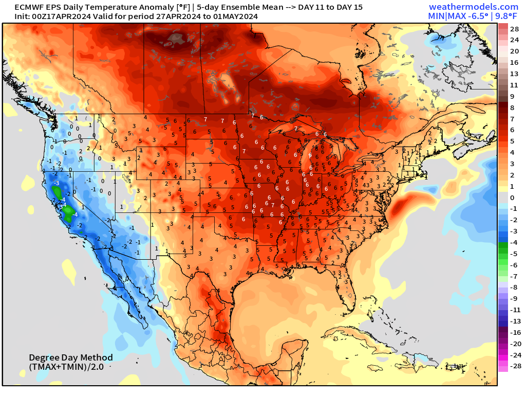
Lower 48 much warmer than normal to end April except for California.
Thank you to Subscribers and Supporters! Almost the growing season — so much is going on in the world of weather!
Maps sourced from weathermodels.com designed and innovated by yours truly! I actually create all of my content from scratch.
- Milepost
- 266 · laid 2024-04-17T10:20:25.323000Z
- Source
- https://weather.substack.com/p/april-17-2024-cooling-trend-into
- Digest
- 6633616ac657562678d03817c923c0b82d7bd79517a1afe32723302ebfad1aff
- Machine
- JSON