March 27, 2024 Very Warm Easter Weekend Ahead
Western snowpack continues to steadily increase into April
March 2024 was the 21st-warmest March in the 132-year national record (1895–2026), at 44.9°F against a 1991–2020 normal of 43.6°F (+1.4°F).
March 2024 was the 29th-wettest March in the 132-year national record (1895–2026), at 2.9in against a 1991–2020 normal of 2.5in (+0.4in).
NOAA/NCEI Climate at a Glance, contiguous United States. This is the observed record for the month, not a score of anything said in this piece — the forecast ledger begins 2026-08-17 and cannot reach earlier posts.

Hurricane Season Clickbait?
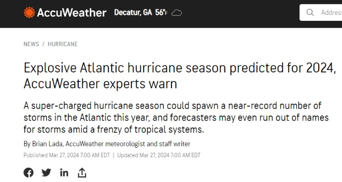
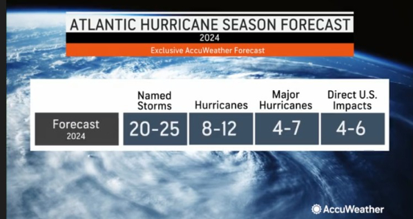
AccuWeather’s hurricane forecasts are simply expert interpretation of the upcoming large-scale climate conditions from June - November. There is no secret sauce per se, just branding or clickbait to garner headlines. a
I think the use of “explosive” or “super-charged” is unnecessary and hyperbolic — and it takes away from the little scientific credibility these seasonal forecasts may have.
In terms of the highest credibility, the NOAA outlook coming out next week checks boxes: published methods and verification of previous forecasts over last 2-decades.
I would also put the Colorado State University (CSU) seasonal forecasting under leadership of Phil Klotzbach as the standard for both scientific rigor and transparency. In order to show skill, you need to provide hindcast capability or some statistical benchmark for performance.
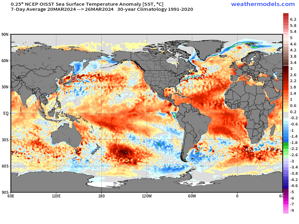
While Atlantic SSTs are quite warm compared to normal here at the end of March, that may not remain the case in the coming months as large-scale wind patterns could impart more mixing in the Eastern Atlantic or the Main Development Region.
Of course, it takes more than just warm water — or warmer water than usual — to form a tropical storm and then intensify it into a major hurricane.
Other inhibiting factors include wind shear, African dust, and dry / stable air in low-to-mid levels.
I would look to moisture parameters to best predict future hurricane activity e.g. precipitable water and convective indices because without deep convection, storms will not be able to overcome the usually semi-hostile average conditions in the tropical Atlantic.
Evening Temperatures 6:45 PM ET
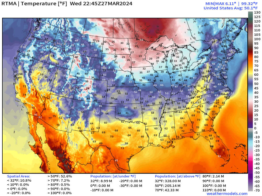
Cold across the upper-Midwest below freezing for 9 million population. Only 2 Million at/above 80°F.
Temperature Anomaly
Overall, the Lower 48 is 5°F below normal with a general northerly flow behind the cold front keeping temperatures down. Notably chilly in OKC in the 40s with clouds and rain all day — really ugly day.
Precipitable Water Next 10-days
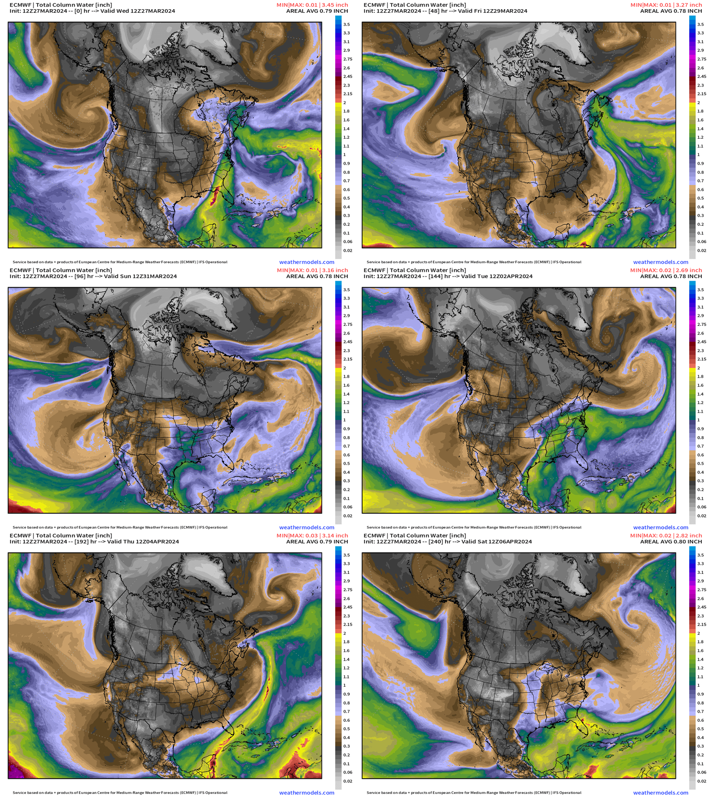
PWAT is my favorite variable since it concisely shows the different weather systems and air masses.
The gray colors are continental cold and dry air while the green/yellow and a little red represent moisture plumes out of the subtropics and tropics in the warm sectors of weather systems.
The influence of Canadian Arctic air is apparent — across the West Coast dipping all the way into central Mexico with a trough, and then settling across the entire Western U.S. by Day 10.
The ridge forming into this weekend centered across the Southeast will bring warmer, more humid air to the Eastern U.S. through early next week before the next front blows through.
Weather on Thursday
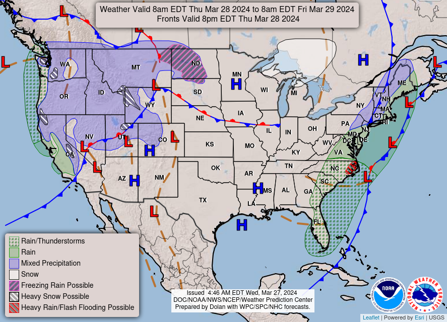
The cold front clears the East Coast by Thursday evening at 8 pm, but heavy rainfall continues throughout the day.
Sunny and warm/dry weather across the Plains and Southeast as High pressure builds for the weekend
Thursday High Temperatures
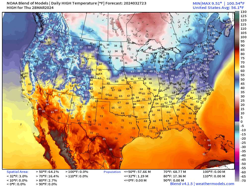
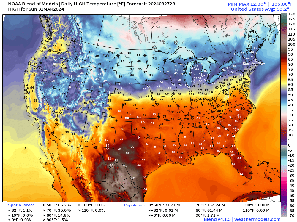
Each of the next several days will see successively warmer temperatures — with 80s by the weekend for a hot Eastern Sunday with 60 million at/above 80°F
Easter Sunday Temperatures
Next 18-hours Simulated Radar | HRRR | Through Thursday Afternoon
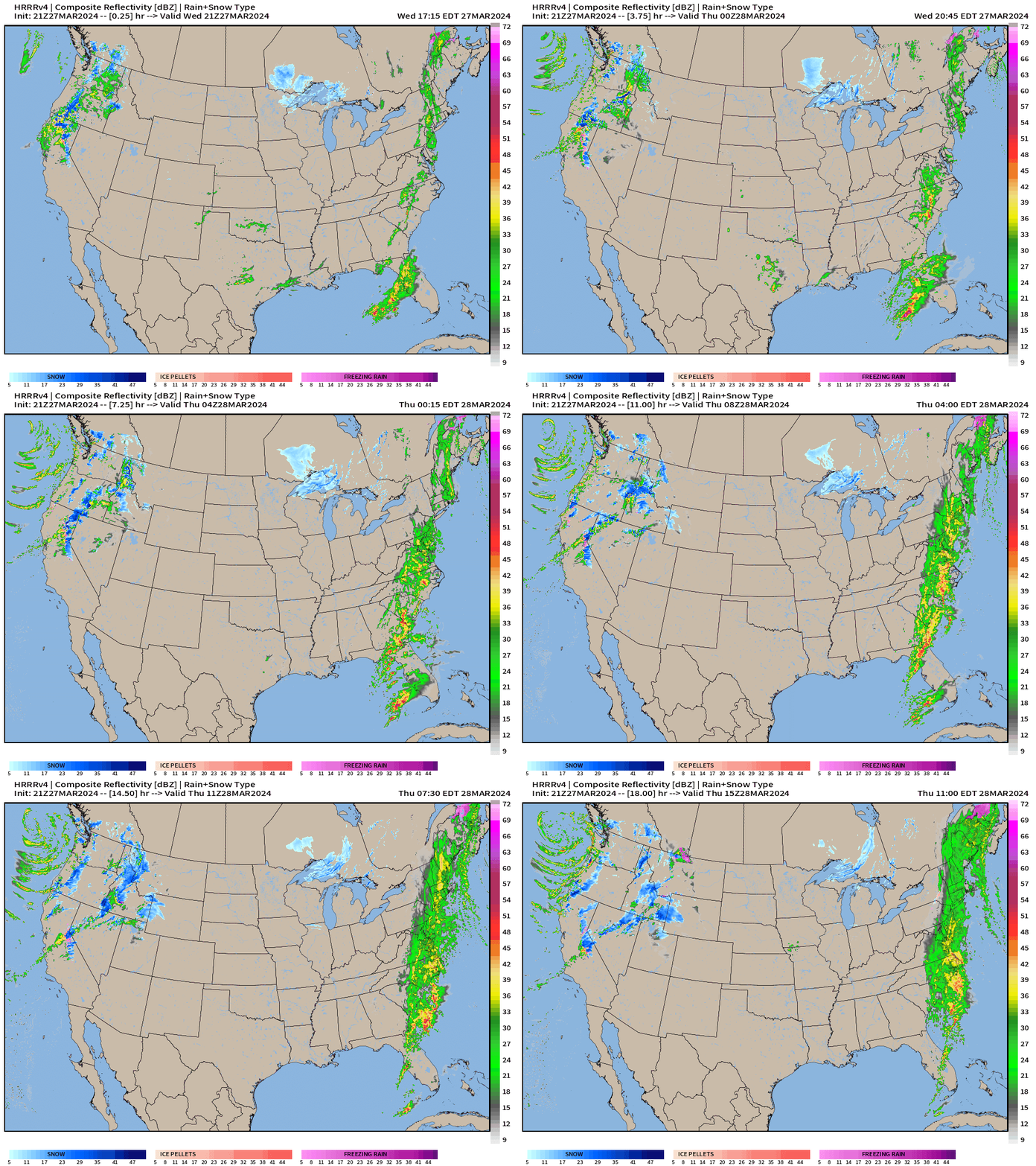
Rain and storms stream up the East Coast through Thursday adding up to several inches of rain in some areas, especially the Carolinas.
Next 8 Days Weather Systems
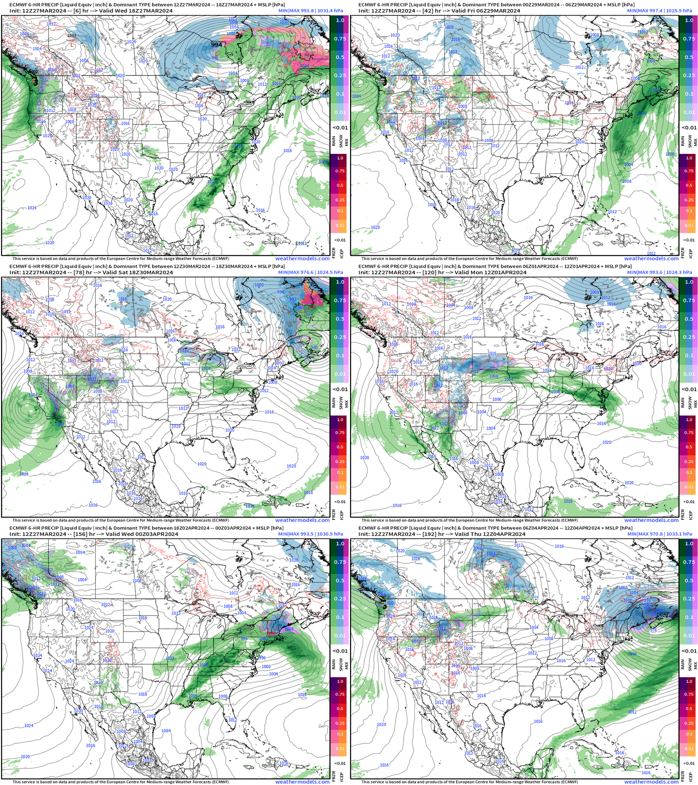
In the medium range — past Day 7-8, there is a coastal storm that develops off New England and brings a significant snowfall accumulation to Maine — again! However, this is uncertain, of course. But 1-2 feet of snowfall on April 4th would be quite something.
3-Days Total Precipitation | NWS NDFD
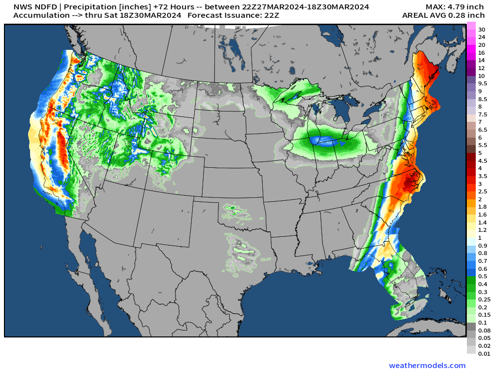
Carolinas into Virginia with 3-4”+ rainfall from frontal boundary, also heavy rainfall amounts for Boston [2”] into Maine.
WPC 7-Day Precipitation Forecast
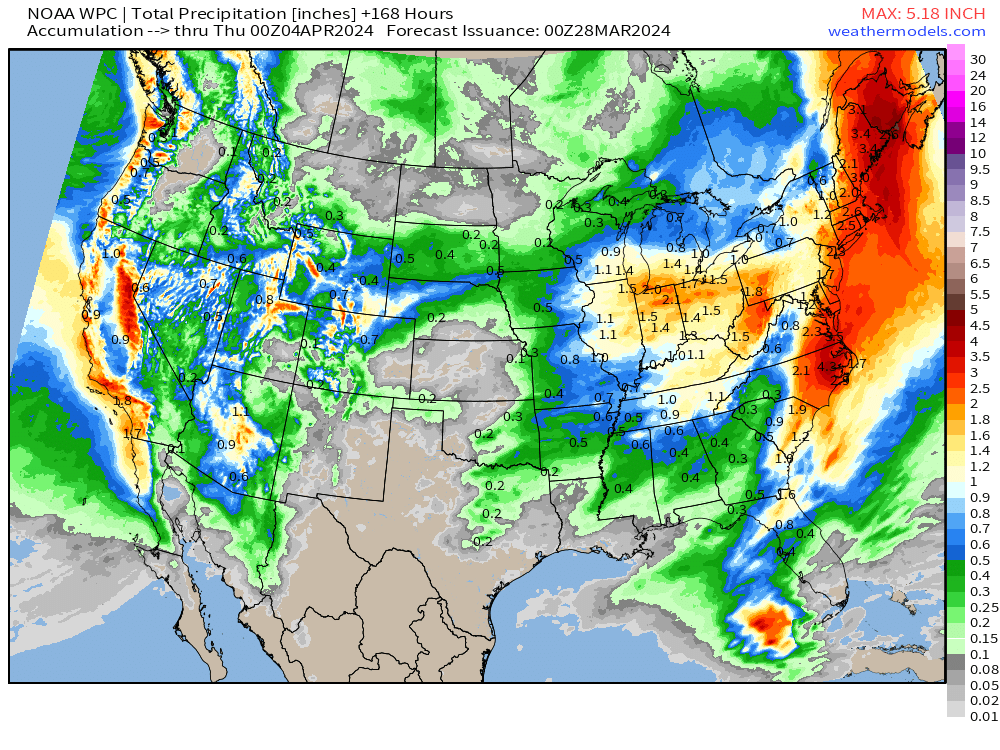
Next 7-Days still dry across Kansas … another 1-2” across the Ohio Valley with California adding up significant rainfall and mountain snows from the trough sinking through the area.
ECMWF HRES 10-Day Snowfall
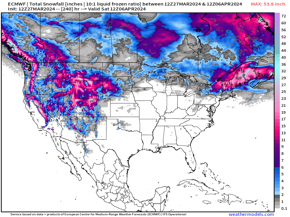
The Western U.S. snowpack builds steadily into April. Amazing!
Even more crazy is the prospective blizzard in the ECMWF HRES 12z forecast for New England. I won’t share the map to X to follow my own clickbait rules, but this map looks very mid-winter!
Thank you to Subscribers and Supporters! Almost Spring 2024 and the growing season — so much is going on in the world of weather!
Maps sourced from weathermodels.com designed and innovated by yours truly! I actually create all of my content from scratch.
- Milepost
- 250 · laid 2024-03-28T00:13:16.834000Z
- Source
- https://weather.substack.com/p/march-27-2024-very-warm-easter-weekend
- Digest
- 9f075dc27b9a4d50a68396f485b31cabe5c16ba6c31072e5580fbf6ae72da3e7
- Machine
- JSON