March 22, 2024 Stormy Spring Weekend Ahead
Risk of Excessive Rainfall up the East Coast including NYC and Boston
March 2024 was the 21st-warmest March in the 132-year national record (1895–2026), at 44.9°F against a 1991–2020 normal of 43.6°F (+1.4°F).
March 2024 was the 29th-wettest March in the 132-year national record (1895–2026), at 2.9in against a 1991–2020 normal of 2.5in (+0.4in).
NOAA/NCEI Climate at a Glance, contiguous United States. This is the observed record for the month, not a score of anything said in this piece — the forecast ledger begins 2026-08-17 and cannot reach earlier posts.

Quick evening update with plenty of maps to visualize the storms on both coasts. A lot of text was spent this morning, so there’s not much to update, rather than the forecast maps themselves!
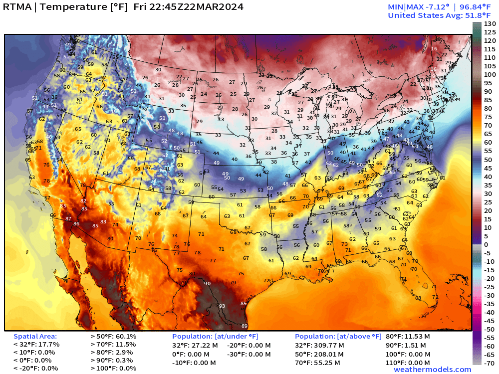
6:45 PM ET Temperature analysis
Hot spots in the 90s along the Rio Grande in South Texas and 85°-87°F around Yuma to Phoenix. Cloud cover and rain keeping the Gulf Coast cooler than otherwise expected in latter half of March.
Large area of 30s dipping in from Canadian border to northern Missouri. Chilly!
Next 48-hours Weather | Simulated Radar | HRRR | Through Sunday Afternoon
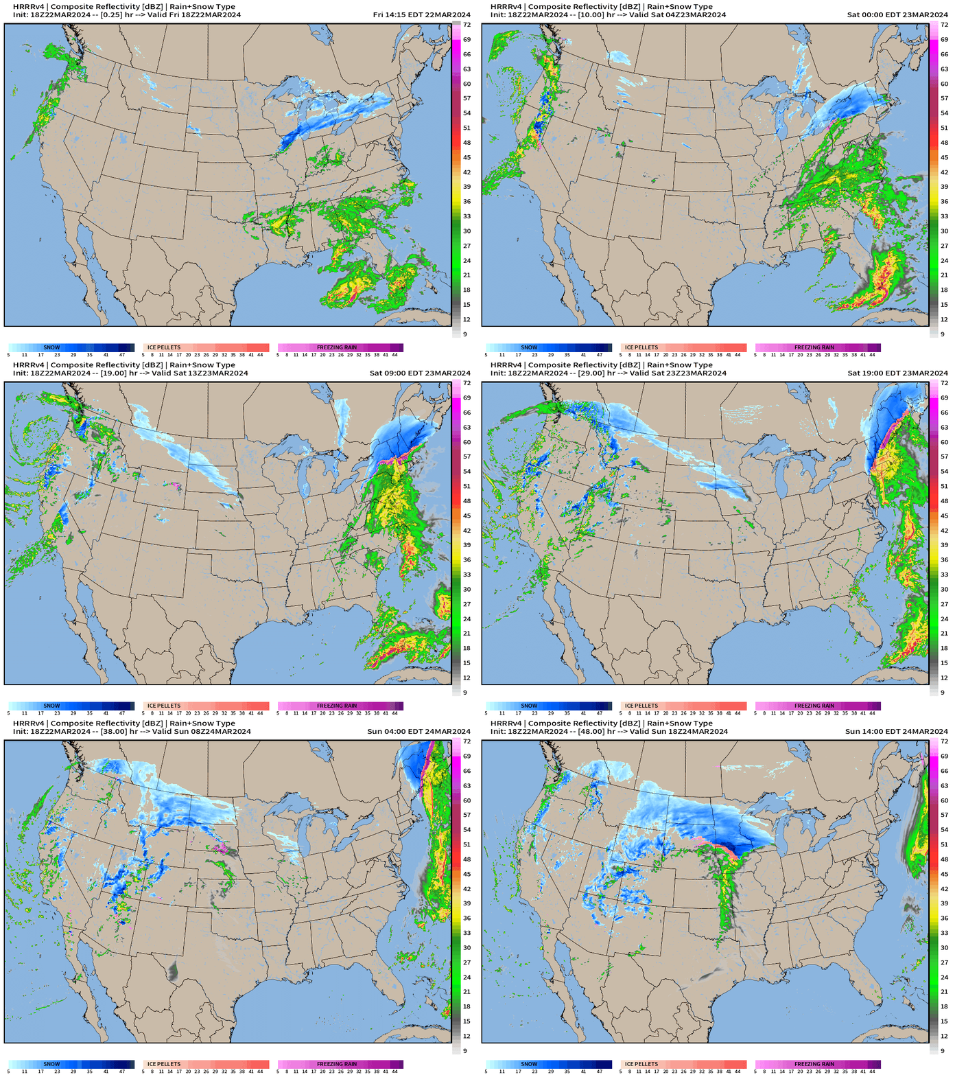
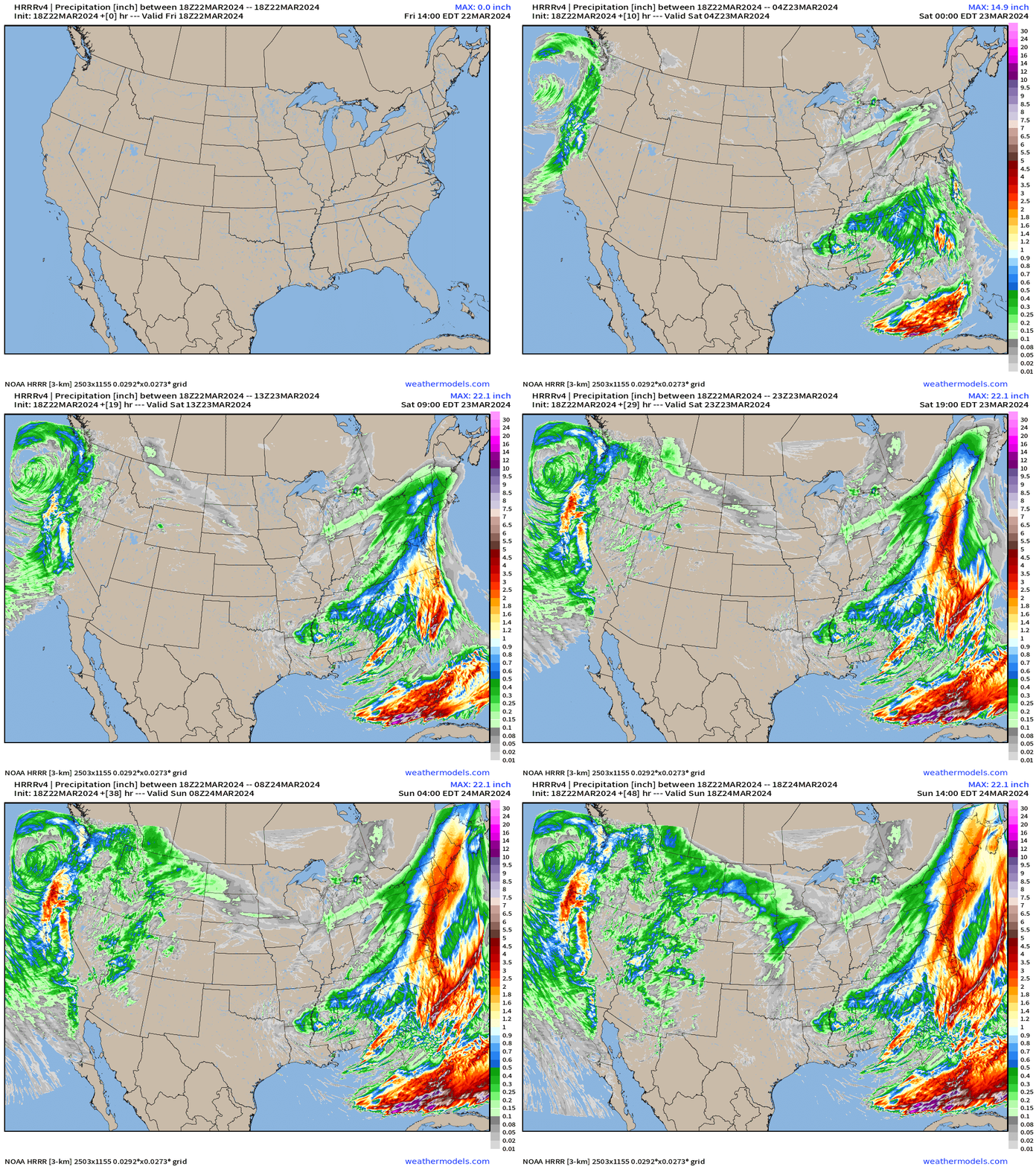
All of that moisture across the Southeast surges up the East Coast — you can see the precipitation add up in the next GIF.
By Sunday, the storm system moves across the Rockies and intensifies — maybe “bombs out” into the 970s mb (sea-level adjusted) in the Foothills of the Rockies. Maybe time to oil up your barometers for near-record low surface pressures.
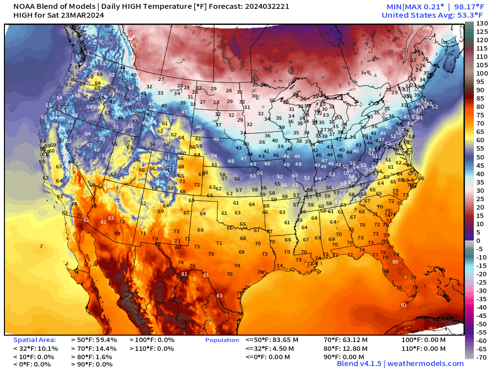
Saturday High Temperatures
Sunday High Temperatures
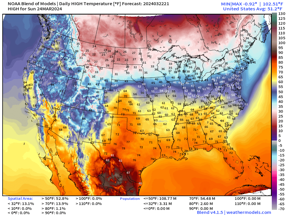
Rather seasonable for a weekend in late March, or a little cool. On Sunday, the Western U.S. cools off even into Phoenix in the 60s.
3-Day Snowfall | NWS NDFD
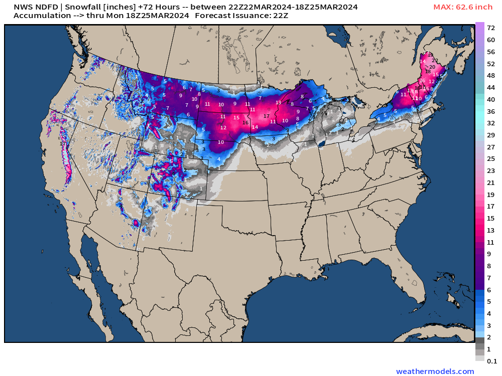
11-inches on Minneapolis … 20-22” around Caribou Main.
Next 8-days Weather Pattern
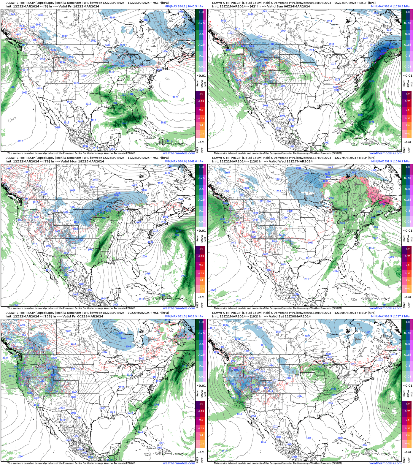
Looks like the overall pattern remains progressive w/rapidly moving and developing storm systems. By next weekend, the West Coast sees another surge of moisture and considerable rain/snow. That will spread eastward and repeat the cycle.
WPC 7-Day Precipitation Forecast
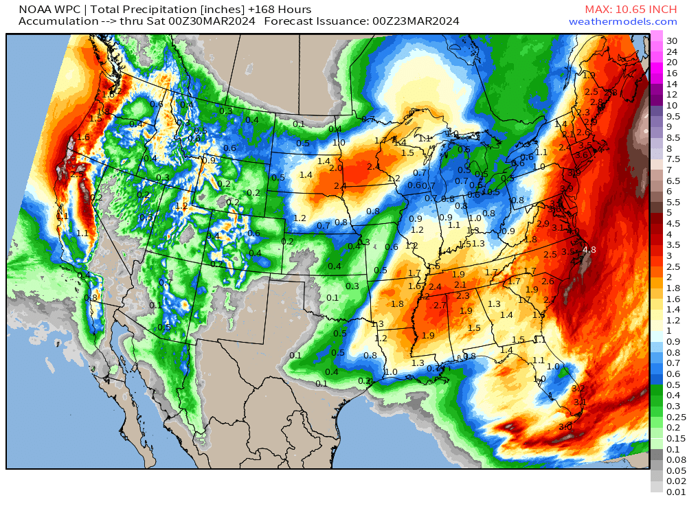
The 1-inch plus rainfall across Nebraska into Minnesota (snow equivalent) is welcome for farmers ahead.
NYC —> Boston in the 3-inches+ rainfall range. What a soggy Winter —> Spring!
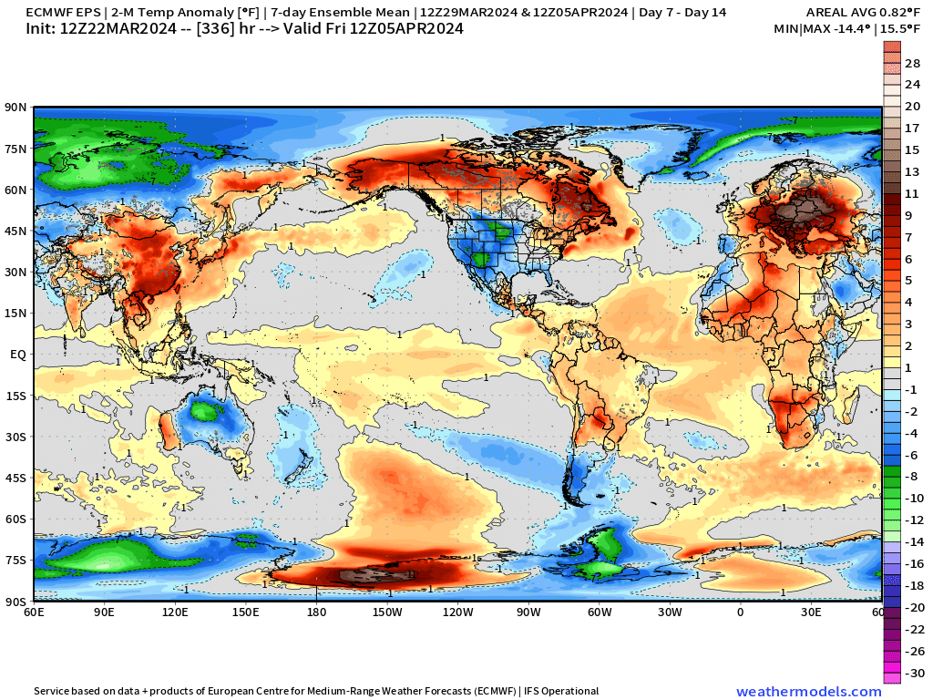
Next 14-Days Temperature Anomaly
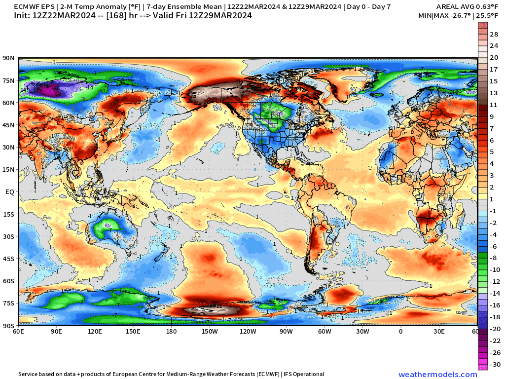
Big global zoom out to show what else is going on around the world. Very cold air in Siberia remains stuck for 2-weeks.
Central and Eastern Europe warm up considerably along with Canada and Alaska.
Waiting on the cooler water in the Eastern Tropical Pacific to emerge from below and kick start the La Nina this summer!
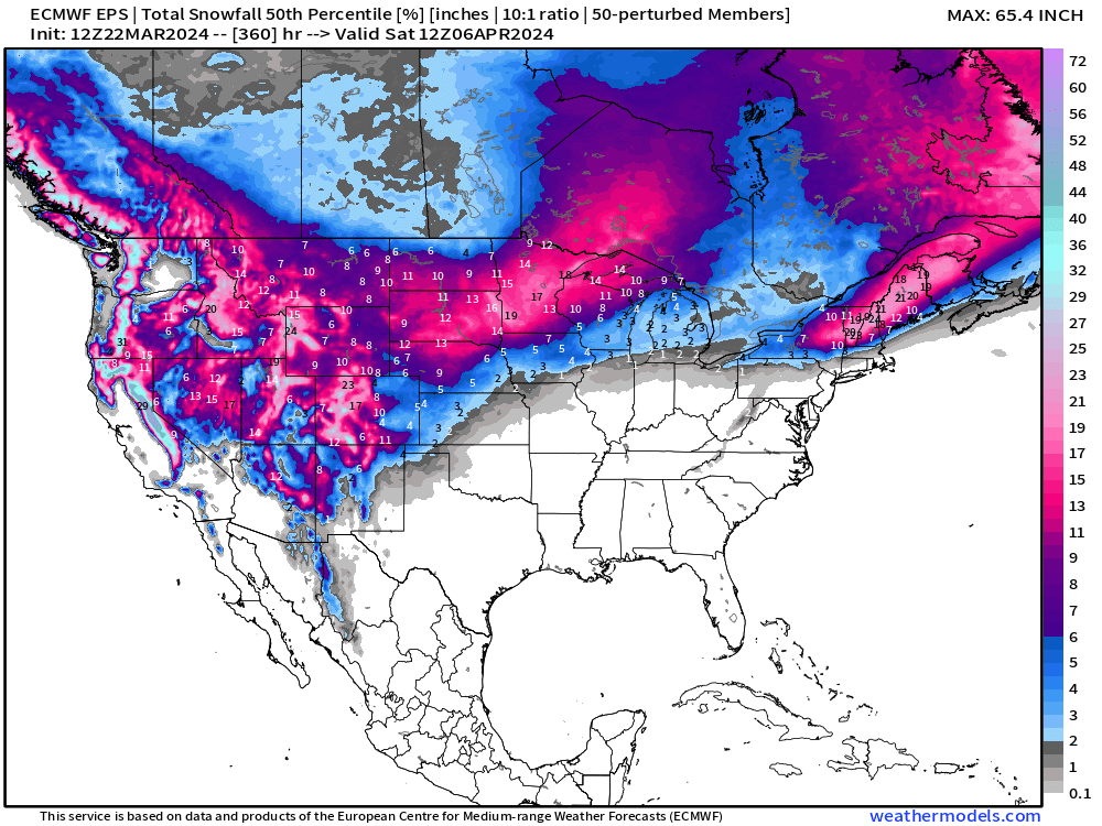
Ensemble 50th Percentile Snowfall 15-Days
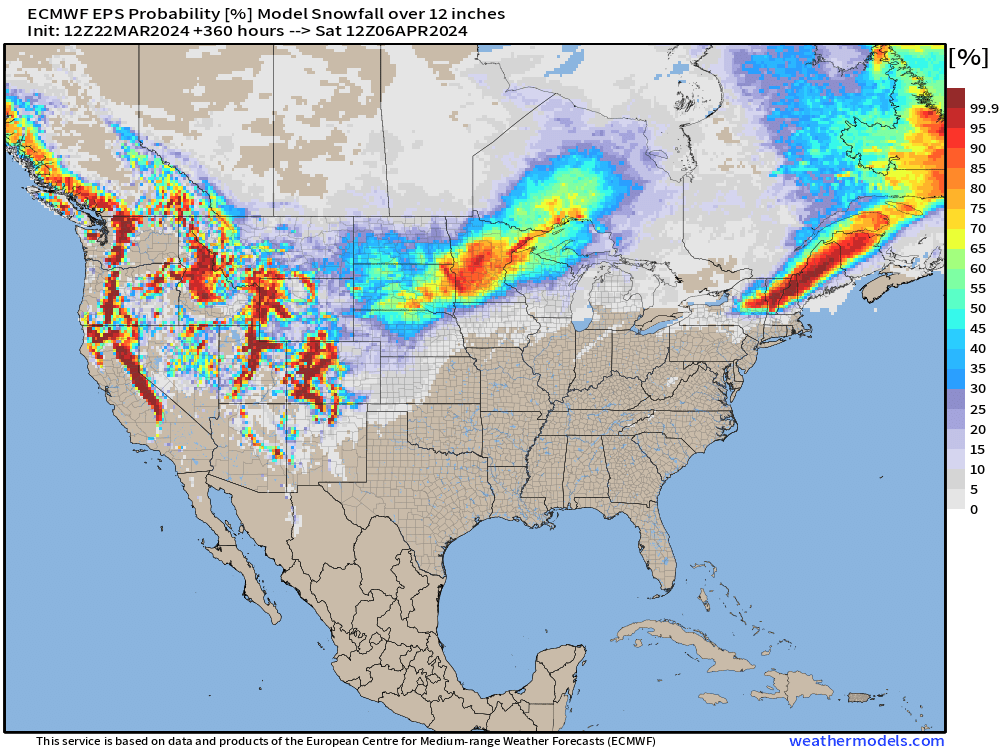
A bonus map — probability of 12” or more of snowfall in the next 15-days.
Upper-Midwest and from northern New York into Maine …
Thank you to Subscribers and Supporters! Almost Spring 2024 and the growing season — so much is going on in the world of weather! Please come along for the ride!
Maps sourced from weathermodels.com designed and innovated by yours truly! I actually create all of my content from scratch.
- Milepost
- 245 · laid 2024-03-22T23:40:02.815000Z
- Source
- https://weather.substack.com/p/march-22-2024-stormy-spring-weekend
- Digest
- 93db6f1846888c53241dc8b9f341e1ca490a3eb74db6504ff30135750261c8ab
- Machine
- JSON