March 20, 2024 Midwest Remains in Winter
Minnesota to see major snowfall while cold air for late-March settles across Northern Lower 48
March 2024 was the 21st-warmest March in the 132-year national record (1895–2026), at 44.9°F against a 1991–2020 normal of 43.6°F (+1.4°F).
March 2024 was the 29th-wettest March in the 132-year national record (1895–2026), at 2.9in against a 1991–2020 normal of 2.5in (+0.4in).
NOAA/NCEI Climate at a Glance, contiguous United States. This is the observed record for the month, not a score of anything said in this piece — the forecast ledger begins 2026-08-17 and cannot reach earlier posts.

Happy Spring 2024
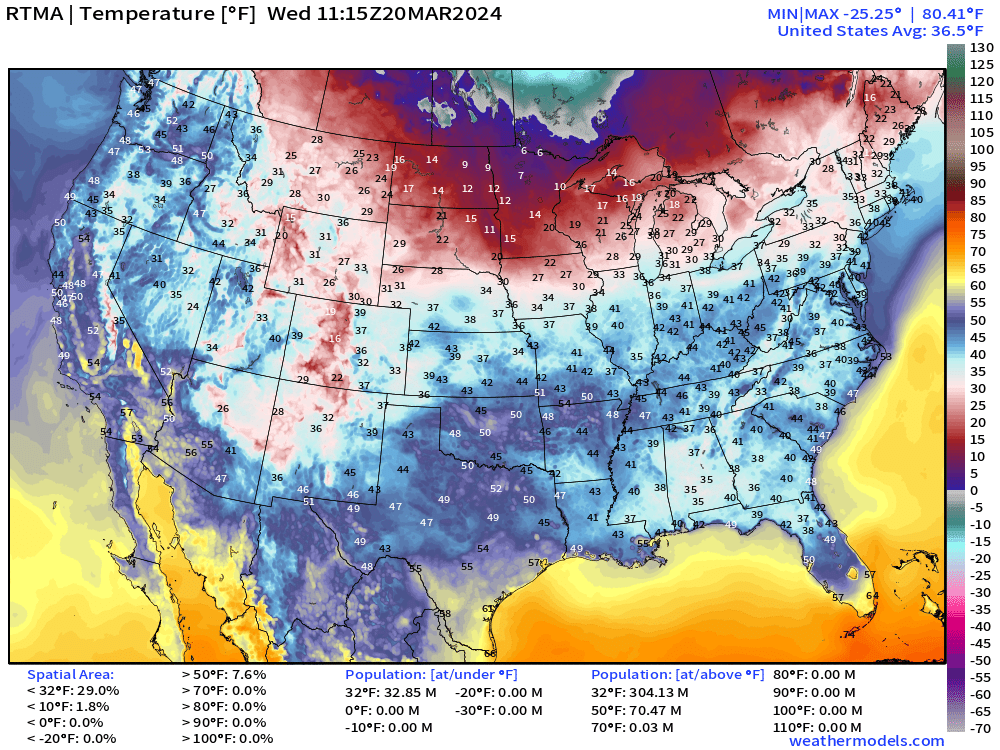
7:15 AM ET Temperature Analysis: Chilly across the Southeast this morning with some areas dipping into the upper-20s and lower-30s across Alabama and around Columbus, Georgia. Also in the 30s to Gainesville, Florida.
Wednesday Afternoon High Temperatures
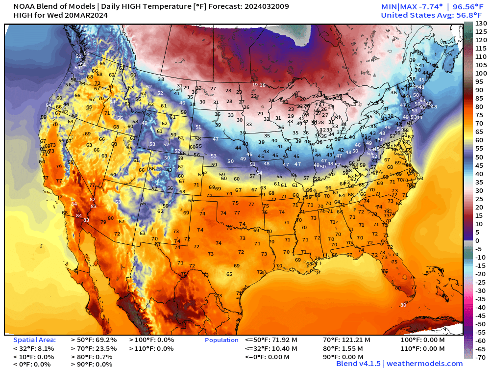
Beautiful and mild spring day across the southern U.S. with 60s and 70s lining up from the Ohio Valley southward.
Still chilly across the Midwest and Great Lakes in the 20s for highs in Northern Michigan — cold enough for scattered Lake Effect snow showers.
Lake Enhanced Snow Showers with Low Pressure System
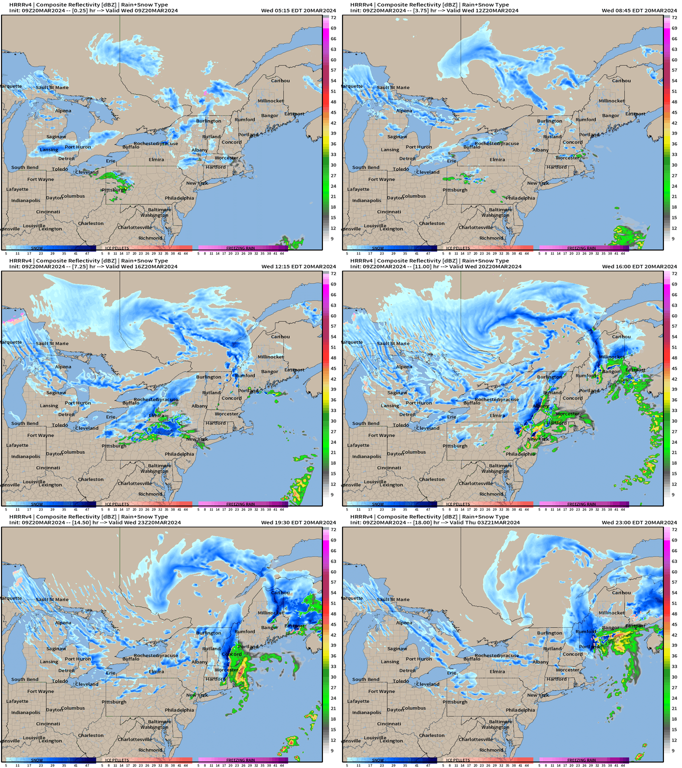
The swirl over Quebec is a rather strong low pressure system for a “Clipper” around 990 mb. The circulation is dragging colder Canadian Arctic behind it + enough moisture + [warmer] Great Lakes enhancement = accumulations
The system re-intensifies over Maine later on Thursday!
Snowfall Next 72-Hours
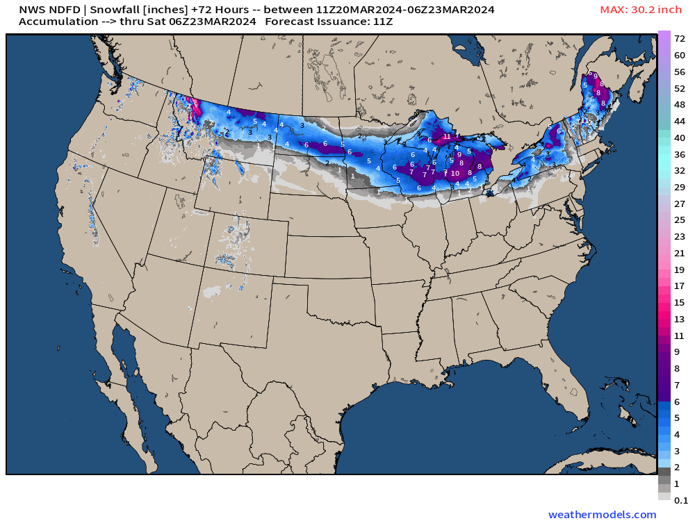
All added up during the next 72-hours will see up to a foot of new snow in Michigan!
The next “Clipper System” will race across the northern tier of states dropping a nice blanket of up to 6-inches from Montana, through Minneapolis into Milwaukee.
Next 10-days Weather Pattern: Several Storm Systems
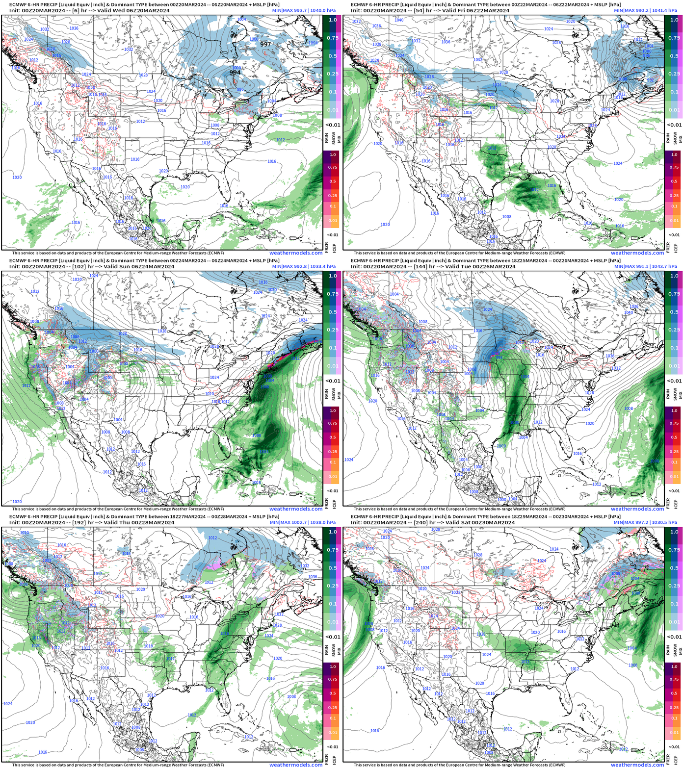
Thursday: Clipper system over Northeast and Maritime Canada deepens with significant snowfall in Maine
Friday into Saturday: area of low pressure skirts along Gulf Coast = heavy rain for Florida,
Saturday into Monday: East Coast low develops and intensifies with heavy rain in Mid-Atlantic and Northeast.
Monday: Powerful central plains into Midwest winter storm
Minneapolis Snowfall
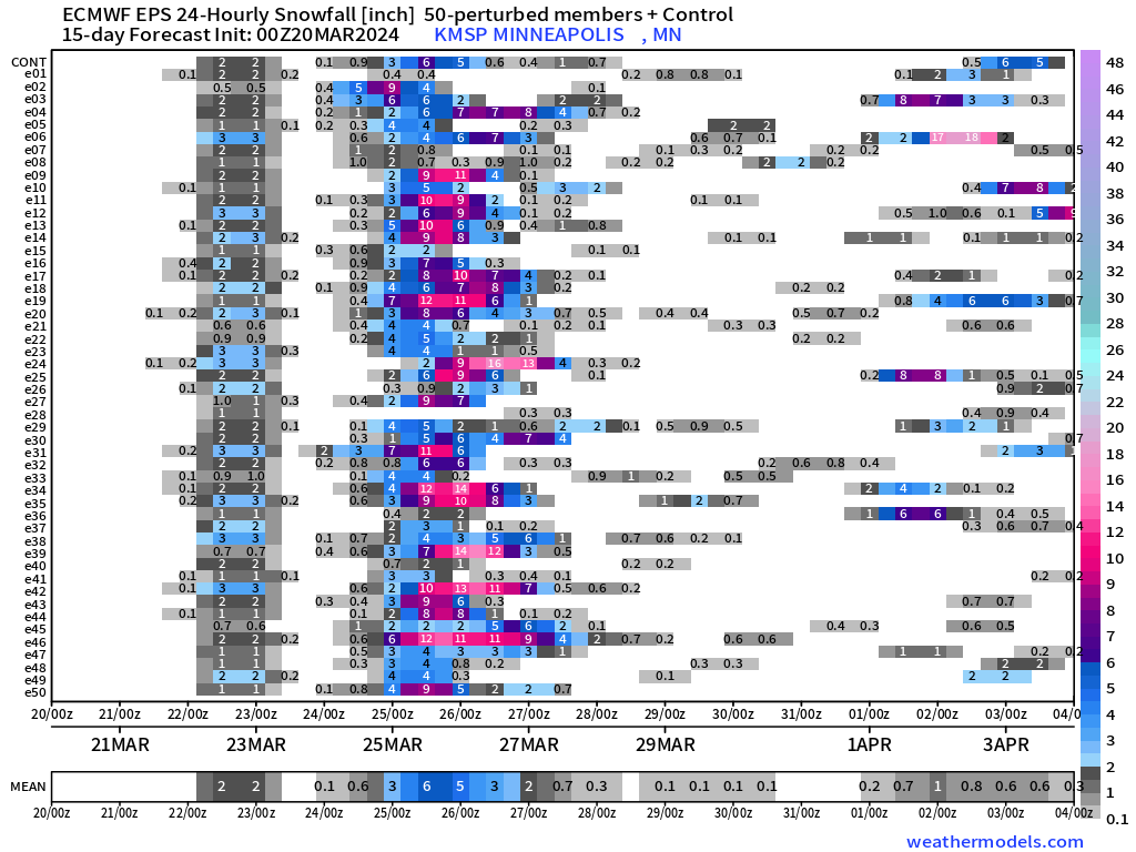
Potential for major snowfall centered on Minneapolis over the next 7-10 days from a powerful winter storm Monday
Blend of Models: 10 Day Snowfall Forecast
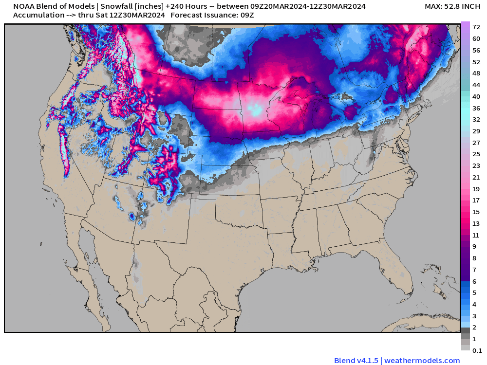
The Blend of Models is a collection of major global weather models and their ensembles so it is typically rather smooth. But not the upcoming 10-day forecast!
That is over 30” centered upon Minnesota with a large area of more than 1-foot of snowfall accumulations across the Midwest into the Great Lakes. Amazing map during the last 10-days of March.
Blend of Models Temperatures Next 8-Days
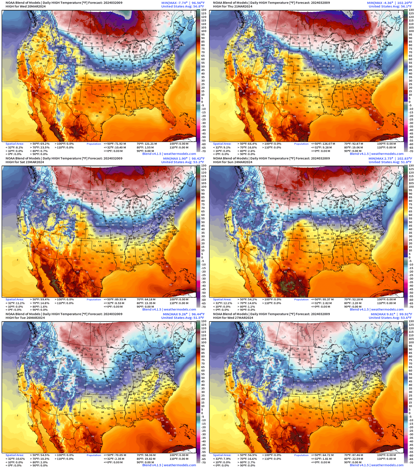
Temperatures remain cold enough for snowfall mainly north of Interstate 80 during the next 8-days even during the daytime. With weather systems tracking through, we’ll see warmer air ahead of fronts, however.
Overall, the last 10-days of March will be seasonably cool without a major heat wave except I suppose for Florida in the 80s.
WPC 7-Day Precipitation Forecast
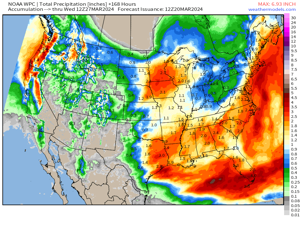
The next week will also be quite wet with this progressive weather pattern.
2.1” of QPF in Minneapolis to fall mostly as snowfall. Large area of 2-3” from Houston into the Southeast and up the Eastern Seaboard including DC, NYC, and Boston.
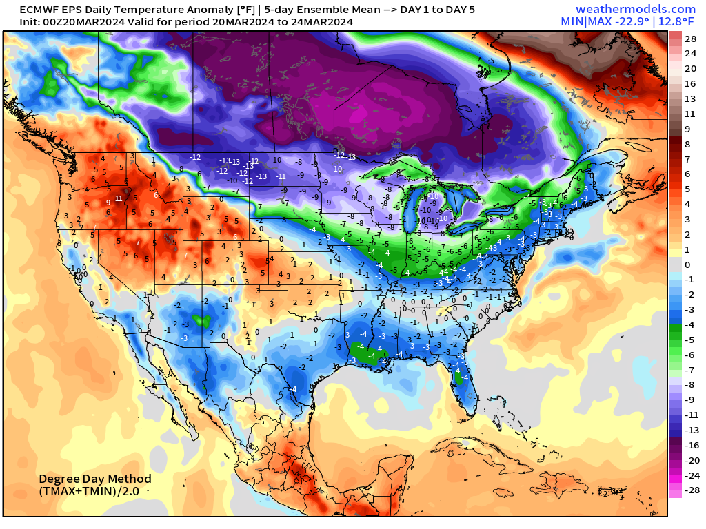
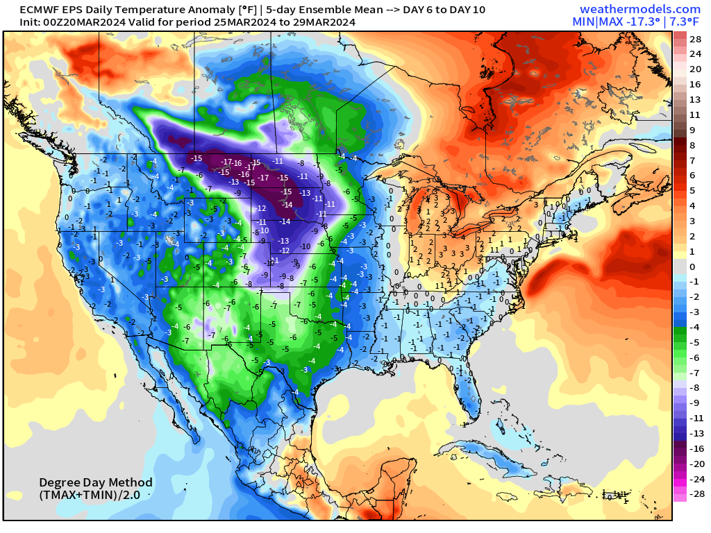
ECMWF EPS 10 Day Temperature Anomaly
Days 1-5 | March 20 - March 24
Days 6-10 | March 25 - March 29
Snowfall Probability over 6-inches | Next 15-days
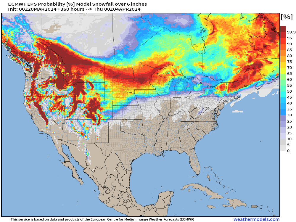
Amazing to see such high probability of at least 6-inches of snowfall in late March into early April across the Lower 48 outside of the mountain west — evidence of the influence of colder Canadian Arctic air.
Median Snowfall Accumulation | Next 15-days
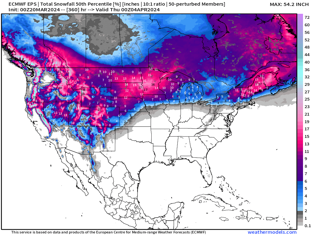
The EPS median snowfall is 12-18” centered upon Minnesota and Maine!
Huge multi-feet accumulations for the Cascades and Sierra as winter continues full-tilt in the Western U.S. into April.
Thank you to Subscribers and Supporters! Almost Spring 2024 and the growing season — so much is going on in the world of weather! Please come along for the ride!
Maps sourced from weathermodels.com
- Milepost
- 240 · laid 2024-03-20T12:12:51.124000Z
- Source
- https://weather.substack.com/p/march-20-2024-midwest-remains-in
- Digest
- ce2aea204d1fda88899401dc4775ced3afdce376abe6a2a3a890c08bfe064b9f
- Machine
- JSON