March 12, 2024 Beautiful Tuesday
Colorado will see major winter storm as Spring spreads across Eastern U.S.
March 2024 was the 21st-warmest March in the 132-year national record (1895–2026), at 44.9°F against a 1991–2020 normal of 43.6°F (+1.4°F).
March 2024 was the 29th-wettest March in the 132-year national record (1895–2026), at 2.9in against a 1991–2020 normal of 2.5in (+0.4in).
NOAA/NCEI Climate at a Glance, contiguous United States. This is the observed record for the month, not a score of anything said in this piece — the forecast ledger begins 2026-08-17 and cannot reach earlier posts.

Spring like warmth until early next week (March 18-19) then a chance of freeze/frost in the Southeast especially next Tuesday
Extended period of “Arctic” air descends upon Lower 48 for following week
Considerable rainfall for Gulf Coast and Southeast in the 2-4” range
Western Ridge builds finally after weeks to finally flip the script on cold air for last 10-days of March east of the Rockies
Denver looking at 7 to 10-inches of snowfall with 3-feet in the mountains
NWS Forecast snowfall for Colorado and Denver
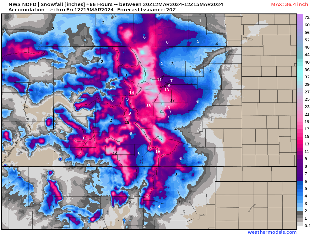
7-10 inches at Denver Int’l with some changes likely — I’m betting to the upside.
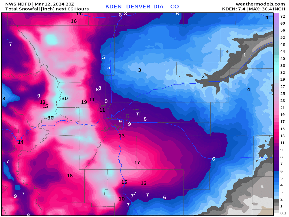
NWS had 10-inches+ at KDIA earlier Tuesday morning, but reduced to 7”. Will watch for another change.
Spring Like Warmth Continues
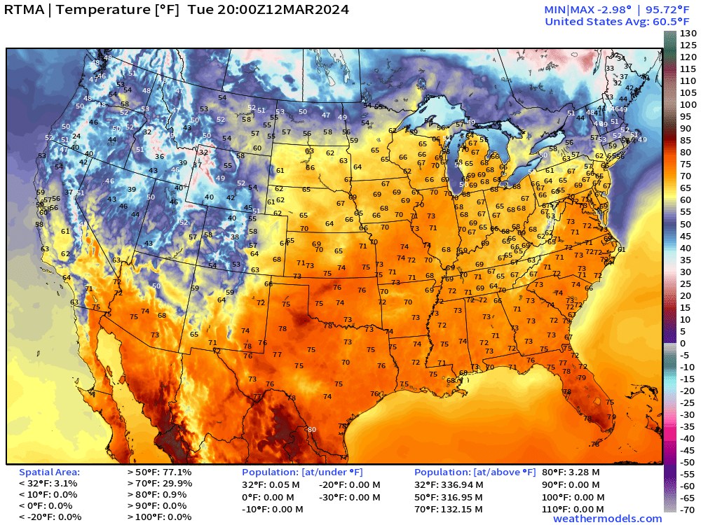
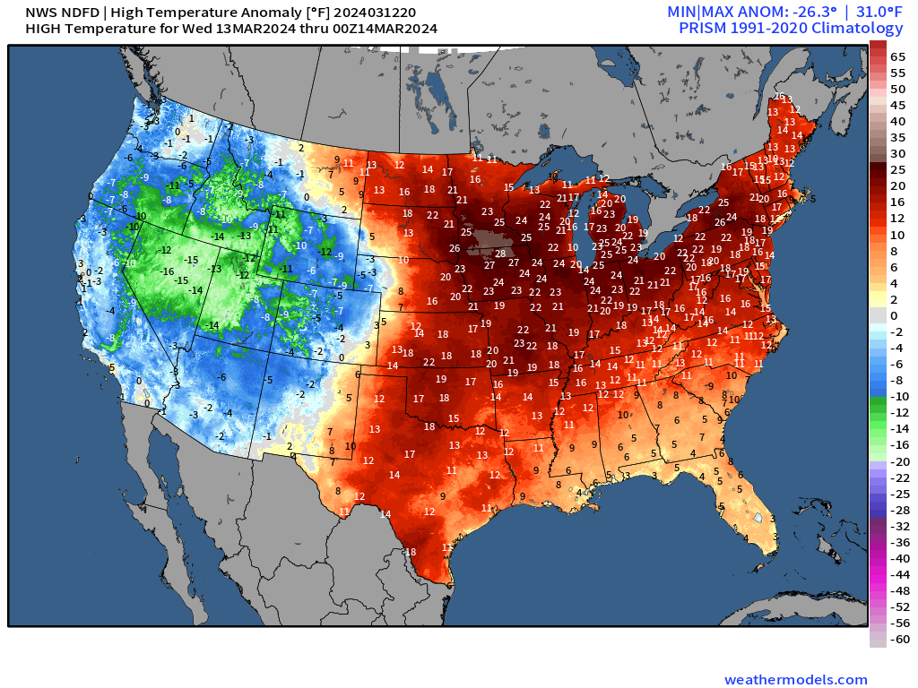
132-million+ at/above 70°F across the Lower 48 with much above normal temperatures east of the Rockies
High Temperatures on Wednesday
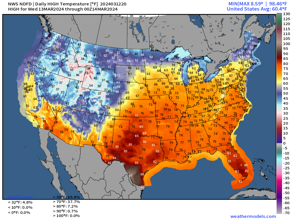
Check out the temperature anomaly map! Widespread 20-25°F above normal centered on Minneapolis and Des Moines over to Chicago and Detroit, Cleveland and Albany, NY.
Short Term | Next 48-Hours
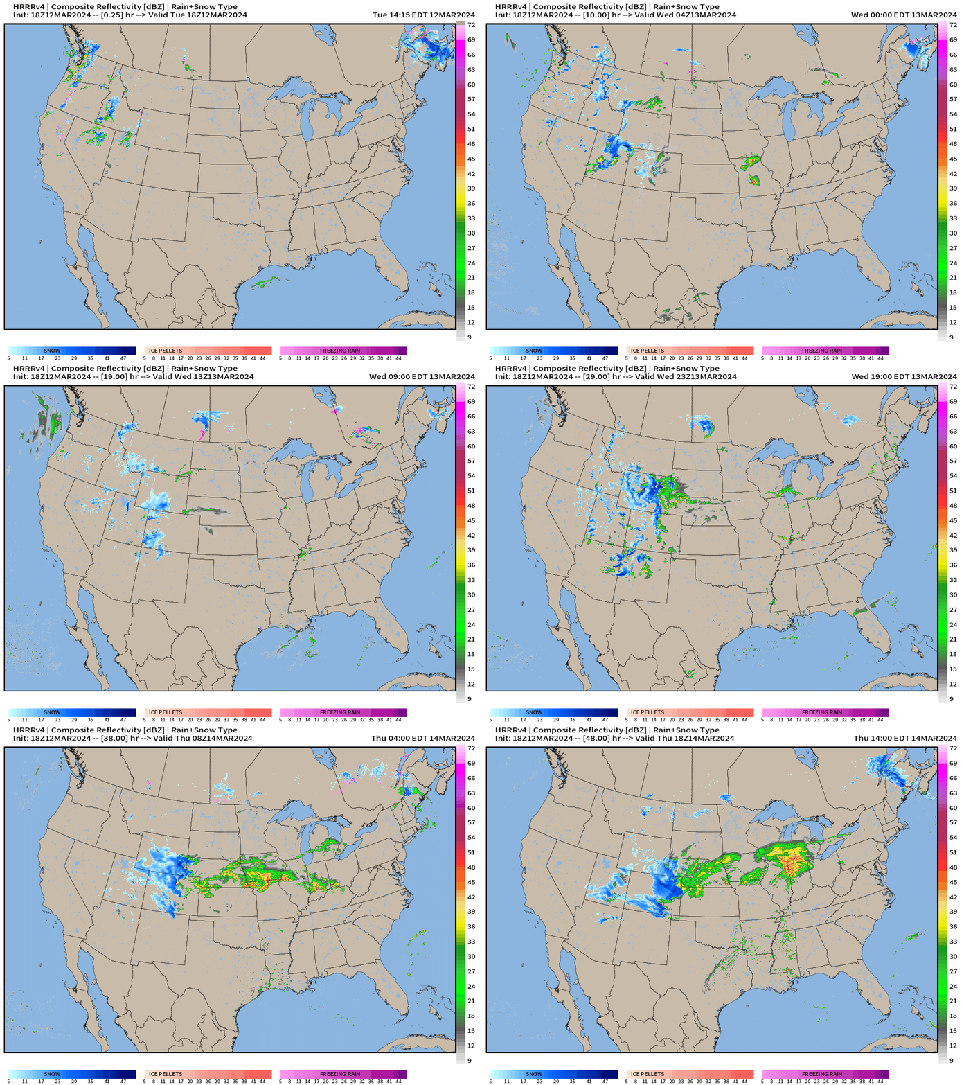
A storm system develops in the Lee of the Rockies on Wed into Thursday with significant snowfall for the mountains. I think Denver hits 10-inches w/range from 7-12” as the best forecast at this point.
Thunderstorms develop overnight Wed into Thursday morning across Iowa and Illinois with a blob of rain moving into Michigan. Only a slight risk of severe weather from SPC at this point.
Weather Systems for next 8-days
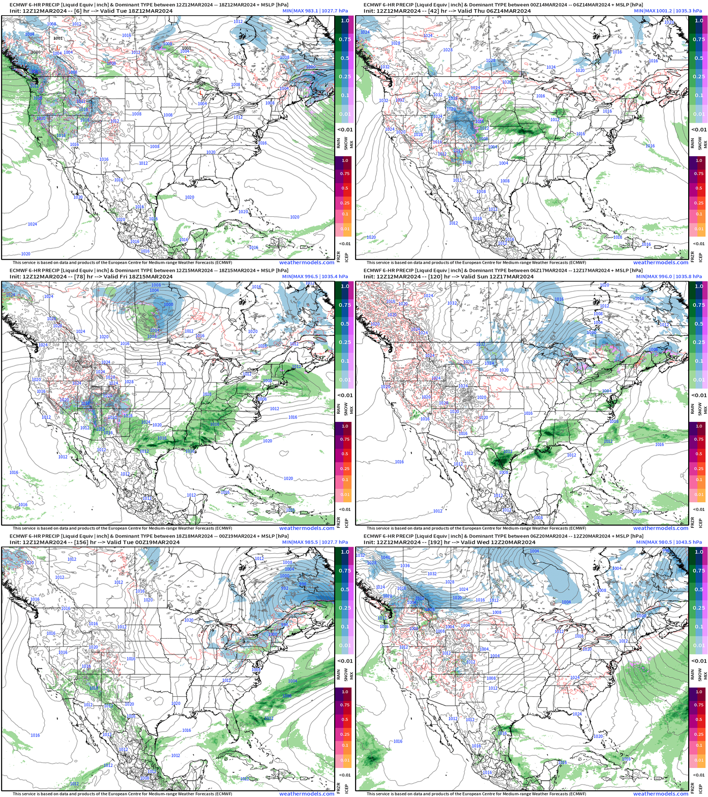
The storm system does not intensify much after departing the Plains, instead spreading out a front along the southern U.S. before clearing the Gulf Coast ushering in much colder air into early next week.
Threat for a freeze/frost into Atlanta and the Southeast!
Tuesday morning | March 19th Minimums
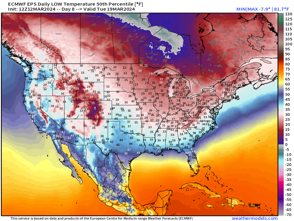
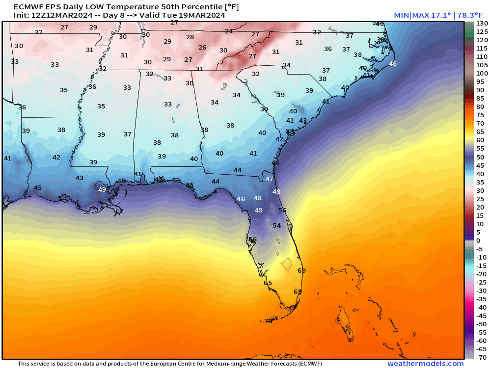
Watching Tuesday morning for frost/freeze as far south as Interstate 20.
7-Day Rainfall Total | NWS WPC
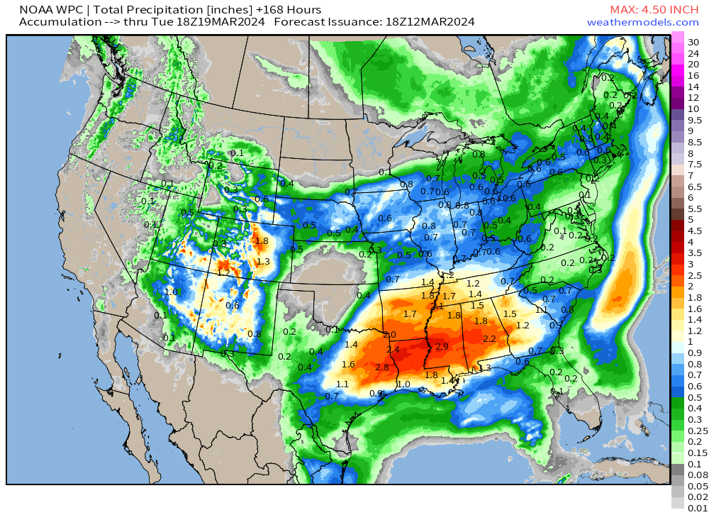
NWS WPC rainfall totals have come down again to 1.5 to 3” from eastern Texas to Atlanta.
7-Day Temperature Anomaly Chunks | Next 14-Days
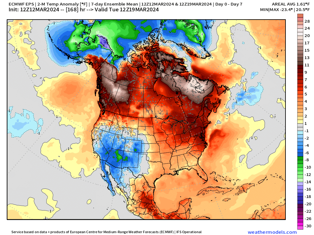
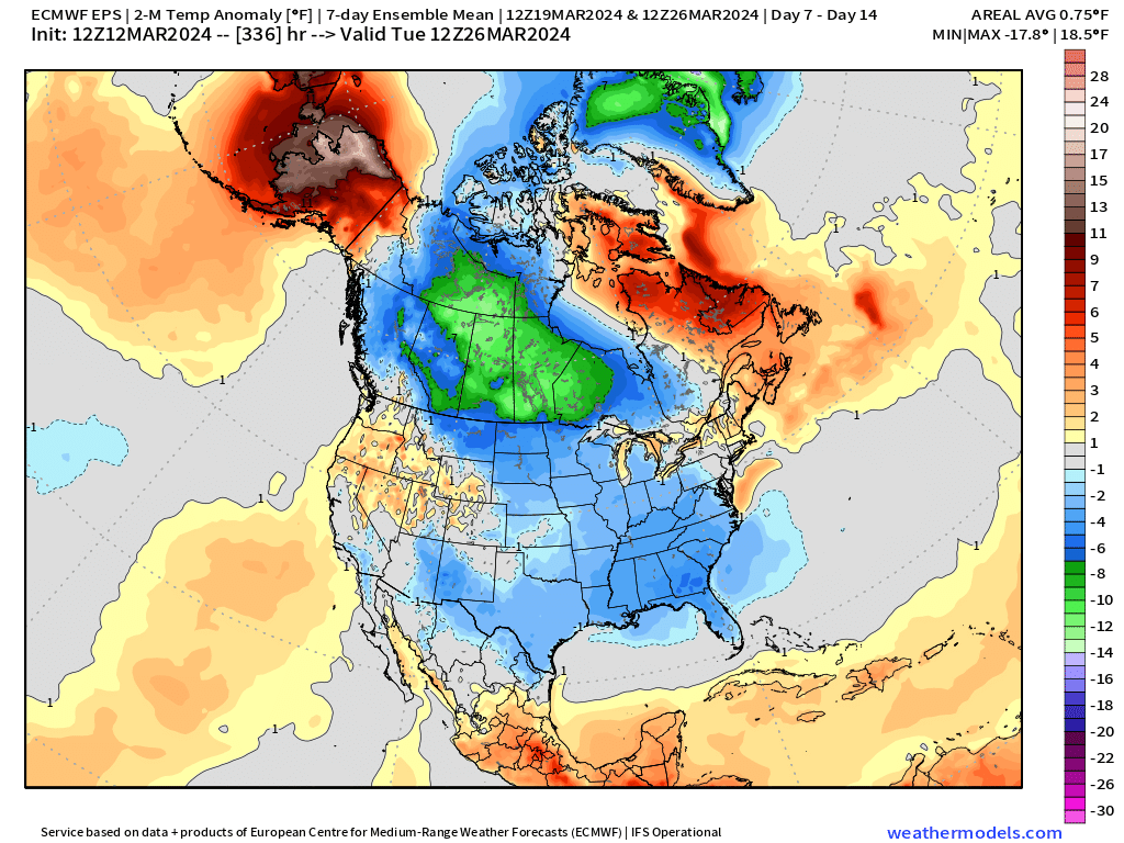
Colder air will finally plunge out of Canada across the Eastern 2/3 of the U.S. while a ridge builds across the West and over Alaska.
Week 2 extends to March 26th, so almost done with the month ending on a significantly colder note.
15-day ECMWF Ensemble Median Snowfall
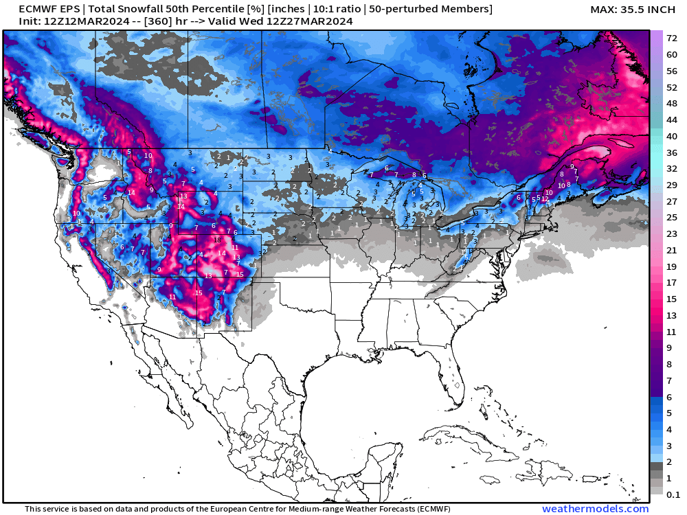
[The ensemble median sorts the model members but does not average them like the mean.]
March will end with cooler, seasonable conditions more typical of late winter/early Spring. There does not look like a threat of baking conditions like 2012 at all. That’s good for drought and farmers.
Thank you to Subscribers and Supporters! Welcome to March 2024 — so much is going on in the world of weather! Please come along for the ride!
- Milepost
- 234 · laid 2024-03-12T21:12:36.589000Z
- Source
- https://weather.substack.com/p/march-12-2024-beautiful-tuesday
- Digest
- c759ad60cb8542a4fea619a567410784e06f9ed3e9f21fea2e86b42ba143a02f
- Machine
- JSON