March 7, 2024 Weekend Storm
Potential flooding rains again in the Southeast
March 2024 was the 21st-warmest March in the 132-year national record (1895–2026), at 44.9°F against a 1991–2020 normal of 43.6°F (+1.4°F).
March 2024 was the 29th-wettest March in the 132-year national record (1895–2026), at 2.9in against a 1991–2020 normal of 2.5in (+0.4in).
NOAA/NCEI Climate at a Glance, contiguous United States. This is the observed record for the month, not a score of anything said in this piece — the forecast ledger begins 2026-08-17 and cannot reach earlier posts.

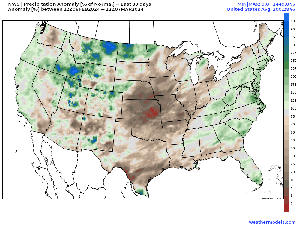
The last 30-days of precipitation (rain and snow) across the Lower 48 is 100% of normal or right on the dot average for the past 30-years. However, it’s not evenly distributed at all with much below normal precipitation across the Plains into the Midwest. The Southeast centered upon Atlanta is wet as well as the Mid-Atlantic. Not much snow to end winter, but plenty of rainfall.
We need to monitor the dryness across the Plains over the next several weeks as drought indicators may start increasing heading into April.
Short Term | Next 3-days
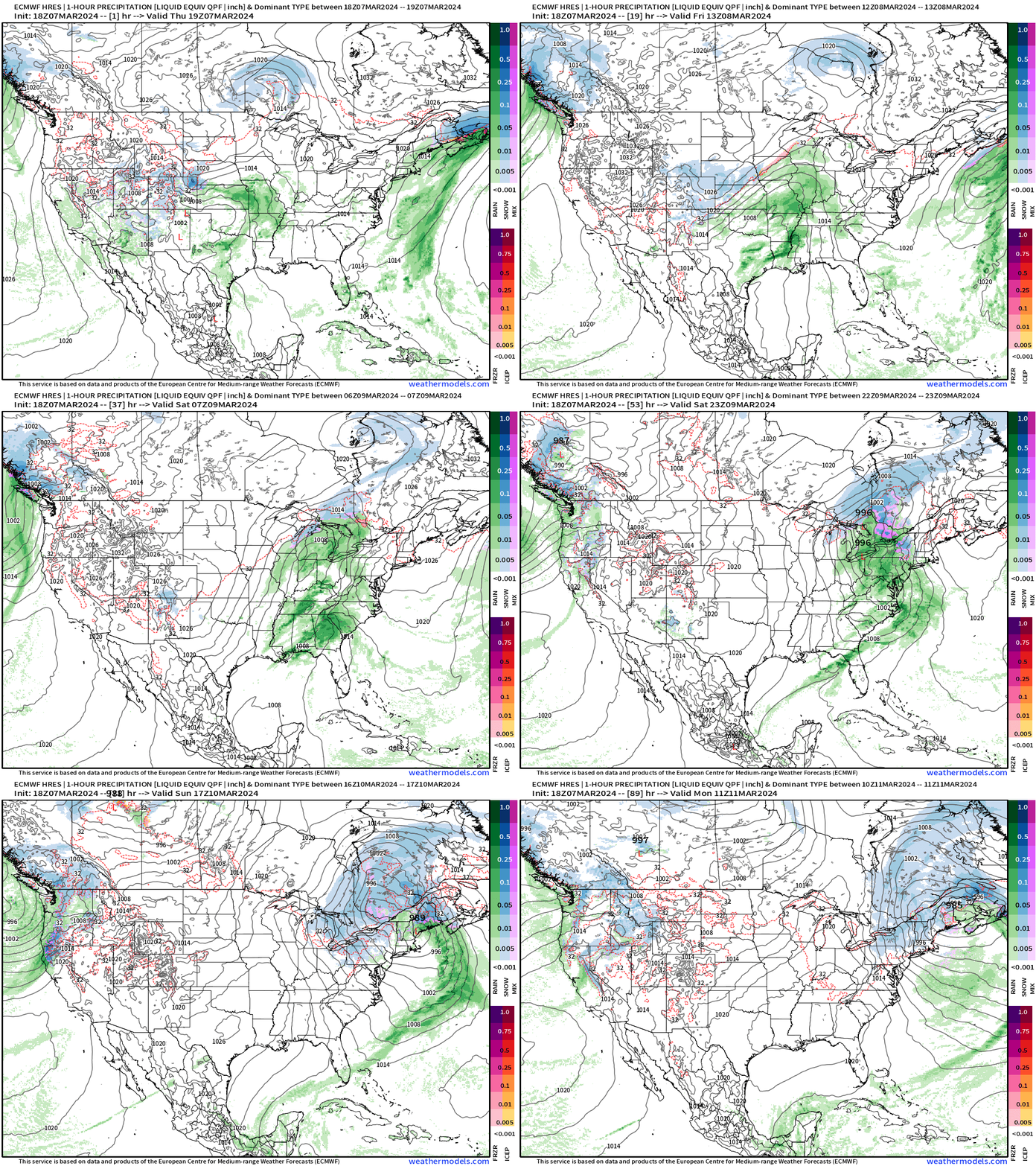
The next storm system is forming across the central U.S. and will track through the Great Lakes into the Northeast by Sunday. The frontal system will have plenty of Gulf of Mexico and subtropical moisture leading to a flood threat in the Southeast.
On the backside of the low, there is enough cold air to drop snowfall especially away from the New England coast Sunday into Monday.
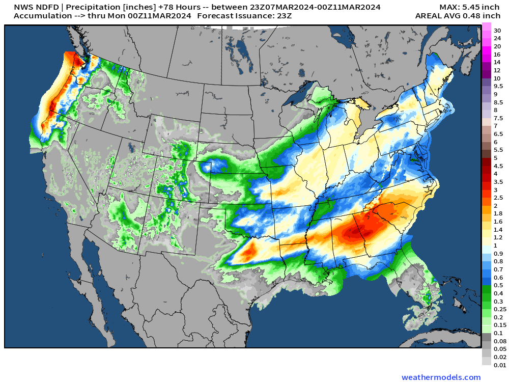
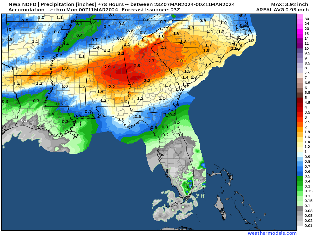
Over the next 3-days, the NWS rainfall shows another band of 2-4 inches across the Southeast including Atlanta, which does not need anymore rain.
Friday High Temperatures | March 8, 2024
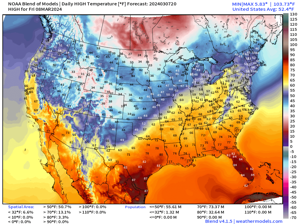
Quite warm ahead of the front and storm system on Friday up into Cleveland well into the 60s. 80s in Florida for Spring Break.
7-Day Rainfall Total
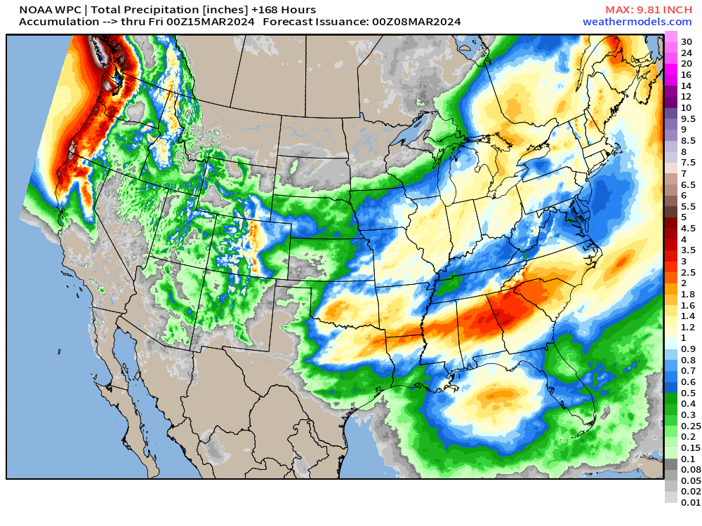
Another major storm system to impact the West Coast later next week.
Medium Range | Next 10-15 Days
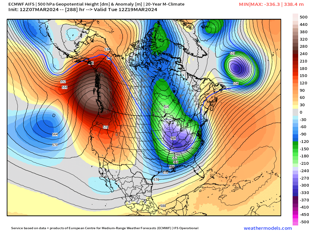
Experimental ECMWF AIFS modeling:
Still marking Tuesday March 19, 2024 as a day to watch for a trough with Arctic air — albeit mid-March, almost Spring, cold air with the “polar vortex” plunge into the Southeast. Need to watch for a frost/freeze into Atlanta in 12-days.
5-Day Temperature Anomaly Chunks | Next 15-Days
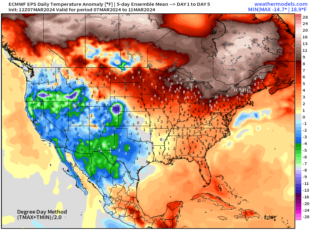
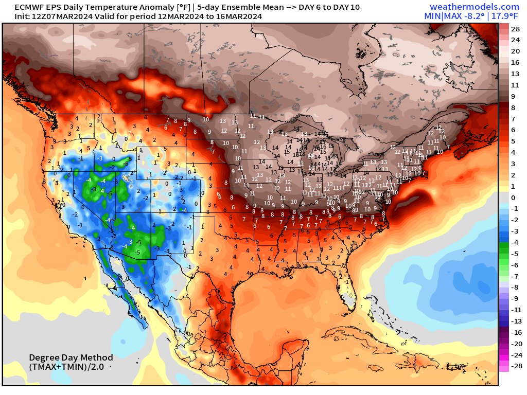
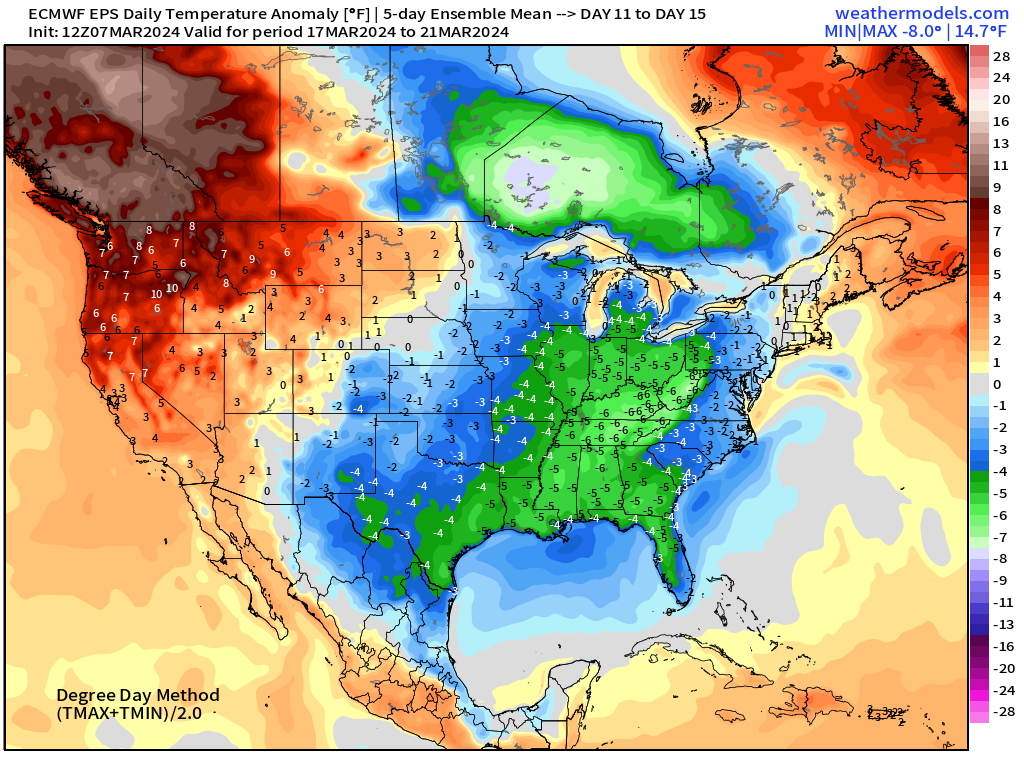
This final period shows the threat of colder air w/ensemble mean of -5 to -6°F compared to normal. However, this is a strong signal for cooler air, and the magnitude will increase as the ensembles sharpen.
Next 10-Days Weather | ECMWF 12z HRES
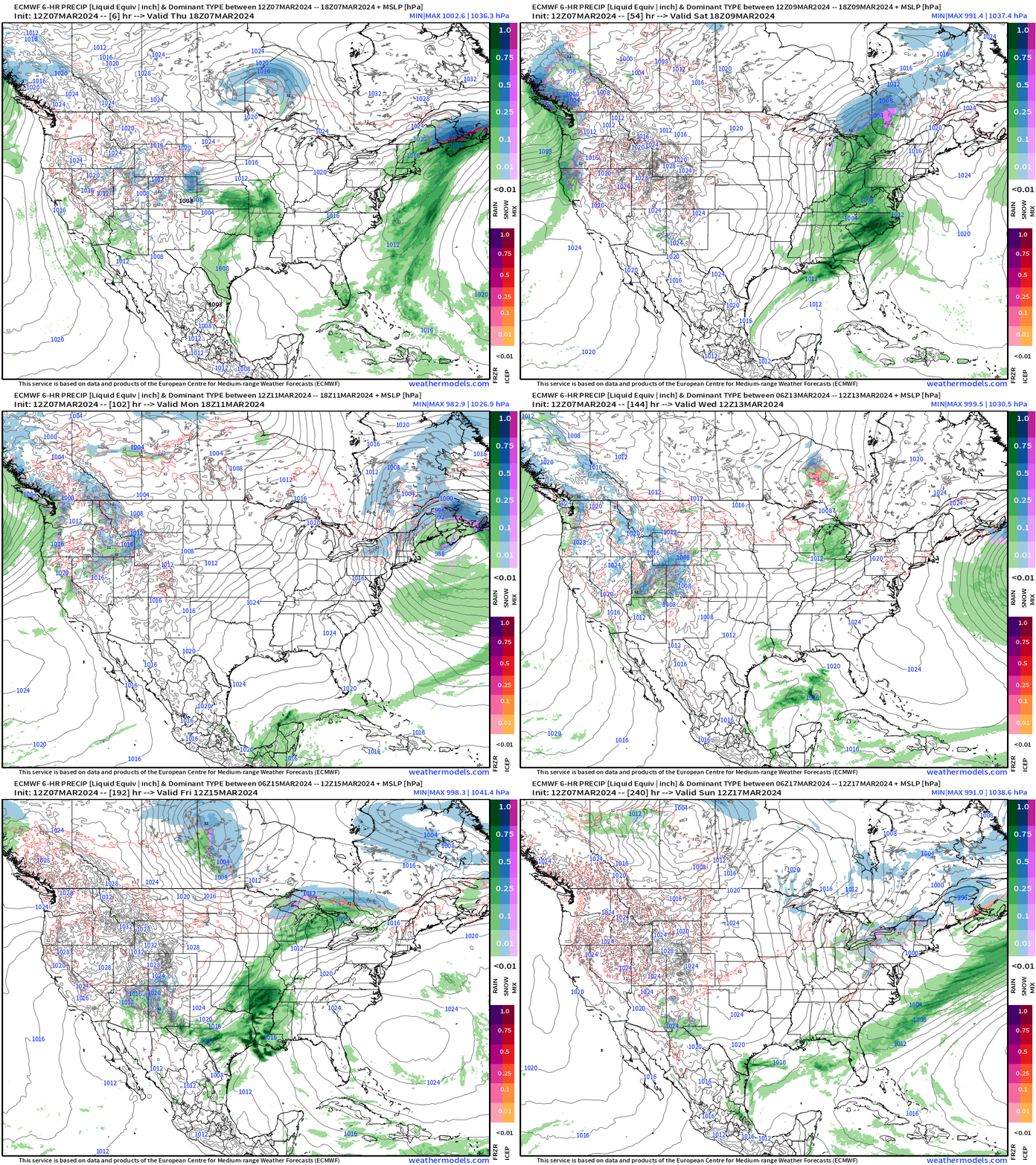
The next storm system crossing the central U.S. will be the following weekend with western U.S. / Pacific moisture crashing onshore.
15-day ECMWF Ensemble Mean Snowfall
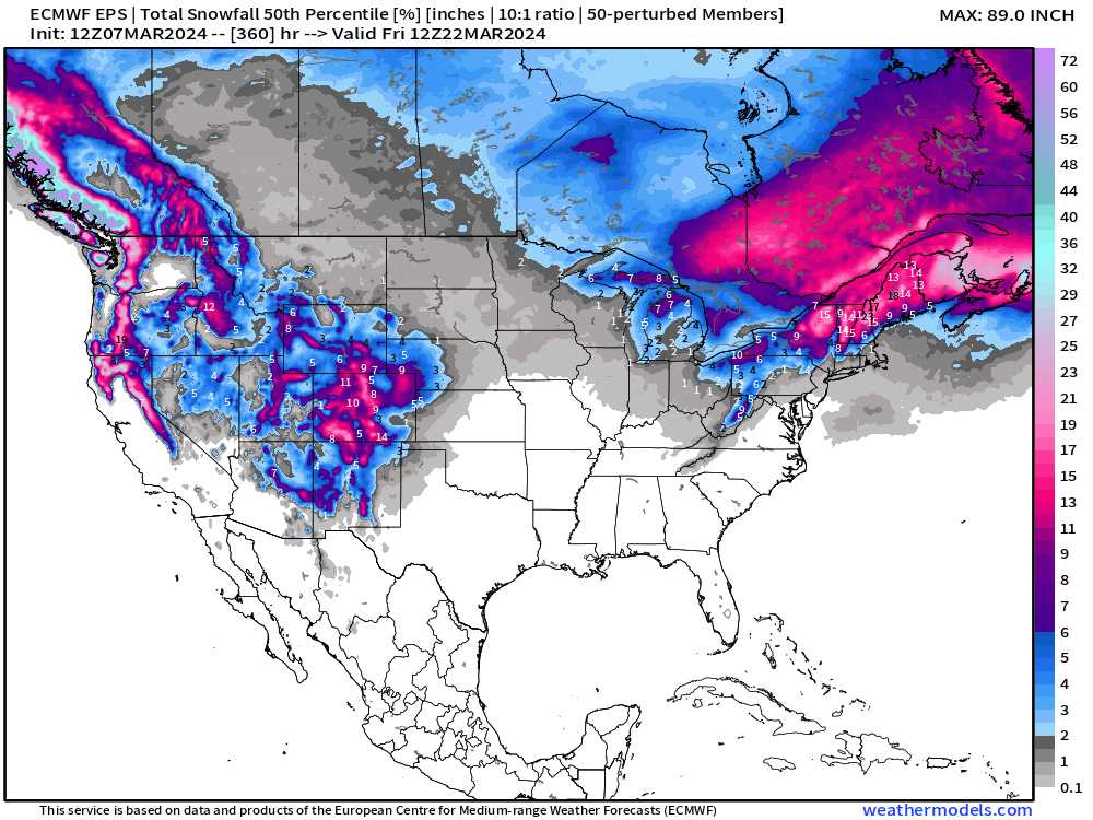
15-Day ensemble median is still lit up for interior New England — quite the end to winter! And, still some Lake Effect snowfall chances behind a Canadian Arctic cold front in Week 2.
Thank you to Subscribers and Supporters! Welcome to March 2024 — so much is going on in the world of weather! Please come along for the ride!
- Milepost
- 231 · laid 2024-03-08T00:35:31.184000Z
- Source
- https://weather.substack.com/p/march-7-2024-weekend-storm
- Digest
- b26b33492a9d7f78a218fc860dd70e74c5b57e4e8c3c0ab5b27dc91a63ee35bf
- Machine
- JSON