February 1, 2024 California Deluge
Enormous rainfall from another California storm system on way
February 2024 was the 3rd-warmest February in the 132-year national record (1895–2026), at 40.8°F against a 1991–2020 normal of 35.6°F (+5.1°F).
February 2024 was the 62nd-driest February in the 132-year national record (1895–2026), at 2.0in against a 1991–2020 normal of 2.1in (-0.1in).
NOAA/NCEI Climate at a Glance, contiguous United States. This is the observed record for the month, not a score of anything said in this piece — the forecast ledger begins 2026-08-17 and cannot reach earlier posts.
Weather Trader | Thursday Update
Major California atmospheric river event with potentially catastrophic impacts including flooding and landslides from upwards of a foot of rainfall including in Southern California
On Sunday, a wave of low pressure tracks into California from the southwest directing an atmospheric river on a collision course with LA
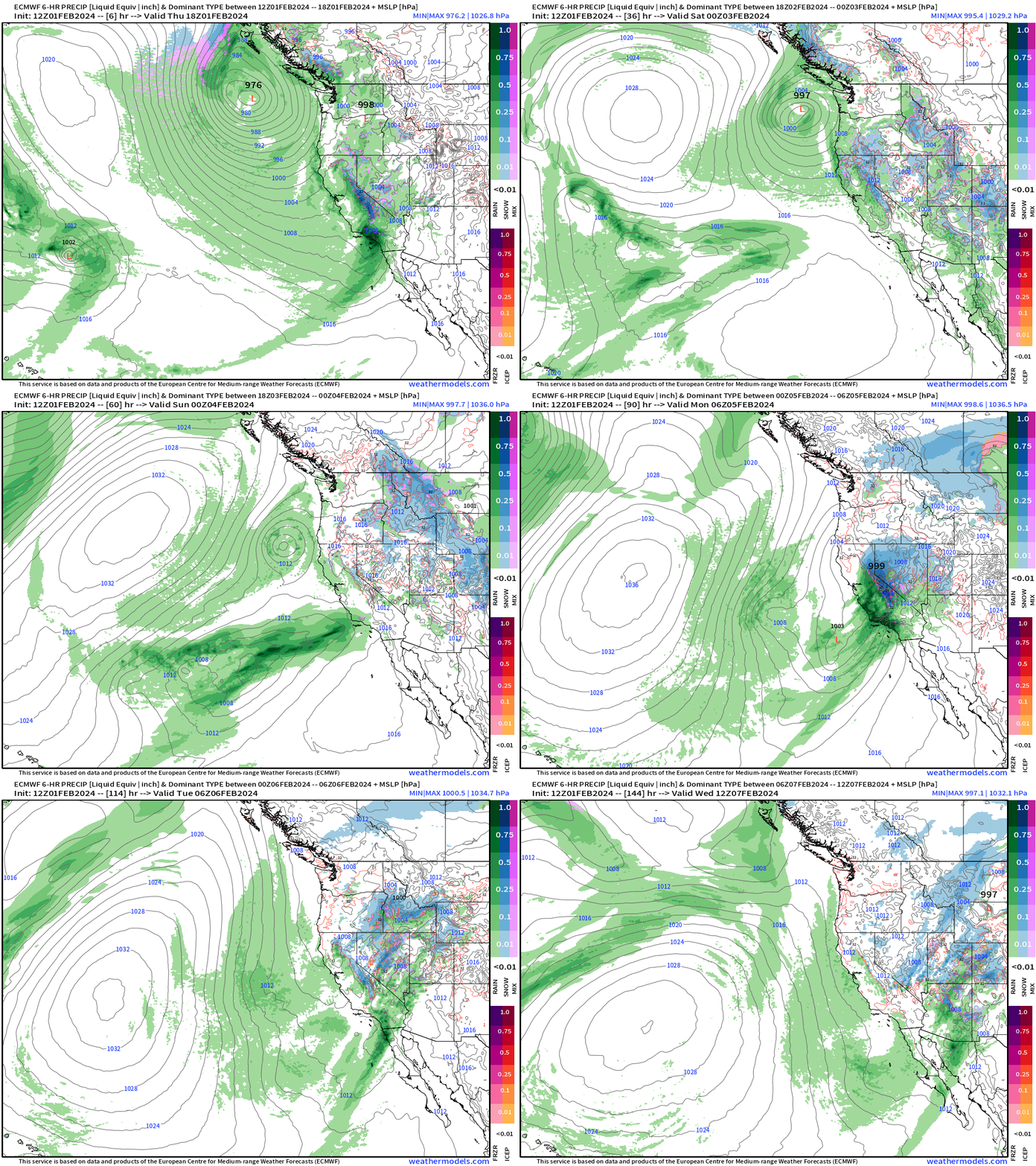
The integrated vapor transport shows the stream of moisture perpendicular to the Southern California coastline.
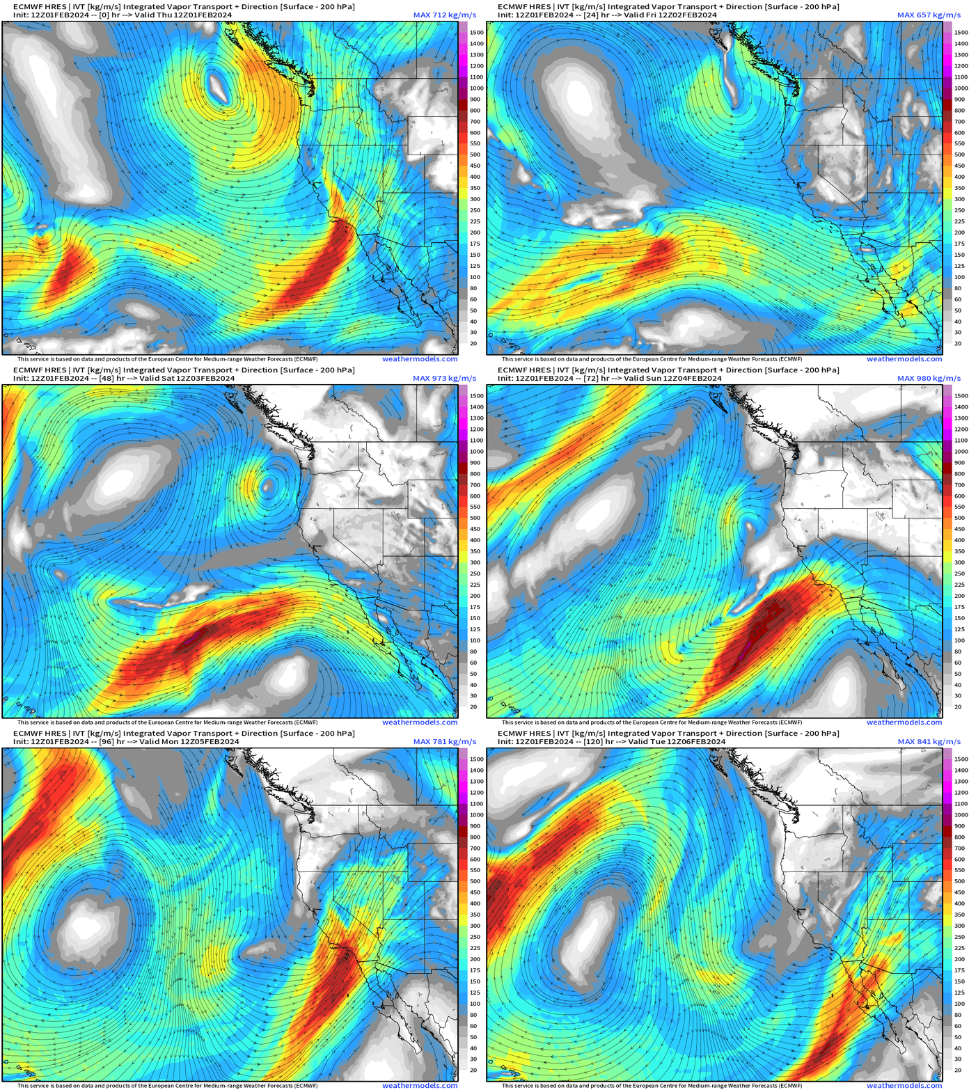
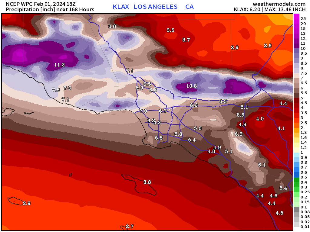
The current NOAA WPC rainfall amounts are enormous — with LA metro in the 6 to 9-inch range for rain (not snow) and coastal range over 1-foot of rainfall. Rainfall totals for the entire state will be in the 9 to 10 trillion gallons range with the heaviest over Southern California. The precipitation in the Sierra will be mostly snow and add up to at least 6-8 feet, or more.
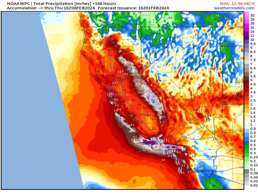
Zoomed in view of Southern California
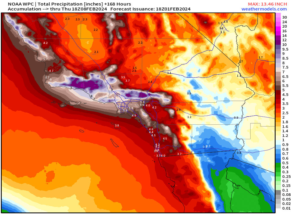
And one more zoom into Los Angeles. Note that weather models like the EPS ensemble have more rainfall — probably not reflected yet in the NOAA WPC blended precipitation forecast.
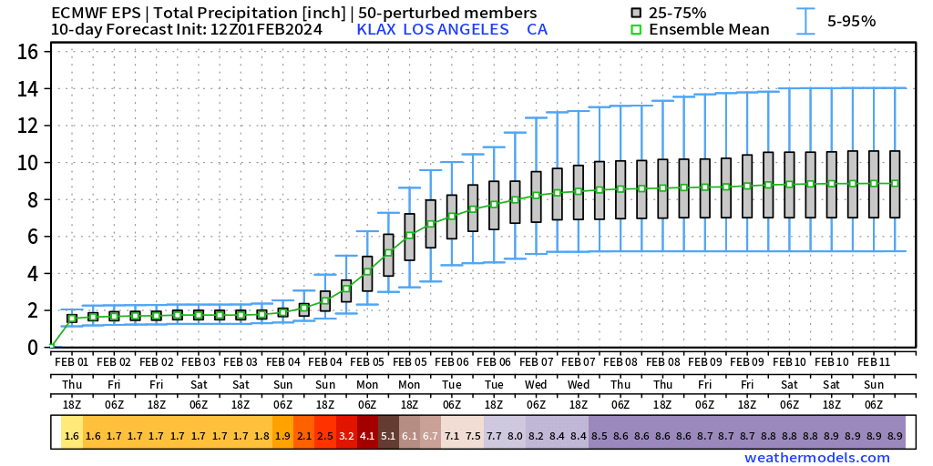
Here the most recent EPS 12z ensemble shows 8.9” as the mean rainfall over 10-days with most of it falling between Sunday and Tuesday, with an interquartile range (25% to 75%) from 8” to 10” at LAX.
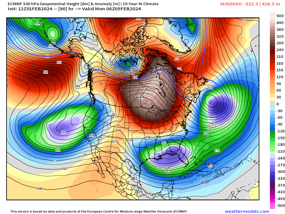
Unusual blocking weather pattern will finally break down in 8-10 days, so we can get Winter back on track. Tomorrow on Groundhog Day, hopefully the critter does see his shadow, he crawls back into his den, and we get another 6-weeks of winter!

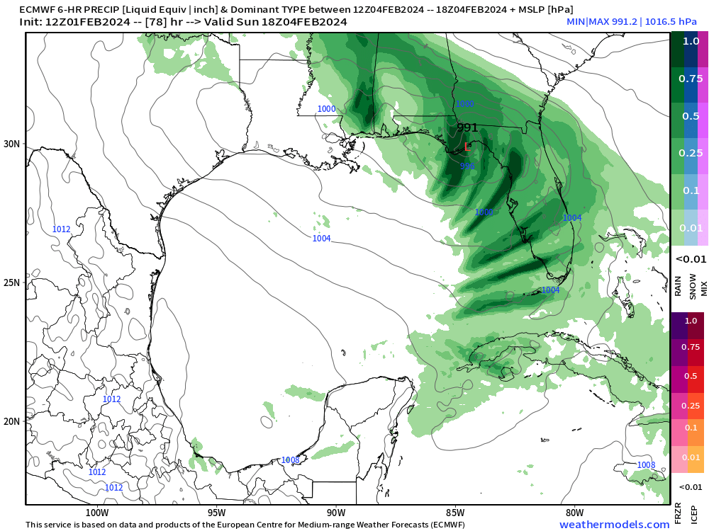
However, on Monday we have the trough associated with the California storm system and another bowling ball cut-off over the Southeast leading to severe weather along the Gulf Coast from Texas to Floirda.
Another unusual weather system for early February, but so far, it has been well forecast by the models. Those dark green tracks are 6-hour precipitation and indicate convection within the ECMWF HRES model akin to strong thunderstorms with exceptional moisture content from the Gulf of Mexico. This is Sunday around noon in the map so we should expect severe weather sometime late Saturday to be a risk from Louisiana to the panhandle of Florida.
February Thaw — Winter on Hiatus east of the Rockies
Friday Highs | February 2, 2024
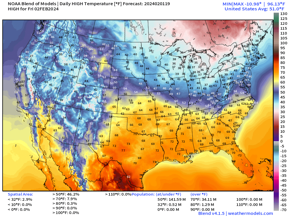
Texas soaring into the 80s now! February 2 and the average high temperature across the Lower 48 is 51°F. Wow!
Next 14-days Temperature Anomaly
7-day Chunks from February 1 to February 15, 2024 [12Z]
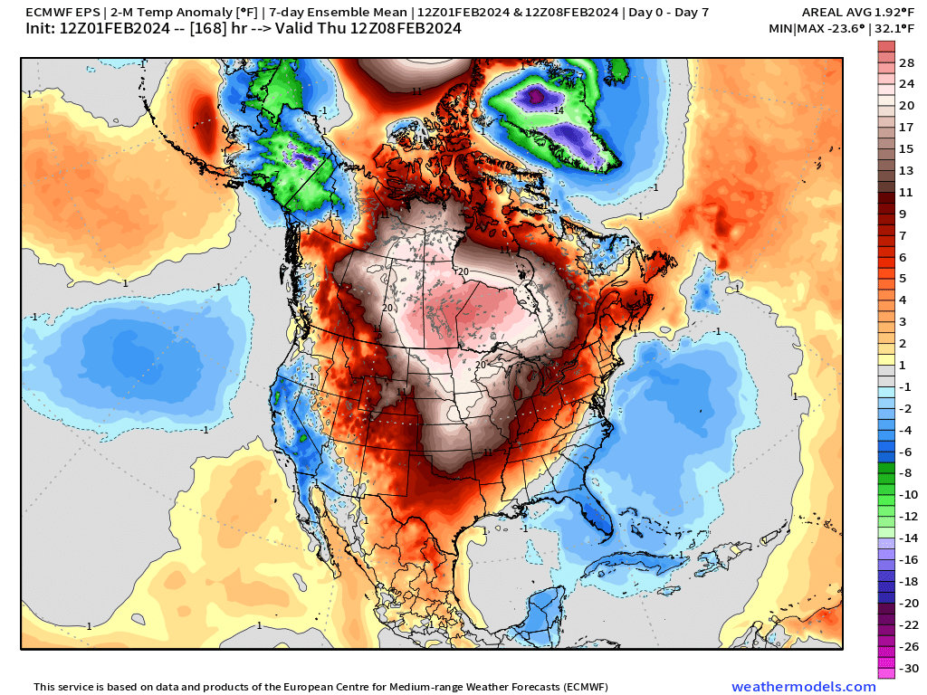
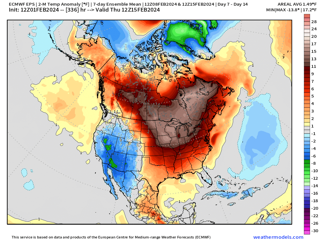
I see cooler than normal air favored in the Southeast U.S. but no change to the warmth smack dab in the center of North America. This wipes out half of February for your snow shovel most likely east of the Rockies!
7-day Total Precipitation from WPC
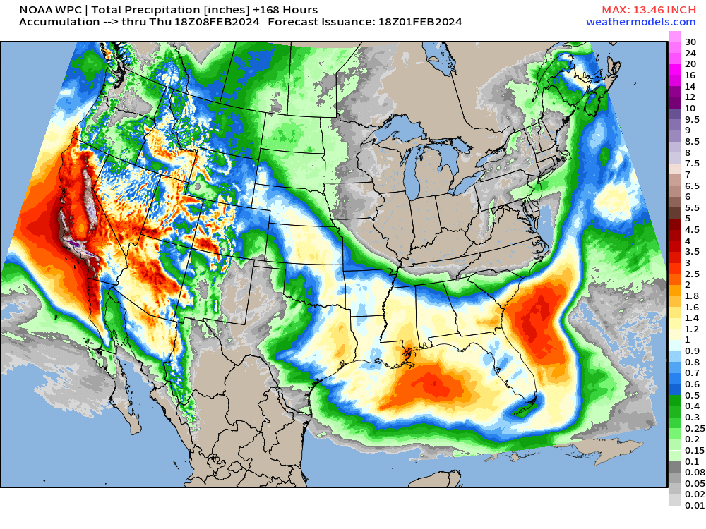
This 7-day period has 37 trillion gallons on the U.S. which is exceptional for early February. This is drought busting rainfall — except there wasn’t any more drought in California. The moisture flow into the Southeast U.S. has mitigated the severe drought conditions in Louisiana.
15-day Snowfall ECMWF EPS Median Accumulations
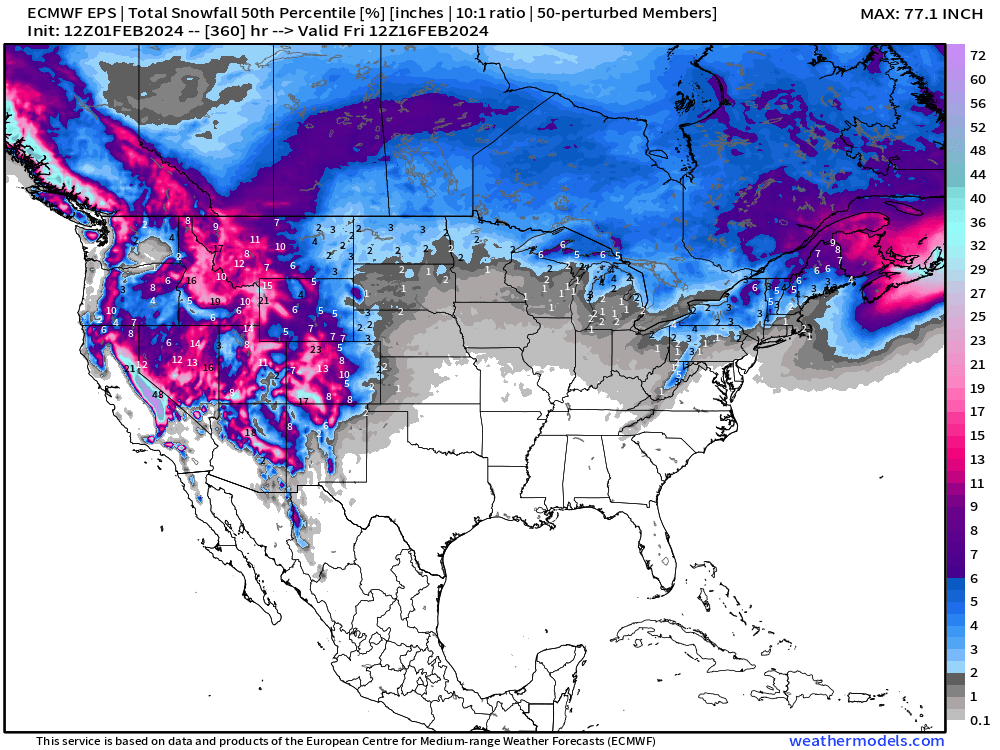
Same story as yesterday — You can probably put away your snow shovels in Minnesota, Iowa and Chicago at least until Valentine’s Day [Feb 14th] as mild conditions continue across the Great Lakes and Middle Atlantic.
The Western U.S. ski resorts will be enjoying massive accumulations — full tilt!
(Maps from weathermodels.com and weathertrader.com)
Thank you to my paying subscribers!
Your support pays for my Linux servers and product development. Also, it allows me to provide (usually) interesting and valuable commentary on scientific topics on X. Feel free to say hello and follow on X/Twitter (@RyanMaue)
- Milepost
- 198 · laid 2024-02-01T21:12:08.965000Z
- Source
- https://weather.substack.com/p/february-1-2024-california-deluge
- Digest
- 9269c1def9147c89fbd14987e34995e25372429903c0ca366afc5418c05bcfa5
- Machine
- JSON