June 6, 2020 Tropical Update: Tropical Storm Cristobal
Poorly organized Tropical Storm Cristobal moving north toward U.S. Gulf Coast with landfall expected late Sunday in Louisiana
June 2020 was the 29th-warmest June in the 132-year national record (1895–2026), at 70.3°F against a 1991–2020 normal of 69.5°F (+0.8°F).
June 2020 was the 40th-driest June in the 132-year national record (1895–2026), at 2.7in against a 1991–2020 normal of 3.1in (-0.4in).
NOAA/NCEI Climate at a Glance, contiguous United States. This is the observed record for the month, not a score of anything said in this piece — the forecast ledger begins 2026-08-17 and cannot reach earlier posts.
Morning satellite view of Tropical Storm Cristobal (winds 50 mph) in the central Gulf of Mexico shows an asymmetric but large system moving north. The heaviest showers and storms are within the thick cloud-cover to the east of the storm center with a plume of tropical moisture beginning to soak the Florida coastline.
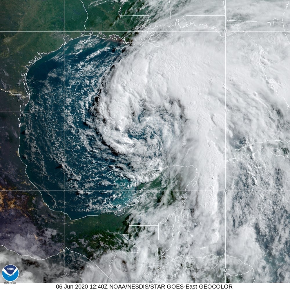
That is the story of Cristobal: rain and lots of it heading up the Mississippi River Valley into the Great Lakes.
Large area of 4-inches of rainfall w/6-10” over Southeast Louisiana just east of the storm center landfall location. The red shading on the precipitation map from WPC marks the storm’s footprint and track into Wisconsin where it will merge/transition into a non-tropical storm. But all of that tropical moisture will head well north over the next week.

Rest of the tropics: including the Eastern Pacific and Western Pacific (typhoons) remains very quiet for at least the next 10-days.

- Milepost
- 19 · laid 2020-06-06T13:13:14.885000Z
- Source
- https://weather.substack.com/p/june-6-2020-tropical-update-tropical
- Digest
- 59a3778744b48cfdbe1b2e92604d843a8523c714a8e6b5ccd2fd57ecc1a2ea9c
- Machine
- JSON