Eyes on stratosphere but any impacts down here will be weeks away if come to fruition

Welcome to new subscribers today & returning multi-year supporters heading into November. Everyone else, thank you for visiting! The goal of this newsletter is to highlight the beautiful and sometimes extreme weather around the world with a focus on the tropics, United States, and Europe. The presentation is first and foremost weather models + maps focused storytelling with the best weather models and maps!
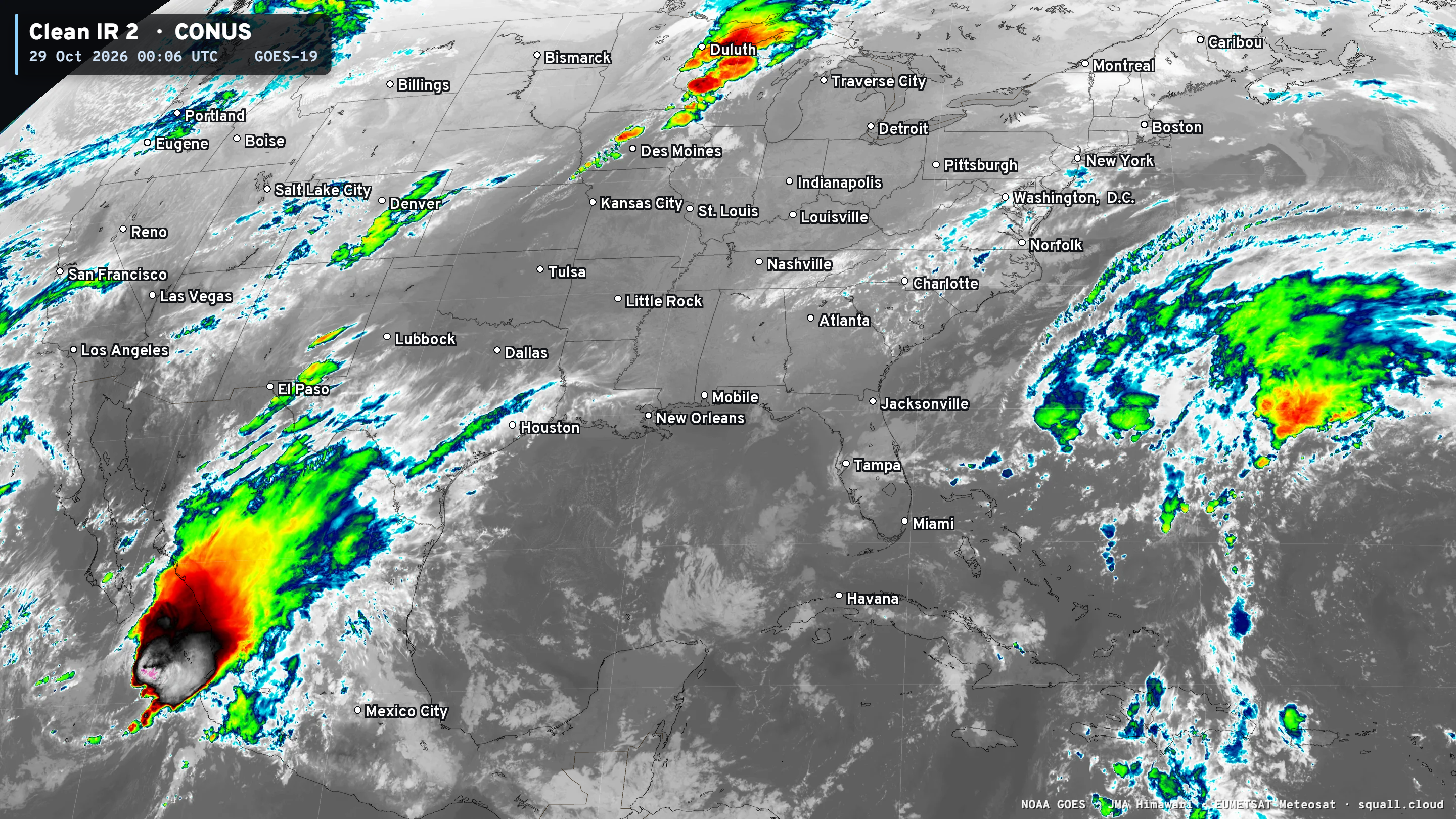
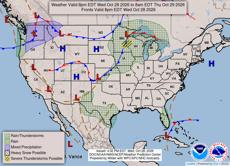
Mostly quiet across the Lower 48 with some storms moving through Minnesota and Wisconsin — a bit unusual so late in October. The rest of the Eastern U.S. is quiet. A trough off the Southeast coast is generating showers but no tropical or subtropical development is likely.
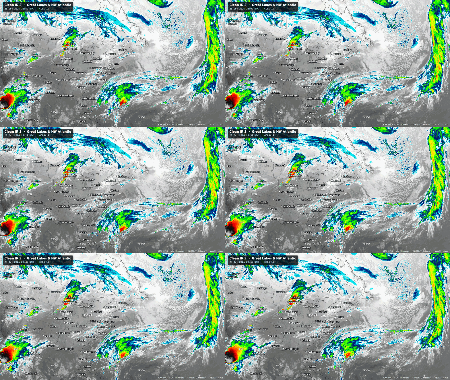
Tropical Depression Vance was sheared apart and its mid-level convection is moving into Mexico with heavy rain threat. The low-level center will drift off the coast before dissipation.
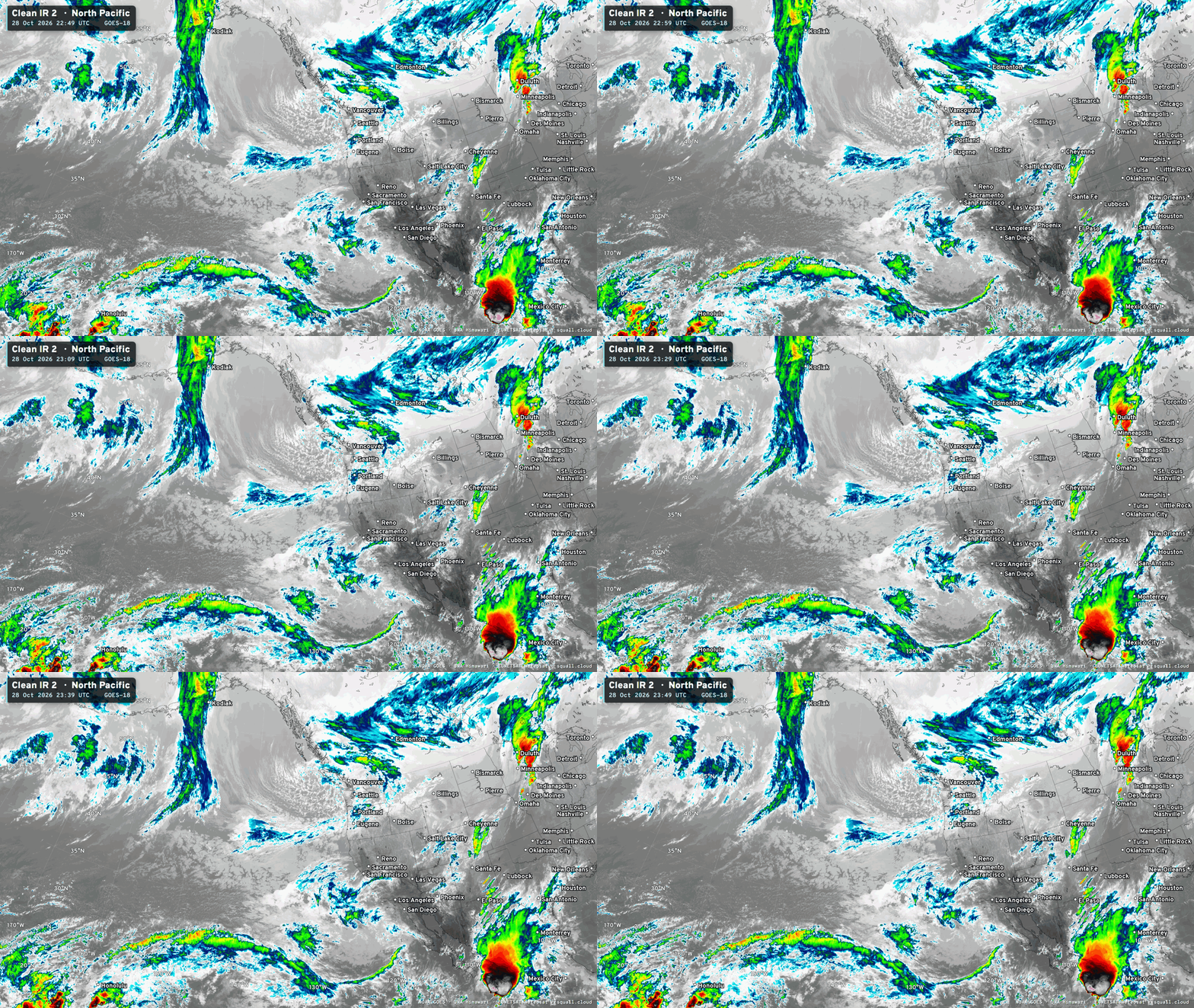
Quick mention of Chilly Weather in Europe —> gas markets a bit frightened
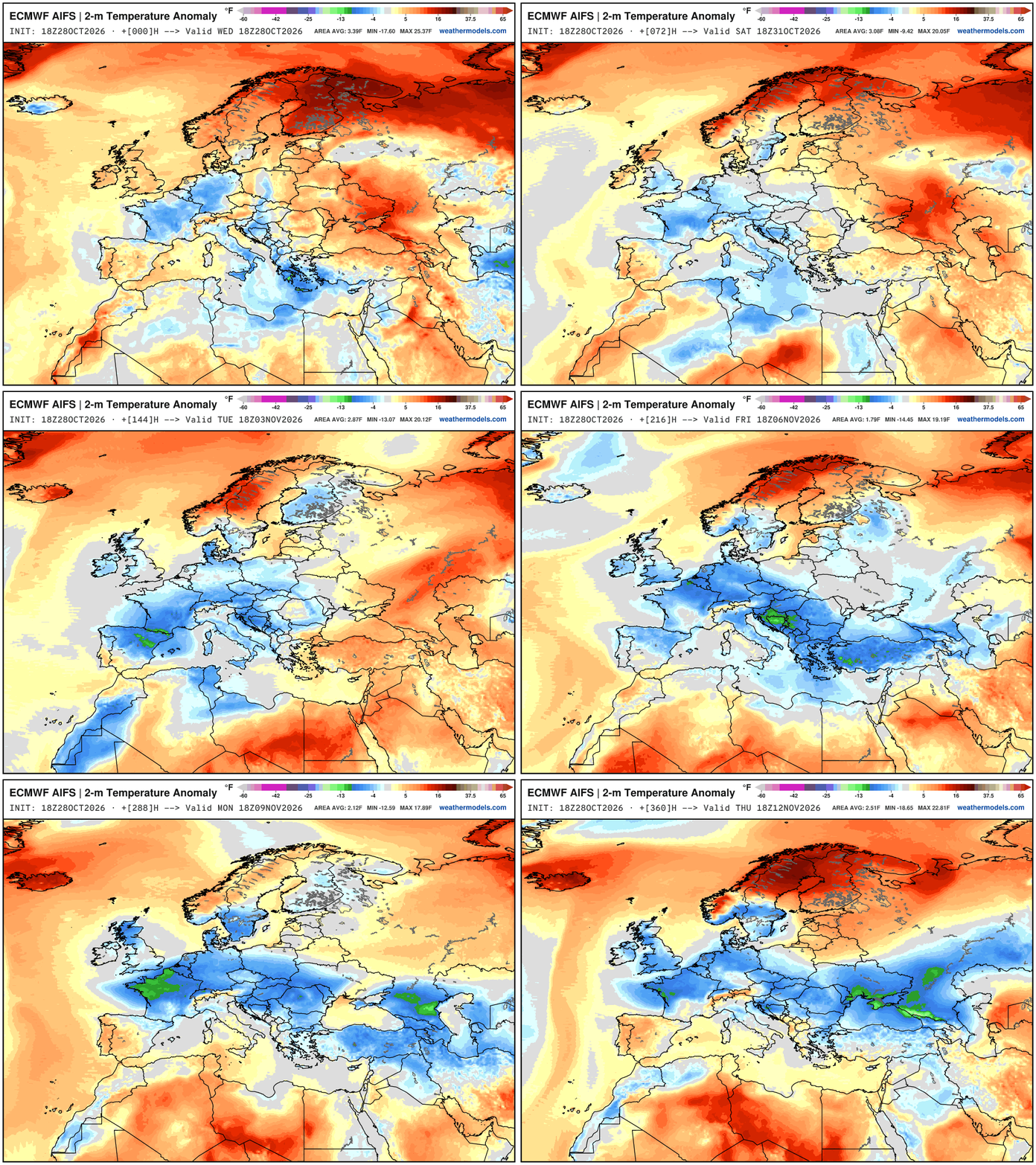
2-weeks of blue over much of Europe —> below average temperatures. Also, normal is getting progressively colder, too! So this is a bullish signal for gas usage for heating. It’s not freezing cold, but chilly — still early November not mid-January or this would be brutal. Paris and Berlin with lows in the 30s and 40s.
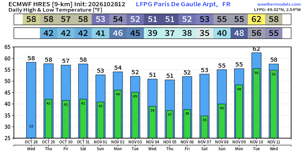
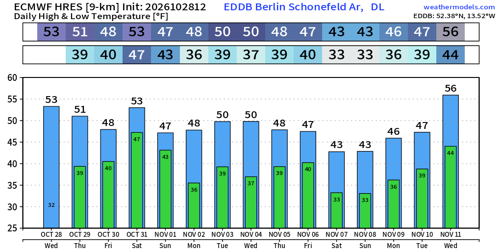
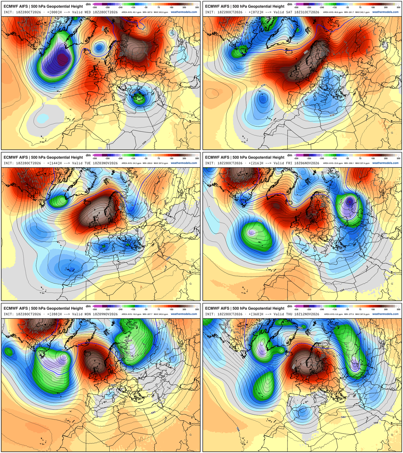
What weather pattern yields such persistent cold in Europe?
A blocking ridge stuck over Scandinavia which repeats over and over! Beneath it continue cut-off lows with cooler air from
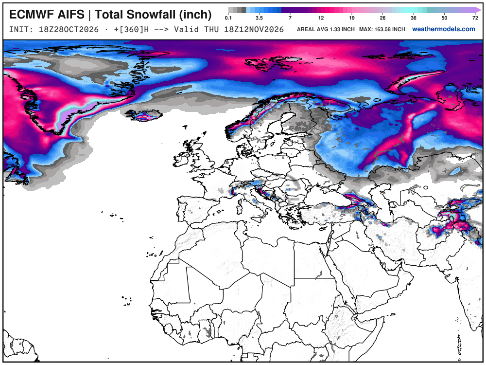
No snow next 2-weeks in major population centers of Europe, not that we’d be expecting any quite yet. Another 3-4 weeks.
Weather Headlines for Wednesday:
Typhoon In-fa motoring westward across the open Western Pacific
Unprecedented Polar Vortex breakdown / warming event seems likely
Southern California and Southwest U.S. pineapple express arrives this weekend but impacts look muted — more into Mexico
Well above normal temperatures for next 2-weeks East of the Rockies
Europe continues chilly into mid-November.
New monitoring site: Polar Vortex Earth
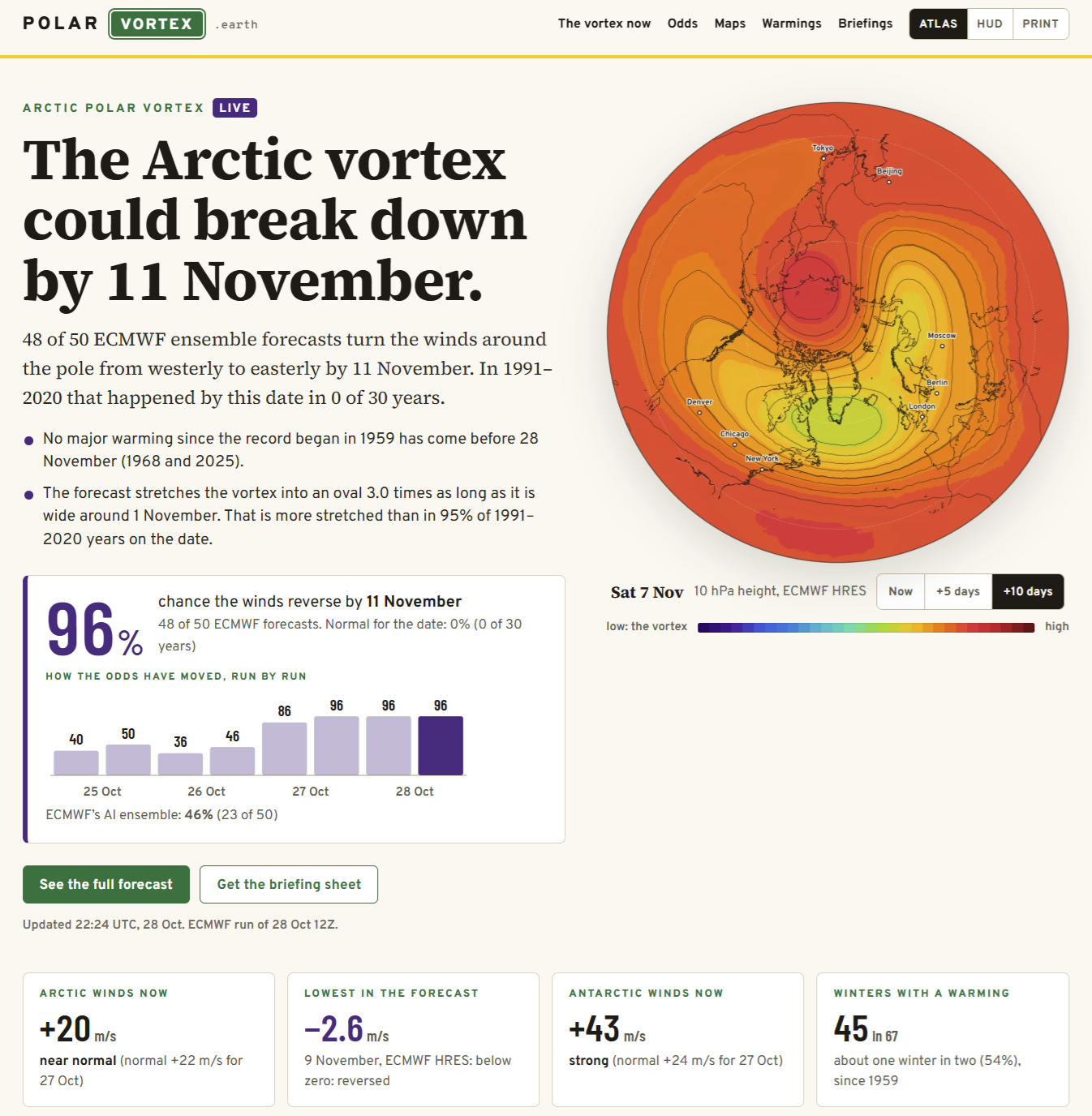
Early winter season breakdown — unprecedented — odds now 96% for the full-physics system (EPS) but only 46% for the AIFS-Ensemble.
A major warming starts on the first day the daily mean wind at 10 hPa and 60°N turns from westerly to easterly, between 1 November and 31 March.
Everyone on X and LinkedIn is chattering about the potential for an unprecedented early-season sudden stratospheric warming (SSW) even that could be strong enough (warm enough) for a reversal in the westerly winds typically spinning through the stratosphere to flip to easterly. Odds in previous days were low, and have completely flipped the script with a sure thing with the EPS ensembles (48/50) but still some indecision with AIFS-Ensemble.
More on this on Thursday — working on fine-tuning maps + charts for the Arctic. Why? Eastern Pacific based Super El Niño continues to rage, and this SSW is likely forced from anomalous convection from the warm pool (Niño 3.4).
Any impacts from the Stratospheric Warming Event will be weeks (!) away if they occur near the surface. I’ll describe more of that process tomorrow with maps.
Lower 48 Weather — Frontal Boundaries across the Midwest into the Corn Belt with cooler air … but not entirely too bad for late October.
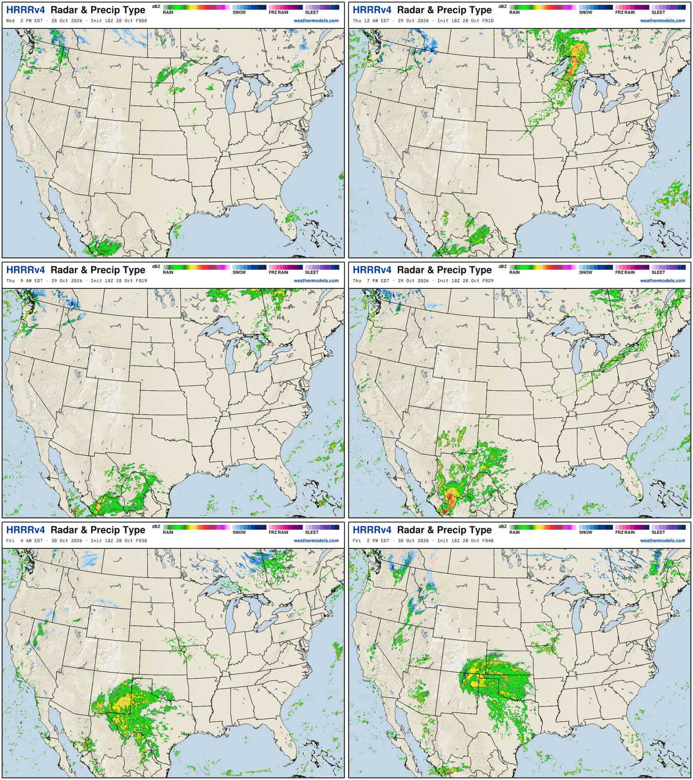
Massive slug of moisture with remnants of Vance come out of Mexico into Texas into Friday. General onshore flow / cyclonic across the Pacific Northwest —> HRRR weather next 48-hours:
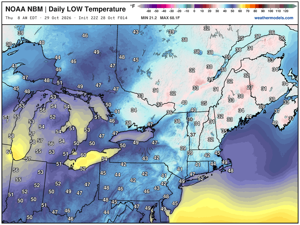
Low Temperatures on Thursday
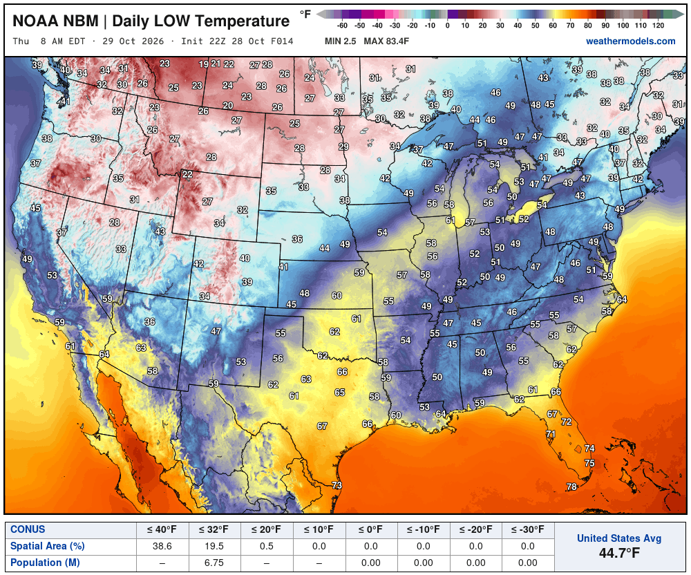
Less than 7 million below freezing
High Temperatures on Thursday
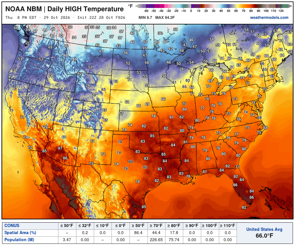
Very warm in the mid-Mississippi River Valley … Texas in the 80s. 82°F in St. Louis, and 70s into Detroit, Philly, and mid-60s into Boston. Really nice Thursday.
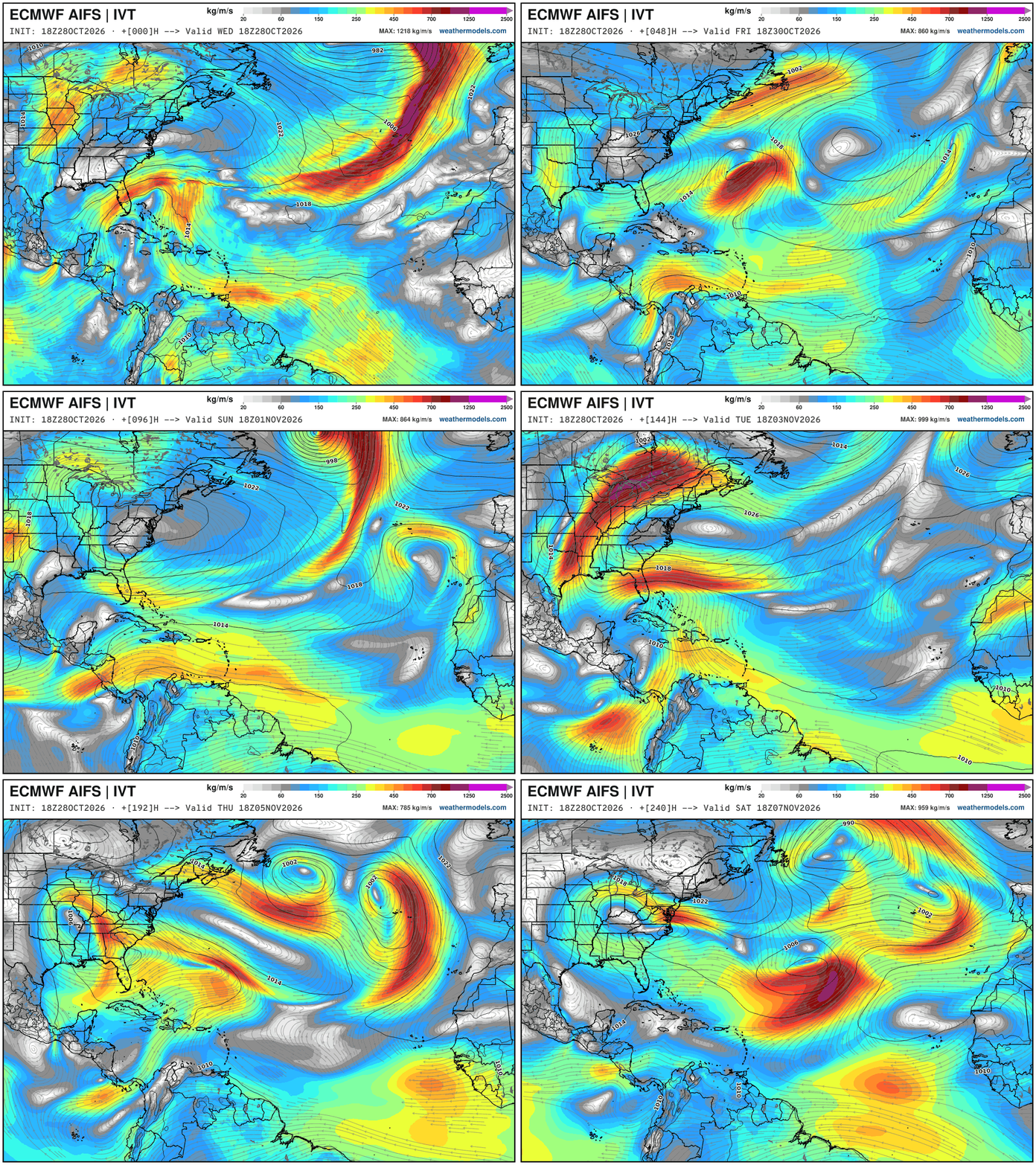
Integrated Vapor Transport Next 10-days | ECMWF AIFS 18z
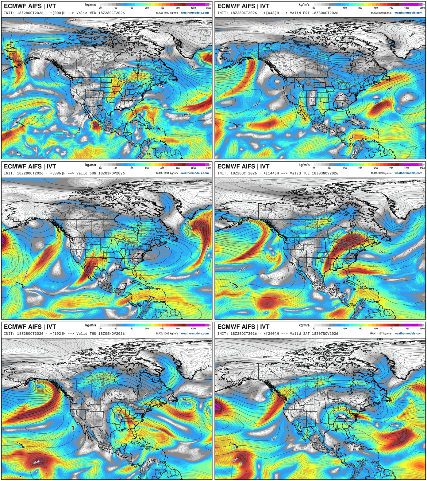
Still watching a weak storm system forming in the subtropical Eastern Pacific with a mini/stubby atmospheric river. Let’s call it the “Pineapple Express” directed at Southern California. The low pressure isn’t tropical, and not particularly intense, but it’s enough vorticity and circulation to collect a lot of ocean moisture. Into Monday, this disturbance intensifies into a strong Central Plains storm system with potential for severe weather.
Height Anomaly Pattern | Next 10-days | AIFS 18z | Flagship model
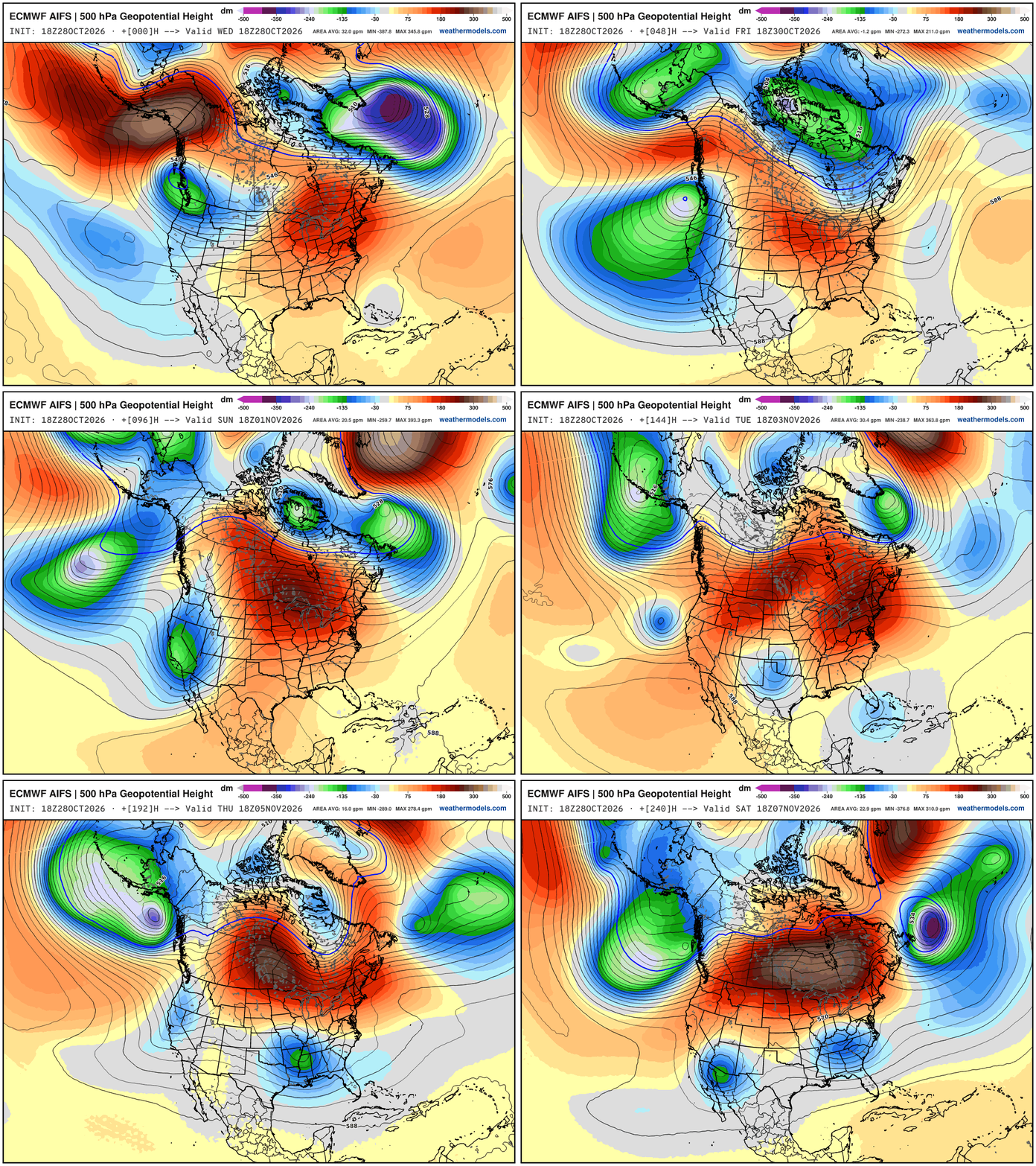
Large scale pattern —> Parade of troughs dipping across the West Coast — and ridging east of the Rockies. The troughs cut-off well away from California and can form short-waves that lead to downstream storm systems.
Note, this ridge over troughs (cut-offs) pattern — sub-Arctic / Mid-Latitude blocking similar to Europe
Eastern Ridging —> Much Above Normal Temperatures East of the Rockies
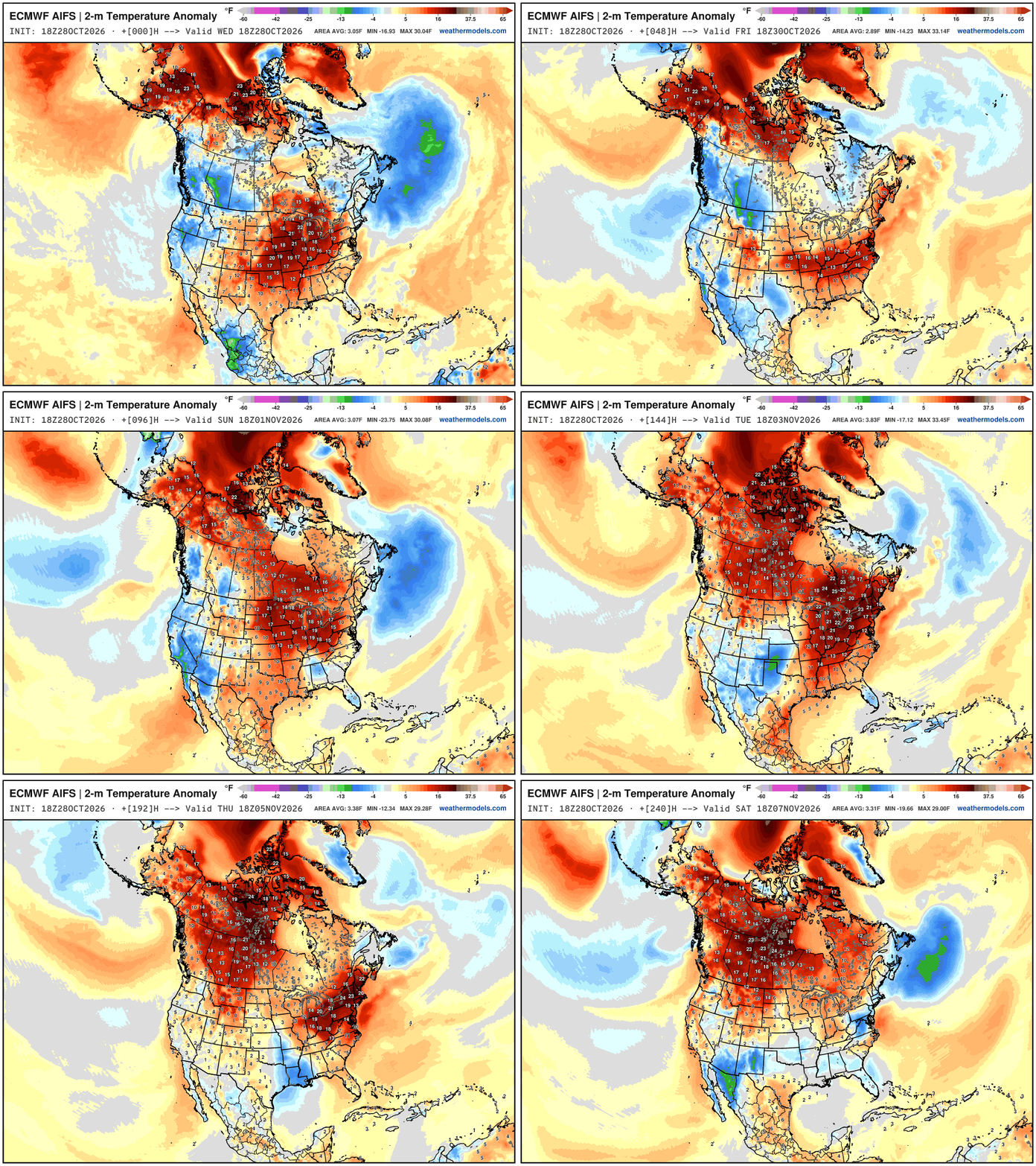
Note the extreme warmth (relative to normal) across the Arctic with widespread >20°F above average — still cold into early November with snowfall.
Blend of Models Precipitation Next 7-days | Lower 48
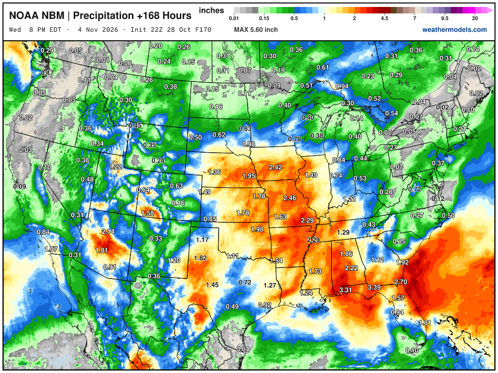
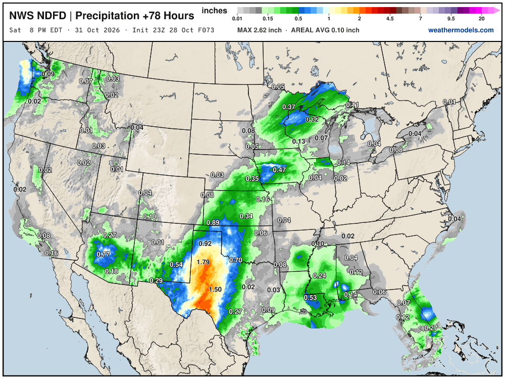
Southwest subtropical jet stream + storm system with a mini-atmospheric river means heavy rainfall for Southern California and Phoenix later this week. Also, thankfully some rain for the Southeast.
My favorite parameter — precipitable water | ECMWF 18Z next 6-days
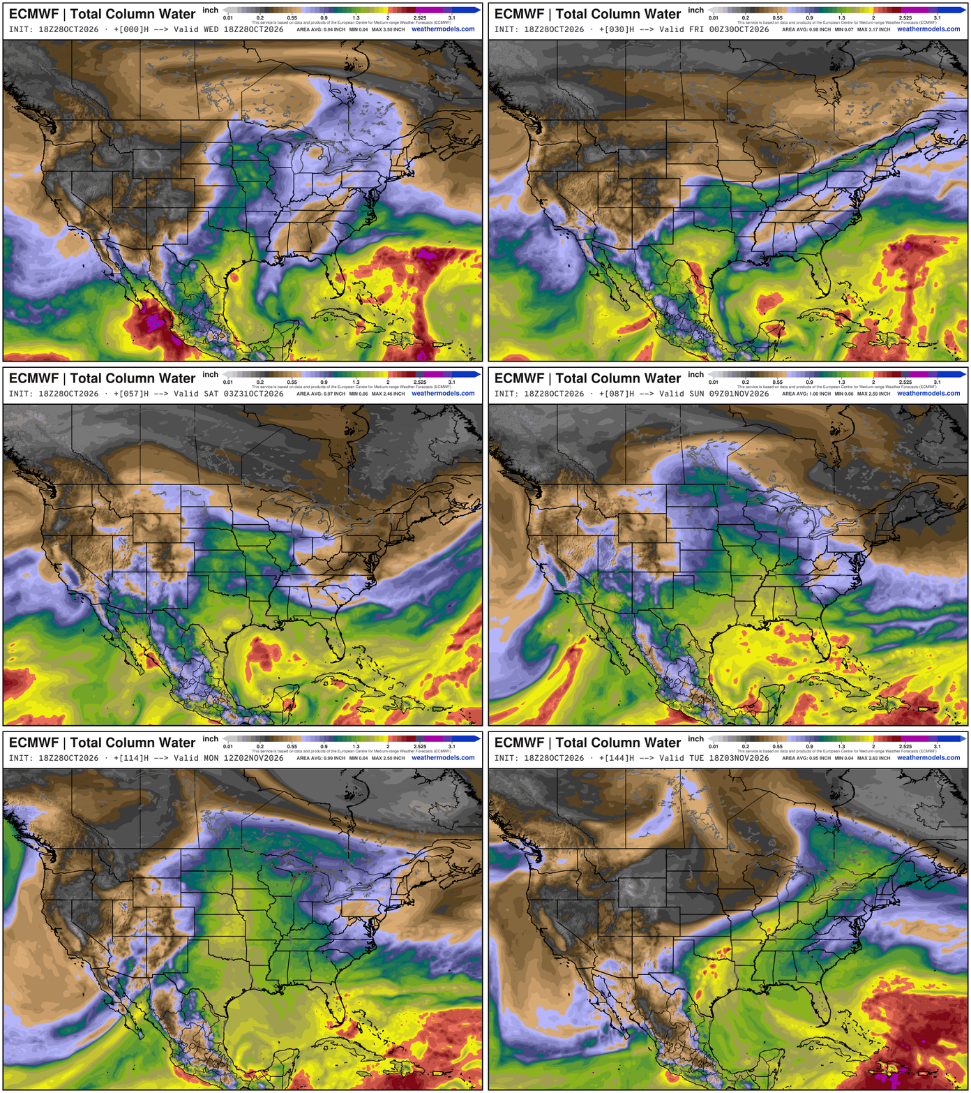
Nice surge of moisture with Vance + Gulf input —> and it all sort of comes together with the subtropical jet stream + little storm into Southern California + Baja California.
The storm system that forms this weekend will have a strong frontal boundary into early next to cool off the Northern Tier.
Temperature Analysis this Evening at 7:15 PM ET
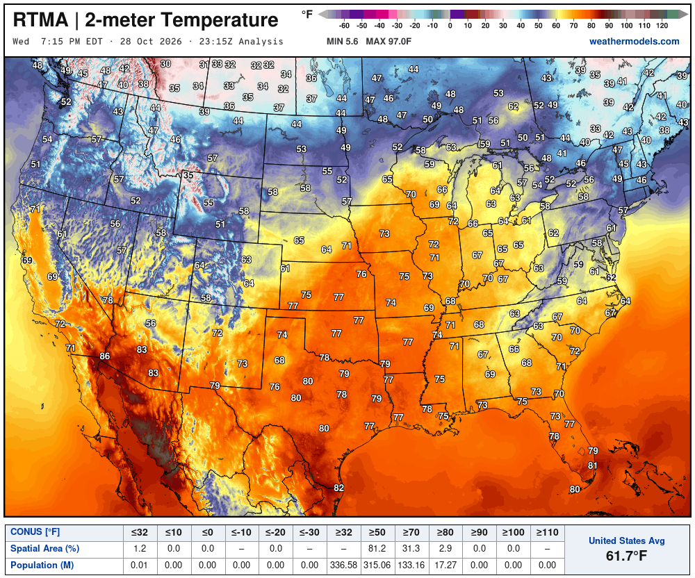
Balmy 60s and 70s into the Great Lakes this evening — way above normal by 20°+
Temperature Analysis | Anomaly from Normal
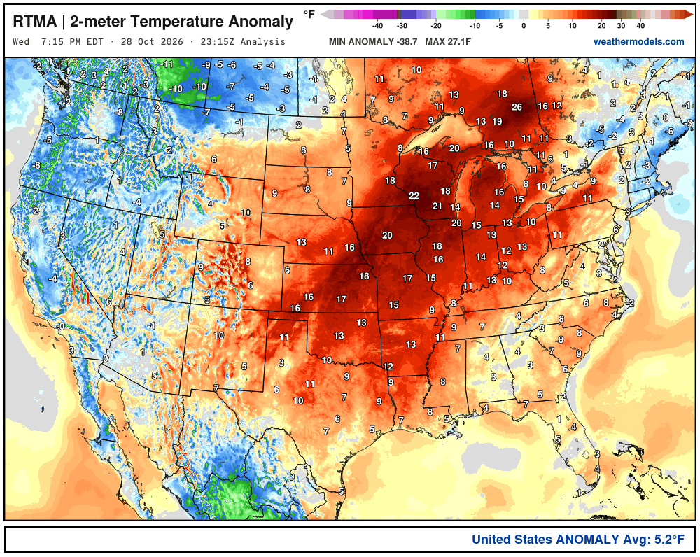
Lower 48 was a whopping 5.2ºF above normal
High Temperatures next 9-Days through first week of November
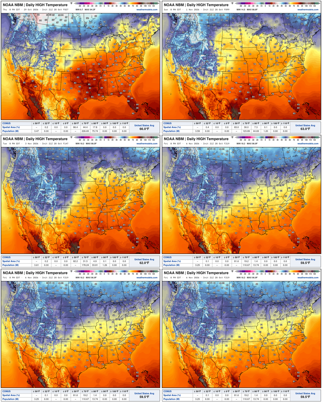
The cooler Canadian air (40s and 50s for highs) remains mostly bottled up as warmth and moisture from the Gulf and Subtropical Pacific combine with the mid-level ridging. Eventually, we lose about 7°F average across the Lower 48 … with the Canadian air winning the battle.
NWS NDFD Next 3-days precipitation
Blend of Models Snowfall Next 7-days
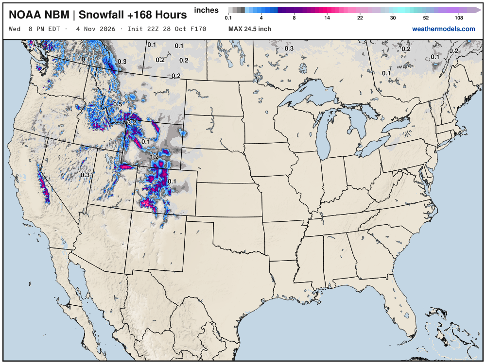
Still waiting on our first Eastern U.S. snowfall through first week of November.
Snowfall Next 15-days | ECMWF Ensemble 12z Median
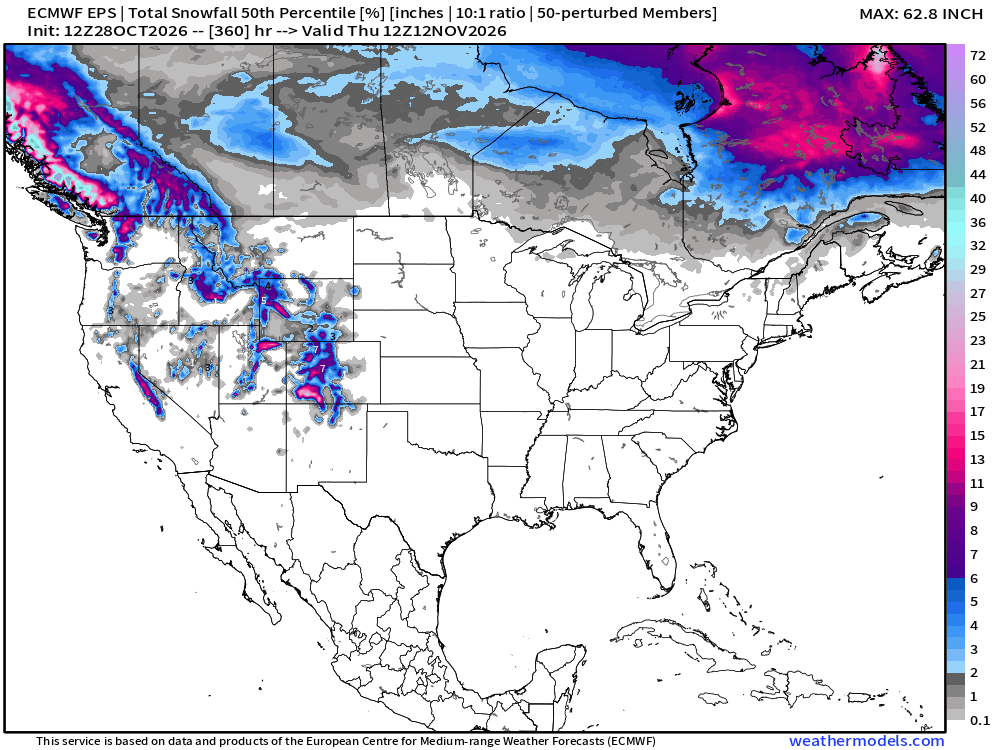
Slowly but surely as these maps head into early November — we’ll see our first legitimate chances of a snow storm for the Midwest, Great Lakes, and Northeast — not yet.
Probability of 1-inch or more of snowfall through November 12th
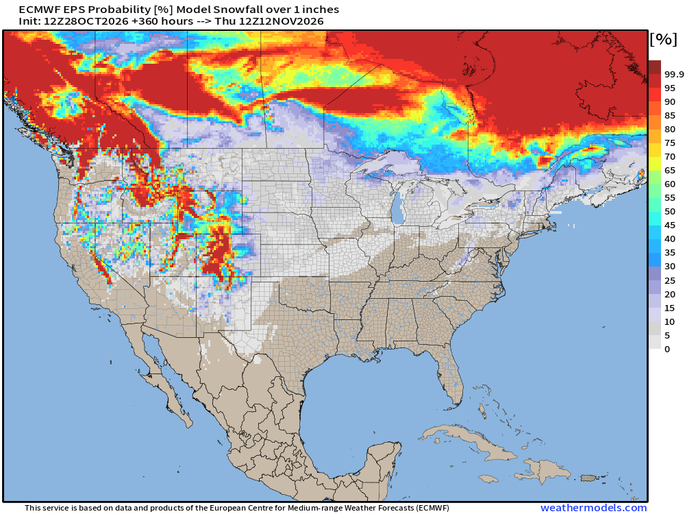
Low chances of snowfall < 10% across Eastern U.S. through 2-weeks — not zero.
Week 1 Temperature Anomaly | Oct 28 - Nov 3
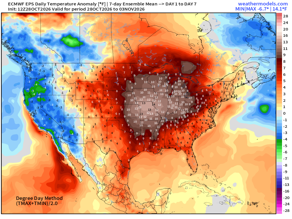
12°F warmth for the Midwest — continues into early November. Warm!
Week 2 Temperature Anomaly | Nov 4 - Nov 10
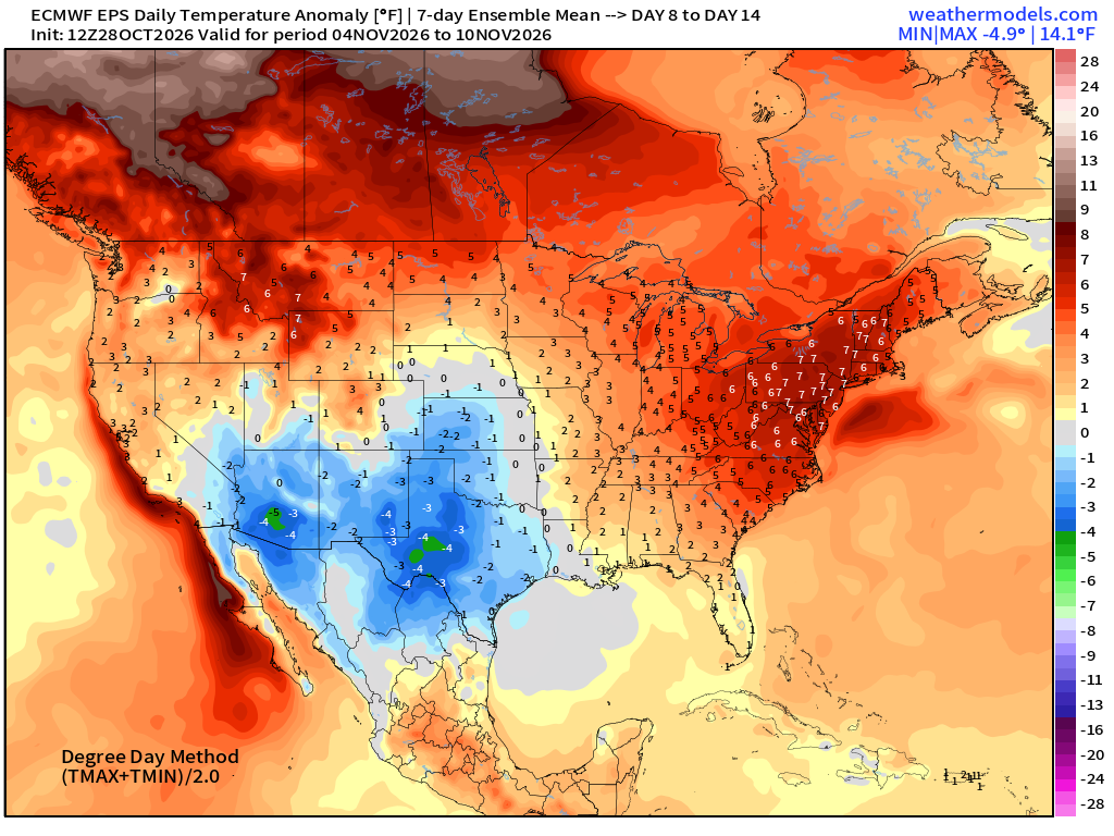
Blow torch continues into second week of November across Eastern U.S.
North Atlantic Hurricane Season | Curtains or not?
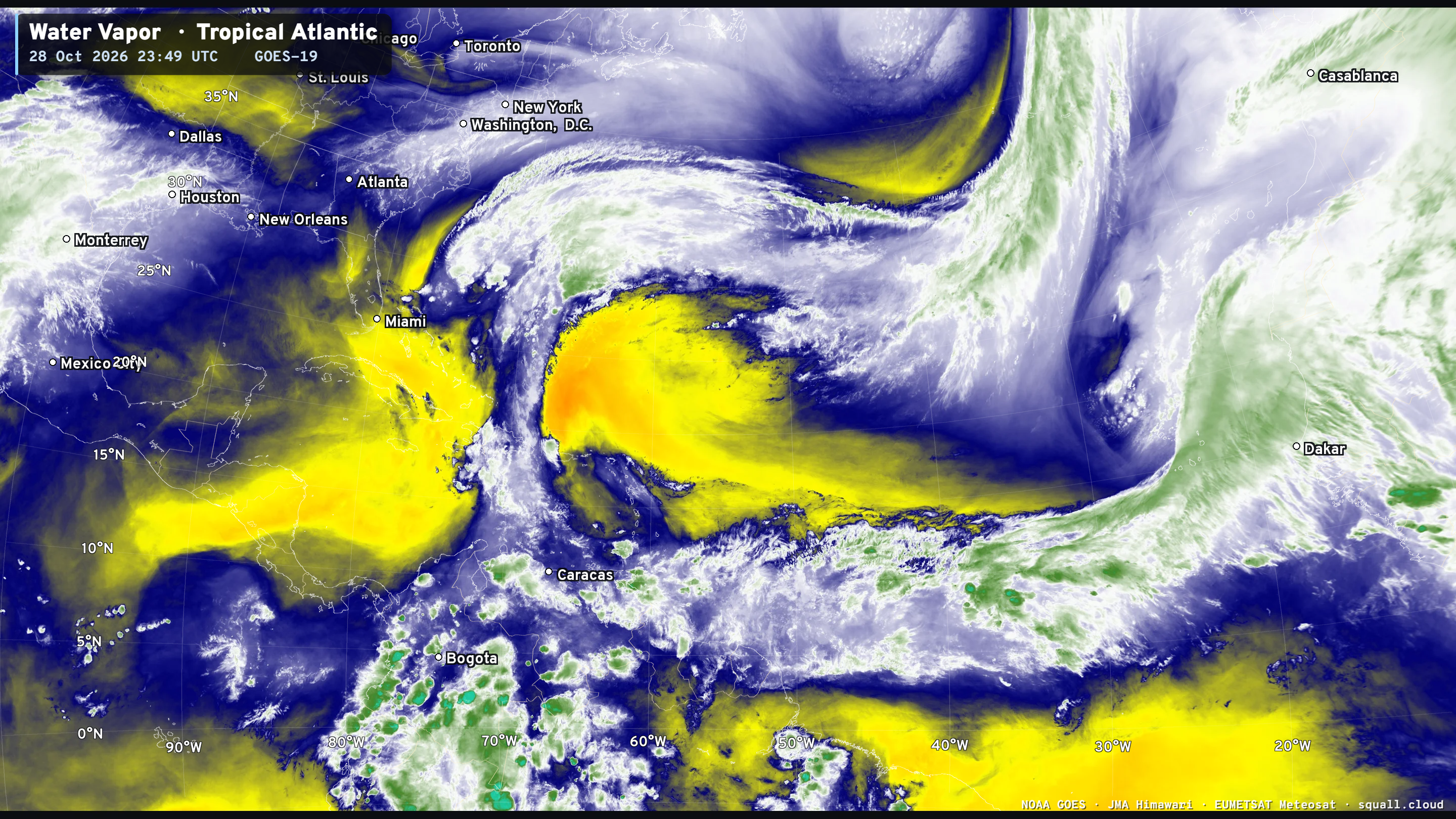
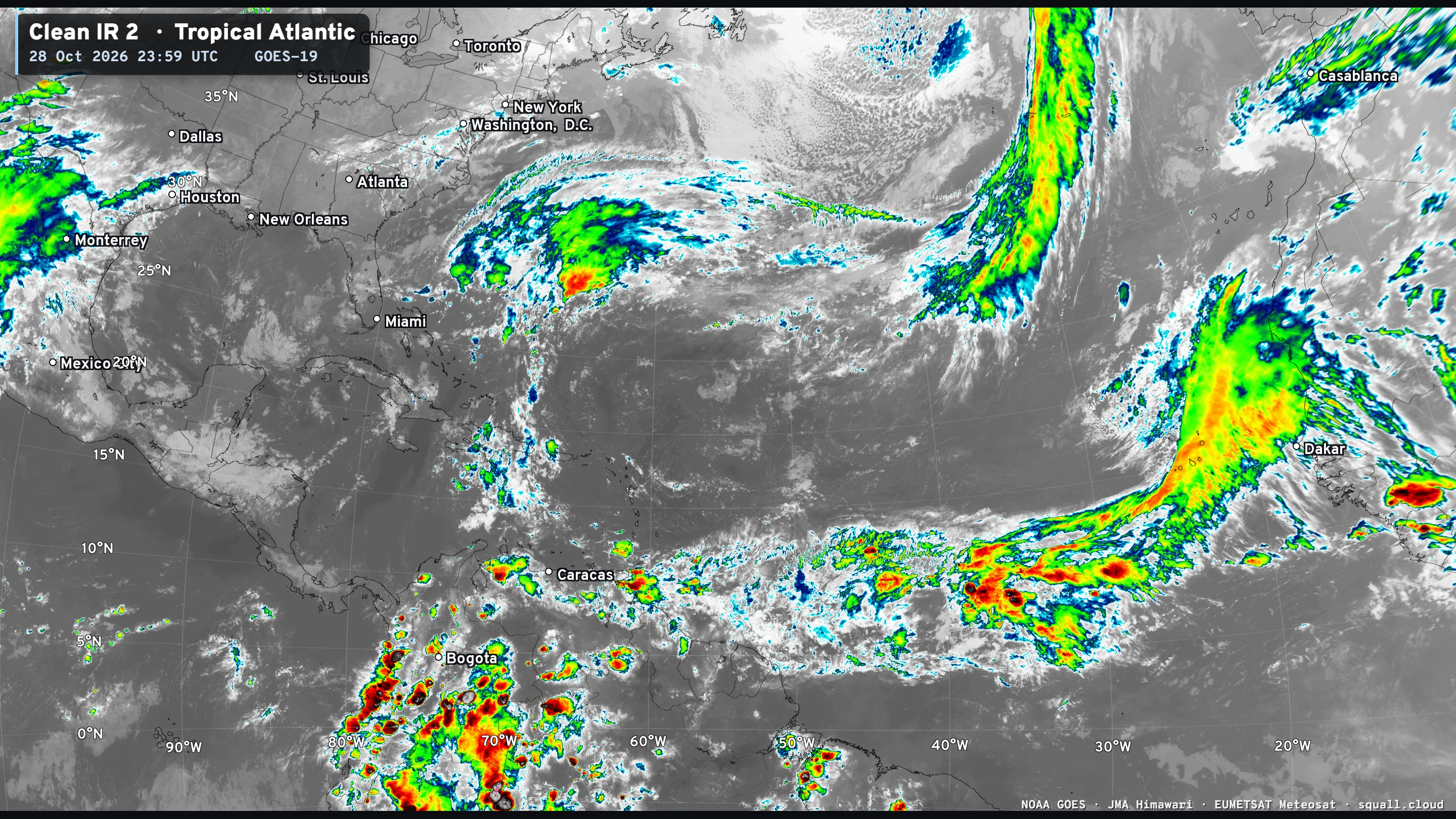
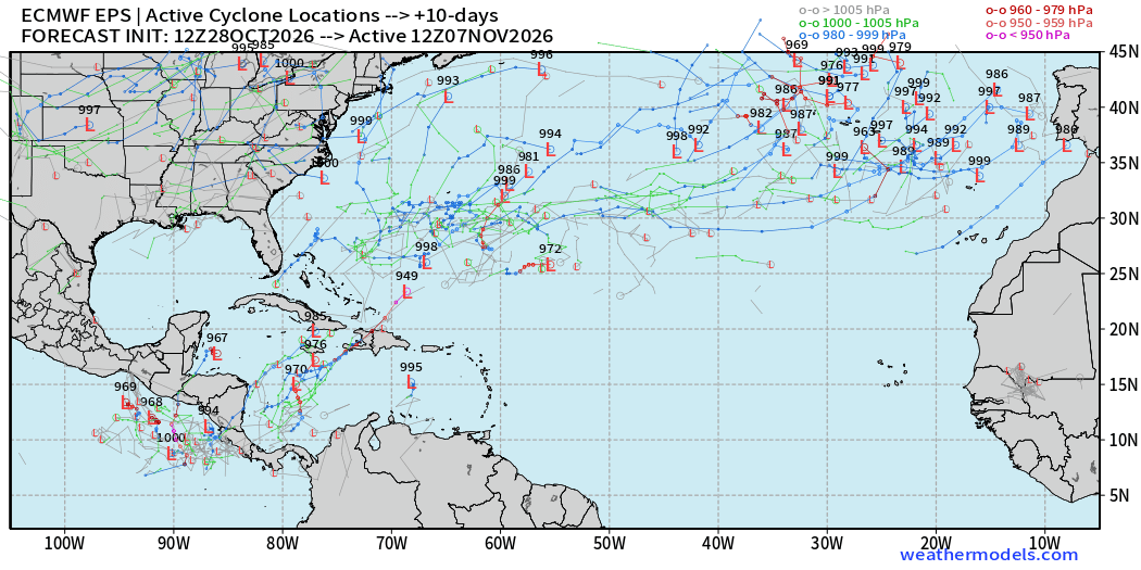
Still plenty of showers across the MDR but that area is dead for 2026. We’d need to look in the Caribbean or SW Atlantic.
IVT next 10-days | ECMWF AIFS
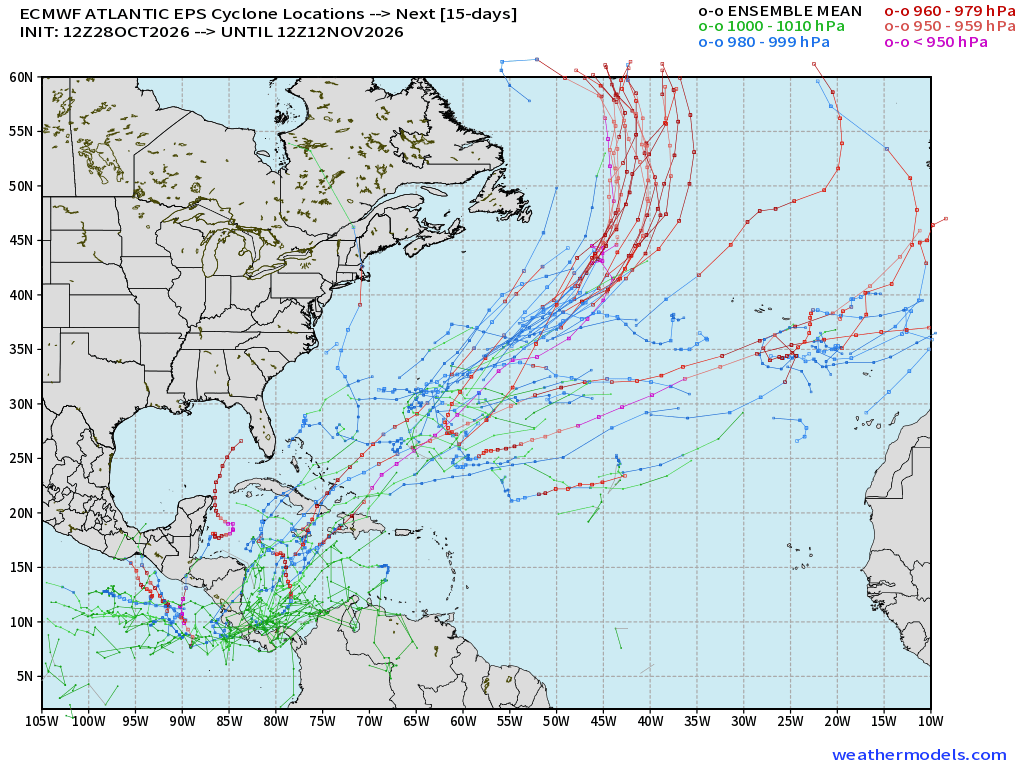
So, what’s going on with all of these hurricane tracks coming out of the southern Caribbean and around Central America? Timeline for these is 10-14 days. The red tracks in the mid-latitude > 40°N are “bomb cyclones” not tropical.
In 4-days we can see that strong “bomb cyclone” in the North Atlantic.
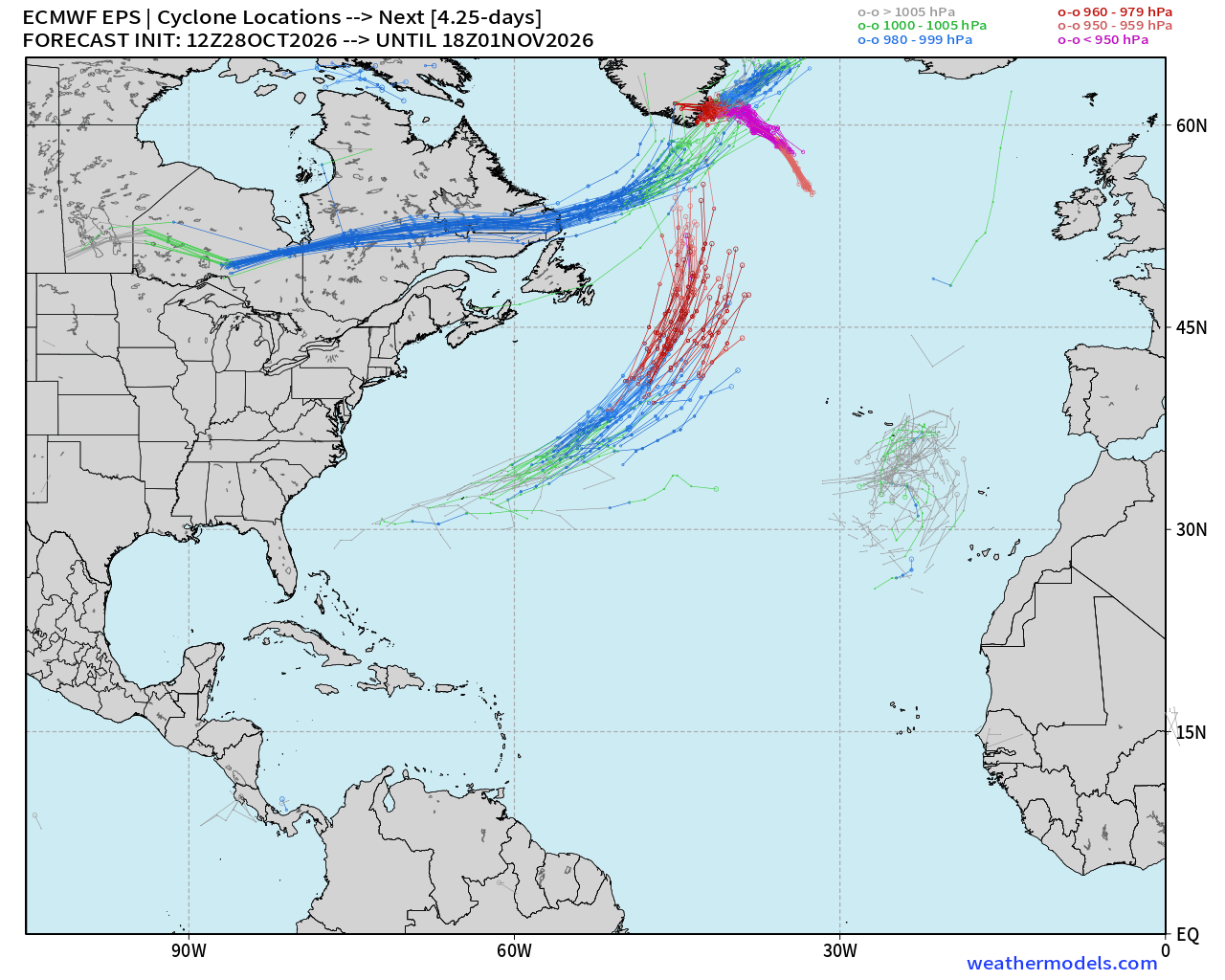
And, I cannot resist an opportunity to highlight this beautiful “bomb cyclone” east of Canada this weekend down into the 960s mb with 100-knot winds at 850 mb. This will look awesome on satellite imagery on Sunday.
And, at Day 10, there are quite a few —> as it 10% to 20% chance of development TS/Hurricane stretching from Pacific side of Central America into the Caribbean and then through Hispaniola. Worth watching for a few more days to see how these trend!
Eastern Pacific | Vance is a depression (tropical)
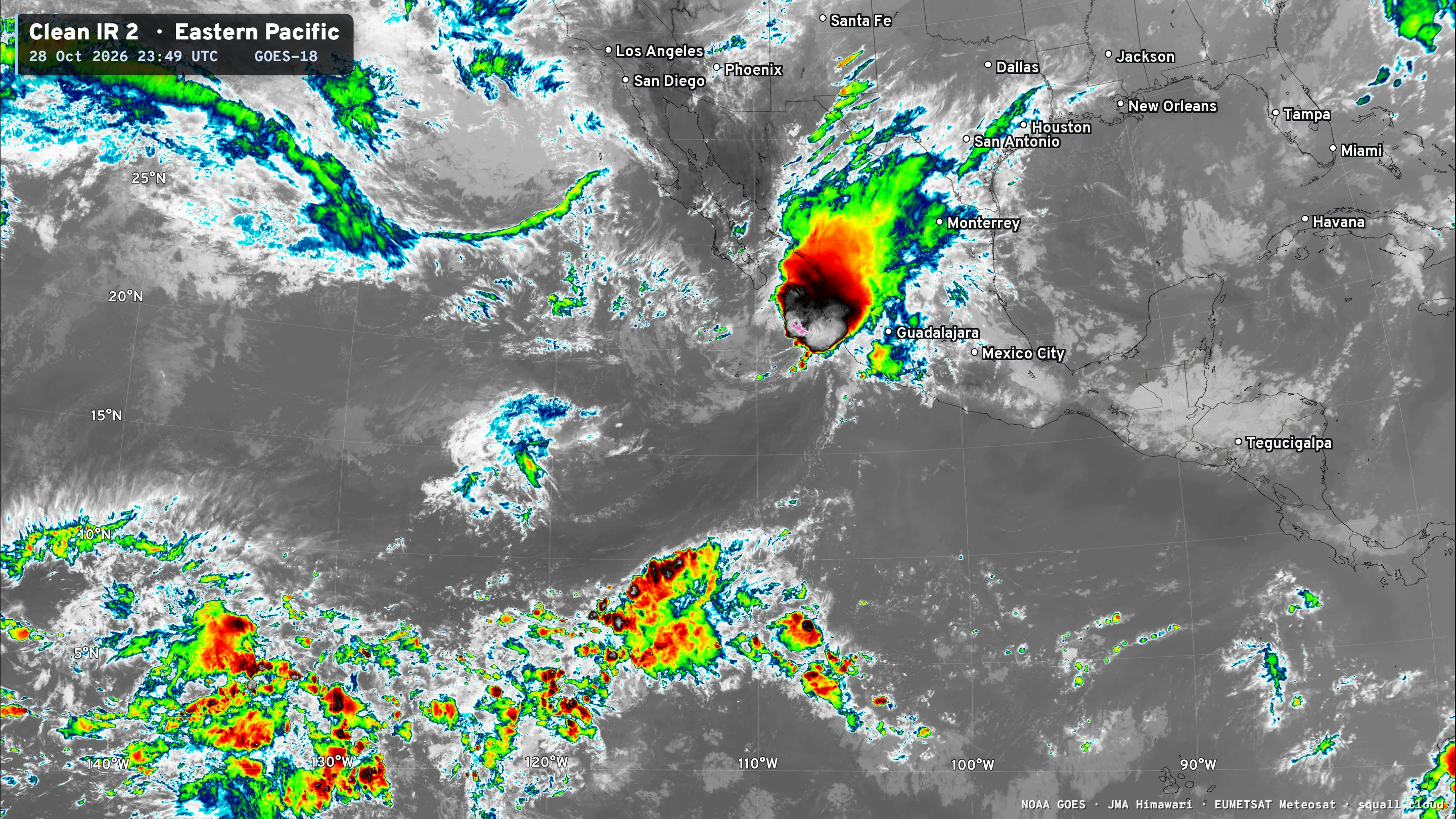
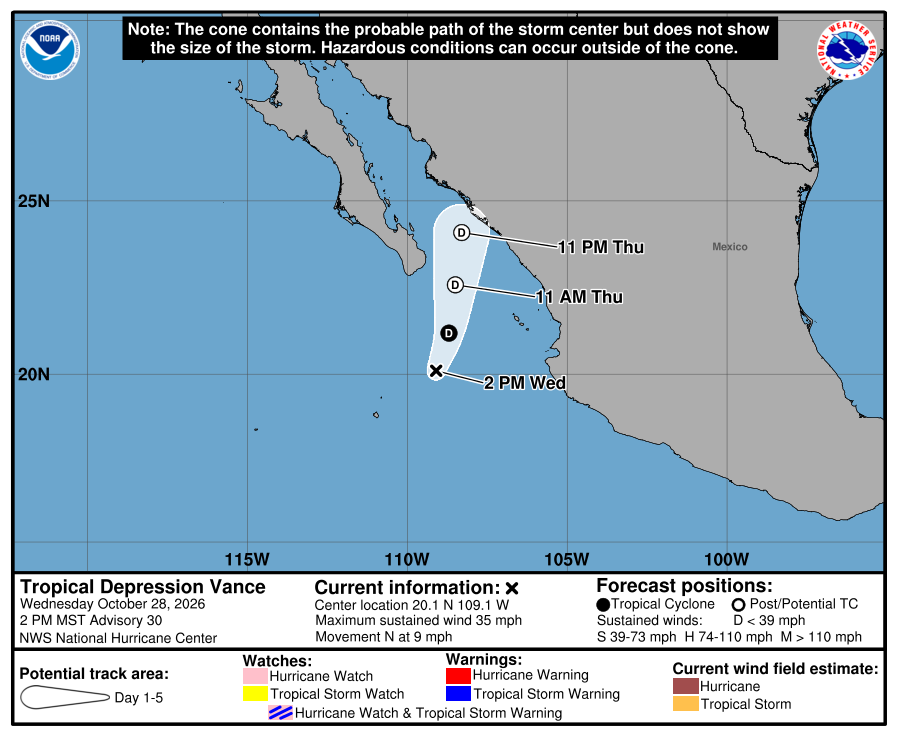
Vance should become post-tropical / weaken to a remnant low by Thursday
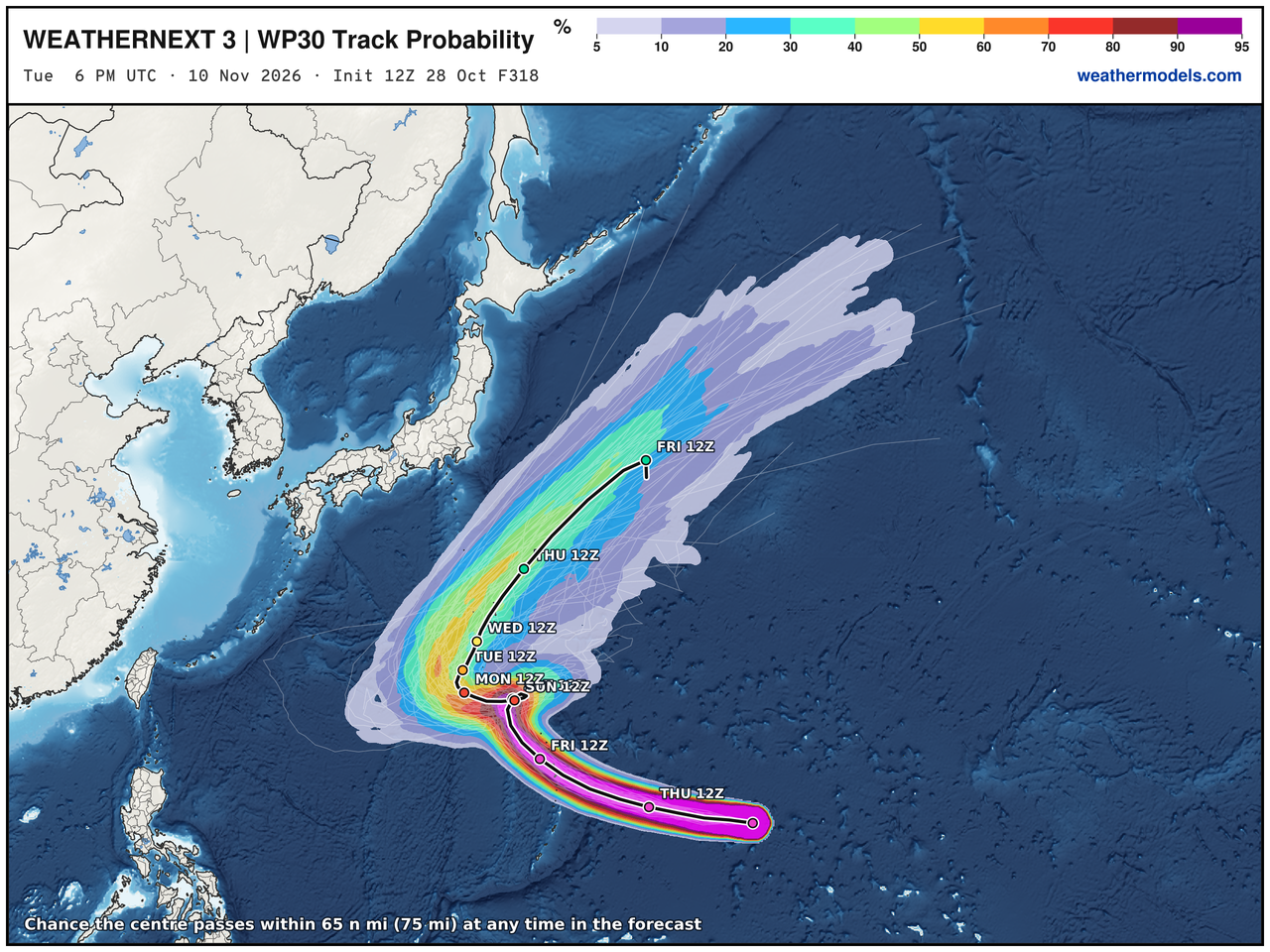
Western Pacific Typhoon Basin | Typhoon In-fa (30W)
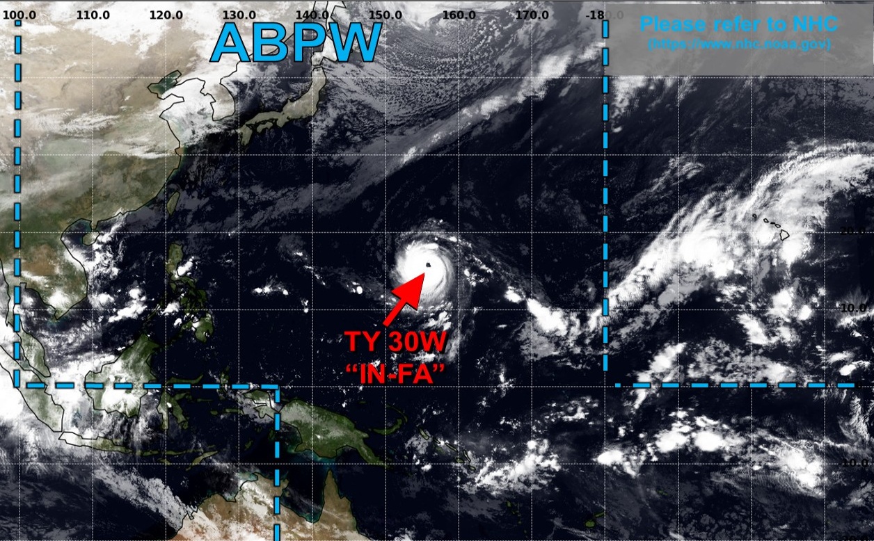
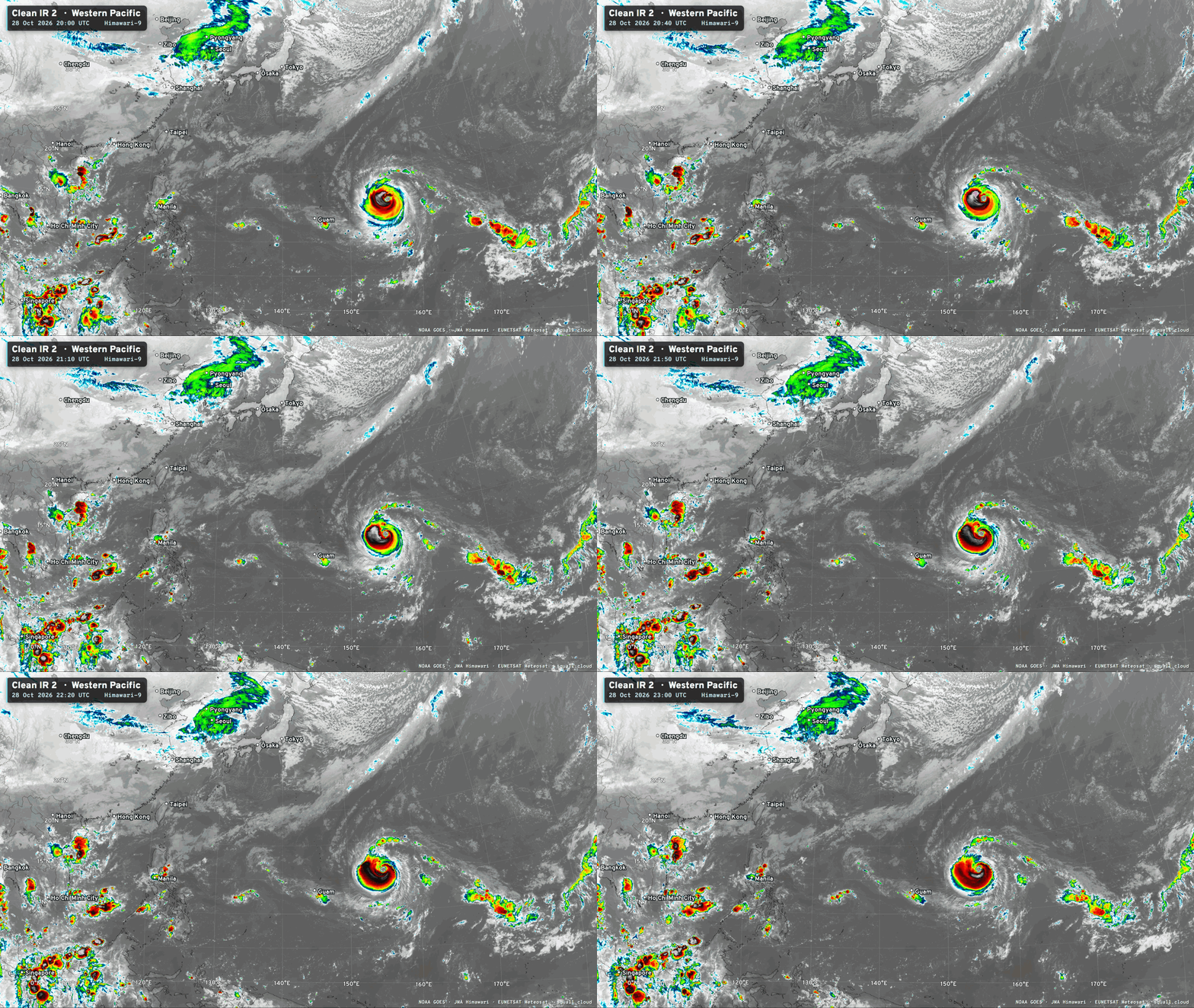
Awesome — annular (large eye) Typhoon In-fa peaked earlier at 130-knots and attained Super status, but didn’t do much better than that — with the Category 5 forecasts overblown.
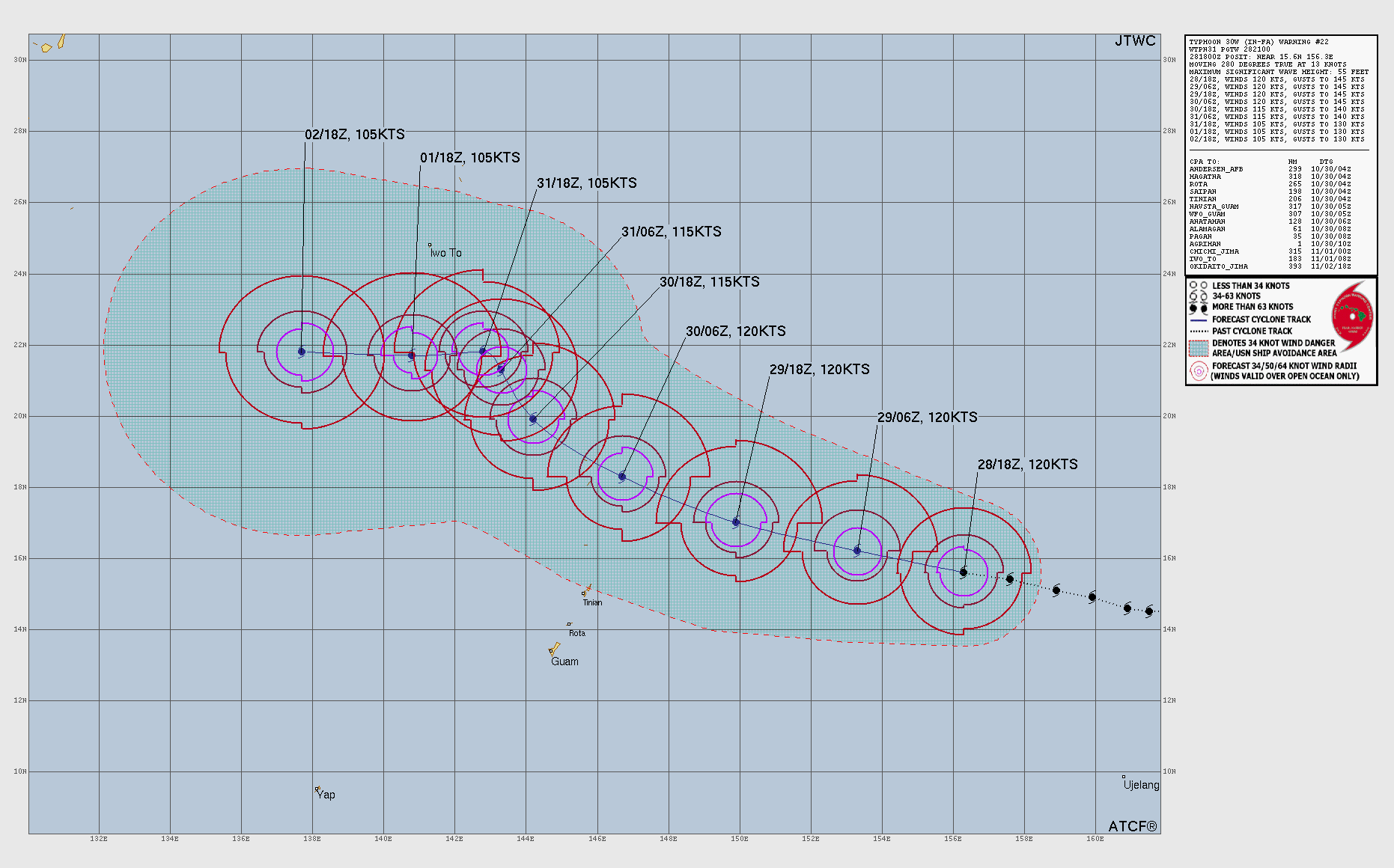
120 knots (Category 4) — JTWC analysis this evening
In-fa will do a little loop and then continue its recurvature out to sea East of Japan.
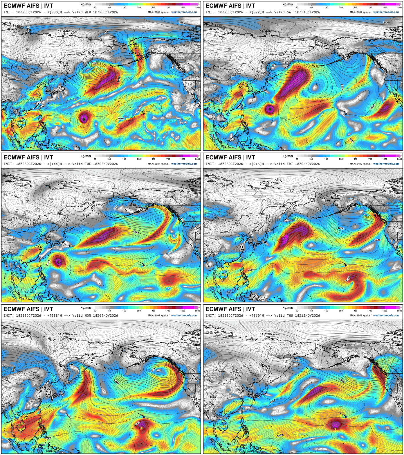
Large scale look of the North Pacific over 15-days — it’s all connected.
In-fa becomes a post-tropical cyclone and ends up bringing an atmospheric river to the U.S. west coast — one scenario, but the North Pacific storm track looks active into mid-November. Meanwhile, another tropical storm south of Hawaii?
Thank you for visiting / reading — always more to come!
Visit Global Tropical Cyclones w/Dr. Pielke Jr. for more ACE information, as well as my original climatlas.com/tropical site with much new research including a calibrated “Best Track” and historical tropical cyclone browser with plenty of interesting features like rankings of storms by their IKE (size). ACE up to 921

Satellite imagery from Squall Cloud. Maps sourced from weathermodels.com designed and innovated by yours truly! Please subscribe there for real-time access to the newest maps, charts from all of the weather models including ECMWF and AIFS, and NOAA GFS/GEFS, HRRR/RRFS and Blend of Models (NBM). NOAA WPC and SPC for fronts/convective outlooks. Our own content is now sourced from hottestsince.com and weather.city and celsius.earth, and global-tropical-cyclones.com and precip.earth and forecastcanada.com and forecastgermany.com
Atlantic Hurricane Season | YTD: 10 Named Storms, ACE = 19.5
NE Pacific Hurricane Season: YTD: 24 Named Storms, ACE = 355
My Atlantic Hurricane Season Forecast (2026)
From April 7, 2026: Atlantic Seasonal Hurricane Forecast: (11/5/2)
9-13 Named Storms (11 most likely)
4-7 Hurricanes (5 or 6 most likely)
1-3 Major Hurricanes (2 most likely)
Accumulated Cyclone Energy: 75-85 (well below normal)
NOAA 2026 Atlantic Hurricane Season Forecast
Previous in this storyline: Potential stratospheric polar vortex breakdown in early November would be unprecedented (OCT 26)
- Milepost
- 1632 · laid 2026-10-29T01:23:13Z
- Source
- https://weather.substack.com/p/october-28-2026-wednesday-weather · October 28, 2026 Wednesday Weather Update
- Tagged
- I-10 Stratosphere · Polar Vortex Watch 2026–27 · Arctic stratosphere (82, -40) · by rule, at build
- Digest
- 5bf09f5e6d25d8e36936d09c55222e906f0e433569caa16532a989bac641aff7