Remnants of Rachel will combine with upper-level trough to deliver heavy rain and snow to the Western US

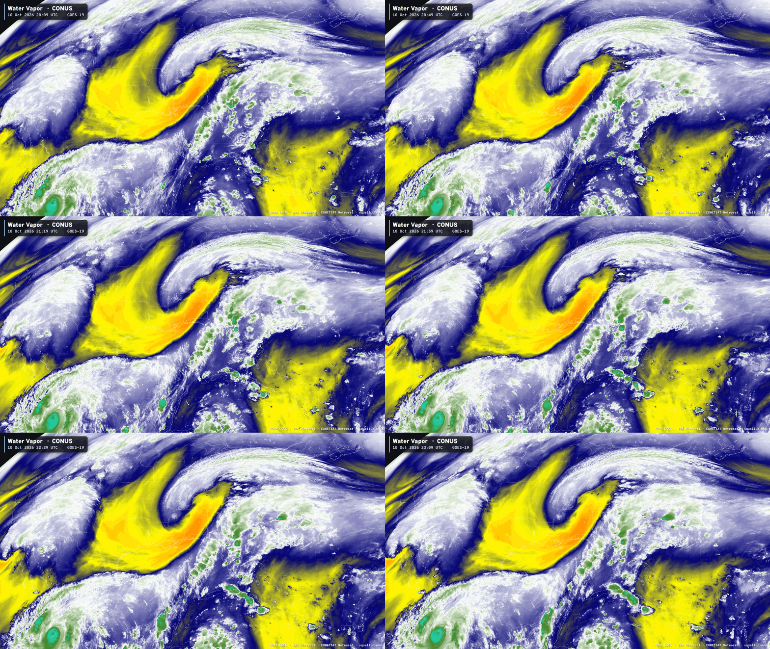
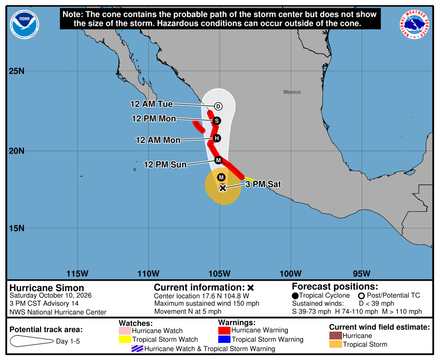
That’s Category 4 Hurricane Simon off the coast of Mexico, and to the north, merging with a cutoff low (trough) Tropical Storm Rachel.
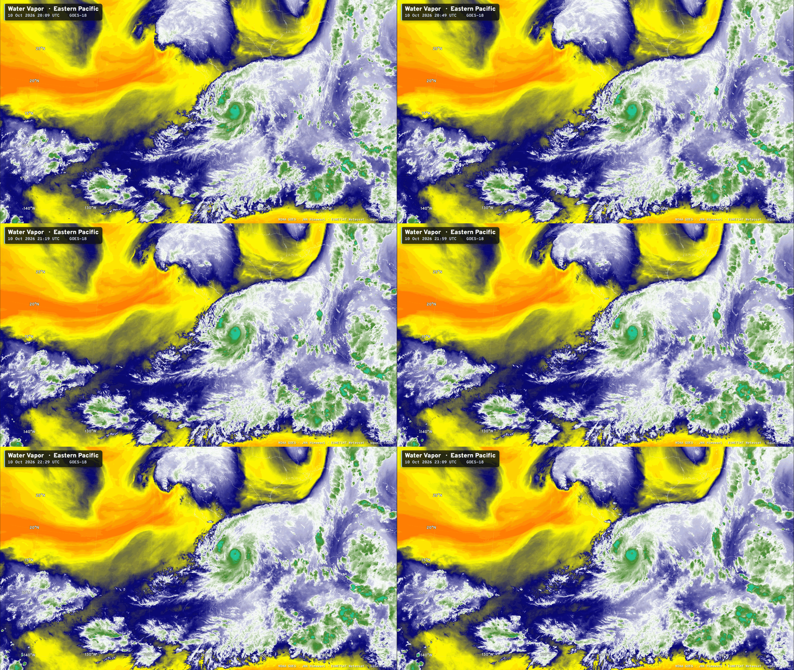
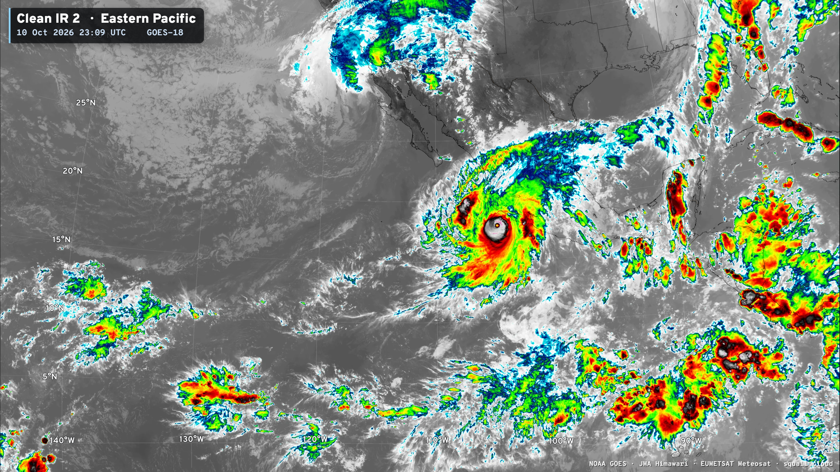
Hurricane Simon is very impressive, and may have briefly become Category 5 earlier this morning. Rachel nearing the coast of Baja California is asymmetric with convection and strongest winds away from the center — more fanned out like a Nor’easter than a tropical storm.
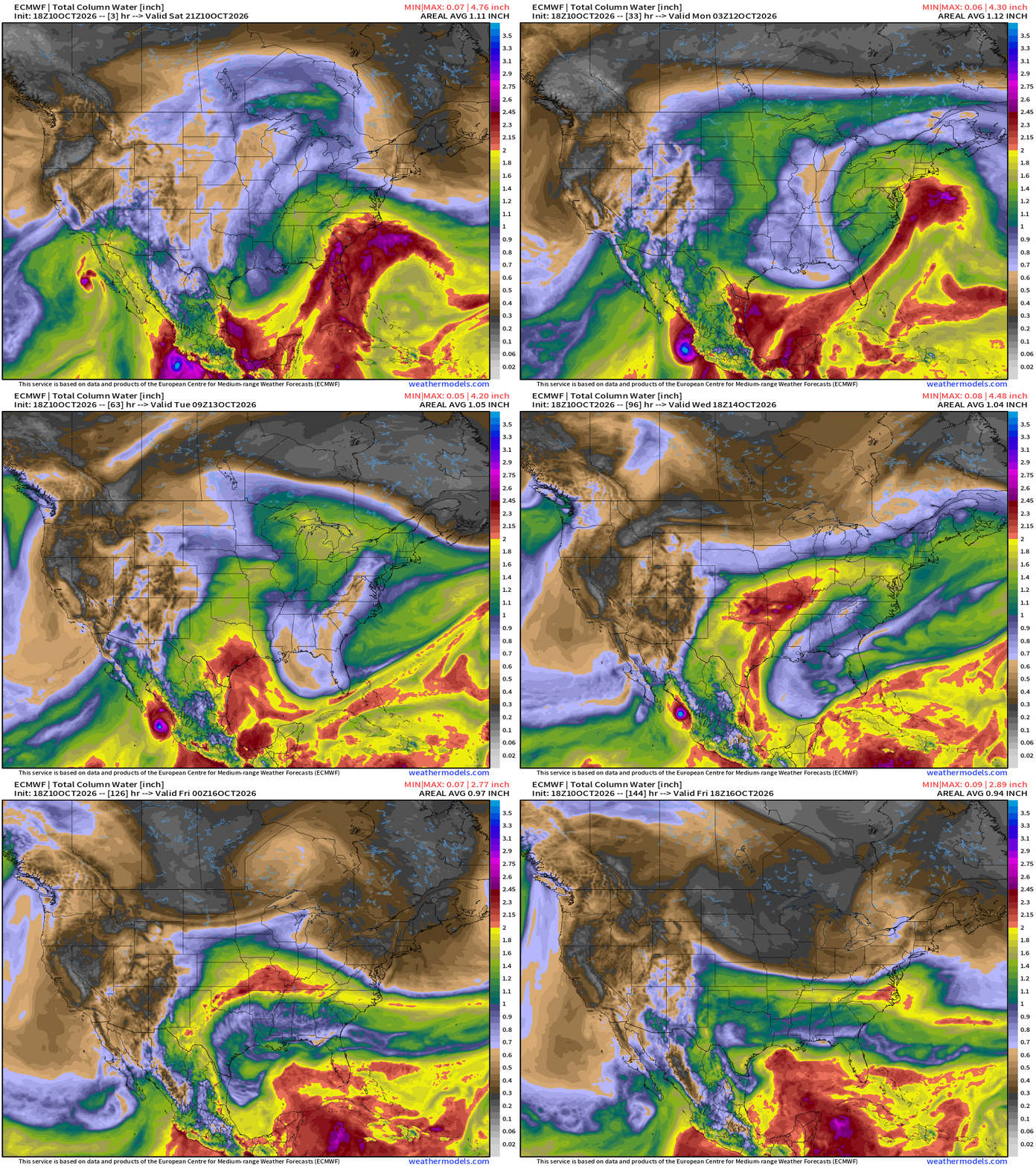
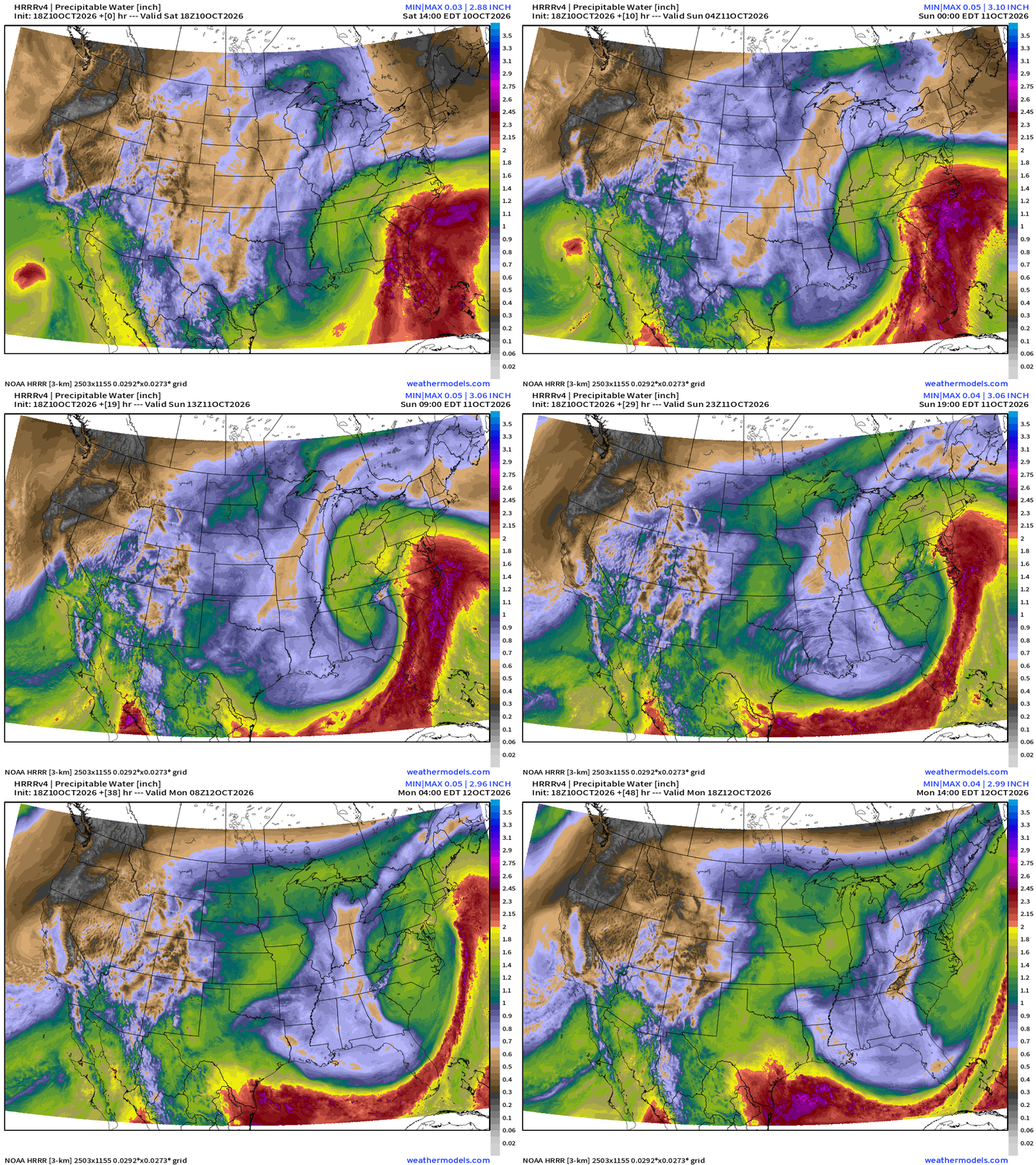
My Favorite Parameter | Precipitable Water Next 6-days
IR Satellite — Views from Squall Cloud | GOES-East
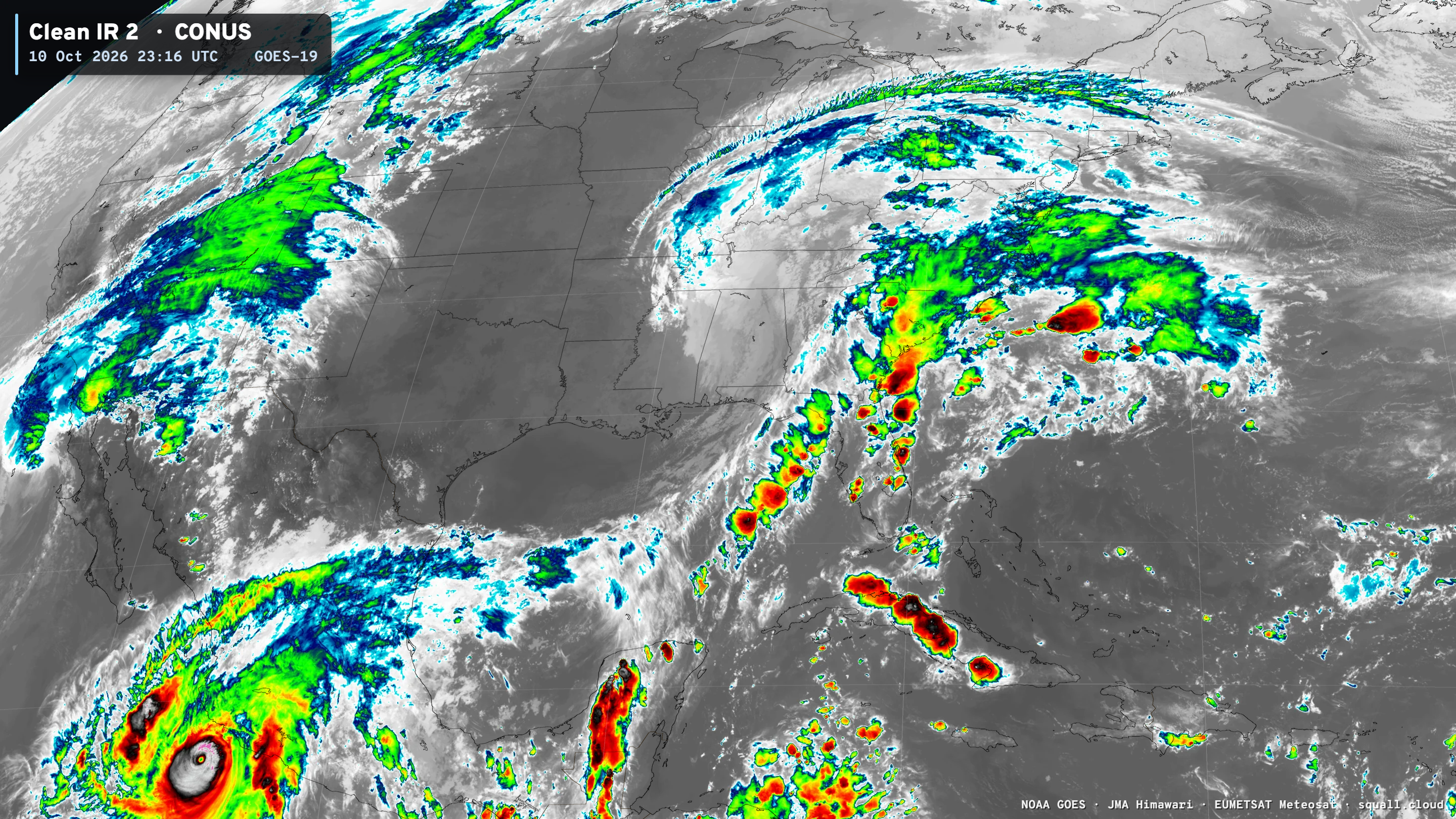
Significant storminess in the “warm sector” of post-tropical storm Isaias with thunderstorms bubbling up in Florida and into the Carolinas.
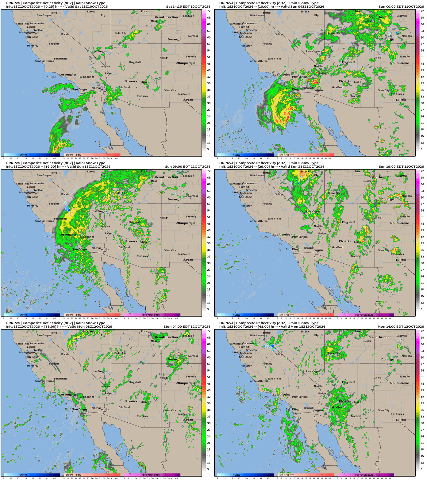
Next 48-hours Simulated Radar from old trusty HRRR | 18z
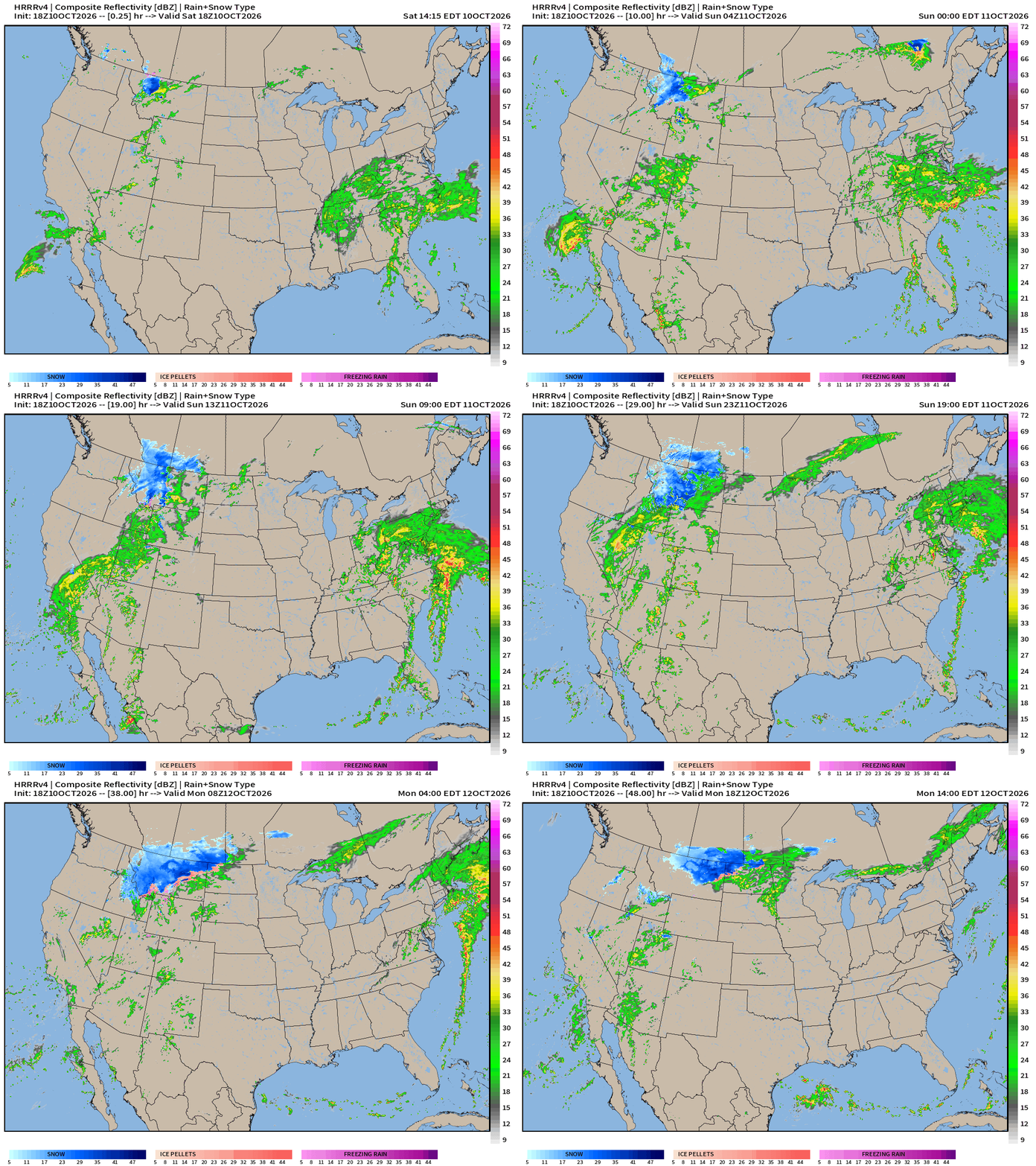
Two former tropical systems: Isaias and Rachel on each respective coast. Impressive rain totals across California and the Great Basin + heavy snowfall in Idaho and western Montana.
This is an unusual moisture feed and bypasses the Sierra that normally would capture most of the atmospheric river type moisture.
HRRR Precipitable Water next 48-hours is very cool to see Rachel zooming in from the Pacific over Southern California.
NDFD 3-day rainfall totals (Forecast Eagle maps)
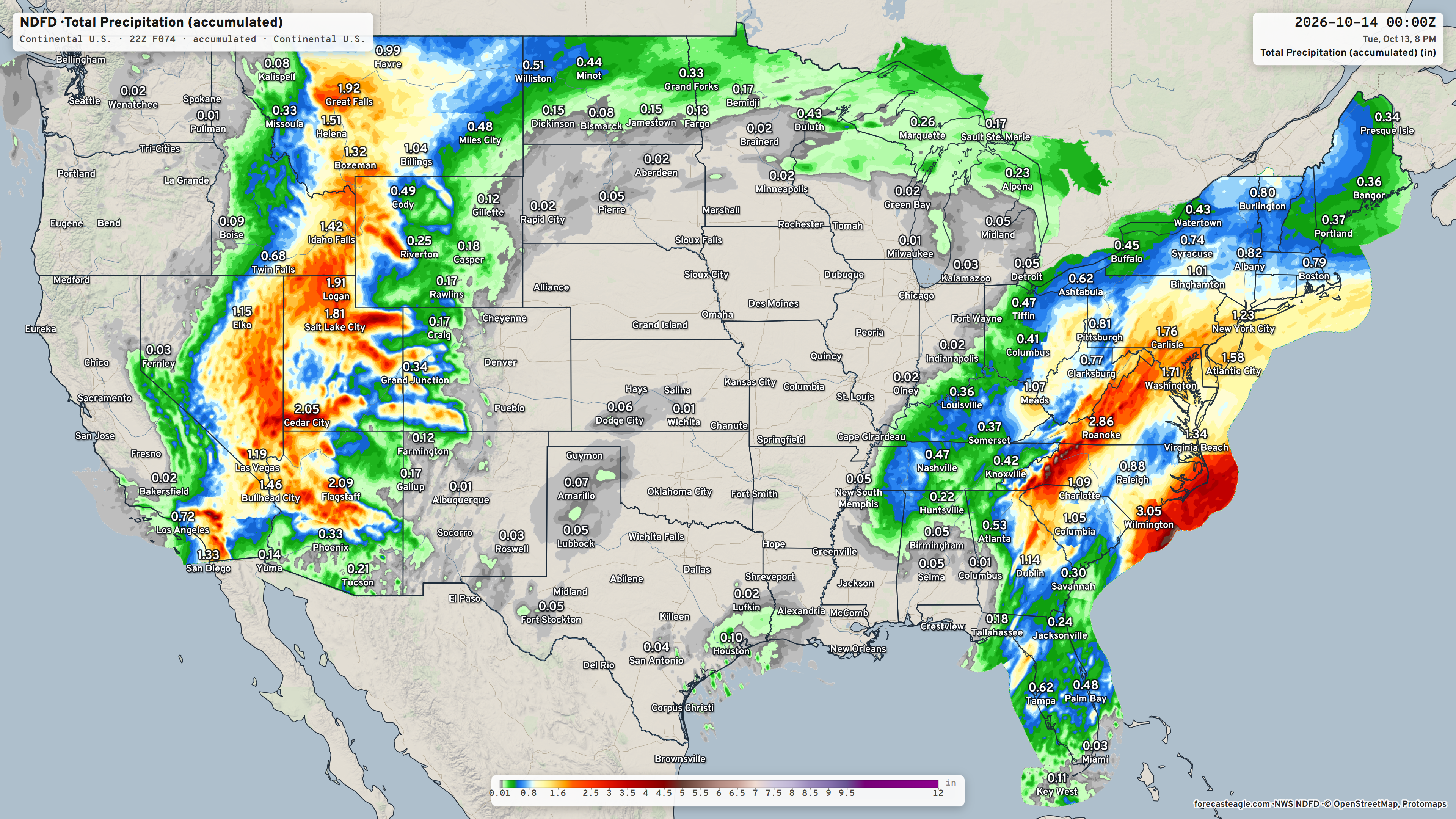
Those are huge rainfall totals including Death Valley, Las Vegas, SLC, Flagstaff, and northward (snowfall) into Montana and Idaho.
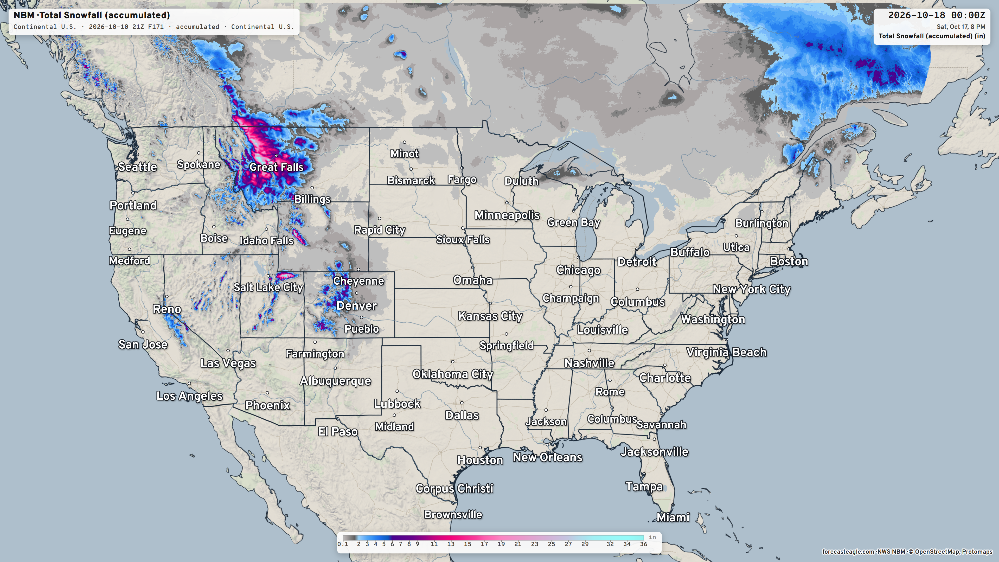
Snowfall Next 3-days —> Whoa! That’s more than foot in Great Falls, Montana
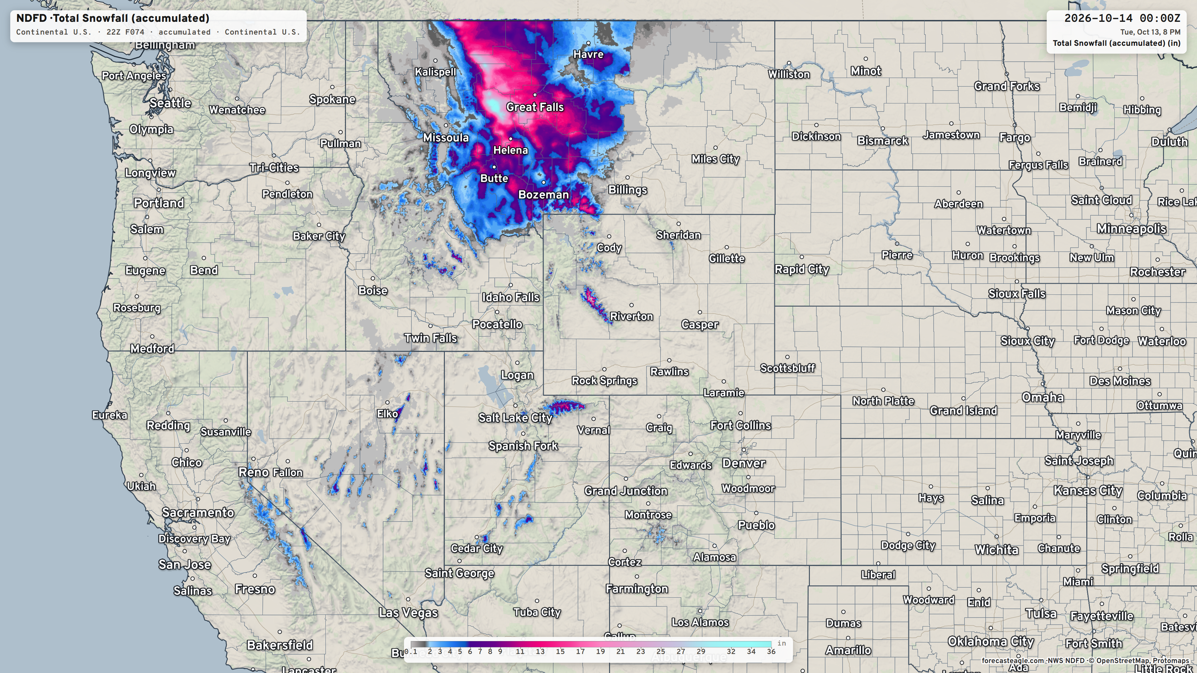
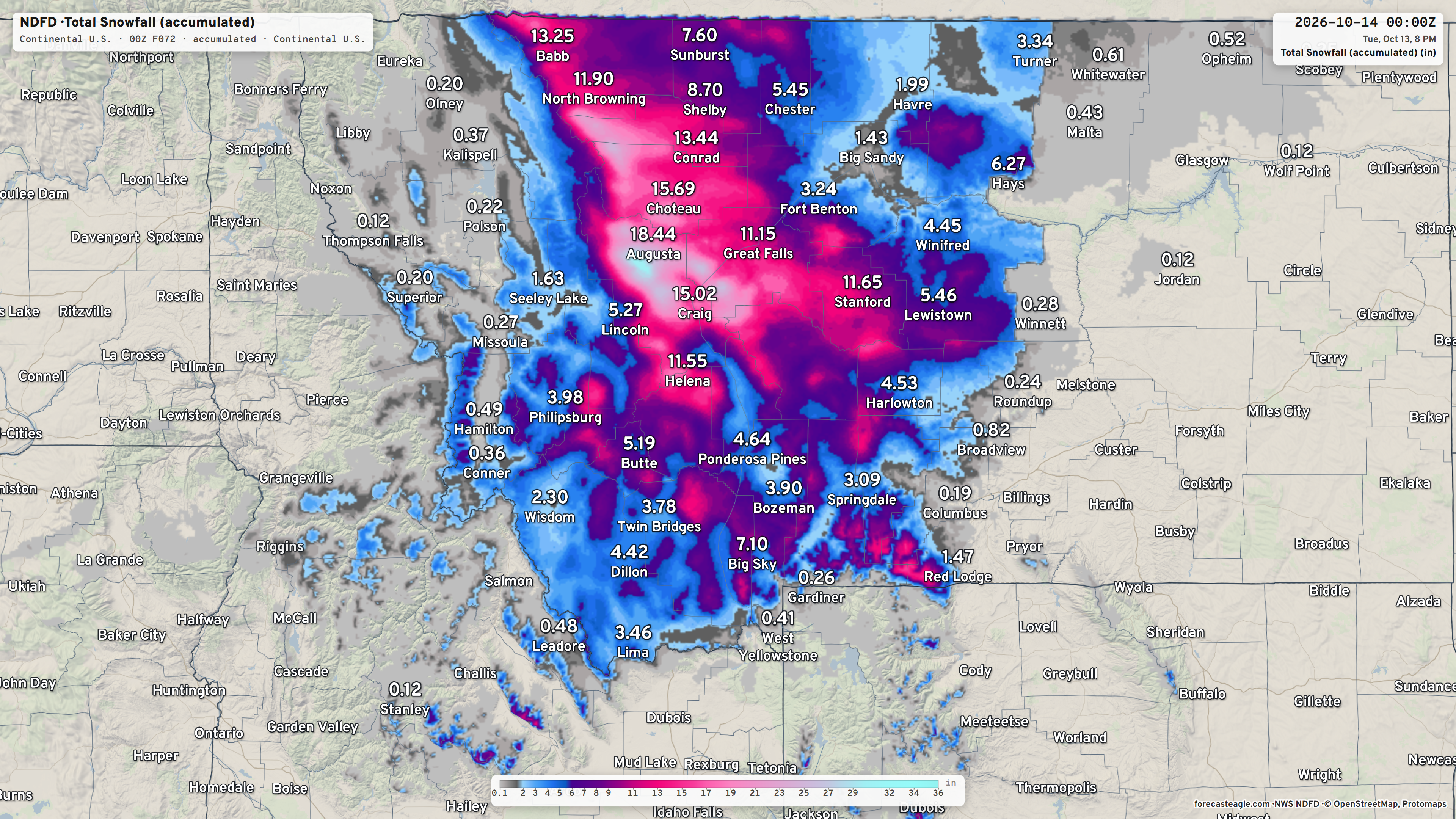
(fixing the decimals on the maps for snowfall — to tenths, I don’t imply that we have this level of precision)
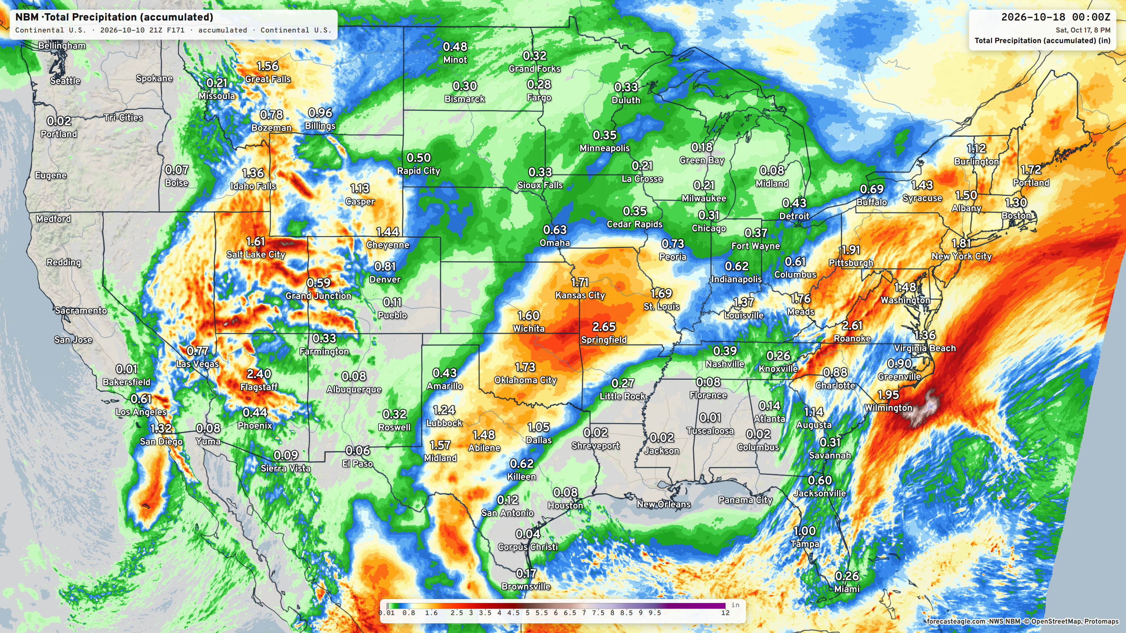
7-day Total Rainfall Blend of Models from Forecast Eagle
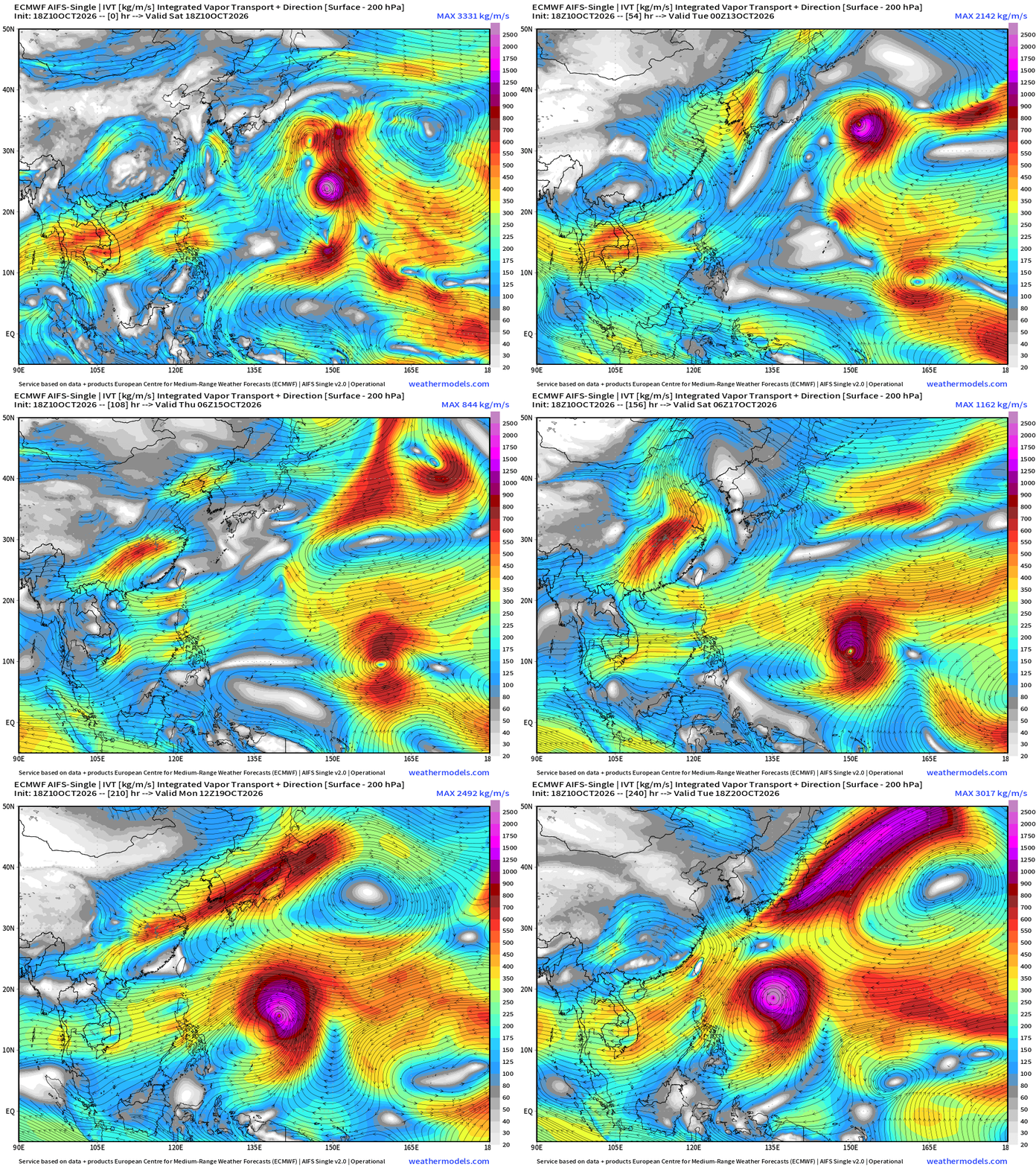
Integrated Vapor Transport Next 10-days | AIFS 18z Flagship Model
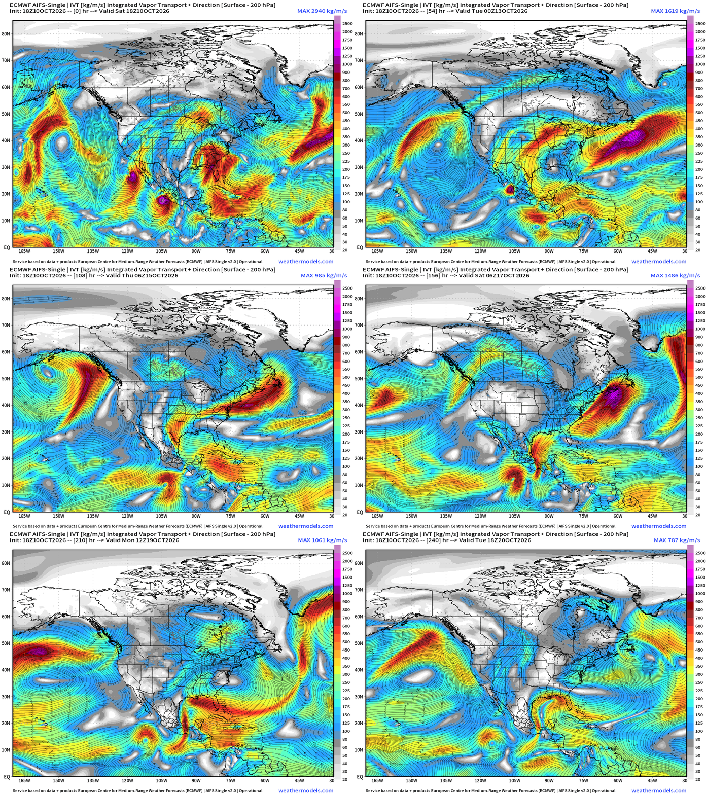
Some saying on X that we may repeat the Simon/Isaias development from last week, as another system in the Eastern Pacific (Trudy) could spin up. But this time there is gap flow from north-to-south through the Gulf across the Tehuantepec Gap, the opposite direction as needed to create low pressure in the Gulf. A tropical wave out of the Caribbean could server as the low-pressure whirl/swirl to get things started, but nothing imminent.
Height Anomaly next 10-days | AIFS 18z
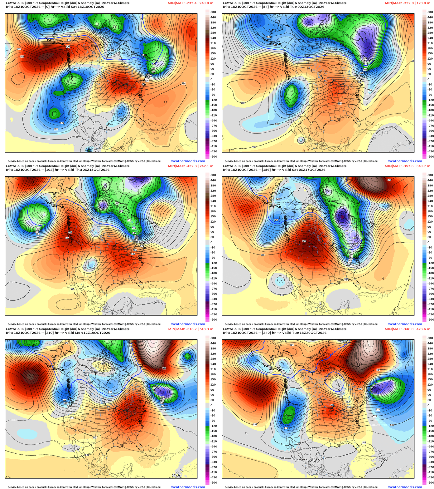
Upper-level pattern is much more progressive heading into mid-October across North America. Mobile troughs/shortwaves + ridges operate on 2-3 day time scales, and we have changeable weather = more exciting. With transition to cold season in the Arctic and Canada, we’ll start seeing more mountain snowfall.
Week 1 Temperature Anomaly
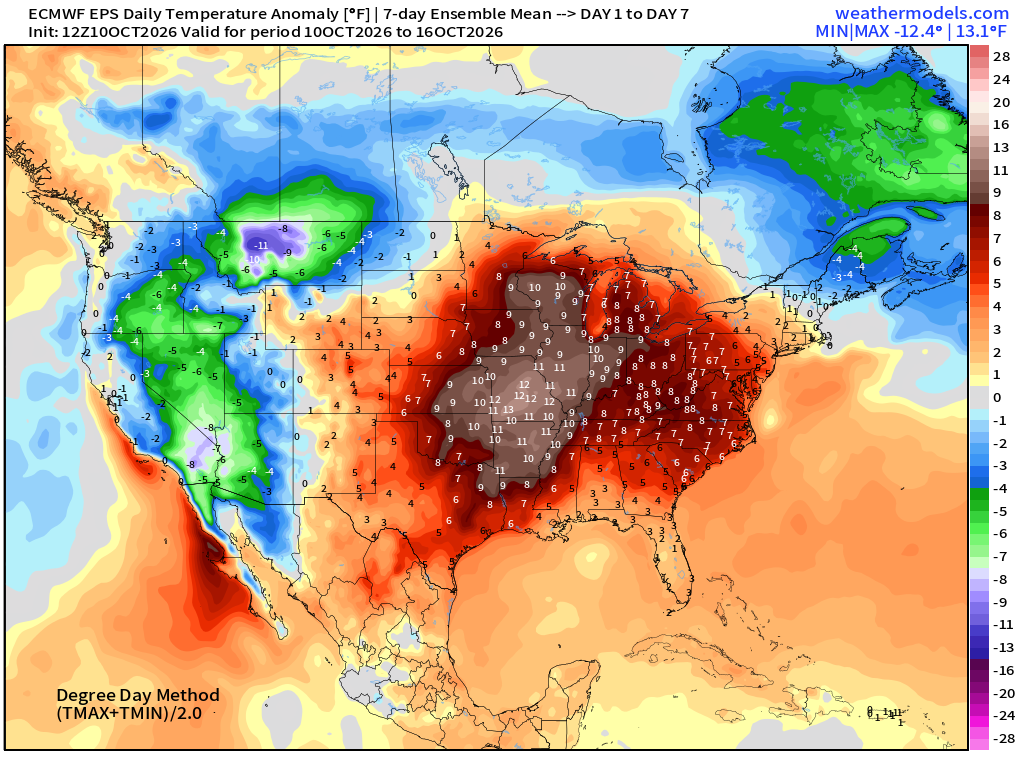
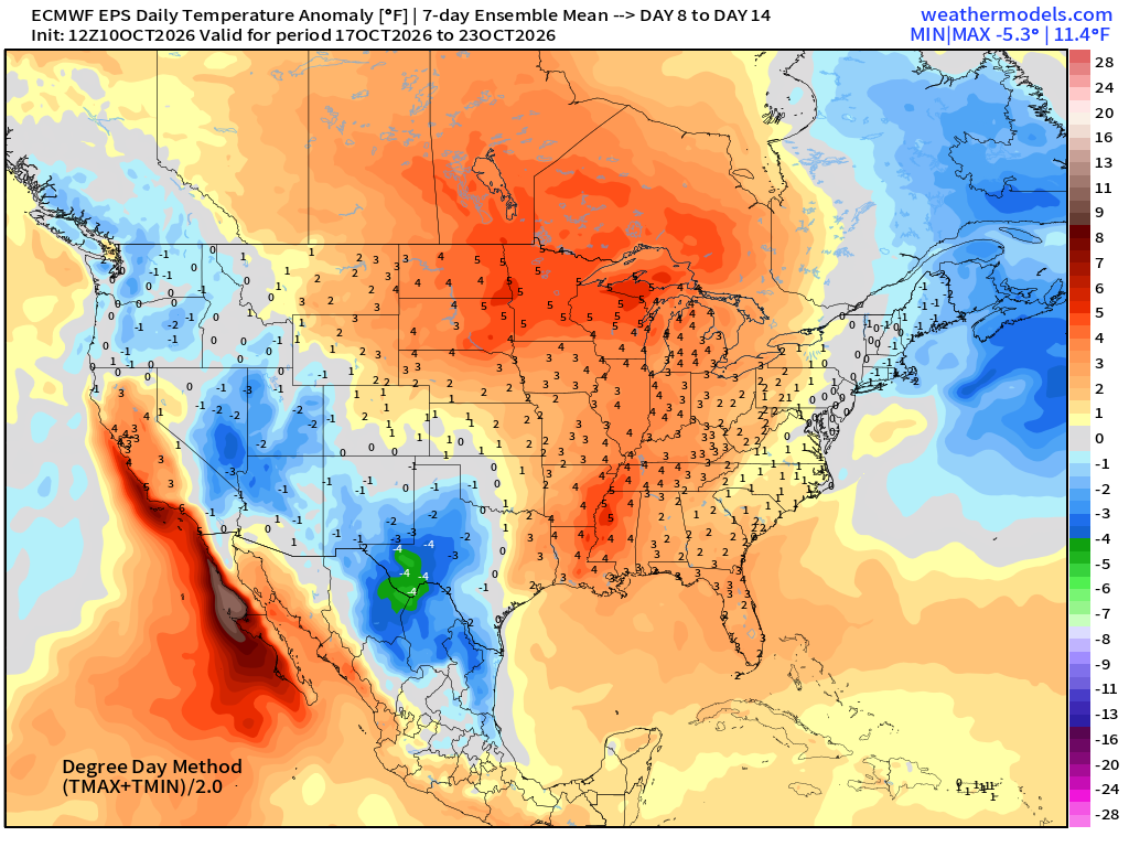
Western Trough —> cool and even snowy in the northern Rockies, very warm in the central and eastern U.S. (at least relative to mid-October)
Week 2 Temperature Anomaly
Saturday Evening in the Tropics | Atlantic Tropical Outlook
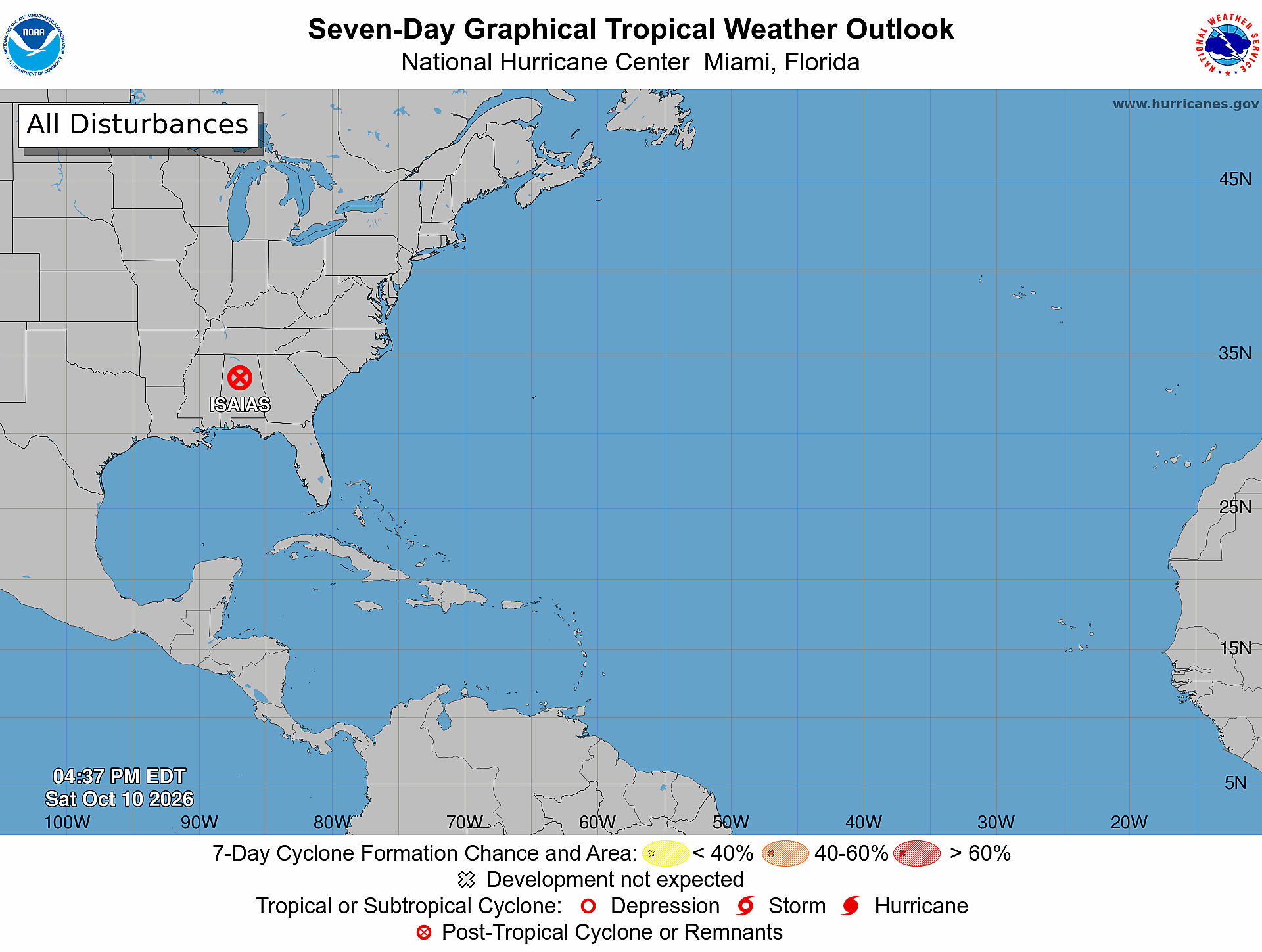
Isaias became post-tropical, and no other activity expected in the next 7-days
Atlantic Satellite
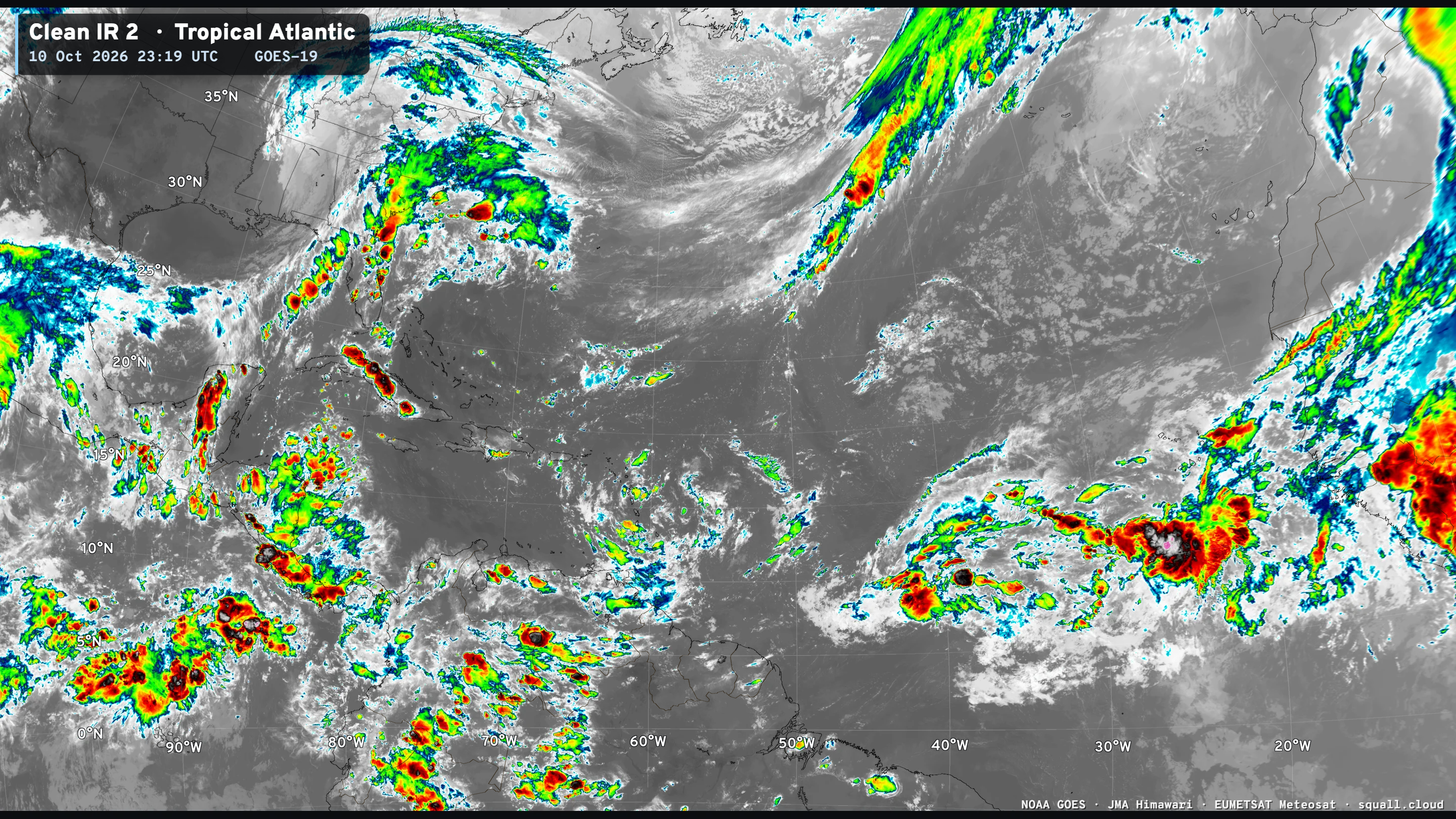
Some active convection with a tropical wave in the eastern MDR, and the ECMWF EPS tracker picks it up, so perhaps this could be a surprise tropical depression?
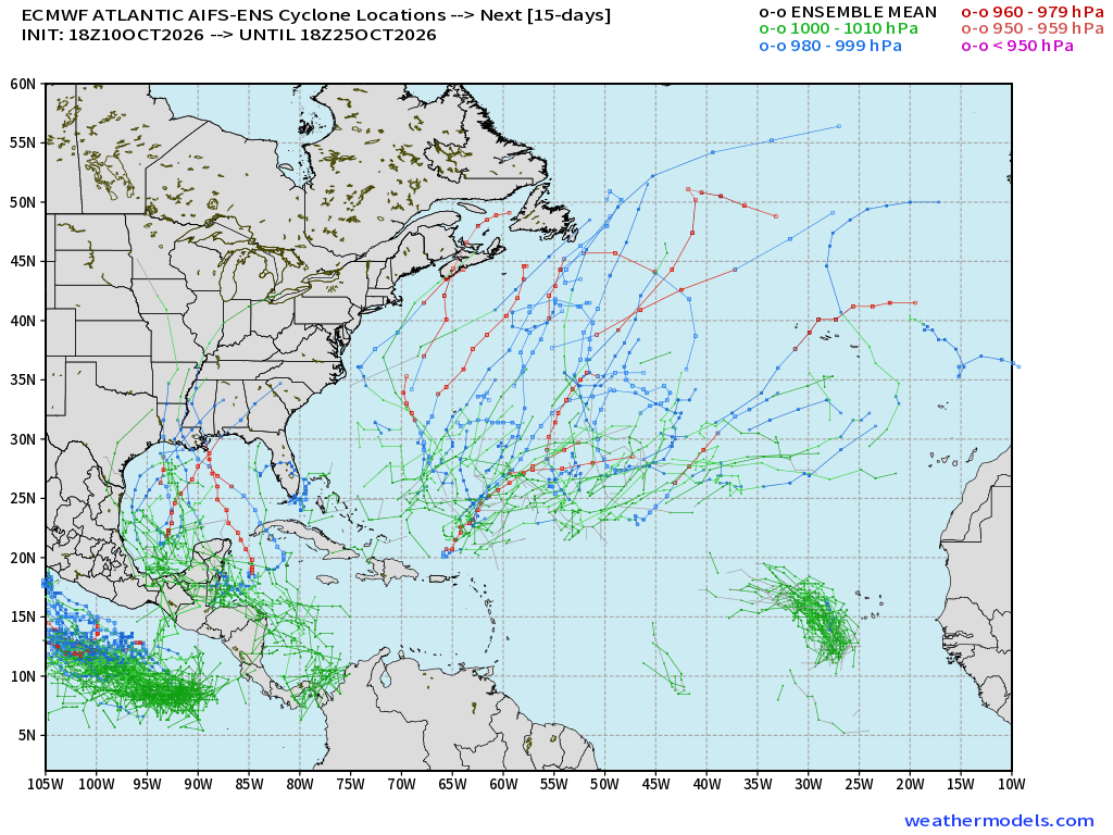
ECMWF Ensemble 12z full-physics tracks next 15-days
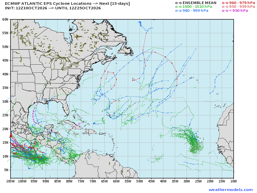
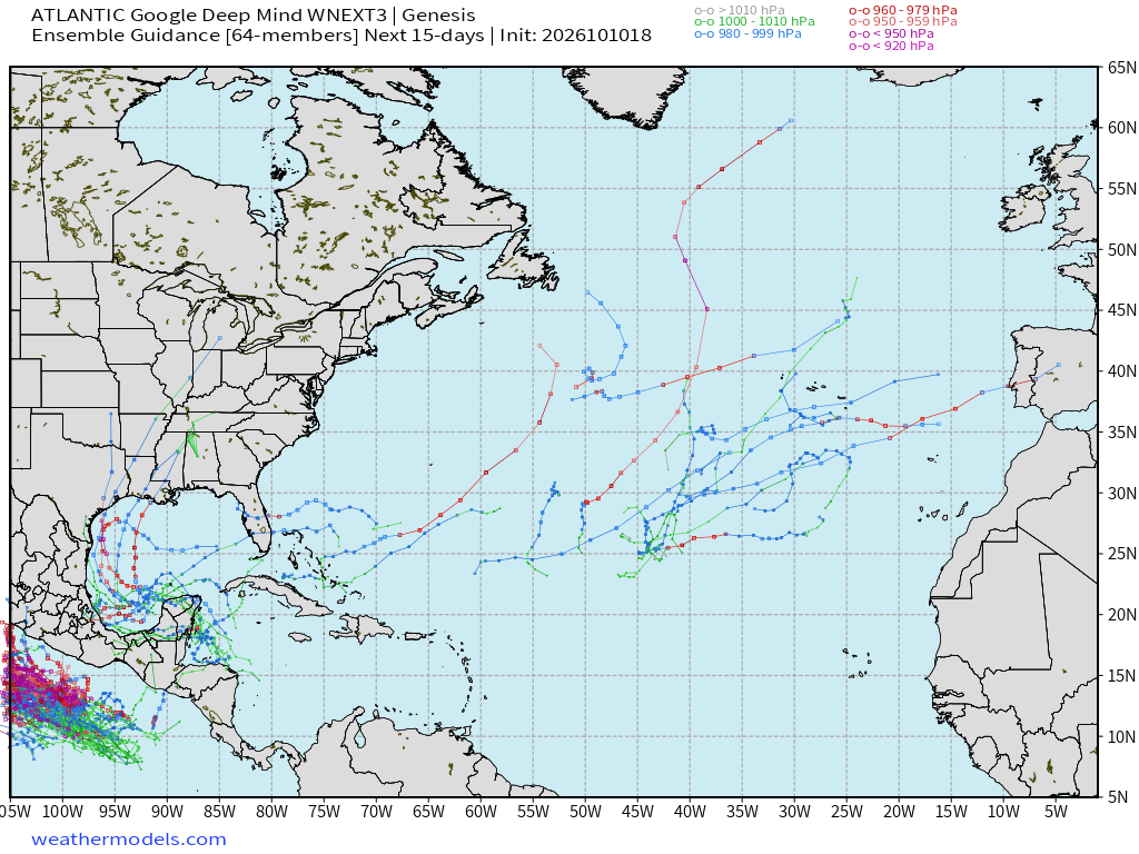
Only a few tracks in the Gulf/Caribbean —> not the signal we saw 7-10 days prior to Isaias. The 18z AIFS Ensemble tracks (15-days) has more weak tracks picked up around Central America w/tropical wave, but only a few become a hurricane = low chance / nothing imminent. Not sure what all these tracks are across the open central Atlantic, but it’s busy — so maybe a subtropical development?
Google Deep Mind | Weather Next 3 | 18z Tracks (64-members)
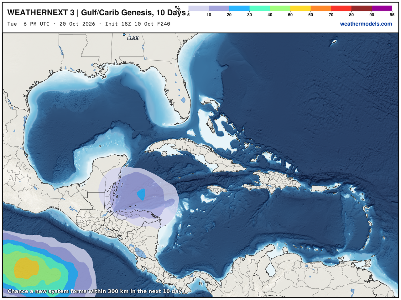
Handful of tracks in the western Caribbean and Gulf, and the genesis shows > 20% chance of development through 10-days.
Eastern Pacific Tropics
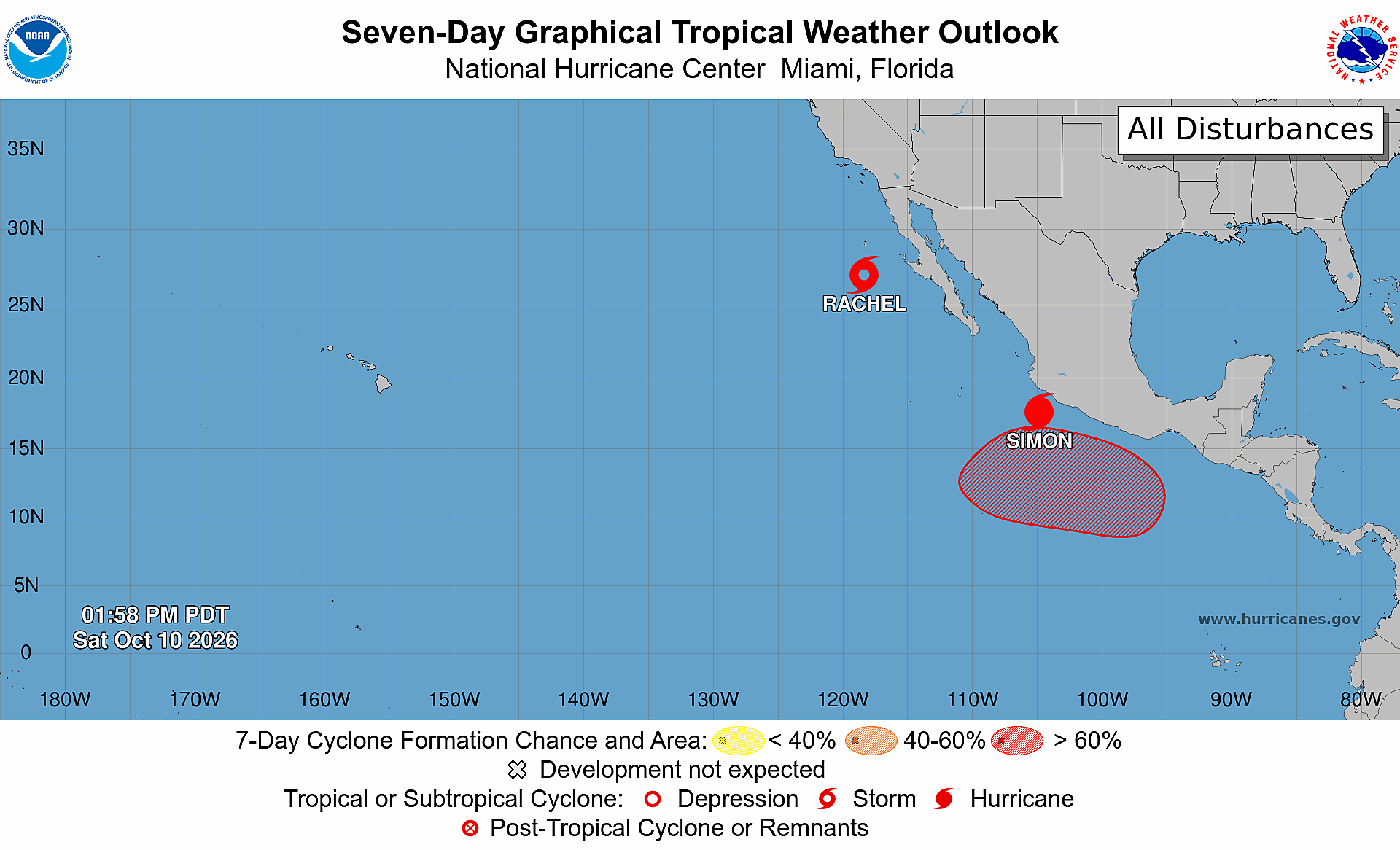
Next storm is Trudy … and could come online later next week.
Tropical Storm Rachel — still sort of tropical but asymmetric interacting with trough
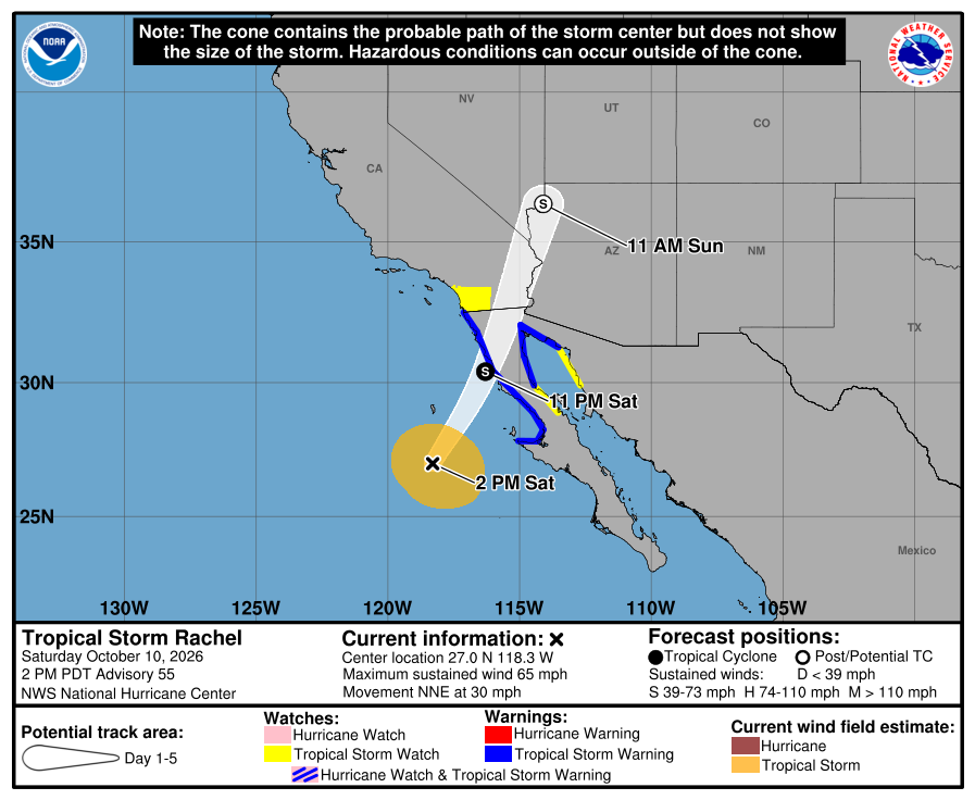
Rachel should become post-tropical before/upon landfall soon.
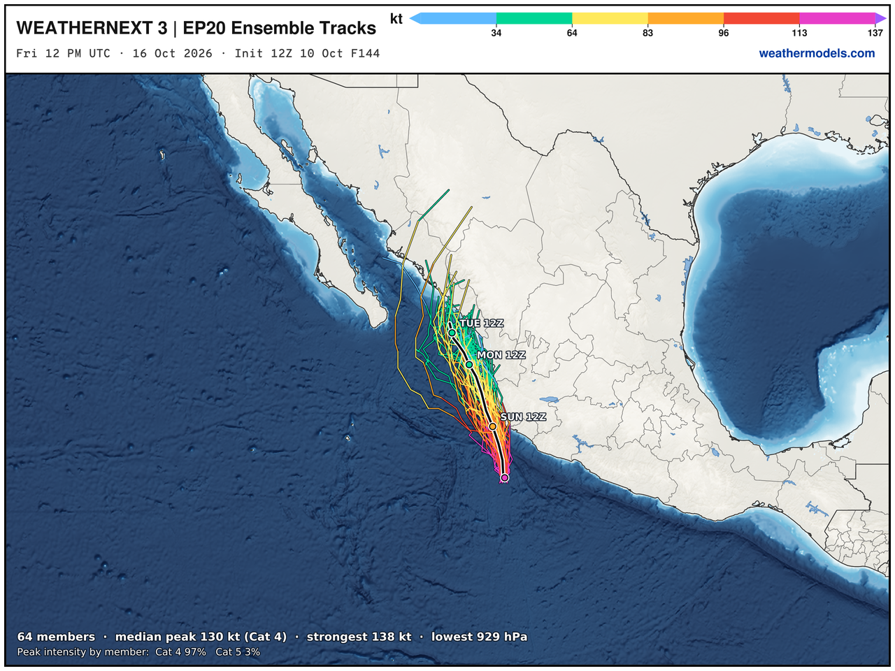
Category 4+ Hurricane Simon
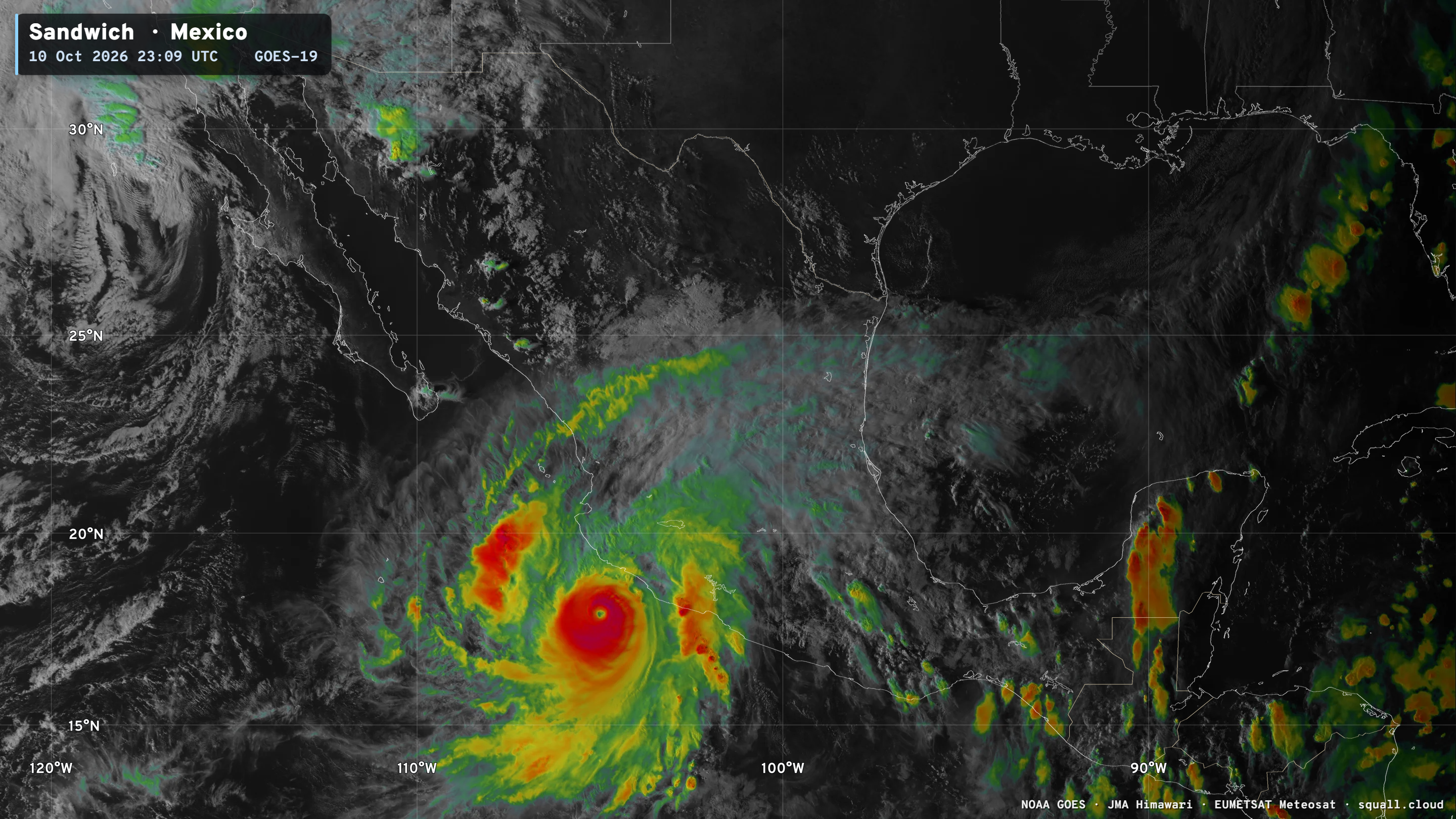
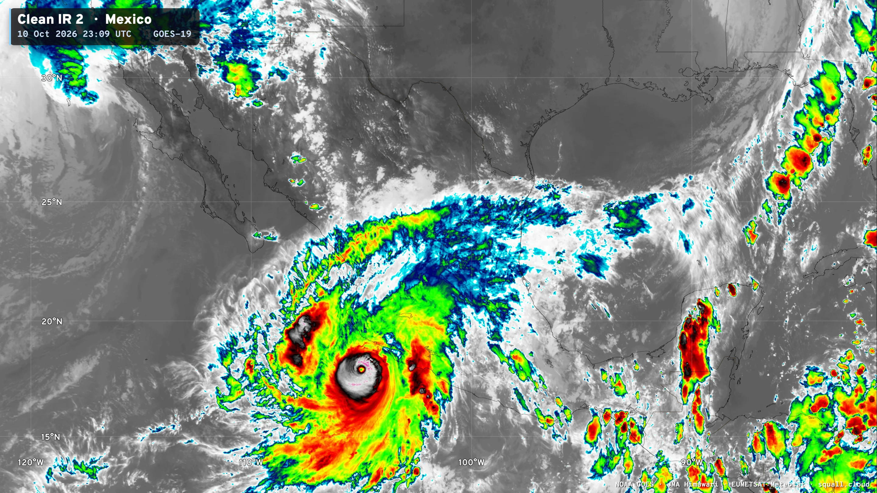
A clearer eye would mean Category 5 — not quite!
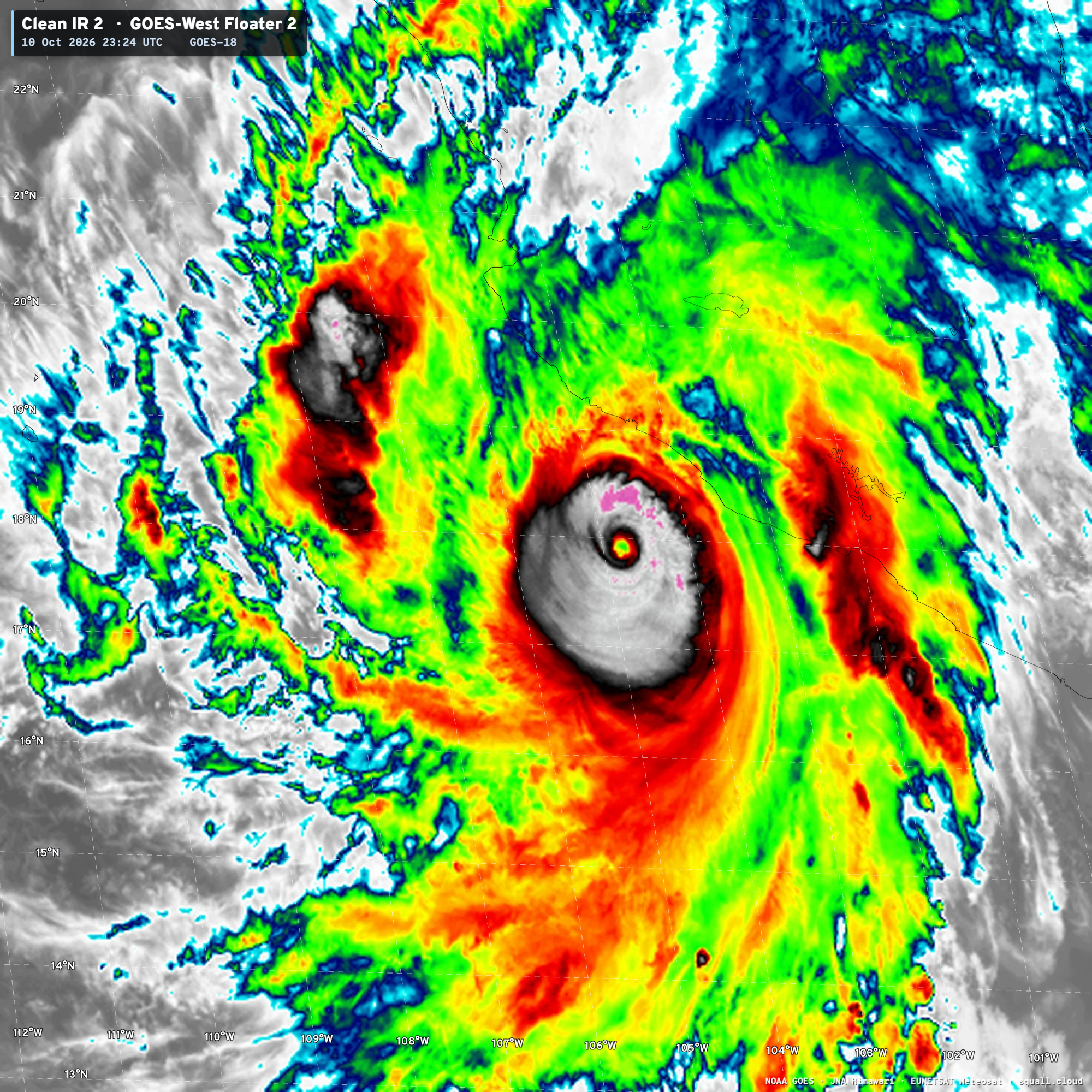
Landfall mid-day Sunday as a Category 4 into Mexico.
Western Pacific Tropics
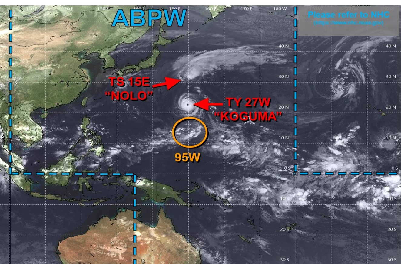
Category 4 Typhoon Koguma — 120 knots
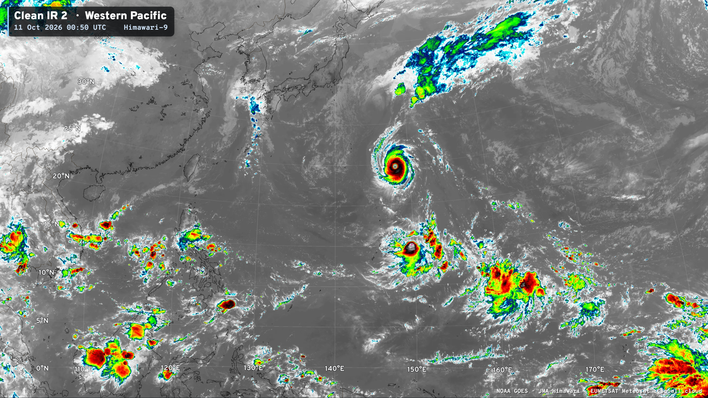
Koguma recurves away from Japan over the next few days.
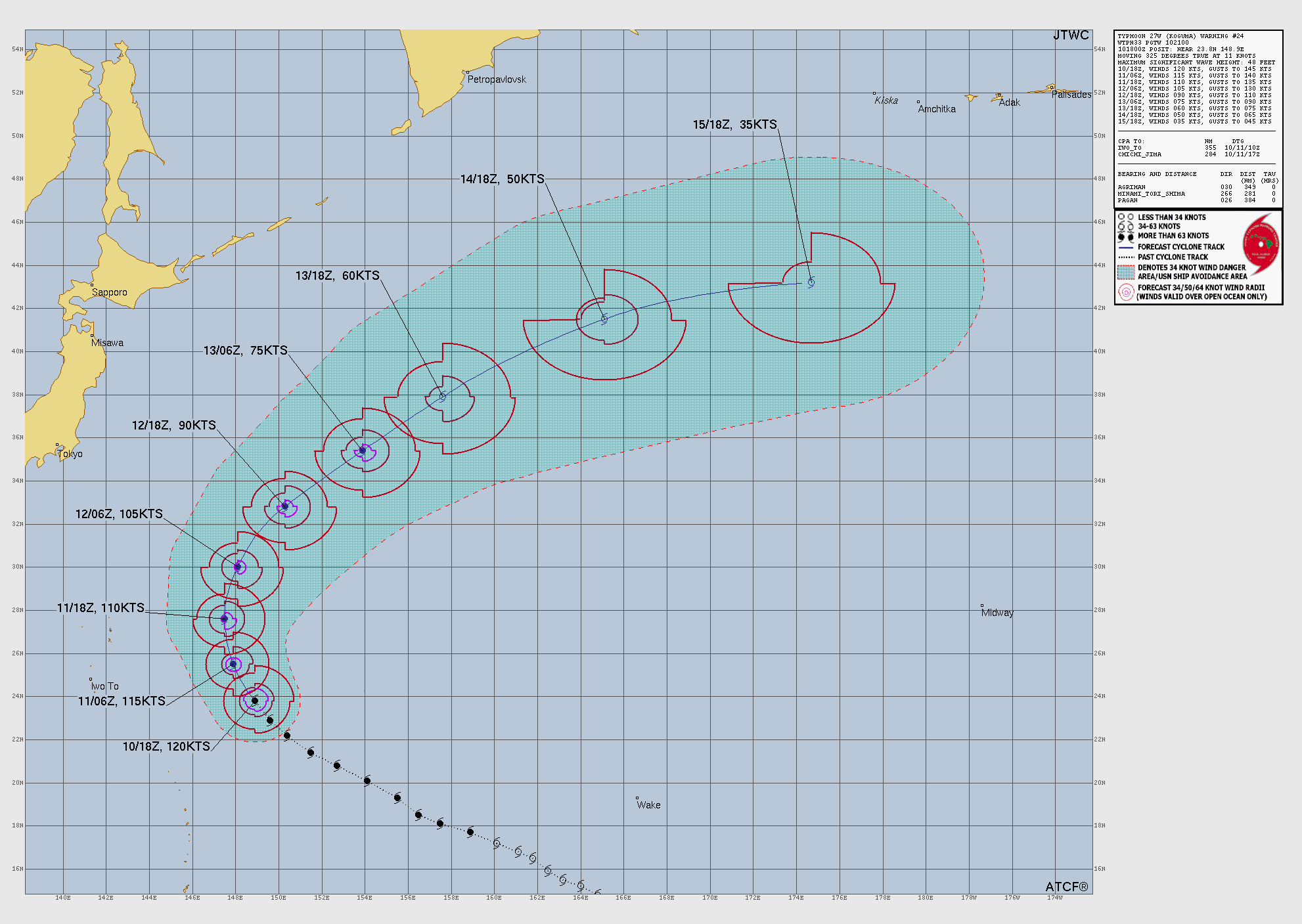
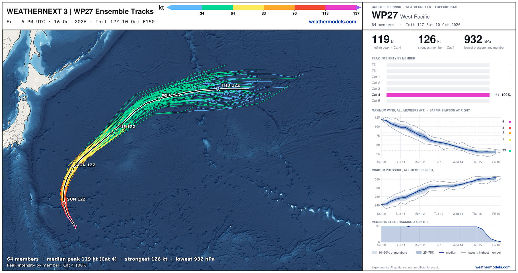
Another typhoon forms in a few days … and we continue onward with this Super El Niño.
Visit Global Tropical Cyclones for more ACE information, as well as my original climatlas.com/tropical site with much new research including a calibrated “Best Track” and historical tropical cyclone browser with plenty of interesting features like rankings of storms by their IKE (size). ACE up to 794.

Satellite imagery from Squall Cloud. Maps sourced from weathermodels.com designed and innovated by yours truly! Please subscribe there for real-time access to the newest maps, charts from all of the weather models including ECMWF and AIFS, and NOAA GFS/GEFS, HRRR/RRFS and Blend of Models (NBM). NOAA WPC and SPC for fronts/convective outlooks. Our own content is now sourced from hottestsince.com and weather.city and celsius.earth, and squall.cloud and weather.football and global-tropical-cyclones.com and precip.earth and forecastcanada.com
My Atlantic Hurricane Season Forecast (2026)
From April 7, 2026: Atlantic Seasonal Hurricane Forecast: (11/5/2)
9-13 Named Storms (11 most likely)
4-7 Hurricanes (5 or 6 most likely)
1-3 Major Hurricanes (2 most likely)
Accumulated Cyclone Energy: 75-85 (well below normal)
NOAA 2026 Atlantic Hurricane Season Forecast
- Milepost
- 1621 · laid 2026-10-11T01:22:21Z
- Source
- https://weather.substack.com/p/october-10-2026-saturday-tropical · October 10, 2026 Saturday Tropical Update
- Tagged
- I-26 Tropics · Rachel · Western U.S. (40.0, -117.0) · by rule, at build
- Digest
- 16d1050bab8263e151311e5da7925c33a17e5c73ac628fb3be0ae12f200c00d9