December 18, 2023 Week Ahead
Quiet week and only 7-days until Christmas
December 2023 was the warmest December in the 131-year national record (1895–2025), at 39.8°F against a 1991–2020 normal of 34.3°F (+5.4°F).
December 2023 was the 49th-wettest December in the 131-year national record (1895–2025), at 2.6in against a 1991–2020 normal of 2.5in (+0.1in).
NOAA/NCEI Climate at a Glance, contiguous United States. This is the observed record for the month, not a score of anything said in this piece — the forecast ledger begins 2026-08-17 and cannot reach earlier posts.
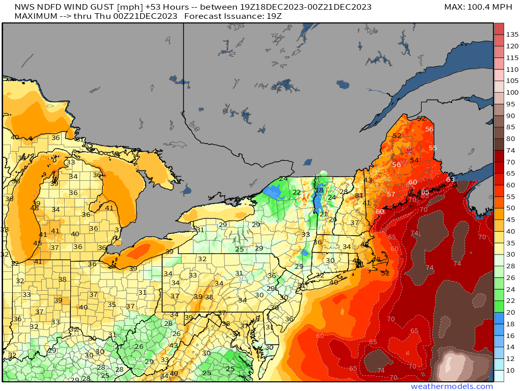
Only a week until Christmas and thankfully, the nation’s weather has quieted down significantly after a powerful East Coast storm drenched and blew away 100-million+ from Florida to Maine. The strong low pressure system is heading into Quebec later tonight and still generating near hurricane force wind gusts in Maine. Bangor has been gusting from 50-70 mph since 10 AM. Logan Airport in Boston was closed earlier with 68 mph wind gusts. This is not a hurricane or a blizzard but the wind and rain impacts might rival what most people have experienced in the past 30-years.
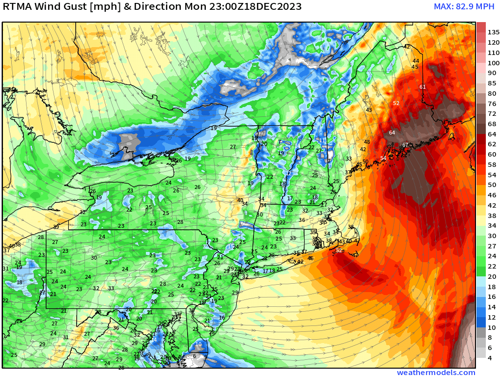
Quickly showing the NWS forecast maximum wind gusts from 3 PM ET to highlight the 60-mph gusts forecast over Maine that were underdone.
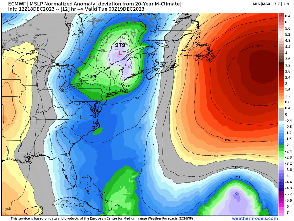
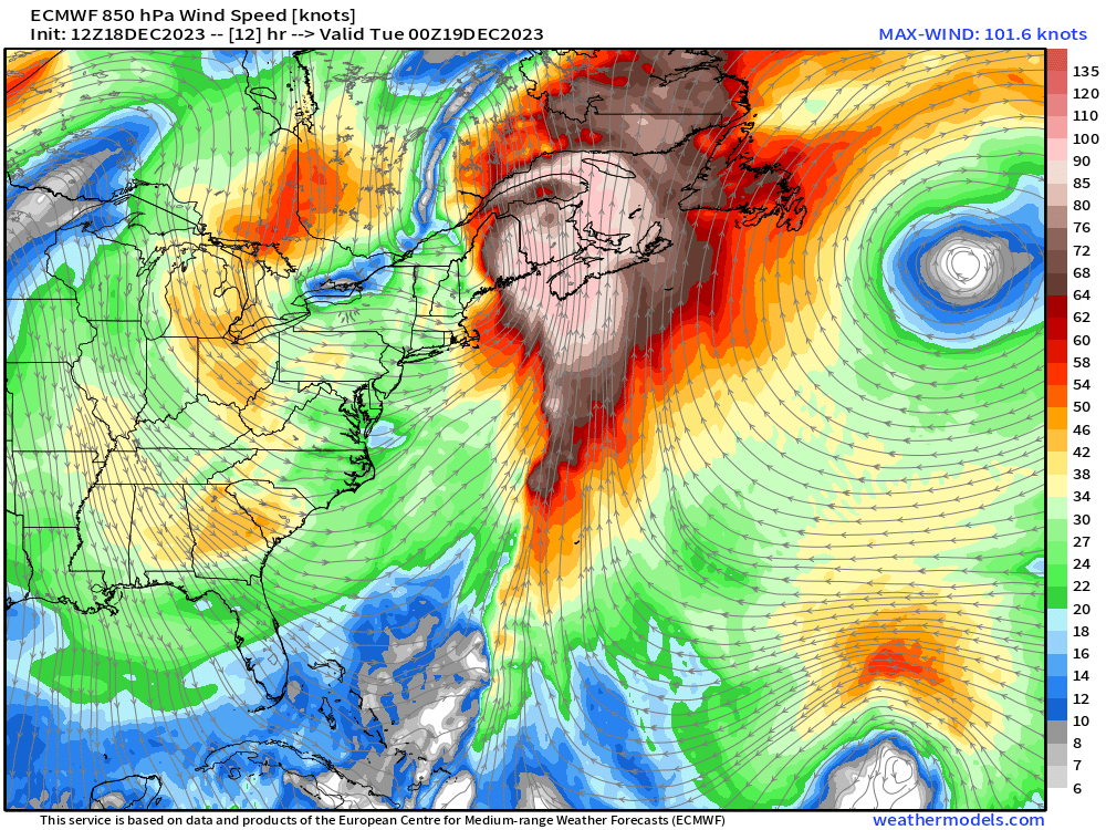
The central pressure by 8 PM ET will be in the upper-970s mb in Quebec with a honking 1050 mb high pressure to the east offshore in the Atlantic. The pressure gradient force between the two features is driving a 100-knot low level jet at 850 hPa. That’s very extreme and only seen in the most dynamic or powerful non-tropical systems.
An area of low pressure and trough will come on shore the West Coast this weekend and combine with another weakness to form a low pressure system in the lee of the Rockies, at least according to the ECMWF 12z HRES forecast. That would provide a White Christmas to Denver. But, as the system moves east, not enough cold air to generate significant snowfall heading into 2024.
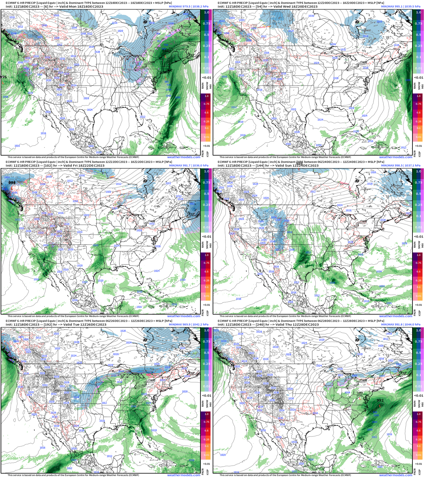
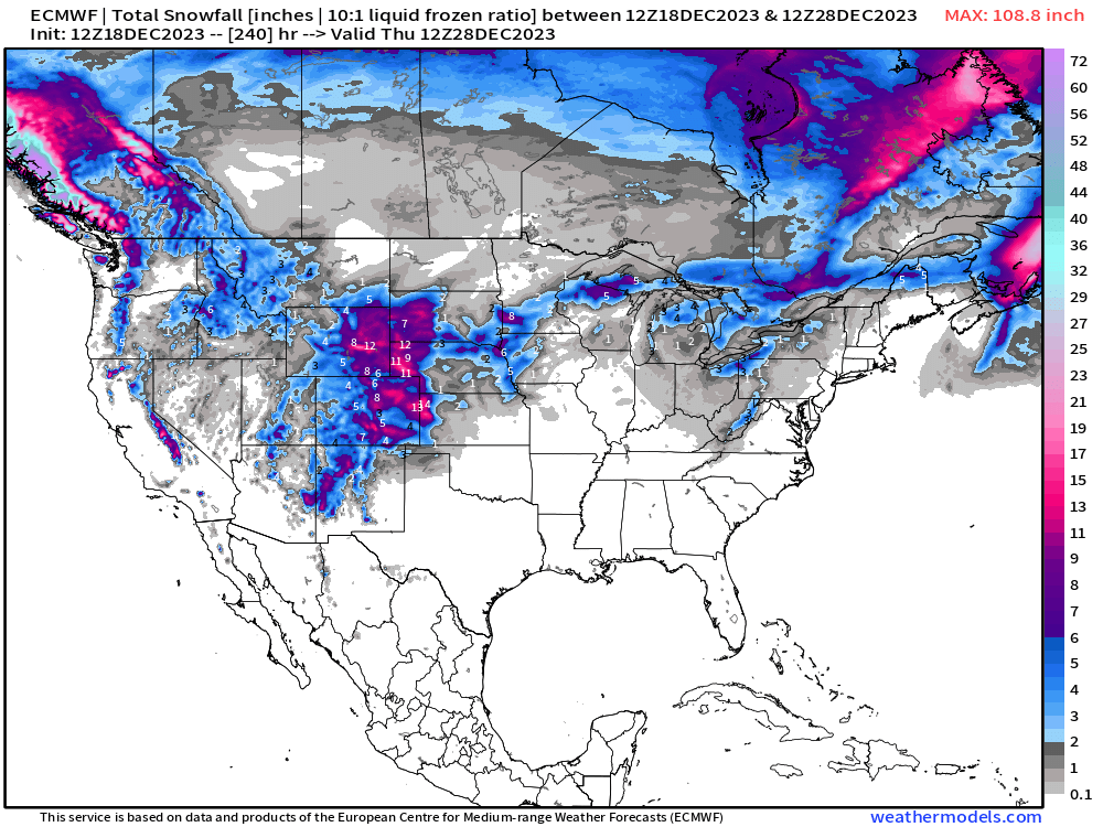
The HRES 10-day snowfall forecast looks bountiful in the lee of the Rockies including Denver, but the storm system is still 6-7 days away. That’s the only major weather system on the board for the Lower 48.
Tuesday Morning Low Temperatures
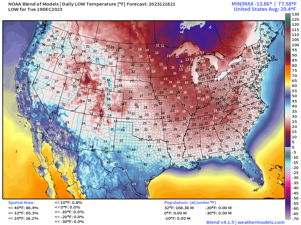
As mentioned Friday, there is a lobe of the tropospheric polar vortex descending out of Canada behind the powerful low pressure system. That has chilly air in the 10s and 20s into the Southeast with gusty winds 30-40 mph out of the northwest. 168 Million Americans are at/below freezing.
Tuesday High Temperatures and Anomaly
Check out the warmth across the western 3/5 of the U.S. with temperature anomalies 15-25°F above normal centered over Denver. That means actual temperatures in the 60s. The Southeast U.S. is chilly but sunny behind the frontal boundary. 40s and 50s to the Gulf Coast.
Temperature Outlook Next 2 Weeks
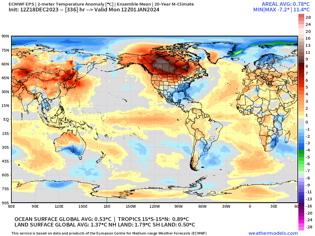
The extreme cold in Siberia will abate and be replaced with much warmer flow from the south. Overall, the Earth is much warmer than normal.
Week 1: December 18 - December 25 [EPS Mean 12z]
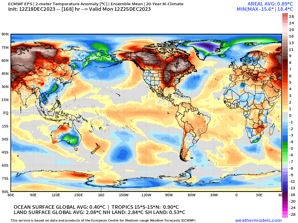
The final week of 2023 will see warmest air over Canada compared to normal. Of course, that’s still not beach weather and likely below freezing.
Week 2: December 25, 2023 - January 1, 2024 [EPS Mean 12z]
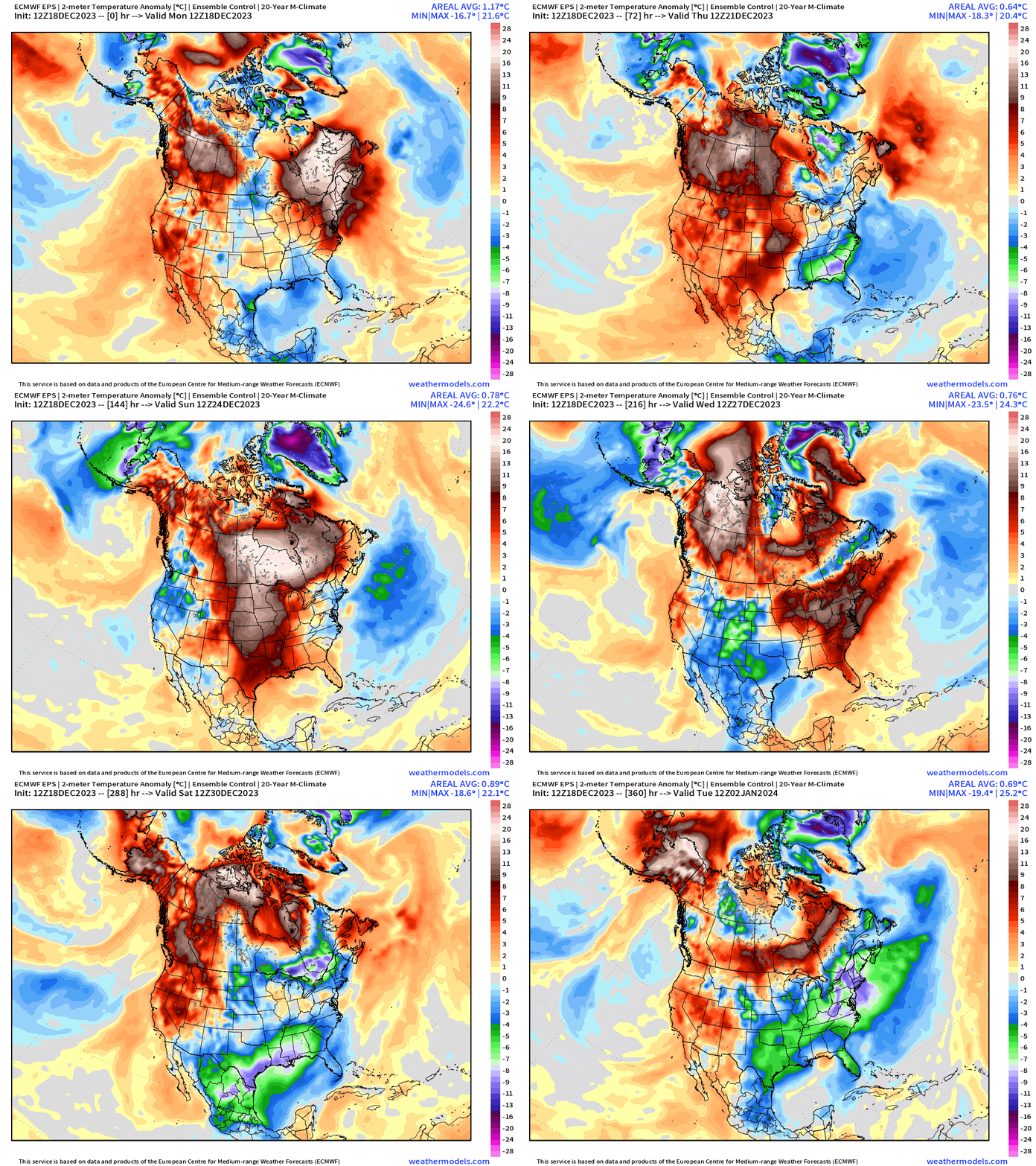
However, I’d like to point out some of the drawbacks in using the 7-day ensemble mean anomaly chunks. The animation is from the control forecast (EPS 12z) at 9-km like the HRES. Using one member from the ensemble shows the weather extremes rather than a smoothed solution. And, lo-and-behold, there is a lot going on in the next 15-days including significant shots of colder than normal air especially across the southern U.S. from Texas into the Southeast. These details are obscured in the ensemble mean whether looking at 500 mb height, precipitation or temperature.
15-day Snowfall ECMWF EPS [median] and Probability of 3-inch of snowfall
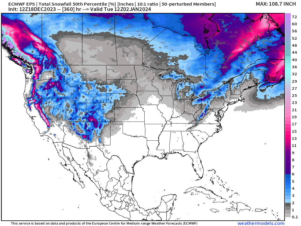
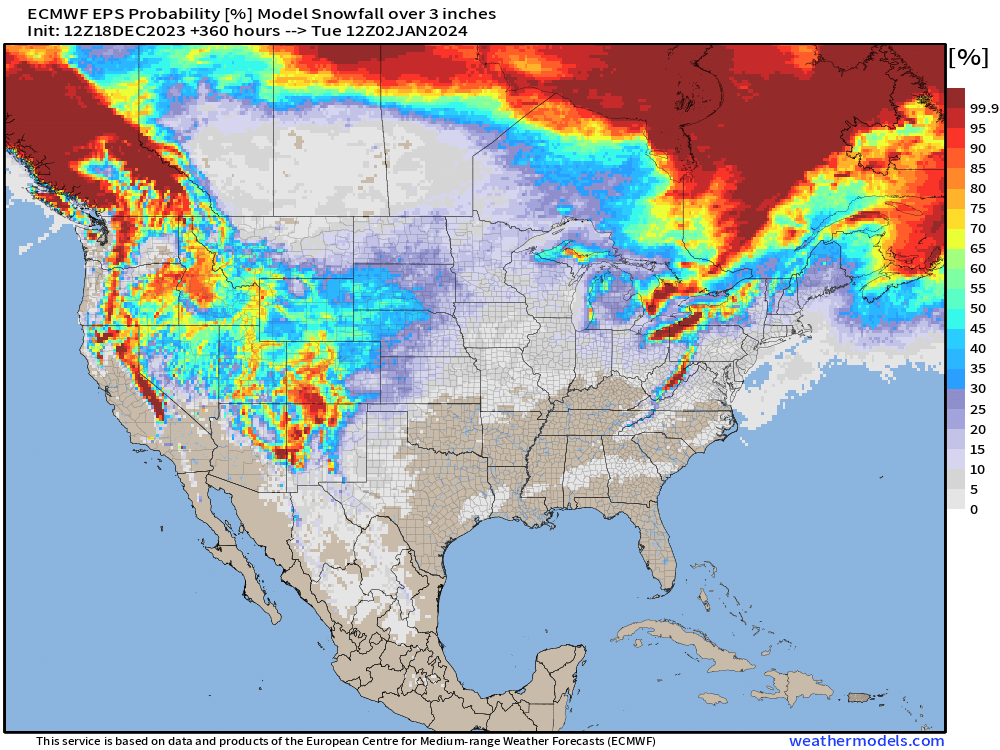
Slim pickings for winter storm signals east of the Rockies. However, shots of colder air expected in late-December should provide Lake Effect snowfall from the very warm Great Lakes. The Western U.S. will see plenty of precipitation over the next 2-weeks, and much of it will fall as snow at higher elevations.
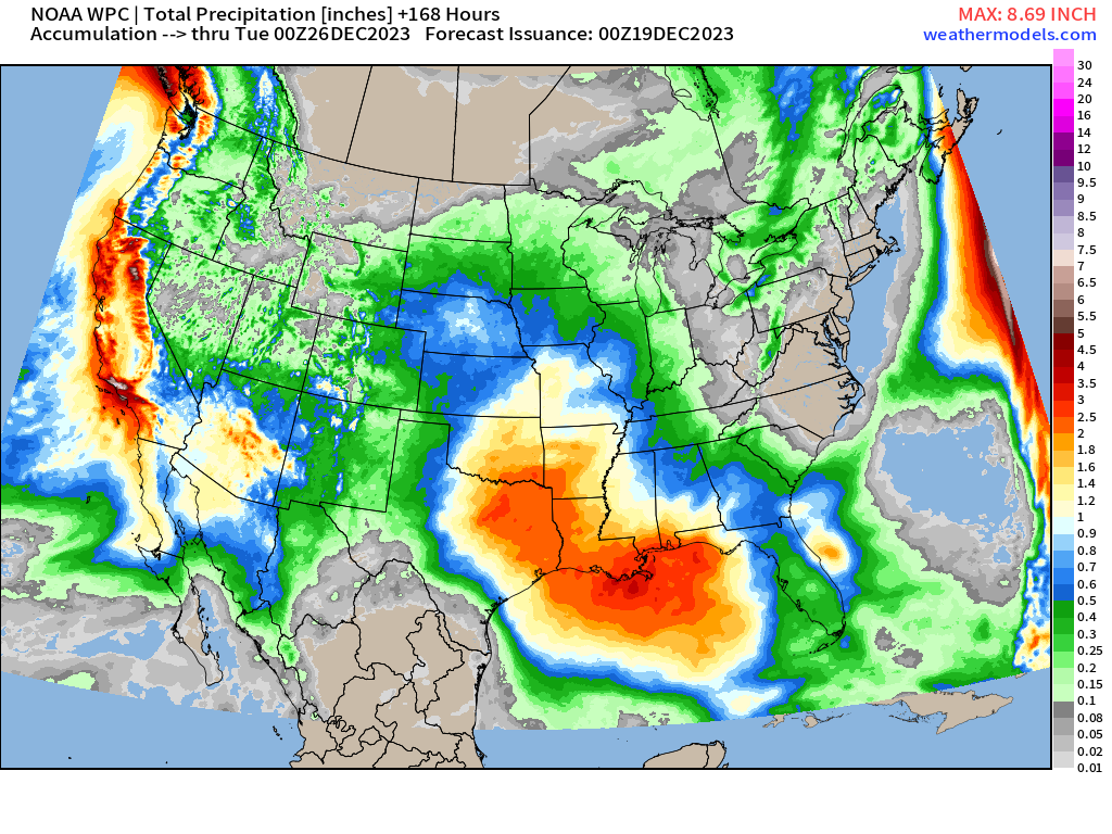
7-Day Precipitation Outlook
2023-2024 Global Tropics
Invest 91W in the Western Pacific became Jelawat (18W) and has moved into the Philippines as a Tropical Depression.
Thank you to my paying subscribers! Your support pays for my Linux servers and product development, and soon A.I. weather forecasts once I figure out the license restrictions. It seems that NVIDIA’s model FourCastNet is open source completely but the other ones are not. A new weather website is coming soon, after several months of development. You’ll like it.
Also, it allows me to provide unfiltered commentary on scientific topics on X. Feel free to say hello and follow on X/Twitter (@RyanMaue)
- Milepost
- 160 · laid 2023-12-19T00:02:50.540000Z
- Source
- https://weather.substack.com/p/december-18-2023-week-ahead
- Digest
- e7c52ed49106031977b6dff923576bfec49e01fd90b9a5ef21d54fb03106967f
- Machine
- JSON