November 27, 2023 Week Ahead
Lake Effect snow piles up for the Great Lakes
November 2023 was the 22nd-warmest November in the 131-year national record (1895–2025), at 44.2°F against a 1991–2020 normal of 43.0°F (+1.3°F).
November 2023 was the 12th-driest November in the 131-year national record (1895–2025), at 1.4in against a 1991–2020 normal of 2.3in (-0.9in).
NOAA/NCEI Climate at a Glance, contiguous United States. This is the observed record for the month, not a score of anything said in this piece — the forecast ledger begins 2026-08-17 and cannot reach earlier posts.
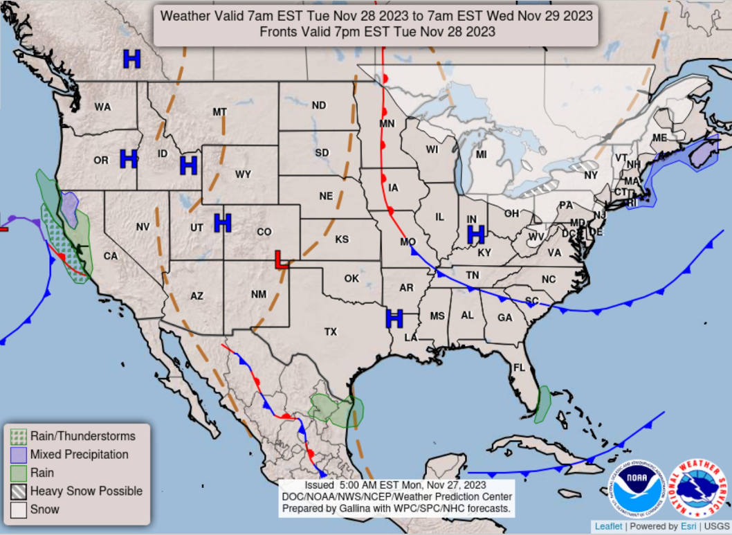
Tuesday’s High Temperatures + Anomaly and Significant Weather
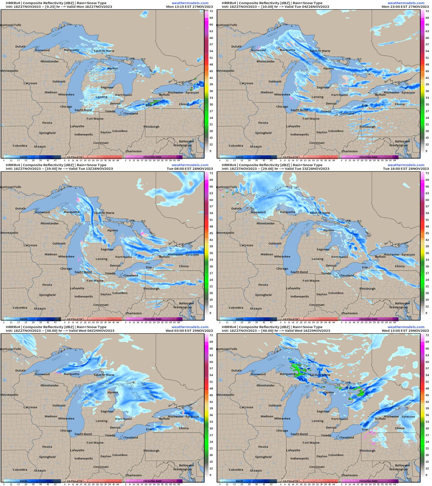
A weak storm system will provide some wet weather from Monterey Bay northward into NorCal. The main story will be continued Lake Effect snowfall in the lee of the still quite warm Great Lakes.
The big winners will be downwind of Erie and Ontario as the westerly winds have the longest zonal fetch over the lakes. 30-inches or more on the Tug Hill Plateau.
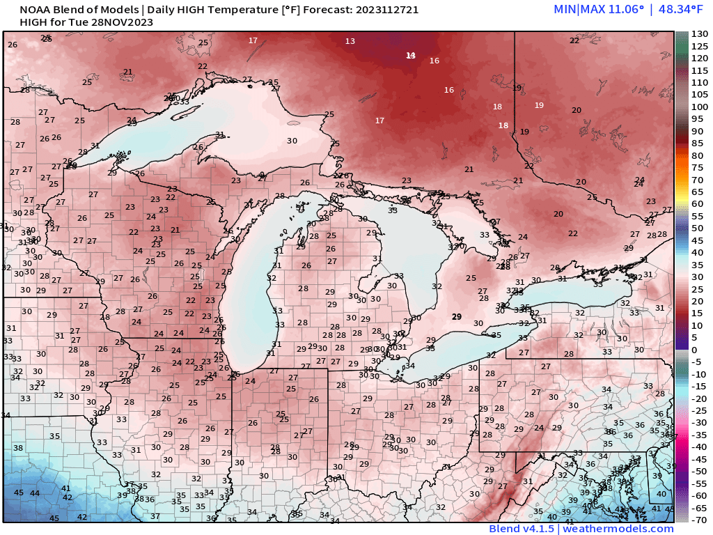
Chilly weather continues across the eastern U.S. with temperatures below freezing in the Great Lakes for daytime high temperatures. We’ll be lucky to see 50°F here in Atlanta after a freeze. Only 20s in Milwaukee, Chicago, and around 30°F in Minneapolis, Detroit, and Cleveland.
64 million Americans will be stuck at/below freezing on Tuesday.
No 80°F high temperatures on Tuesday, November 28 is rather rare as well.
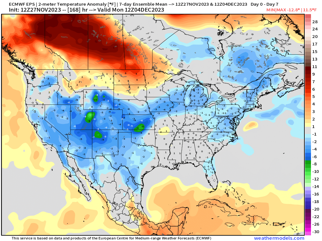
Temperature Outlook Next 2 Weeks
Very nice warming trend for the Lower 48 heading into next week.
Week 1: November 27 - December 4 [EPS Mean 12z]
Week 2: December 5 - 12 [EPS Mean 12z]
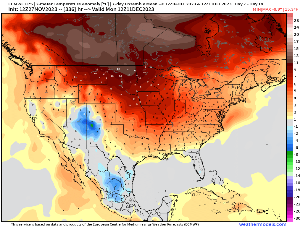
Europe will be quite chilly during the next 2-weeks with bouts of snowfall
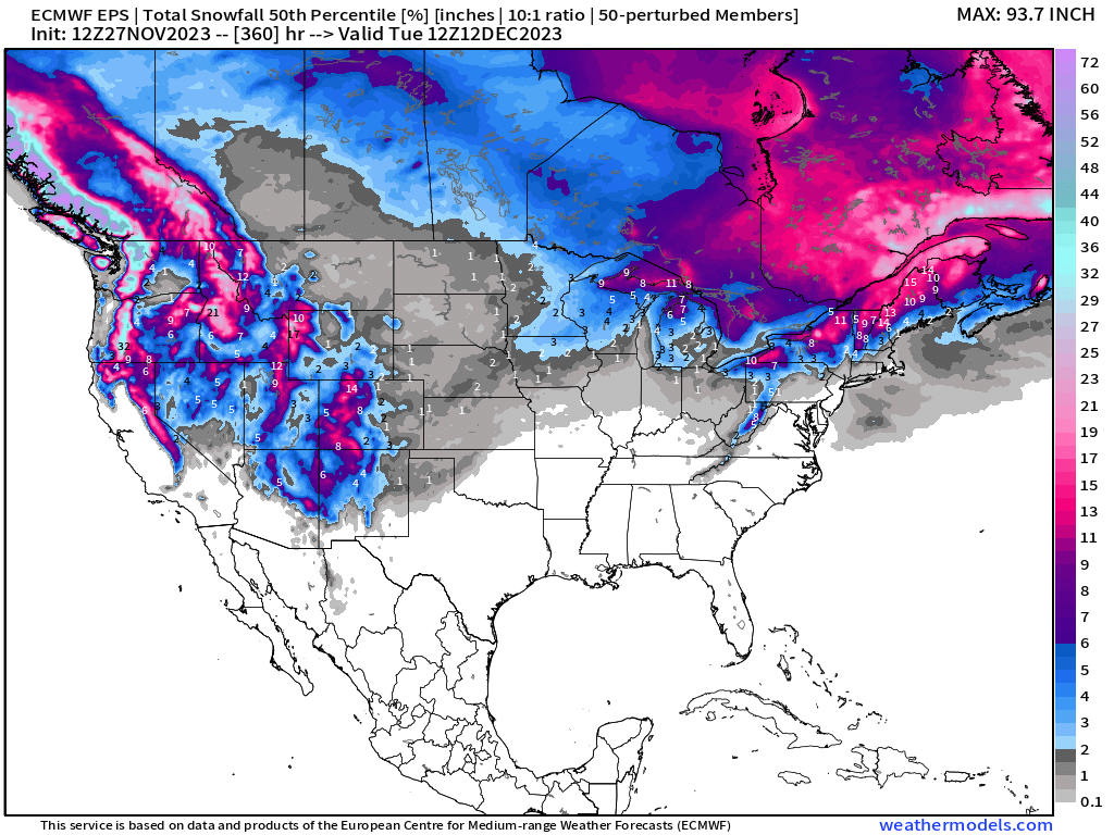
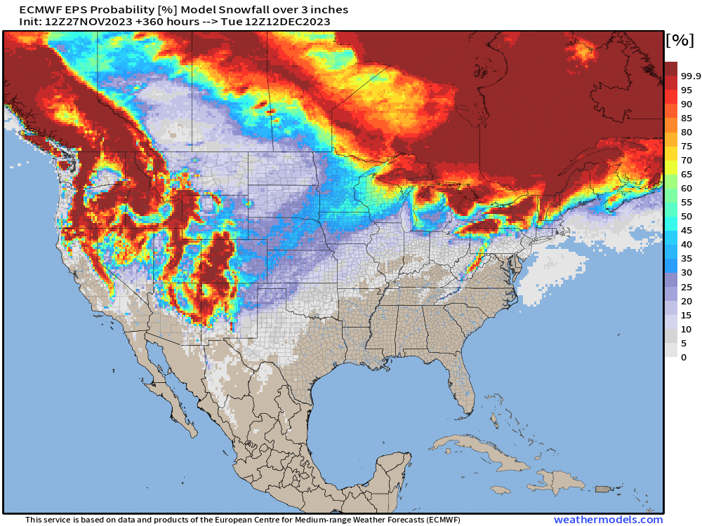
15-day Total Snowfall 51-member EPS ensembles [median] and Probability of 3-inches of snowfall
Still not seeing a strong Winter Storm signal for the Midwest or Northeast aside from Lake Effect snowfall.
7-Day Precipitation Outlook
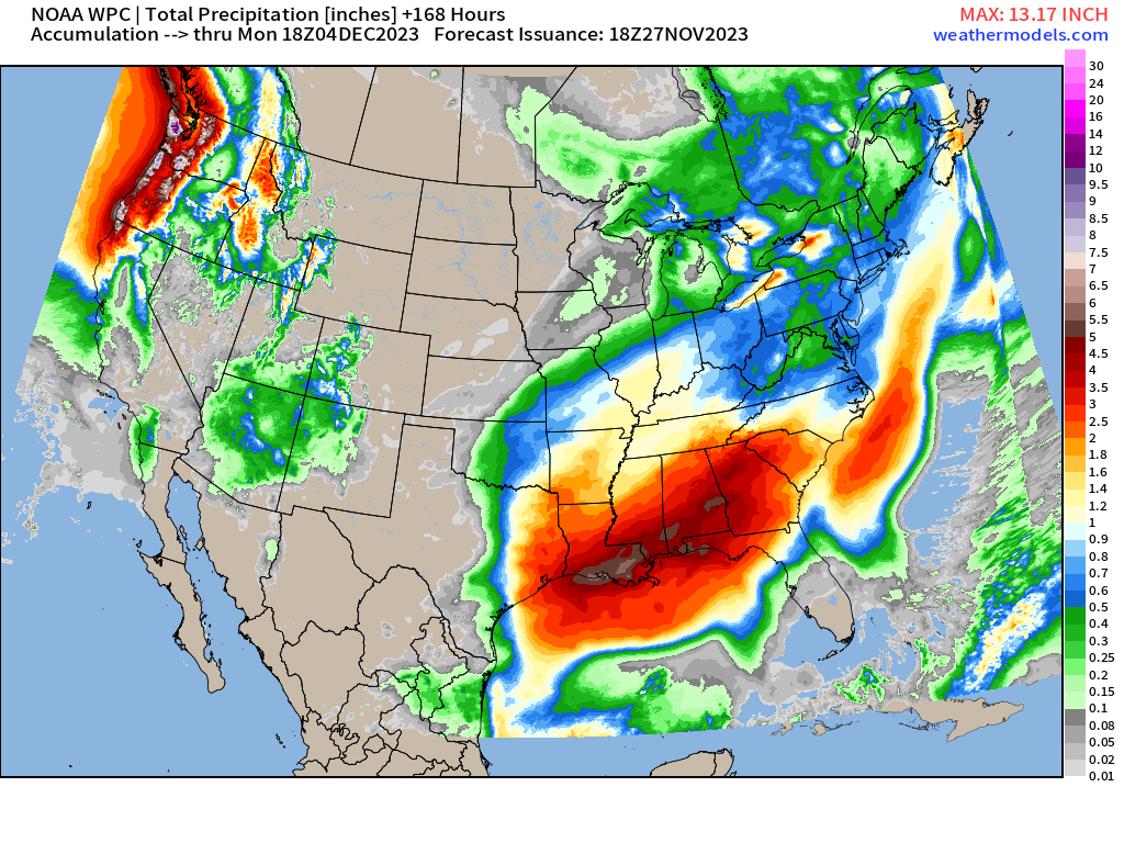
Another major rainfall event takes shape across the Gulf Coast and Southeast into the weekend. Totals of 2-4” of rainfall look likely from this very moist pattern off the Gulf of Mexico.
A decent atmospheric river event pounds the Pacific Northwest later on Friday into the weekend.
2023 Atlantic Hurricane Season
Quiet. Nothing expected as a relatively quiet 2023 hurricane season ends this weekend.
2023 Eastern & Western Pacific and Northern Indian Ocean
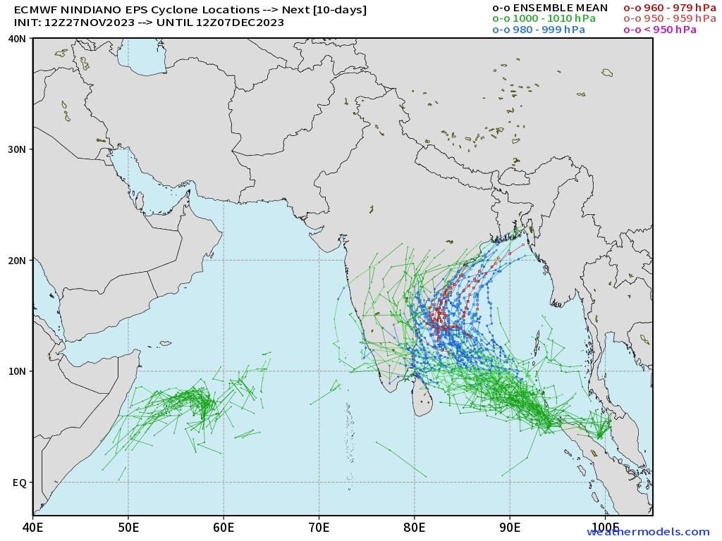
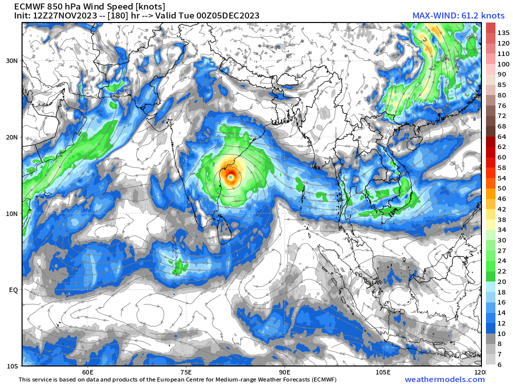
An area of low pressure could develop into a powerful Tropical Cyclone by this weekend, and affect the Indian coast next week. Still too soon to pinpoint impacts on land or maximum intensity. Early December is not unusual for tropical cyclone development in the Bay of Bengal.
2023-24 South Pacific Cyclone Season
Unusually quiet for next 7-10 days, or longer. The ECMWF ensembles have nothing!
Thank you to my paying subscribers! Your support pays for my Linux servers and product development. Also, it allows me to provide unfiltered commentary on scientific topics on X. Feel free to say hello and follow on X/Twitter (@RyanMaue)
- Milepost
- 146 · laid 2023-11-27T22:34:10.734000Z
- Source
- https://weather.substack.com/p/november-27-2023-week-ahead
- Digest
- d38c964f1254f88b80b6dc1efe952a4ce058c779828f15972564d94f02226505
- Machine
- JSON