October 26, 2023 Afternoon Update
Arctic blast poised to slowly erase record warmth
October 2023 was the 23rd-warmest October in the 131-year national record (1895–2025), at 56.0°F against a 1991–2020 normal of 54.5°F (+1.5°F).
October 2023 was the 62nd-driest October in the 131-year national record (1895–2025), at 2.2in against a 1991–2020 normal of 2.5in (-0.3in).
NOAA/NCEI Climate at a Glance, contiguous United States. This is the observed record for the month, not a score of anything said in this piece — the forecast ledger begins 2026-08-17 and cannot reach earlier posts.
What a spectacular mid-autumn week this has been across much of U.S. east of the Rockies with very warm weather, in the 70s and 80s for 250 Million + Americans.
While the extremes average out across the Lower 48, there is a significant blast of cold air chilling over Montana and into the Dakotas cutting through Nebraska this evening with a powerful Arctic cold front. Current temperatures are in the teens in the northern Rockies while the 70s and 80s rule from Texas to New England.
The good news for folks in the Eastern and Southeastern U.S. is the cold front and Arctic blast will take its time to arrive. We need to wait for a reinforcing trough or lobe of the Arctic polar vortex to swing through like a pendulum mainly next week.
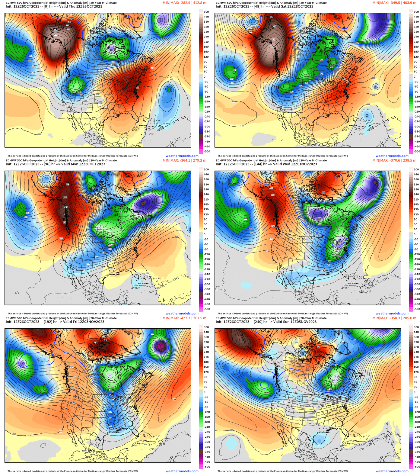
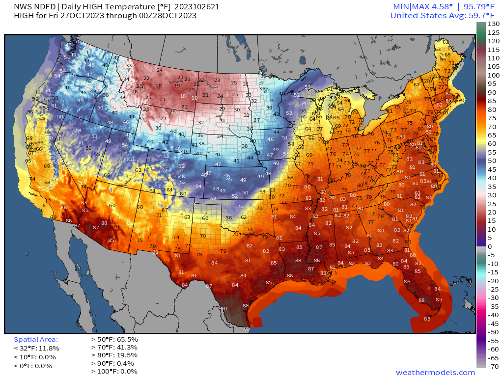
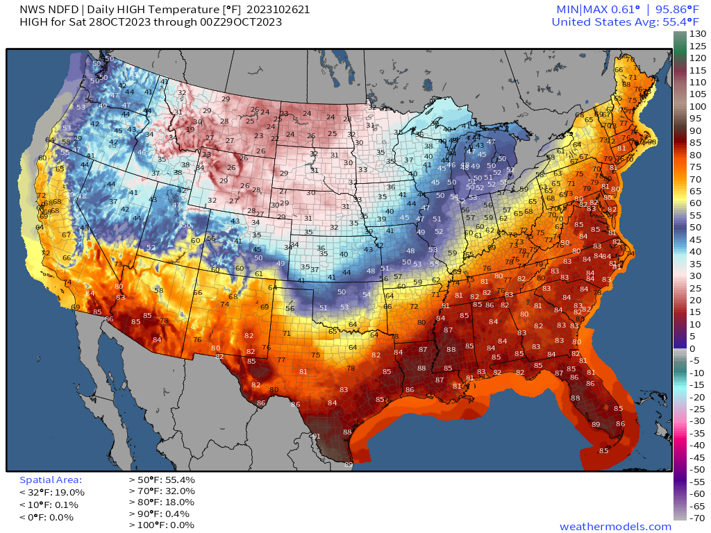
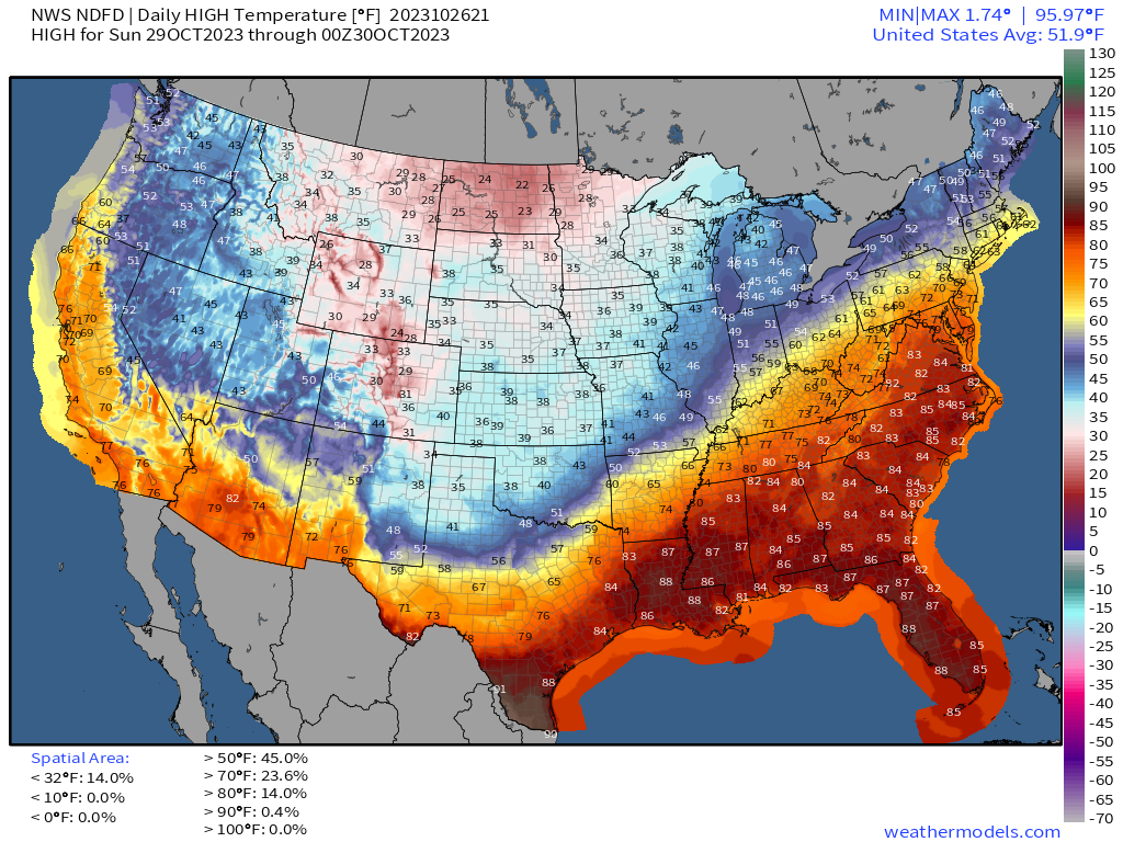
Until the main core of the cold air arrives, we’ll see mild temperatures continue, only slowly being eaten away from west to east.
Friday’s highs: Great Lakes and New England enjoying 70s. Well into the 80s from Ohio Valley into Mid-Atlantic.
Saturday’s highs: 70s and 80s into New England.
Sunday’s highs: 80s into D.C.
10-Day GFS and ECMWF snowfall forecasts
Significant accumulations limited to the Rockies mainly in Wyoming and Idaho with a nice snow swath along the Canadian border. Lake effect snow showers likely as the Arctic blast proceeds eastward with lighter snow in the Northeast possible. Not seeing an Nor’easters or blizzards during the next 10-days, but it’s still early in the winter season.
2023 Atlantic Hurricane Season | Medium Range Outlook
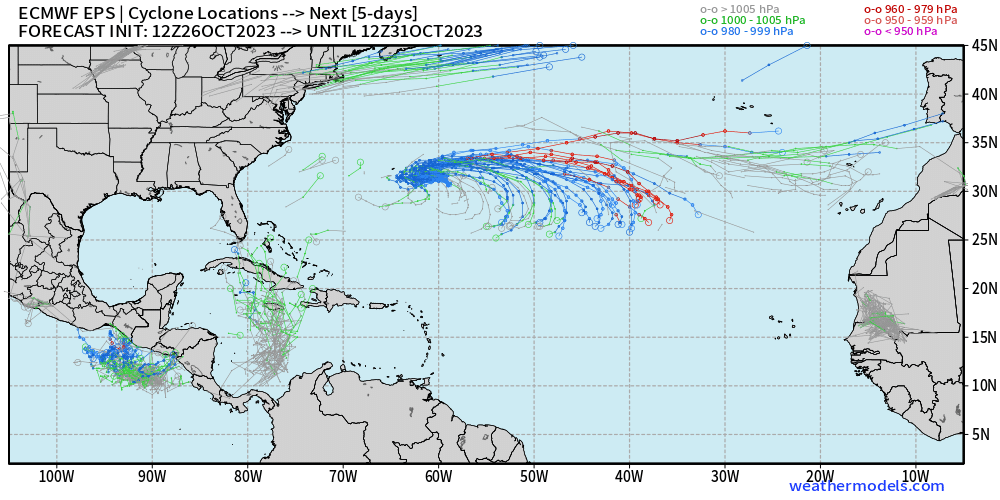
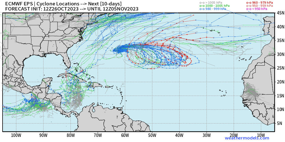
Tammy is now post-tropical but remains as an area of low pressure with near-hurricane force winds. Over the next 5-days, we are watching Tammy loop clockwise, but only a 30% chance to regenerate or transition back into a (sub)-tropical cyclone. Hopefully we are done with Tammy!
Watching the SW Caribbean for tropical disturbance that could lift north over the upcoming days. Otherwise, nothing imminent as the 2023 hurricane season winds down.
2023 Eastern Pacific Hurricane Season
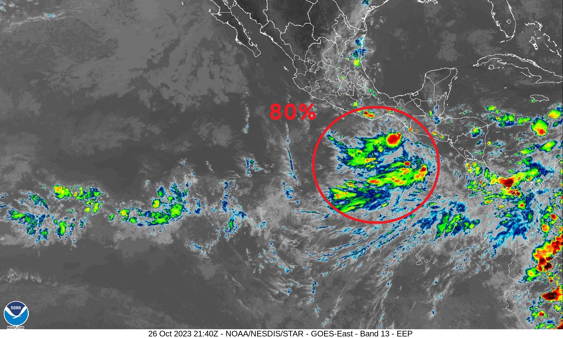
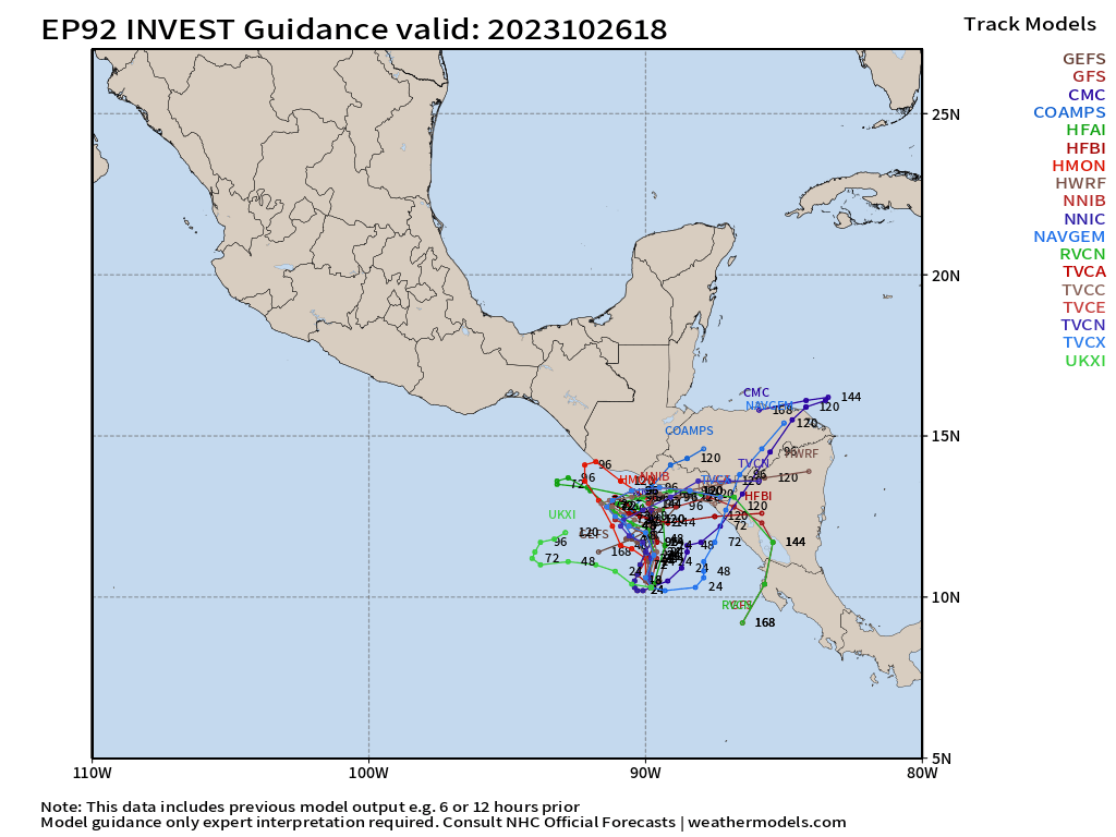
Invest 92E has an 80% chance of developing into a tropical depression or storm in the next few days. The next name is Pilar. After the rapid intensification debacle of Otis, I really don’t want to go onto much of a limb with the intensity of Pilar. However, models are currently showing limited development, perhaps to Category 1 before making landfall into Central America.
2023 Western Pacific Typhoon Season
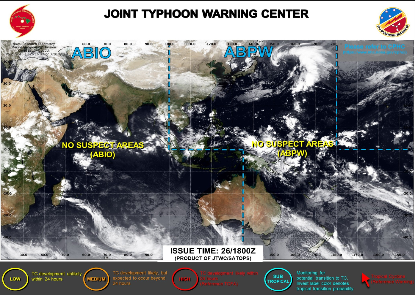
Chance of development in 7-days or so east of the Philippines.
2023 North Indian Ocean Cyclone Season
Quiet for the next 7-days
2023-24 South Pacific Cyclone Season
Quiet for next 7-days
Thank you to my paying subscribers! Your support pays for my servers and product development. Feel free to say hello and follow on Twitter (@RyanMaue)
- Milepost
- 129 · laid 2023-10-26T22:22:12.088000Z
- Source
- https://weather.substack.com/p/october-26-2023-afternoon-update
- Digest
- e9295455bfc2fbd4d29ed473108173d10f807ac7dce0f4cffd82eb5c17b3ca79
- Machine
- JSON