June 2, 2020 Tropical Update
Tropical Depression 03L in the southern Gulf of Mexico is very close to Tropical Storm strength. Will linger and then head north toward Gulf coast by weekend.
June 2020 was the 29th-warmest June in the 132-year national record (1895–2026), at 70.3°F against a 1991–2020 normal of 69.5°F (+0.8°F).
June 2020 was the 40th-driest June in the 132-year national record (1895–2026), at 2.7in against a 1991–2020 normal of 3.1in (-0.4in).
NOAA/NCEI Climate at a Glance, contiguous United States. This is the observed record for the month, not a score of anything said in this piece — the forecast ledger begins 2026-08-17 and cannot reach earlier posts.
Tropical Depression nearing storm strength in fare southern Gulf of Mexico
Tropical Depression 03L is nearing storm strength (Cristobal)
Very slow movement until Saturday in the Bay of Campeche
Weekend: the storm will then move north quickly.
This will be a slowly evolving storm system for the next 4-5 days before it takes aim on the Gulf coast likely from Texas to Louisiana.

The storm is currently centered over the very warm waters of the Bay of Campeche with convection (storms) over the Yucatan peninsula. Heavy rain and flooding will continue in Mexico over the next several days.
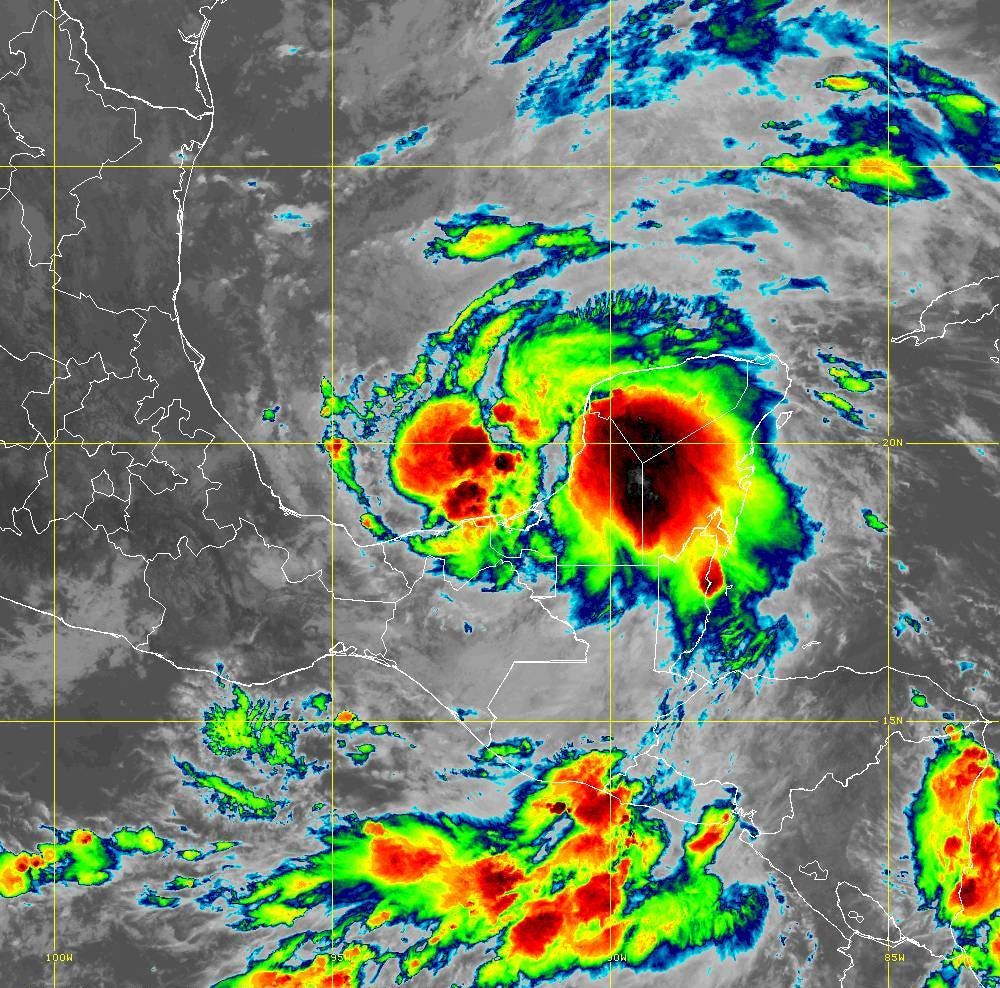
Satellite GOES-16 (10:50 AM EDT June 2, 2020)
I’ll be watching the new models come in:
GFS 12z - 18z at 11:30 and 5:30 PM EDT
ECMWF 12z + EPS 12z from 2:00 - 3:15 PM EDT
- Milepost
- 12 · laid 2020-06-02T15:15:19.173000Z
- Source
- https://weather.substack.com/p/june-2-2020-tropical-update
- Digest
- 48644b81a6206877218c9192a1b172a8b8eeaac2a606fbfb69cd9e2d93602692
- Machine
- JSON