October 9, 2023 Afternoon Update
Boatloads of rainfall on the way this week
October 2023 was the 23rd-warmest October in the 131-year national record (1895–2025), at 56.0°F against a 1991–2020 normal of 54.5°F (+1.5°F).
October 2023 was the 62nd-driest October in the 131-year national record (1895–2025), at 2.2in against a 1991–2020 normal of 2.5in (-0.3in).
NOAA/NCEI Climate at a Glance, contiguous United States. This is the observed record for the month, not a score of anything said in this piece — the forecast ledger begins 2026-08-17 and cannot reach earlier posts.
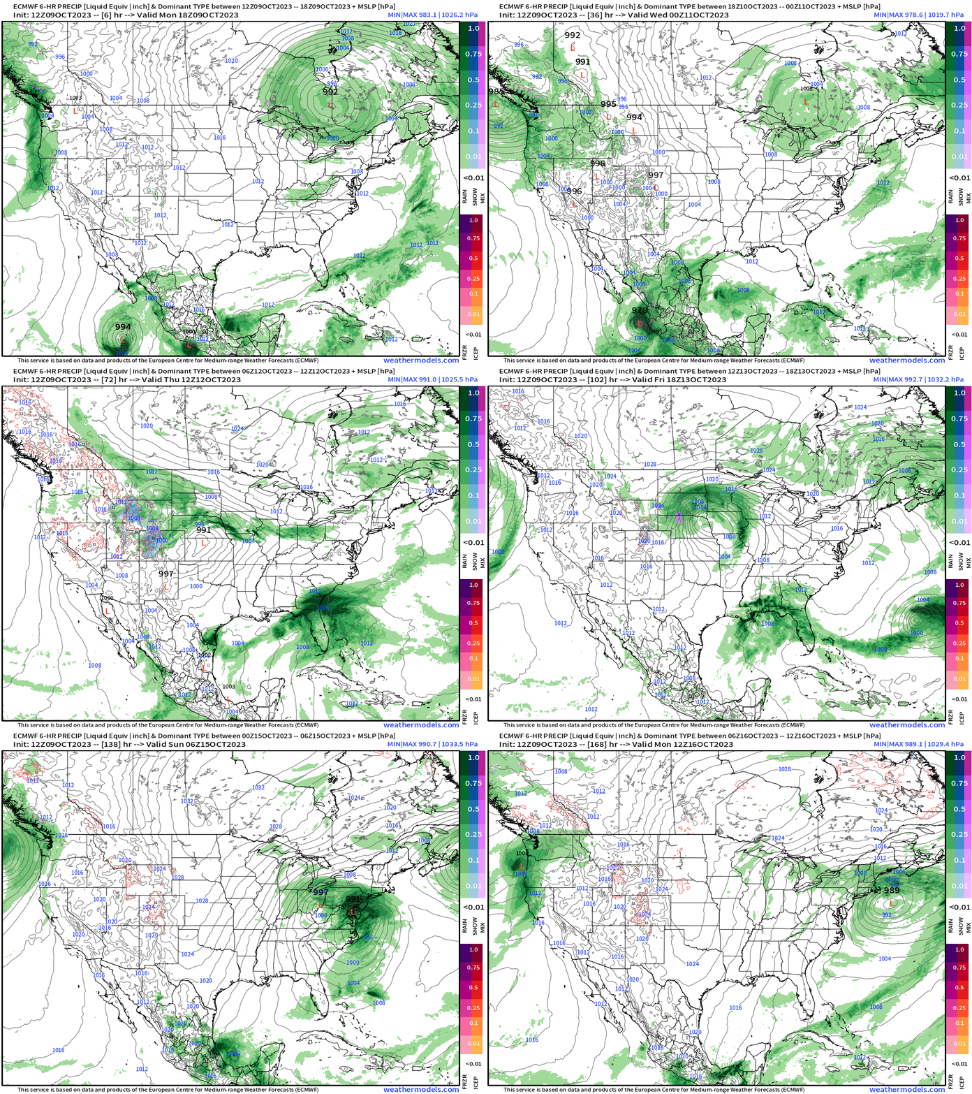
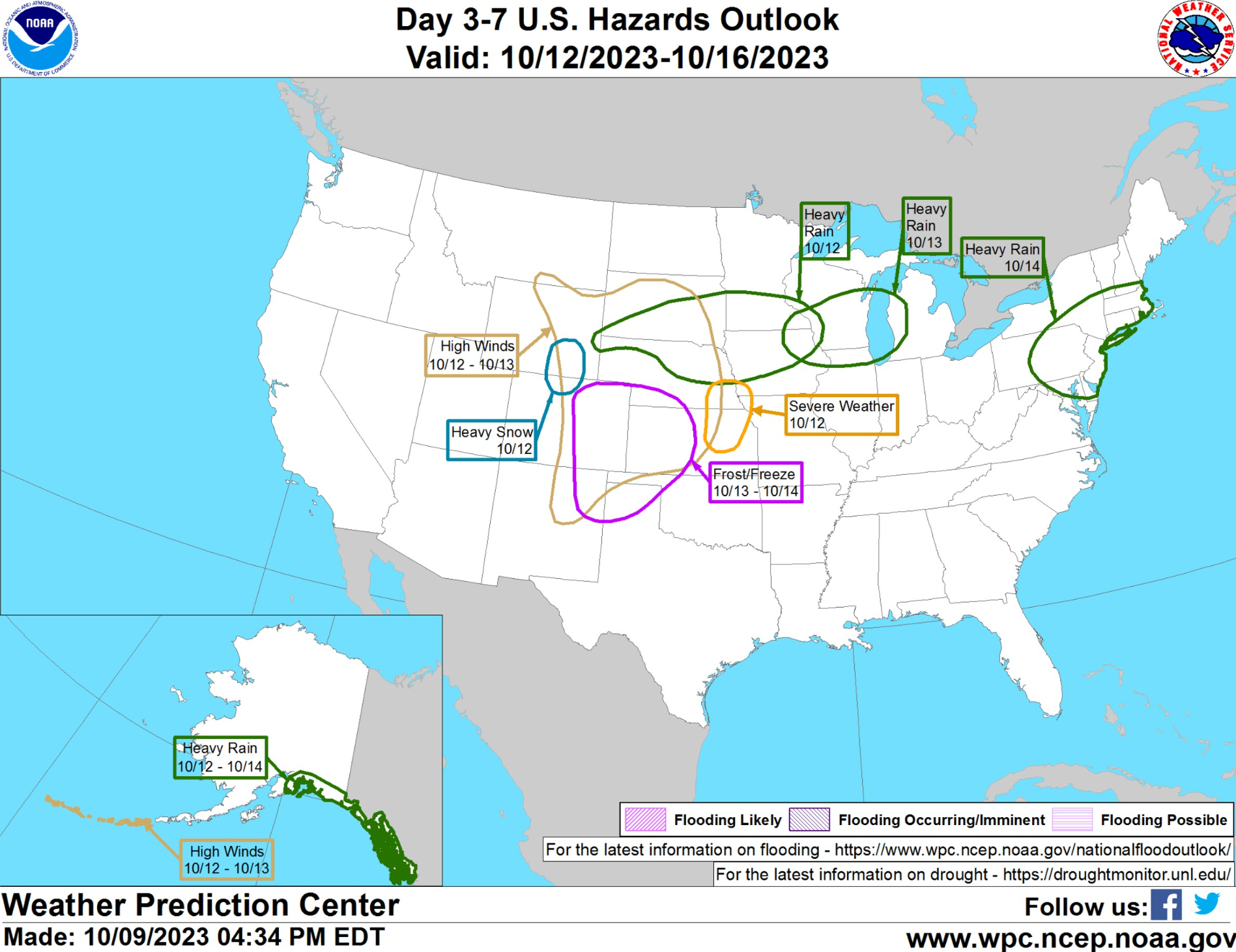
Matching up the ECMWF 7-day forecast with the WPC Hazards outlook is a nice way to visualize the active weather across the Lower 48. The Gulf of Mexico tropical disturbance is prior to the 3-day time frame.
An area of low pressure develops in the lee of the Rockies and pushes eastward through the Ohio Valley by Saturday emerging off the mid-Atlantic coast where it could undergo intensification. No surprise, but this looks like another washout weekend from D.C. to NYC. Hopefully there will be some breaks in the rainfall.
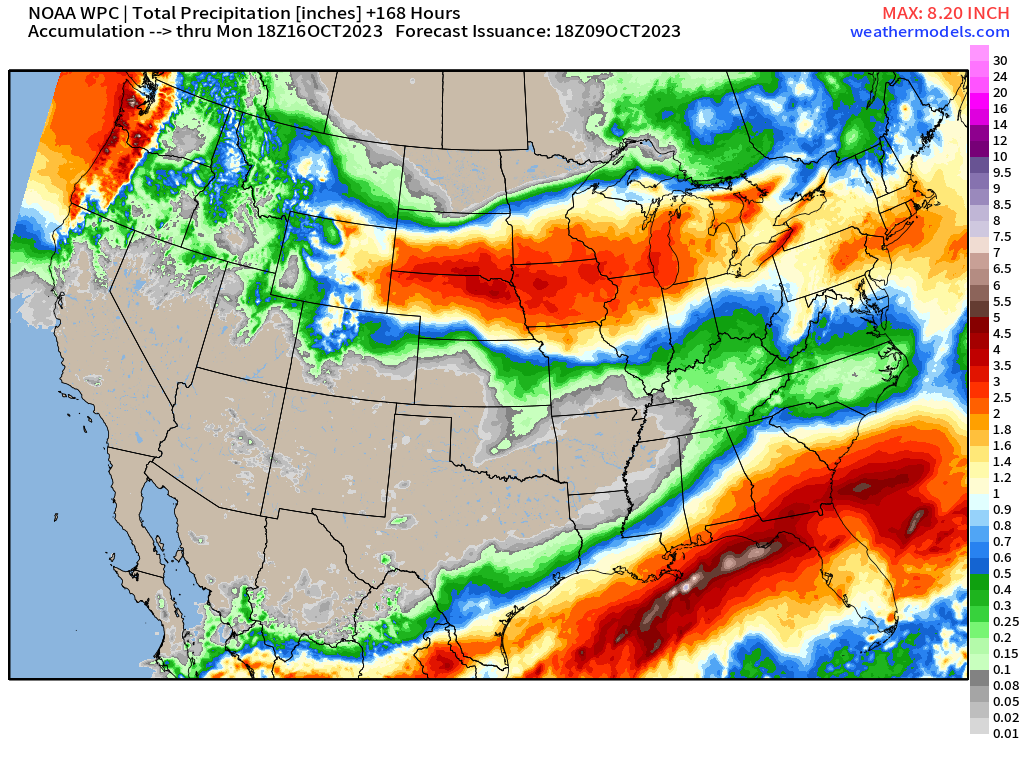
Boatloads of rainfall across the Lower 48 over the next 7-days will add up to 2-3 inches for many states. The highest totals will likely be across the panhandle of Florida.
Look at the area of 2-4” across the Central Plains. Where was that all summer?
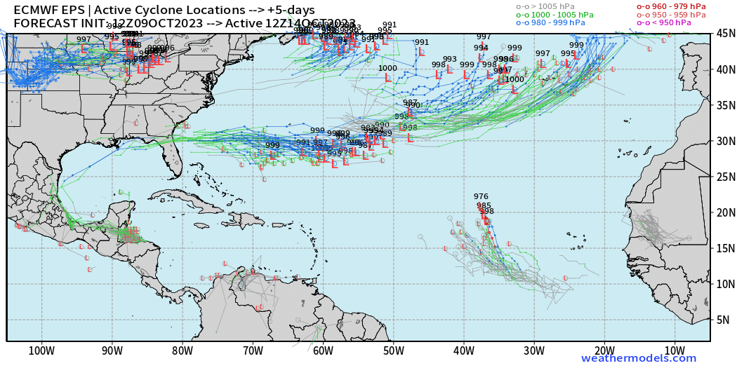
2023 Atlantic Hurricane Season | Medium Range Outlook
Tropical cyclone formation is looking unlikely [NHC 20% LOW] in the Gulf of Mexico over the next few days primarily because of high wind shear. However, significant tropical moisture will drench the Gulf coast. The system may develop an area of low pressure that heads east into the Atlantic south of Bermuda — and could develop there.
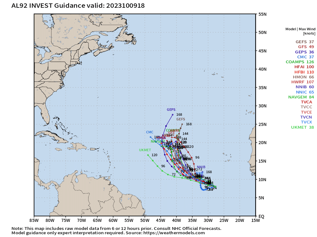
Invest 92L in the far eastern Atlantic could be a short-lived tropical storm, but ensembles do not favor long-term survival. The mesoscale models go nuts with it over 100-knots. That seems unlikely.
2023 Eastern Pacific Hurricane Season
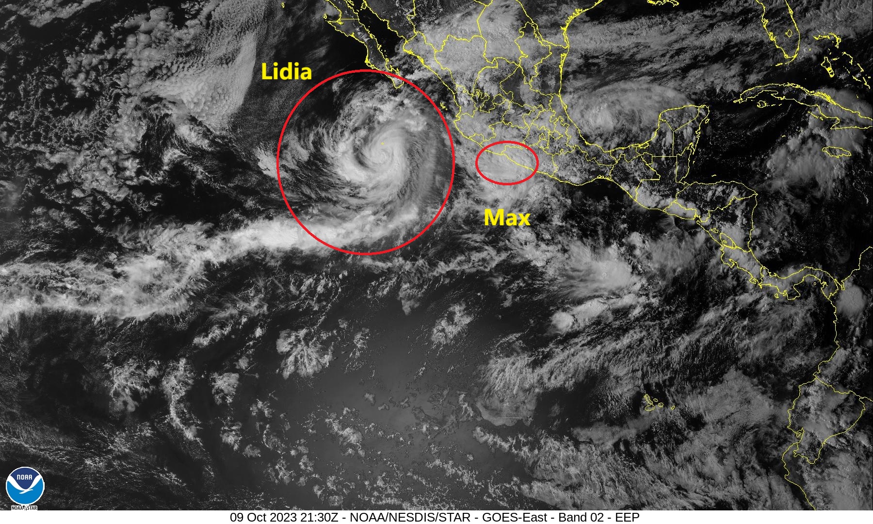
Tropical Storm Lidia is on the cusp of becoming a hurricane with aircraft recon measured pressure of 985 mb and winds of 60-knots. The forecast is for 85-knots at landfall later on Tuesday, but Lidia could be stronger if a burst of rapid intensification occurs over the 30°C ocean waters.
Tropical Storm Max made landfall along the Mexican coast to the east with 55-knots winds and 991 mb pressure.
2023 Western Pacific Typhoon Season
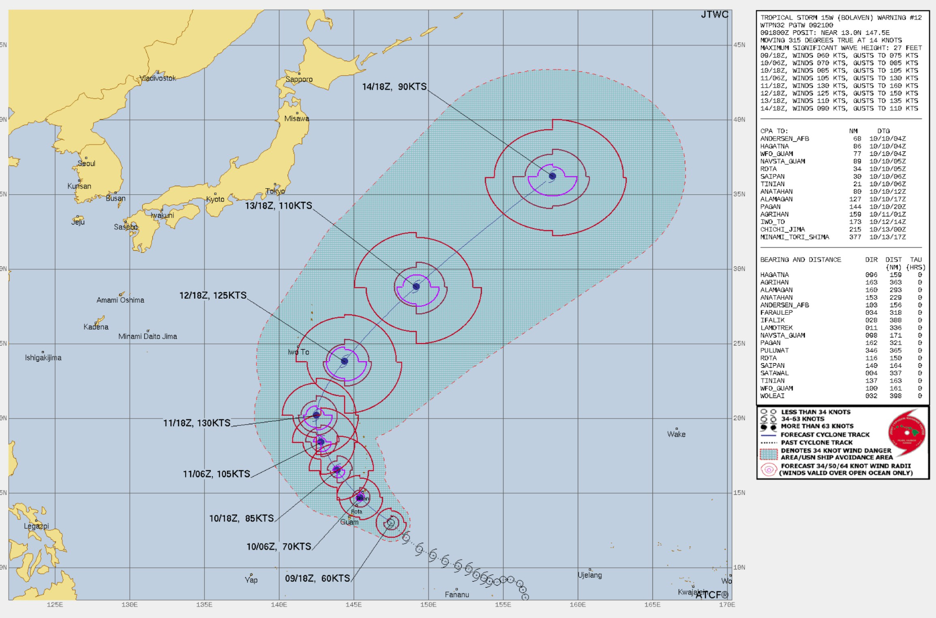
The center of intensifying soon-to-be Typhoon Bolaven (currently 60-knots but looks ready to rapidly intensify) will pass between Rota and Tinian islands. JTWC forecast Bolaven to 130-knots which is Super Typhoon Status.
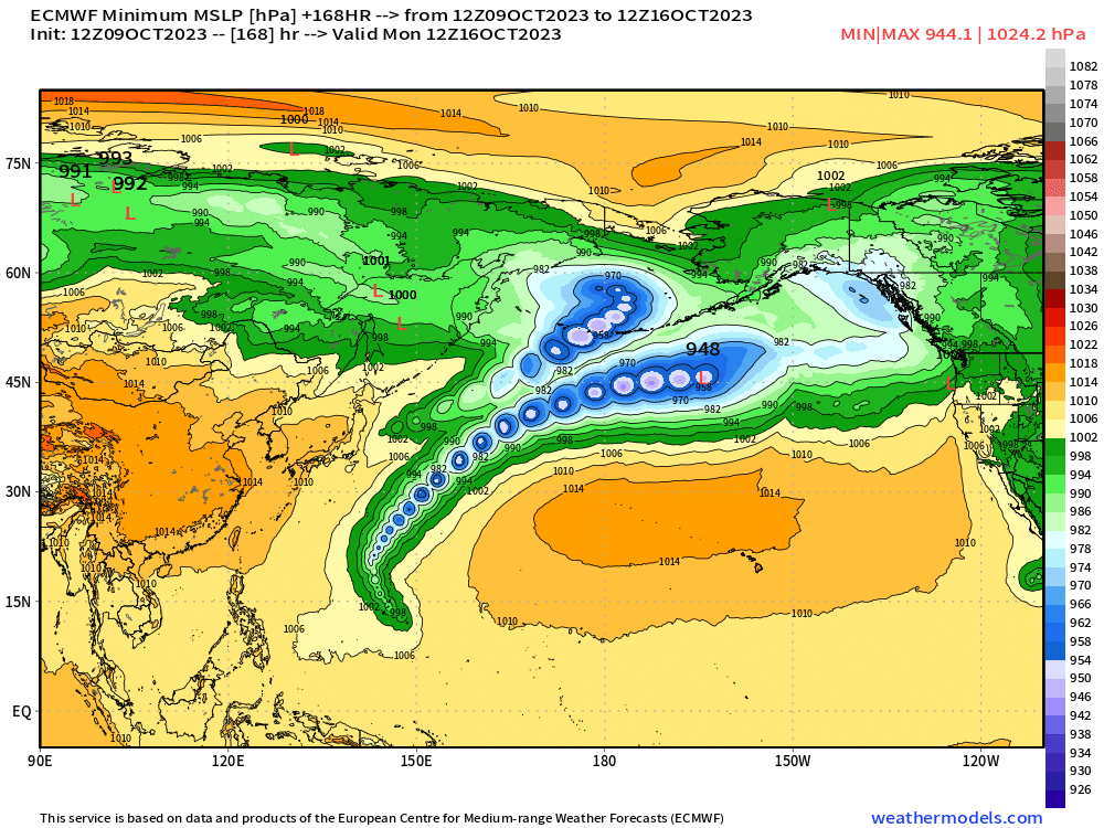
ECMWF 12z transitions Bolaven into a powerful extratropical storm w/948 mb pressure south of the Aleutians before it occludes and weakens in the Gulf of Alaska. The recurvature of Bolaven will certainly affect the jet stream and downstream weather over North America by amplifying the waveguide — troughs/ridges. In these situations, weather models skill goes down as predictability suffers from errors in the location of the Typhoon and when it merges with the middle latitude jet.
Thank you to my paying subscribers! Your support pays for my servers and product development. Feel free to say hello and follow on Twitter (@RyanMaue)
- Milepost
- 116 · laid 2023-10-09T22:12:43.427000Z
- Source
- https://weather.substack.com/p/october-9-2023-afternoon-update
- Digest
- ed364dacdc072c90480e738cf84167b1080b3060fbd82220035d04feae3410c5
- Machine
- JSON